The best walks and hikes around San Anselmo
4.8
(476)
8,258
hikers
286
hikes
Hiking around San Anselmo offers diverse landscapes within Marin County, characterized by hills, creeks, meadows, oak woodlands, and redwood groves. The region provides an extensive network of trails, with significant areas like the Mount Tamalpais Watershed, Sorich Ranch Park, and Bald Hill Preserve. These natural features contribute to a variety of scenic experiences for hikers.
Best hiking trails around San Anselmo
- The most popular hiking route is Phoenix Lake loop — Mt. Tamalpais Watershed, a 2.8 miles (4.6 km) trail that takes 1 hour 13 minutes to complete. This easy loop offers scenic views around Phoenix Lake.
- Another top favourite among local hikers is Eldridge Grade to Tucker Trail loop — Ross Open Space, a moderate 5.8 miles (9.4 km) path. This route winds through Ross Open Space with varied terrain and elevation changes.
- Local hikers also love the Phoenix Lake via Gertrude Ord & Tucker Trail loop — Mt. Tamalpais Watershed, a 4.2 miles (6.7 km) trail leading through the Mount Tamalpais Watershed, often completed in about 1 hour 51 minutes.
- Hiking around San Anselmo is defined by watershed trails, oak woodlands, and redwood groves. The network offers options for different ability levels, from easy loops to more challenging routes with significant elevation gains.
- The routes in San Anselmo are highly rated by the komoot community with an average score of 4.8 stars from over 300 reviews. More than 6,000 hikers have used komoot to explore San Anselmo's varied terrain.
Last updated: October 11, 2026
4.0
(2)
16
hikers
18.3km
05:59
780m
760m
Mount Tamalpais via Collier Trail offers a rugged and challenging hiking experience, covering 11.4 miles (18.3 km) with a significant elevation gain of 2568 feet (783 metres). You will navigate steep, rocky sections through dry-looking woods before descending into a ravine. A highlight is Collier Springs, where water consistently trickles, even during drier periods. Below the springs, discover a small, isolated old-growth redwood grove, providing a lush contrast to the surrounding brushy landscape. This difficult route, estimated to take 5 hours and 58 minutes, provides expansive panoramas from Eldridge Grade, making it a true test of your fitness.
Before you set out, be aware that the trail features challenging terrain, with some sections being steep, rocky, and not always well-maintained. This is a difficult hike, so ensure you are adequately prepared for the physical demands it presents. You can begin your adventure from various access points, including the Railway Grade Fireroad Trailhead located at East Ridgecrest Boulevard. Plan your visit carefully to allow ample time for this demanding journey.
This trail is notable for its unique ecological contrasts within the Mount Tamalpais Watershed. You will experience the transition from dry, brushy landscapes to the surprising lushness of the old-growth redwood grove near Collier Springs. The consistent water flow at Collier Springs, even in dry months, supports this isolated pocket of ancient trees. The route provides a distinct perspective on the diverse ecosystems of Mount Tamalpais, showcasing both its arid and verdant sides.
5.0
(1)
16
hikers
5.84km
01:43
180m
170m
The Deer Park Loop offers a delightful and accessible hiking experience, perfect for a relaxing day outdoors. The trail winds through pleasant natural landscapes, providing a refreshing escape from the everyday. You'll find yourself immersed in a tranquil environment, making it an ideal choice for a peaceful walk or a family outing.
Planning your visit to the Deer Park Loop is straightforward. The trailhead is easily accessible, and parking is generally available, though it's wise to arrive earlier on busy days. This easy 3.6-mile (5.8 km) route, with its 577 feet (176 metres) of elevation gain, typically takes around 1 hour and 43 minutes, making it a great option for a quick, rewarding hike.
This particular Deer Park Loop is known for its beginner-friendly nature, making it one of the more popular routes for those new to hiking or looking for a less strenuous adventure. Its gentle terrain and manageable distance provide a welcoming introduction to the outdoors, allowing you to enjoy the scenery without significant physical challenge.

12
hikers
5.54km
01:37
160m
130m
Embark on the Phoenix Lake and Yolanda Trail Loop, an easy 3.4-mile (5.5 km) hike that offers a diverse landscape. You will gain 519 feet (158 metres) in elevation, taking about 1 hour and 36 minutes to complete. The route transitions from wide fire roads to singletrack paths, leading you through forests of coast live oak, madrone, and redwood trees. Keep an eye out for seasonal wildflowers and enjoy views of Mount Tamalpais summit and Bald Hill as you hike.
To start your adventure, head to Natalie Coffin Greene Park, where you will find the trailhead, picnic tables, and restrooms. This area is dog-friendly, but please keep your dog on a leash for everyone's safety and enjoyment. Be aware that the trail and its parking lot can become quite busy, especially on weekends, so plan your visit accordingly. Also, remember to watch for poison oak in certain sections of the trail.
This loop is a highlight within the Mount Tamalpais Watershed, known for its varied scenery and natural beauty. As you explore, you might spot ducks, herons, and turtles around Phoenix Lake, adding to the wildlife viewing opportunities. Don't miss the historic Phoenix Lake Log Cabin along the way, a notable landmark that provides a glimpse into the area's past and makes this route particularly special.
5.0
(1)
8
hikers
8.86km
02:36
270m
220m
Embark on the Terra Linda Ridge and 680 Trail for a moderate hike spanning 5.5 miles (8.9 km). You will ascend 893 feet (272 metres) over approximately 2 hours and 35 minutes. The route offers a mix of wide fire roads and narrower singletrack paths, often featuring steep sections that challenge you. As you climb, you will discover expansive views of Marin County, with Mount Tamalpais visible in the distance and Lucas Valley stretching out below. On clear days, you might even catch a glimpse of San Pablo Bay. The trail's character shifts with the seasons, from vibrant spring wildflowers to the welcome shade of California bay and oak trees.
Planning your visit to the Terra Linda Ridge and 680 Trail is straightforward, as the preserve is easily accessible from several neighborhoods. You will find multiple access points, and parking is generally available nearby. This route is a popular choice for various outdoor activities; you can expect to share the paths with other hikers, cyclists, and equestrians. Dogs are also welcome, often enjoying the freedom of being off-leash if they are under voice control. Consider starting your hike in the morning to enjoy cooler temperatures and clearer views.
This trail explores the Terra Linda-Sleepy Hollow Divide Open Space Preserve, an important natural area in Marin County. The diverse terrain and changing landscapes reflect the region's unique ecology, supporting a variety of plant life including California bay and oak trees. The preserve serves as a vital green corridor, offering both recreation and a habitat for local wildlife. Its accessibility and multi-use trails make it a community favorite, providing a natural escape close to urban areas.
7
hikers
14.2km
04:00
300m
290m
Embark on a moderate hike through varied terrain, covering 8.8 miles (14.2 km) with an elevation gain of 994 feet (303 metres). You can expect to complete this journey in about 4 hours, winding through the Mount Tamalpais Watershed. The route takes you past the scenic Phoenix Lake, where you'll enjoy views of its calm waters and surrounding greenery. You'll encounter both narrow single tracks and wider fire roads, offering a diverse walking experience as you traverse different sections of the trail.
When planning your visit, be aware that parking can be competitive, especially near Phoenix Lake, so arriving early is advisable. The area's extensive network of paths means you have options to extend or shorten your hike if you wish. This trail is accessible year-round, but spring and fall offer pleasant temperatures and vibrant scenery. Always check local conditions before heading out to ensure a smooth experience. Consider starting your hike in the morning to avoid crowds and enjoy cooler temperatures.
This route stands out for its blend of natural beauty and historical intrigue. As you hike, you can discover the historic Phoenix Lake Log Cabin, a fascinating relic from the 1890s that adds a unique touch to your journey. While parts of the Gertrude Ord Trail are generally easy, combining it with Shaver Grade creates a more challenging yet rewarding moderate loop, showcasing the diverse landscape of the region.
Get access to more routes and recommendations from other explorers.
Already have an account?
Our route recommendations are based on thousands of hikes, rides, and runs completed by other people on komoot.
Start today with a free account
Your next adventure awaits.
Tips from the Community

Open only on Saturdays and Sundays
0
0


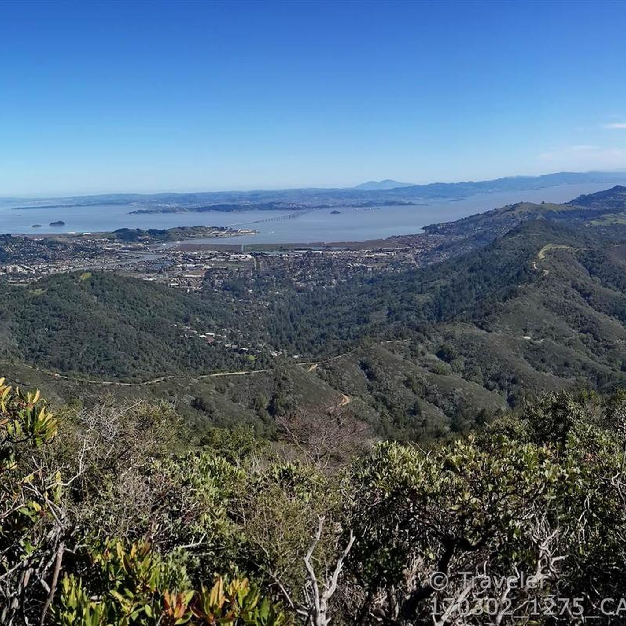
Mount Tam East Peak offers some of the most majestic views north of the bay. From this vantage point, you can see all of Marin, along with Point Reyes to the north and Oakland and San Francisco to the south. The stunning panoramic vistas make the journey well worth the effort. There are restrooms and picnic tables, ideal for a snack or lunch while you capture some incredible photos.
0
0

Fern Creek Trail is an excellent trail – scenic views, technical underfoot, loose at times, mind your head on low branches. Close to the bottom there have been caribou land slips and tree falls over the years that have meant the trail is rerouted up and over ever so slightly. Absolutely adore this trail.
0
0
Often busy on weekends, this is a great spot to take moment before/after summiting Mt Tam. There are spigots to fill up water and bathrooms that are open during park hours. The parking lot is very close for those that drive up. There is access to MANY trails for those on foot/bike.
0
0
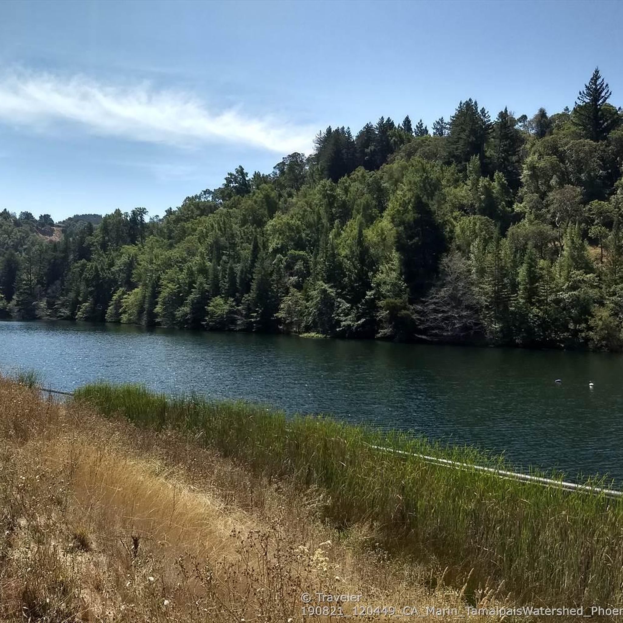
Narrower waters often glow green/blue down here. Has a different feel to the rest of the lake.
0
0

Just before the last ascent of East Ridgecrest Blvd toward the East Peak of Mt Tamalpais is the Railway Grade Fireroad Trailhead on the south side, and a few dozen yards furthe south, the Eldridge Grade Fire Road down on the north side.
0
0
This cabin dates back to the 1890s and was originally a caretaker's home located on what was known as part of the ranch for the nearby Porteous Mansion. The cabin's construction comes from redwood logs cut from the Deer Park section of the ranch and the trim around the windows and doors from a fallen tree on the southwest side of Shaver Grade. It is an interesting piece of local history and the only structure of its kind in Marin County.
1
0
Frequently Asked Questions
How many hiking trails are available around San Anselmo?
San Anselmo offers an extensive network of over 200 hiking routes. These trails traverse diverse landscapes including hills, creeks, meadows, oak woodlands, and redwood groves, catering to various skill levels.
Are there easy hiking trails suitable for beginners or families in San Anselmo?
Yes, San Anselmo has many easy trails. For a gentle and scenic walk, consider the Phoenix Lake loop — Mt. Tamalpais Watershed, which is 4.6 km long and takes about 1 hour 13 minutes. The area around Phoenix Lake is known for its peaceful atmosphere.
Where can I find trails with good views of the surrounding area?
Many trails in San Anselmo offer excellent views. Sorich Ranch Park, for example, has diverse trails with stunning vistas of Mount Tamalpais, Bald Hill, and the Seminary. The Bald Hill & Phoenix Lake loop — Bald Hill Preserve is a moderate option that provides expansive views.
Are there any challenging hiking trails for experienced hikers?
Yes, for a more challenging experience, you can explore routes with significant elevation gains. The Phoenix Lake & Lake Lagunitas via Tucker Trail & Pilot Knob loop — Mount Tamalpais Watershed is a moderate 13.1 km trail that includes substantial climbs and descents, offering a good workout.
What kind of natural features or attractions can I expect to see along the trails?
San Anselmo's trails wind through diverse natural settings. You'll encounter oak woodlands, redwood groves, and serene creeks. Highlights include the tranquil Phoenix Lake and the expansive Mount Tamalpais Watershed. For ancient redwoods, you can visit nearby attractions like the Muir Woods National Monument Entrance or the Cathedral Grove of Giant Redwoods.
Are there any circular hiking routes in San Anselmo?
Many of San Anselmo's trails are designed as loops, perfect for a complete hiking experience. A popular moderate loop is the Eldridge Grade to Tucker Trail loop — Ross Open Space, which is 9.4 km long and takes around 2 hours 47 minutes to complete.
What do other hikers say about the trails in San Anselmo?
The hiking routes in San Anselmo are highly regarded by the komoot community, with an average rating of 4.8 stars from over 370 reviews. Hikers frequently praise the varied terrain, beautiful scenery, and the well-maintained paths within the watershed areas.
Are there specific parks or open spaces known for hiking in San Anselmo?
Key areas for hiking include the Mount Tamalpais Watershed, Sorich Ranch Park, and Bald Hill Preserve. These locations offer a wide range of trails, from easy strolls to more strenuous climbs, all within a short distance of San Anselmo.
Can I find trails with wildflowers in San Anselmo?
Yes, Sorich Ranch Park is particularly known for its beautiful wildflowers, especially during spring. The diverse ecosystems in the region, including meadows and oak woodlands, provide excellent opportunities to spot various native flora.
Where can I find more information about parks and trails in San Anselmo?
For additional details on local parks and trails managed by the town, you can visit the official San Anselmo government website at sananselmo.gov/Parks or explore their dedicated trails page at sananselmo.gov/Trails.
What is the best time of year to go hiking in San Anselmo?
San Anselmo offers pleasant hiking conditions year-round. Spring brings vibrant wildflowers, while fall provides cooler temperatures and beautiful foliage. Even in winter, the mild climate often allows for enjoyable hikes, though some trails might be muddy after rain.
Are there any trails that lead to a lake or water feature?
Absolutely. Phoenix Lake is a central feature for many hikes in the area. The Phoenix Lake via Gertrude Ord & Tucker Trail loop — Mt. Tamalpais Watershed is an easy 6.7 km route that takes you directly to and around the tranquil waters of Phoenix Lake.
Most popular routes around San Anselmo
Most popular attractions around San Anselmo

Get inspired with the komoot mobile app


Explore more
Browse the best Hikes in other regions.
