The best running trails in Arapaho National Recreation Area
121
runners
22
runs
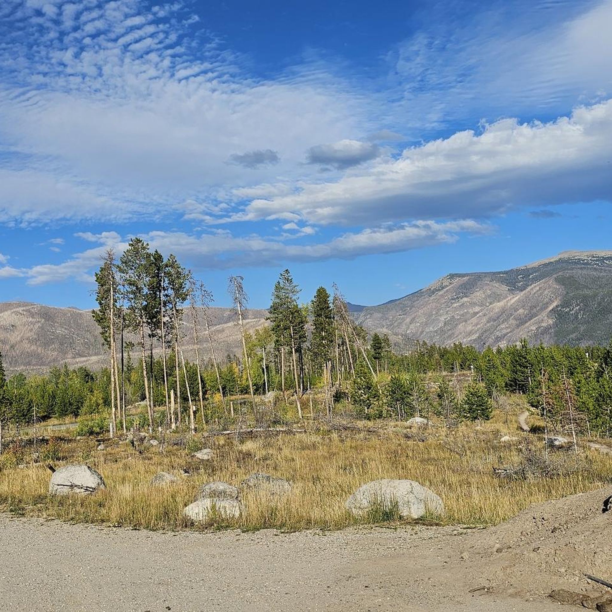
Jogging routes in Arapaho National Recreation Area traverse 35,000 alpine acres within the upper Colorado River Valley. The region is characterized by alpine meadows, mountain peaks, and crystal-clear waters, including five major reservoirs: Lake Granby, Shadow Mountain Lake, Monarch Lake, Willow Creek Reservoir, and Meadow Creek Reservoir. The area also straddles the Continental Divide, offering varied terrain from forested paths to open landscapes.
Best jogging routes in Arapaho National Recreation Area
- The most popular jogging route is Adams Falls Trail, an easy 0.8 miles (1.3 km) trail that takes about 8 minutes to complete, leading to a waterfall.
- Another top favourite among local runners is Strawberry Lake Trail, a moderate 3.6 miles (5.8 km) path featuring views of the Indian Peaks and wildflowers.
- Local runners also love the Monarch Lake loop run, a 4.1 miles (6.6 km) trail leading through forested areas and along the lake, often completed in about 49 minutes.
- Jogging in Arapaho National Recreation Area is defined by alpine meadows, forested paths, and lakeside routes, with options for different ability levels.
- The routes in Arapaho National Recreation Area are highly rated by the komoot community with an average score of 5.0 stars from over 1 review. More than 100 runners have used komoot to explore Arapaho National Recreation Area's varied terrain.
Last updated: August 31, 2026
10
runners
6.64km
00:49
80m
80m
Embark on the Monarch Lake loop run, a difficult jogging route covering 4.1 miles (6.6 km) through shaded forests and alongside the lake's glistening waters. You will gain 248 feet (76 metres) in elevation, with an estimated duration of 49 minutes. This challenging route offers a rewarding experience, providing views of the towering Rocky Mountain summits as you navigate the terrain.
For your visit, the Monarch Lake trailhead offers convenient parking, bathroom facilities, and picnic areas. The trail is dog-friendly, but please note that dogs are not permitted to swim in Monarch Lake itself. This popular spot can get busy, especially on weekends, so plan your arrival accordingly.
Located within the Indian Peaks Wilderness, this route is a great opportunity to observe local wildlife such as deer and moose. You might also spot antique logging equipment, known as "steam donkeys," which are relics from the area's past. The trail provides a unique blend of natural beauty and historical intrigue.
8
runners
9.29km
01:11
150m
150m
Lace up your jogging shoes for the East Shore Trail, a moderate route offering serene views of Shadow Mountain Lake. As you jog, the path gently winds through the natural landscape, providing glimpses of the majestic Rocky Mountain National Park scenery. This 5.8 miles (9.3 km) journey involves a manageable 495 feet (151 metres) of elevation gain, making it a rewarding experience without being overly strenuous. You can expect to complete this route in about 1 hour and 10 minutes, enjoying the fresh mountain air and peaceful atmosphere. It's a perfect way to immerse yourself in the area's natural beauty.
Accessing the East Shore Trail is straightforward, with general parking conveniently available right at the trailhead. This makes it easy for most visitors to start their jogging adventure without hassle. Before you head out, it's always a good idea to check the current local conditions. Mountain weather can change rapidly, especially during the shoulder seasons, so being prepared will ensure a more enjoyable and safe outing. Plan your visit accordingly to make the most of your time on the trail.
This trail is situated within the beautiful Arapaho National Recreation Area, offering a unique opportunity to experience the region's diverse ecosystem. The route provides a chance to connect with nature, observing the local flora and fauna that thrive in this mountain environment. Its location near Rocky Mountain National Park also means you are in a prime spot to explore other natural wonders. The East Shore Trail stands out as an accessible option for those looking to combine a good jog with stunning natural scenery.

Sign up for free
7
runners
22.6km
03:00
590m
590m
Prepare for a challenging jogging adventure on the Cascade Creek Trail, a difficult 14.1-mile (22.6 km) route that climbs 1934 feet (590 metres) over approximately 3 hours. You will journey through lush aspen groves and open meadows, experiencing quintessential Colorado terrain. The trail leads you past stunning waterfalls, including the impressive Cascade Creek Waterfall, and eventually to crystal-clear alpine lakes like Mirror Lake and Crater Lake, set against the dramatic craggy Indian Peaks.
When planning your visit, be aware that this route is very popular in the Indian Peaks Wilderness, especially on weekends and holidays. The first 1.5 miles from the Monarch Lake Trailhead offer a relatively flat start, but don't be fooled; subsequent sections become very steep with numerous switchbacks. You should also expect technical terrain, including rock scree and downed trees, making for a demanding workout.
This trail is a highlight within the Indian Peaks Wilderness, known for its diverse landscapes and rewarding views. It offers a substantial workout for experienced joggers seeking both a physical challenge and the beauty of high-alpine environments. The journey from Monarch Lake provides a deep dive into the region's natural splendor, making it a memorable outing.
6
runners
17.1km
02:13
520m
520m
Embark on a difficult jogging adventure along the East Inlet Trail, a challenging 10.6-mile (17.1 km) route that demands a significant 1702 feet (519 metres) of elevation gain. You can anticipate spending around 2 hours and 12 minutes navigating this path. The trail guides you alongside the East Inlet Creek, where you will encounter the striking Adams Falls, before continuing its ascent through varied terrain towards higher alpine lakes.
Before you begin your jogging trip, note that the East Inlet Trail starts at an elevation of 8,420 feet, so allow yourself time to adjust if you are not accustomed to high altitudes. Dogs are not permitted on this route, so make alternative arrangements for your pets. Always check the Rocky Mountain National Park regulations for any required permits or fees to ensure a smooth visit.
This trail offers a unique opportunity to experience the diverse ecosystems within Rocky Mountain National Park. As you jog, keep an eye out for local wildlife, including elk and moose, particularly in the expansive Kawuneeche Valley. The journey from wildflower-filled meadows to pristine alpine lake views showcases the natural beauty that makes this area so special.
4
runners
15.5km
02:08
520m
520m
If you are looking for a challenging jogging route with big rewards, the Shadow Mountain Lookout Trail is a difficult 9.6 miles (15.5 km) journey that climbs 1712 feet (522 metres). You will spend about 2 hours and 8 minutes ascending through mixed pine and aspen forests, with intermittent views of Shadow Mountain Lake. The highlight is reaching the historic Shadow Mountain Lookout, where you can enjoy expansive panoramic views of Shadow Mountain Lake, Grand Lake, Lake Granby, and the majestic peaks of the Continental Divide.
To begin your adventure, you can access the Shadow Mountain Lookout Trail from various trailheads, including the Grand Lake East Shore Trailhead. Parking is typically available at these access points, making it convenient to start your run. Always check local conditions before heading out, especially during different seasons, to ensure the trail is open and accessible.
This route stands out for its unique blend of forest immersion and dramatic alpine vistas, offering a true Rocky Mountain experience. The trail's path through diverse ecosystems, from lakeside views to high-altitude forests, provides a dynamic backdrop for your jogging efforts. It's a fantastic way to connect with the natural beauty and scale of the region.
3
runners
1.30km
00:09
20m
20m
If you are looking for a quick and easy jogging route in Rocky Mountain National Park, the Adams Falls Trail offers a rewarding experience. This short path covers just 0.8 miles (1.3 km) with a gentle elevation gain of 68 feet (21 metres), making it an easy option that takes around 8 minutes to complete. You will wind through a beautiful forested area, where aspens and pine trees line the way, leading you to the impressive 55-foot Adams Falls, which rushes through a narrow rock gorge. Along the route, you can also catch glimpses of Grand Lake in the distance, adding to the scenic beauty of your run. This trail is perfect for a refreshing outdoor break without a major time commitment.
To plan your visit, know that the Adams Falls Trail is located just outside Grand Lake on the western side of Rocky Mountain National Park. While the route is generally easy, be prepared for a rocky uphill incline at the start and some natural steps along the path. If you plan to jog during colder months, it is a good idea to bring microspikes, as icy conditions can occur. This trail is easily accessible and a great option for a quick outing when you are in the area.
The trail is particularly notable for its vibrant autumn colors when the aspens turn brilliant shades, creating a picturesque backdrop for your jog. Keep an eye out for wildlife, as you might spot elk or moose in the area, especially during quieter times. The combination of the powerful waterfall, the serene forest, and potential wildlife sightings makes this short trail a memorable part of your visit to the park. It is a fantastic way to experience a slice of the park's natural beauty without committing to a longer excursion.
2
runners
5.81km
00:51
250m
250m
Embark on a moderate jogging route along the Strawberry Lake Trail, covering 3.6 miles (5.8 km) with an elevation gain of 827 feet (252 metres). You can expect to complete this journey in about 51 minutes. The trail winds through lush green forests and past flowing brooks, with an initial steep ascent in the first mile before leveling out. Your efforts are rewarded with the tranquil beauty of Strawberry Lake, adorned with water lilies and framed by the Indian Peaks Range.
When planning your visit, be aware that the trailhead for Strawberry Lake Trail is unmarked. To find parking, look for a small pull-off situated between mile markers 7 and 8 on County Road 6. Once you reach Strawberry Lake, remember to stay on designated dock areas or the metal boardwalk. This helps protect the fragile floating mat fen ecosystem, ensuring its preservation for future visitors.
This trail offers more than just a good jog; it's an opportunity to connect with nature and observe local wildlife. Keep an eye out for deer or elk, which are sometimes spotted on the rock ledges near the lake. The serene alpine setting, complete with water lilies and mountain views, makes this route a notable experience in the Arapaho National Recreation Area.
6.11km
00:45
70m
70m
Embark on a moderate jogging adventure through Rocky Mountain National Park with the East Shore Trail and Continental Divide Trail Loop. This route offers a refreshing experience as you cover 3.8 miles (6.1 km) and gain 223 feet (68 metres) in elevation. You can expect to complete this scenic loop in about 44 minutes, enjoying the natural beauty and the distinct feel of the East Shore Trail as it guides you along.
When planning your visit, you will find general parking conveniently located near the trailhead for this loop. Before heading out, it is always a good idea to check local park regulations for Rocky Mountain National Park, as specific permits or fees might be required for access. Consider an early morning or late afternoon start to enjoy cooler temperatures and potentially fewer people on the trail.
This loop provides a wonderful opportunity to immerse yourself in the diverse landscape of Rocky Mountain National Park. A key highlight of your journey will be the picturesque views of Shadow Mountain Lake, which adds a serene backdrop to your jogging experience. The combination of the East Shore Trail and the Continental Divide Trail offers a unique perspective on the park's varied terrain and natural features.
12.8km
02:17
610m
610m
Jog the difficult 8.0-mile Caribou Pass Trail in Indian Peaks Wilderness, gaining 2013 feet with panoramic alpine views.
12
runners
7.86km
00:58
70m
70m
Hard run. Good fitness required. Sure-footedness, sturdy shoes and alpine experience required.
Get access to more routes and recommendations from other explorers.
Sign up for free
Already have an account?
Our route recommendations are based on thousands of hikes, rides, and runs completed by other people on komoot.
Start today with a free account
Your next adventure awaits.
Login or Signup
Tips from the Community

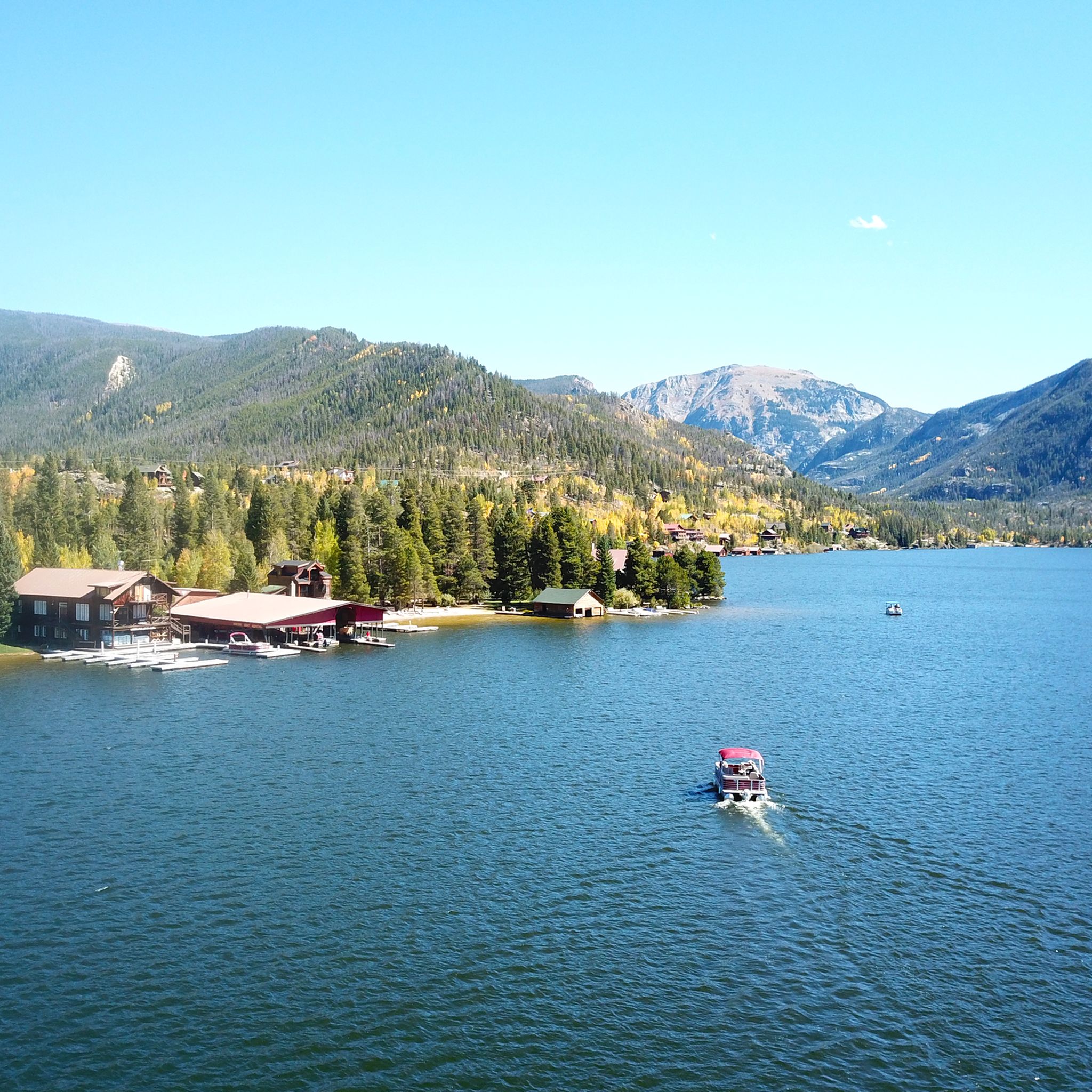
The town of Grand Lake is located at the western entrance to Rocky Mountain National Park. It is situated in a beautiful mountain landscape and serves as a starting point for many activities in the western half of the park.
0
0
A short walk from the large parking lot to Adam Falls. They are very easy to reach, and the path is well-maintained, although there are a few steps and rocks to climb. A circular trail has been created near the falls, which runs along the river.
0
0

This stunning lake in Indian Peak Wilderness is surrounded by mountains and offers spectacular views. It's not too far from the parking area and is the junction point for several trails in the area, allowing for more extensive tours!
0
0
The East Shore Trail leads alongside Shadow Lake and to the east to form a loop. From this trail, you have the option to connect to Shadow Mountain Lookout Trail and the Continental Divide Trail to extend your outing!
0
0

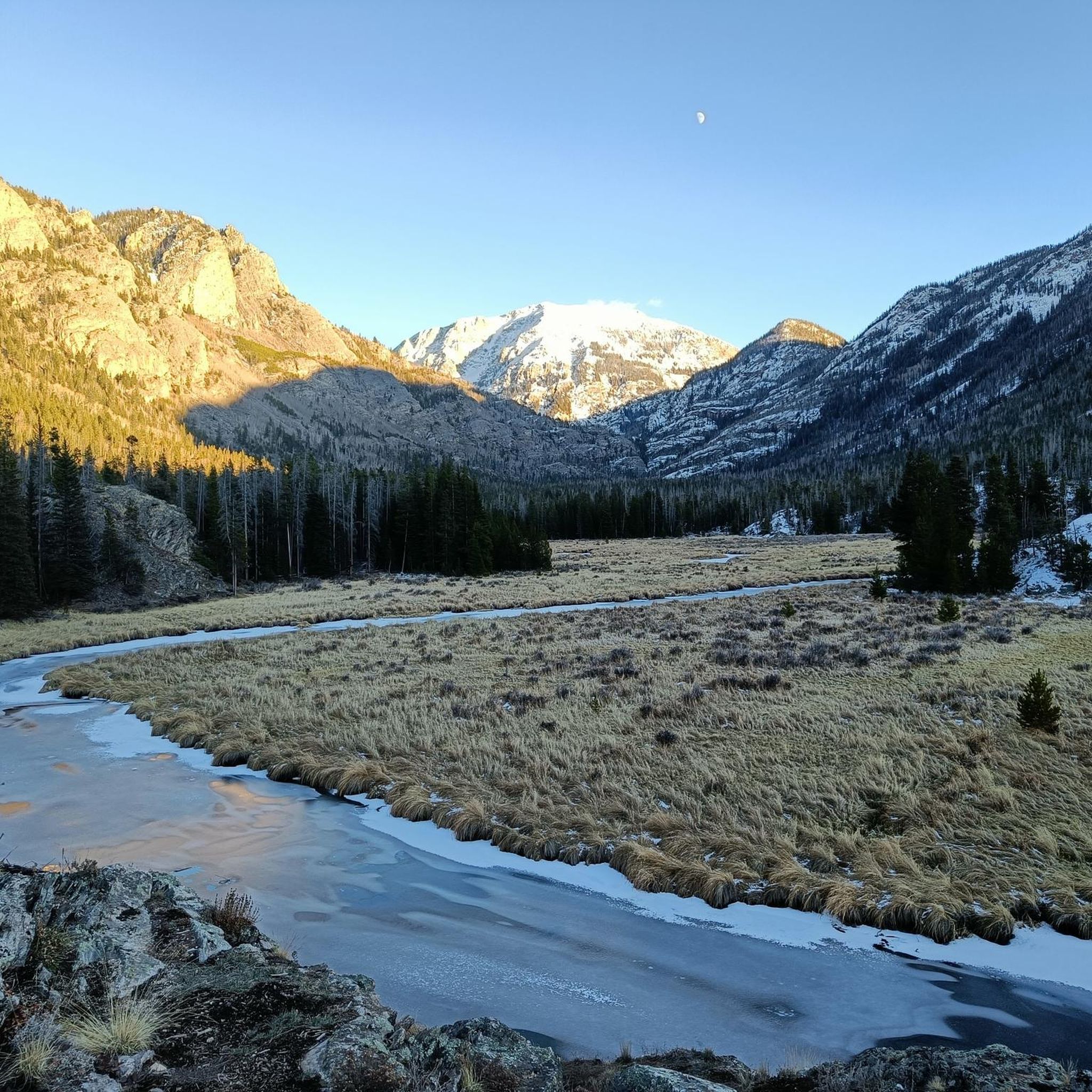
Lake Dorothy is a beautiful alpine lake in the southern part of Indian Peaks Wilderness. At 12,061 ft Lake Dorothy is the highest lake in the Indian Peaks Wilderness and can still be frozen over until July.
0
0

Monarch Lake is a stunning lake surrounded by trees and awesome mountain views. It is easily accessible and close to parking, so it is a great spot for hiking, paddleboarding, kayaking and fishing. There are also campgrounds and more extended hiking trails nearby that make this a great starting point for an adventure.
1
0
This serene lake surrounded by meadows is a beautiful destination at the end of the Strawberry Lake Trail. It is an awesome spot to be in the autumn when the colors are at their peak!
1
0
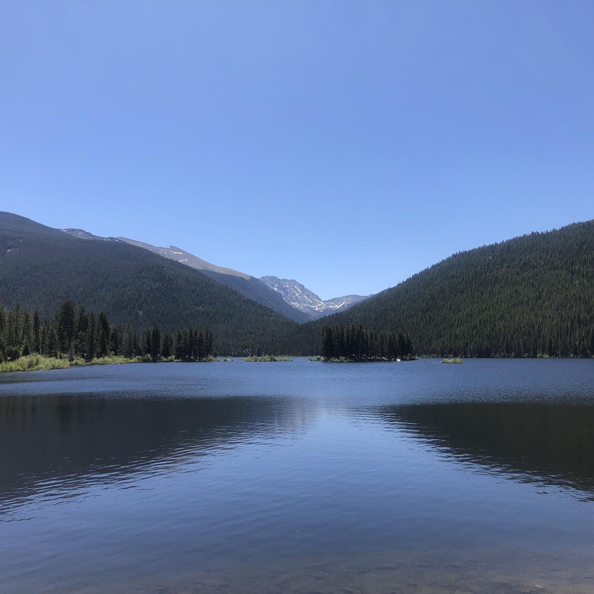
This is a Picturesque Lake surrounded by towering pines. There is also a "lone" pine tree on a small rock/island not far from the shore.
0
0
Frequently Asked Questions
What kind of terrain can I expect on running routes in Arapaho National Recreation Area?
The Arapaho National Recreation Area offers a diverse range of terrain for runners. You'll find everything from alpine meadows and forested paths to routes along the shores of its five major reservoirs: Lake Granby, Shadow Mountain Lake, Monarch Lake, Willow Creek Reservoir, and Meadow Creek Reservoir. The area also straddles the Continental Divide, providing varied landscapes and elevation changes.
Are there any easy or beginner-friendly running trails in the area?
Yes, there are routes suitable for beginners. For a relatively easy and scenic run, consider the Adams Falls Trail, which is only 0.8 miles (1.3 km) long and leads to a beautiful waterfall. This trail is a great option for a relaxed jog.
Can I find routes with waterfalls or other natural features?
Absolutely! The Arapaho National Recreation Area is rich in natural beauty. The Adams Falls Trail is a popular choice for its waterfall. Additionally, the region is known for its crystal-clear waters, alpine meadows, and opportunities to spot wildlife and wildflowers, especially during warmer months.
Are there any loop or circular running routes available?
Yes, if you prefer circular routes, the Monarch Lake loop run is a great option. This 4.1-mile (6.6 km) trail takes you through forested areas and along the picturesque Monarch Lake, offering a refreshing experience.
What do other runners say about the trails in Arapaho National Recreation Area?
The running routes in Arapaho National Recreation Area are highly regarded by the komoot community, holding an average score of 5.0 stars. Over 100 runners have used komoot to explore the varied terrain, often praising the scenic beauty and diverse options available.
Are there any longer or more challenging running routes for experienced runners?
For those seeking a greater challenge, the area offers several difficult routes. The North Inlet - Tonahutu Creek Loop is a substantial 30.5-kilometer (19-mile) trail with significant elevation gain, perfect for long-distance runners looking for a demanding experience.
What are some scenic viewpoints or landmarks I might encounter while running?
The Arapaho National Recreation Area is full of scenic spots. You can enjoy views of the Indian Peaks from trails like the Strawberry Lake Trail. The region's five major reservoirs also provide stunning lakeside vistas, and many trails offer glimpses of the Continental Divide's dramatic topography.
Are there any trails that offer a mix of forest and open landscapes?
Yes, many trails provide a varied experience. Routes originating from the Monarch Lake Trailhead, for instance, often lead through dense forests before opening up to expansive landscapes like Coyote Park, offering a dynamic running environment.
What is the best time of year to go running in Arapaho National Recreation Area?
The warmer months are generally ideal for running in the Arapaho National Recreation Area, as this is when you can best enjoy the vibrant displays of wildflowers and encounter various wildlife. However, conditions can vary, so checking local weather and trail reports is always recommended.
Are there any moderate-difficulty running trails in the area?
Yes, there are several moderate options. The Strawberry Lake Trail is a moderate 3.6-mile (5.8 km) path known for its wildflowers and views of the Indian Peaks. Another moderate choice is the East Shore Trail and Continental Divide Trail Loop, offering a 6.1 km run with varied scenery.
Are there opportunities for lakeside running?
Definitely. With five major reservoirs—Lake Granby, Shadow Mountain Lake, Monarch Lake, Willow Creek Reservoir, and Meadow Creek Reservoir—the area provides excellent opportunities for lakeside runs. These routes offer unique views and a different running experience compared to mountain trails.
Most popular routes in Arapaho National Recreation Area

Get inspired with the komoot mobile app


Didn’t find what you were looking for?
Check out more Running Trails & Routes throughout Arapaho National Recreation Area below and find the perfect route in your destination.
Explore more
Browse the best Running Trails & Routes in other regions.
