The best road cycling routes in Stanislaus National Forest
5.0
(4)
337
riders
33
rides
Road cycling routes in Stanislaus National Forest traverse a diverse landscape within California's Central Sierras, characterized by significant elevation changes. The region features extensive forestlands of cedar, pine, fir, and oak, alongside serrated river valleys and high mountain passes. Paved roads wind through this varied topography, offering routes from lower elevations up to nearly 10,000 feet.
Best road cycling routes in Stanislaus National Forest
- The most popular road cycling route is From Mather to Hetch Hetchy Reservoir and back, a 18.0 miles (29.0 km) moderate trail that takes 1 hour 35 minutes to complete. This route offers scenic views of the Hetch Hetchy Reservoir area.
- Another top favourite among local road cyclists is Ebbets Pass – Ebbetts Pass loop from Bear Valley, a difficult 36.3 miles (58.4 km) path. This challenging route features significant elevation gain through mountain terrain.
- Local road cyclists also love the Bear Valley Bear – Spicer Reservoir Rd / SnoPark loop from North Grove, a 45.0 miles (72.4 km) trail leading through forested areas and past reservoirs, often completed in about 3 hours 42 minutes.
- Road cycling in Stanislaus National Forest is defined by soaring mountains, lush forestlands, and scenic paved roads, including notable mountain passes. The network offers options for different ability levels, from moderate rides to challenging climbs.
- The routes in Stanislaus National Forest are highly rated by the komoot community with an average score of 5.0 stars from 4 reviews. More than 270 road cyclists have used komoot to explore Stanislaus National Forest's varied terrain.
Last updated: July 7, 2026
9
riders
29.0km
01:35
580m
580m
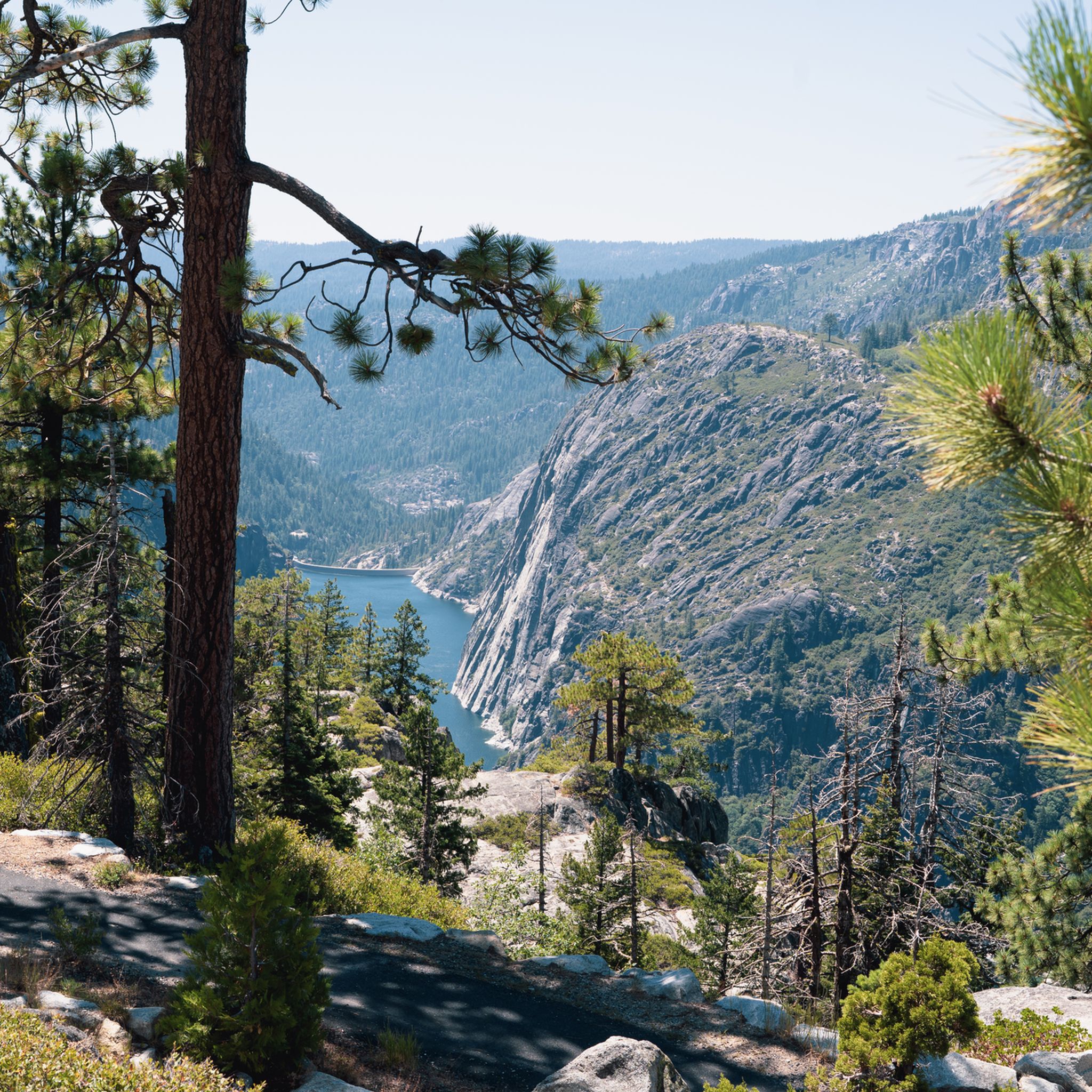
Embark on a moderate road cycling journey from Mather to Hetch Hetchy Reservoir and back, covering 18.0 miles (29.0 km) with a total elevation gain of 1916 feet (584 metres). This route typically takes about 1 hour and 34 minutes to complete. As you cycle, you will follow a winding, tree-lined path, offering views of rustic landscapes and towering granite walls. The ride culminates at the O'Shaughnessy Dam, providing a peaceful and immersive experience.
This route is situated in the northern part of Yosemite National Park, offering a quieter alternative to the park's more crowded areas. The road's dead-end at the dam ensures a serene atmosphere, allowing you to fully appreciate the pristine wilderness. Remember that standard park entrance fees apply when planning your visit to this section of the national park.
The Hetch Hetchy Valley, now home to the Hetch Hetchy Reservoir, is a notable feature of this area. You can expect to see dramatic waterfalls, such as Wapama Falls, cascading down the stunning vertical granite formations. This unique setting provides a distinctive and scenic experience for road cyclists looking for trails near Hetch Hetchy.
17
riders
58.4km
03:28
1,410m
1,410m
The Ebbets Pass – Ebbetts Pass loop from Bear Valley is a demanding road cycling route that plunges you into the heart of the high Sierra. You'll navigate a difficult 36.3-mile (58.4 km) journey with a significant 4620 feet (1408 metres) of elevation gain, typically completed in about 3 hours and 27 minutes. The scenery unfolds from granite outcrops and ancient volcanic peaks to deep river canyons and glacially carved valleys, with spectacular views of the Mokelumne Wilderness and the welcome sight of Kinney Lake near the summit. This ride is for experienced cyclists who thrive on challenging terrain and majestic alpine vistas.
Starting from Bear Valley, a popular hub for outdoor adventures, you'll find parking available. Be aware that the weather in the Sierra Nevada can shift dramatically, bringing anything from intense heat to snow, sometimes within the same day, so prepare for varied conditions. The best time to experience the full visual splendor of this route is in the fall when the foliage transforms into vibrant colors. The narrow roads and steep, blind hairpin turns, especially on the eastern approach, require focused attention and confident bike handling.
This route is part of a National Scenic Byway, celebrated as a

Sign up for free
5.0
(1)
14
riders
Hard road ride. Very good fitness required. Mostly well-paved surfaces and easy to ride.
11
riders
34.7km
01:50
630m
630m
Moderate road ride. Good fitness required. Mostly well-paved surfaces and easy to ride.
5.0
(1)
15
riders
Moderate road ride. Good fitness required. Mostly well-paved surfaces and easy to ride.
Get access to more routes and recommendations from other explorers.
Sign up for free
Already have an account?
Our route recommendations are based on thousands of hikes, rides, and runs completed by other people on komoot.
Start today with a free account
Your next adventure awaits.
Login or Signup

Other adventures in Stanislaus National Forest

Tips from the Community

Don't miss it before you leave the valley. Be sure to stop, because the view isn't the same from the car.
0
0

Accessible free for bikers, good visitor center with info about history and nature trails, restrooms, drinking water fountains, snack sales. Safe place to leave bikes to explore the walking-only trails.
0
0

These lakes are a popular spot for fishing. There are a couple of nice hiking trails too, and a campground.
0
0
It's quite a grind to get up here, at an elevation of 8,736 feet or 2,663 m, but sometimes you just have to play road biker for the views.
0
0


One of many excellent Yosemite Valley viewpoints. The valley shows off Half Dome, El Capitan, and Yosemite Falls.
0
0
Tall wooden carved bear sculpture carved from massive tree stumps greets visitors at the entrance of Bear Valley.
0
0
In the southern portion of Yosemite, this river is a boisterous cataract plunging down a steep channel. But here, it's more of a meandering channel and rich home for birds and fish. Swimming is generally allowed in calm parts of the river, as long as you enter/exit via sandy beaches to protect the shore from erosion. Watch out for poison oak along the banks!
0
0
Frequently Asked Questions
How many road cycling routes are available in Stanislaus National Forest?
Stanislaus National Forest offers a wide selection of road cycling routes, with over 28 tours available on komoot. These routes traverse diverse landscapes, from lower elevations to high mountain passes.
What is the best time of year for road cycling in Stanislaus National Forest?
The best time for road cycling in Stanislaus National Forest is generally from late spring through early autumn. During these months, mountain passes are typically clear of snow, and the weather is most favorable for exploring the varied terrain. Always check local conditions, especially for higher elevation routes, as snow can persist into early summer.
What are the difficulty levels of road cycling routes in Stanislaus National Forest?
The routes cater to a range of abilities. You'll find 13 moderate routes, suitable for cyclists with good fitness, and 15 difficult routes, which involve significant elevation gains and longer distances, ideal for experienced riders seeking a challenge. There are no easy routes listed, indicating the terrain generally requires some level of fitness.
Are there scenic viewpoints or landmarks along the road cycling routes?
Yes, many routes offer breathtaking views and pass by notable landmarks. You can find stunning vistas at places like Leavitt Lake Overlook - PCT or experience the dramatic scenery of Ebbetts Pass National Scenic Byway. The forest is also home to numerous alpine lakes and rivers, providing picturesque backdrops for your ride.
Can I see Giant Sequoias while road cycling in the area?
Yes, the Stanislaus National Forest encompasses areas like Calaveras Big Trees State Park, which is famous for its majestic Giant Sequoias. While specific road cycling routes might not go directly through the groves, you can plan a ride that allows for a visit to these impressive trees, such as the Bear Valley Bear – Spicer Reservoir Rd / SnoPark loop from North Grove, which passes through forested areas.
Are there any notable mountain passes for challenging road cycling routes?
Absolutely. The region is renowned for its challenging mountain passes. The Ebbets Pass – Ebbetts Pass loop from Bear Valley is a difficult route featuring significant elevation gain. The Highway 108 Corridor (Sonora Pass) is another iconic climb, ascending to over 9,600 feet, offering spectacular views and a demanding ride. You can find highlights like Sonora Pass Climb West and Ebbetts Pass 🗻 Pacific Grade Summit.
Are there any loop routes for road cycling in Stanislaus National Forest?
Yes, several excellent loop routes are available for road cyclists. Examples include the challenging Ebbets Pass – Ebbetts Pass loop from Bear Valley and the Bear Valley Bear – Spicer Reservoir Rd / SnoPark loop from North Grove. For a moderate option, consider the Roadbike loop from Groveland-Big Oak Flat.
What are the parking options for road cyclists in Stanislaus National Forest?
Parking is generally available at various trailheads and access points throughout the forest. For specific routes, it's advisable to check the route details on komoot, as many start points are near designated parking areas or small towns like Mather, Bear Valley, or Groveland, which offer facilities.
Is public transport available for accessing road cycling routes?
Public transport options directly into the more remote areas of Stanislaus National Forest are limited. Most cyclists typically access the routes by car, parking at designated trailheads or nearby towns. Planning your route to start and end in a town with amenities is recommended if you're relying on limited transport options.
Where can I find amenities like cafes or accommodation near the cycling routes?
Towns bordering or within the Stanislaus National Forest, such as Groveland, Arnold, Murphys, and Bear Valley, offer various amenities including cafes, restaurants, and accommodation. Planning your rides to pass through or start from these towns can provide convenient access to services.
What do other road cyclists say about their experience in Stanislaus National Forest?
The road cycling routes in Stanislaus National Forest are highly regarded by the komoot community, with an average rating of 5.0 stars from 4 reviews. Over 270 road cyclists have explored the area using komoot, often praising the diverse terrain, stunning mountain scenery, and the less crowded experience compared to more famous national parks.
Are there less crowded road cycling options compared to more famous parks?
Yes, Stanislaus National Forest is often considered a 'backcountry gem' and is generally less crowded than more famous national parks like Yosemite. This allows for a more tranquil and immersive cycling experience, letting you enjoy the natural beauty without the hustle and bustle.
Are there any routes that offer views of lakes or reservoirs?
Many routes in the Stanislaus National Forest provide stunning views of its numerous alpine lakes and reservoirs. For example, the route From Mather to Hetch Hetchy Reservoir and back offers scenic views of the Hetch Hetchy Reservoir area. Other notable water bodies in the region include Cherry Lake 🌊 near Yosemite and Lower Highland Lake 🗻.
Most popular routes in Stanislaus National Forest
Most popular attractions in Stanislaus National Forest

Get inspired with the komoot mobile app


Explore more
Browse the best Road cycling routes in other regions.
