The best road cycling routes in El Tepozteco
5.0
(3)
53
riders
8
rides
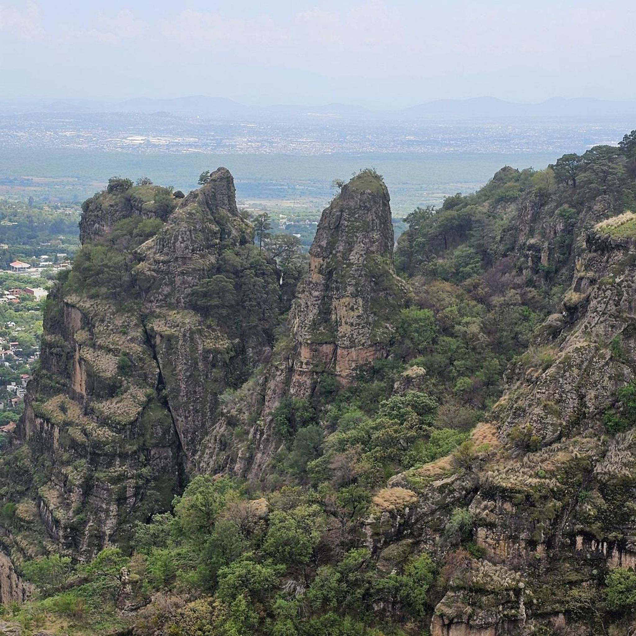
Road cycling in El Tepozteco is characterized by its rugged, mountainous terrain within the Sierra del Tepozteco mountain range, part of the Cordillera Neovolcánica. The region features steep cliffs, deep canyons, and towering rock formations, creating diverse cycling opportunities. Cyclists navigate challenging ascents with significant elevation gain through dense pine-oak forests, offering panoramic views of the Tepoztlán valley. This varied topography provides routes suitable for different fitness levels.
Best road cycling routes in El Tepozteco
- The most popular road cycling…
Last updated: July 2, 2026
9
riders
60.8km
03:14
940m
940m
Hard road ride. Very good fitness required. Some segments of this route may be unpaved and difficult to ride.
5.0
(1)
22
riders
Moderate road ride. Good fitness required. Mostly well-paved surfaces and easy to ride.

Sign up for free
10
riders
62.5km
03:10
930m
930m
Hard road ride. Very good fitness required. Mostly well-paved surfaces and easy to ride.
5.0
(2)
7
riders
53.5km
02:35
670m
670m
Moderate road ride. Good fitness required. Mostly well-paved surfaces and easy to ride.
2
riders
71.6km
03:34
760m
760m
Moderate road ride. Good fitness required. Some segments of this route may be unpaved and difficult to ride.
Get access to more routes and recommendations from other explorers.
Sign up for free
Already have an account?
Our route recommendations are based on thousands of hikes, rides, and runs completed by other people on komoot.
Start today with a free account
Your next adventure awaits.
Login or Signup
Popular around El Tepozteco

Tips from the Community


You can get there by road bike with low pressure and a gentle pace.
0
0
Delicious coffee in Ixcatepec, using the route to either Amatlán or Yautepec. Opens at 8 a.m.
0
0

Good place, nature and good gradient.
0
0


Full of greenery and curves. Going down or up is delicious and hot. There is a double lane there which is quite safe as long as there is no accident
3
0

You can buy food at affordable prices
0
0
Frequently Asked Questions
What kind of terrain can I expect on road cycling routes in El Tepozteco?
El Tepozteco is characterized by its rugged, mountainous terrain, part of the Cordillera Neovolcánica. Cyclists will encounter steep cliffs, deep canyons, and towering rock formations. The routes often feature challenging ascents with significant elevation gain, winding through dense pine-oak forests and offering panoramic views of the Tepoztlán valley.
Are there routes suitable for different fitness levels?
Yes, the varied topography of El Tepozteco provides road cycling opportunities for different fitness levels. While many routes involve challenging ascents, there are also moderate paths available. For example, the Café Binta – View From Yellow Bridge loop from Antigua Estación de Ferrocarril de Cuernavaca is rated as moderate, offering scenic vistas through varied terrain.
What are some notable landmarks or viewpoints I might encounter while cycling in El Tepozteco?
Road cycling routes in El Tepozteco offer numerous panoramic views of the Tepoztlán valley and surrounding mountains. While cycling, you can appreciate the dramatic setting of the ancient Tepozteco Pyramid from a distance. Other points of interest include the View of Tepoztlán from the Cliffs and the Cruz de Axitla.
How many road cycling routes are available in El Tepozteco?
There are 8 road cycling routes available in El Tepozteco, offering a range of experiences from moderate to difficult. These routes are highly rated by the komoot community, with an average score of 5.0 stars.
Are there any long-distance road cycling routes in the region?
Yes, El Tepozteco offers several longer road cycling routes. For instance, the Cañón de Lobos – Ex Cuartel de Zapata loop from Jiutepec is a moderate route spanning 44.5 miles (71.5 km), typically completed in over 3.5 hours.
What do other road cyclists enjoy most about road cycling in El Tepozteco?
The komoot community highly rates road cycling in El Tepozteco, with an average score of 5.0 stars from 3 reviews. Cyclists often praise the challenging ascents, the stunning panoramic views, and the experience of riding through dense pine-oak forests and unique volcanic formations.
Are there any circular road cycling routes in El Tepozteco?
Yes, many of the road cycling routes in El Tepozteco are designed as loops. Examples include the Café Binta – View From Yellow Bridge loop from Los Venaditos and the Cañón de Lobos loop from Antigua Estación de Ferrocarril de Cuernavaca, allowing you to start and finish at the same point.
What is the best time of year for road biking in El Tepozteco?
El Tepozteco's climate, being part of the Trans-Mexican Volcanic Belt, generally offers pleasant conditions for cycling. While specific seasonal recommendations are not provided, the region's natural beauty, including its pine-oak forests and panoramic views, can be enjoyed throughout much of the year. It's always advisable to check local weather forecasts before planning your ride.
Can I find challenging road cycling routes in El Tepozteco?
Absolutely. El Tepozteco is known for its rugged, mountainous terrain, making it an excellent destination for challenging road cycling. Routes like the Cañón de Lobos – View From Yellow Bridge loop from Jiutepec are rated as difficult, featuring significant elevation gain and demanding ascents.
Are there any road cycling routes that start near historical sites or towns?
Yes, some routes are conveniently located near points of interest. For example, the Café Binta – View From Yellow Bridge loop from Antigua Estación de Ferrocarril de Cuernavaca starts near the Old El Parque Station. The charming town of Tepoztlán itself, a 'Pueblo Mágico,' serves as an excellent base for exploring the surrounding natural beauty and routes.
What are the typical elevation gains on road cycling routes in El Tepozteco?
Due to the mountainous terrain, road cycling routes in El Tepozteco often feature significant elevation gains. For instance, the Café Binta – View From Yellow Bridge loop from Los Venaditos involves an elevation gain of approximately 946 meters (3,100 feet) over its 38.1-mile (61.4 km) distance.
Most popular attractions in El Tepozteco

Get inspired with the komoot mobile app


