The best walks and hikes around Beaver Lake
4.6
(13)
235
hikers
20
hikes
If you've ever tried planning hiking around Beaver Lake, you know how quickly the options can feel overwhelming. With so many trails winding through the Ozarks, it's tough to tell which routes are genuinely worth your time and effort, and which are just filler. That's where we come in. Our komoot community has mapped, walked, and reviewed these trails, and we've distilled all that local knowledge into a curated shortlist of the best hiking routes around Beaver Lake, saving you…
Last updated: May 10, 2026
1
hikers
11.1km
03:11
260m
260m
The Lost Bridge Trail in Arkansas offers a dynamic hiking experience, winding through dense tree canopies and past impressive bluff outcroppings. You'll navigate varied terrain, from challenging singletrack with steep,…
503m
00:09
20m
20m
The Rim Rock Nature Trail offers a delightful, brief immersion into the local environment, perfect for a quick refresh. This easy hiking trail is designed for accessibility, guiding you through…

Sign up for free
5
hikers
10.5km
02:52
150m
150m
The War Eagle Valley Loop offers a delightful journey through forest-covered areas and along scenic hillsides, providing pleasant valley views through the trees. You'll encounter cool limestone bluffs and the…
5
hikers
10.5km
02:53
170m
170m
Moderate hike. Good fitness required. Easily-accessible paths. Suitable for all skill levels.
1
hikers
1.19km
00:19
10m
20m
The Historic Van Winkle Trail offers a delightful blend of natural serenity and historical intrigue, making it a standout easy hike in the Ozarks. As you wander along the wide,…
Get access to more routes and recommendations from other explorers.
Sign up for free
Already have an account?
Our route recommendations are based on thousands of hikes, rides, and runs completed by other people on komoot.
Start today with a free account
Your next adventure awaits.
Login or Signup




Tips from the Community

Whitney Mountain sits above Beaver Lake and has great views down to the lake and of the woods around it. The hilltop is best visited on a clear day so you can take in the full panorama.
0
0
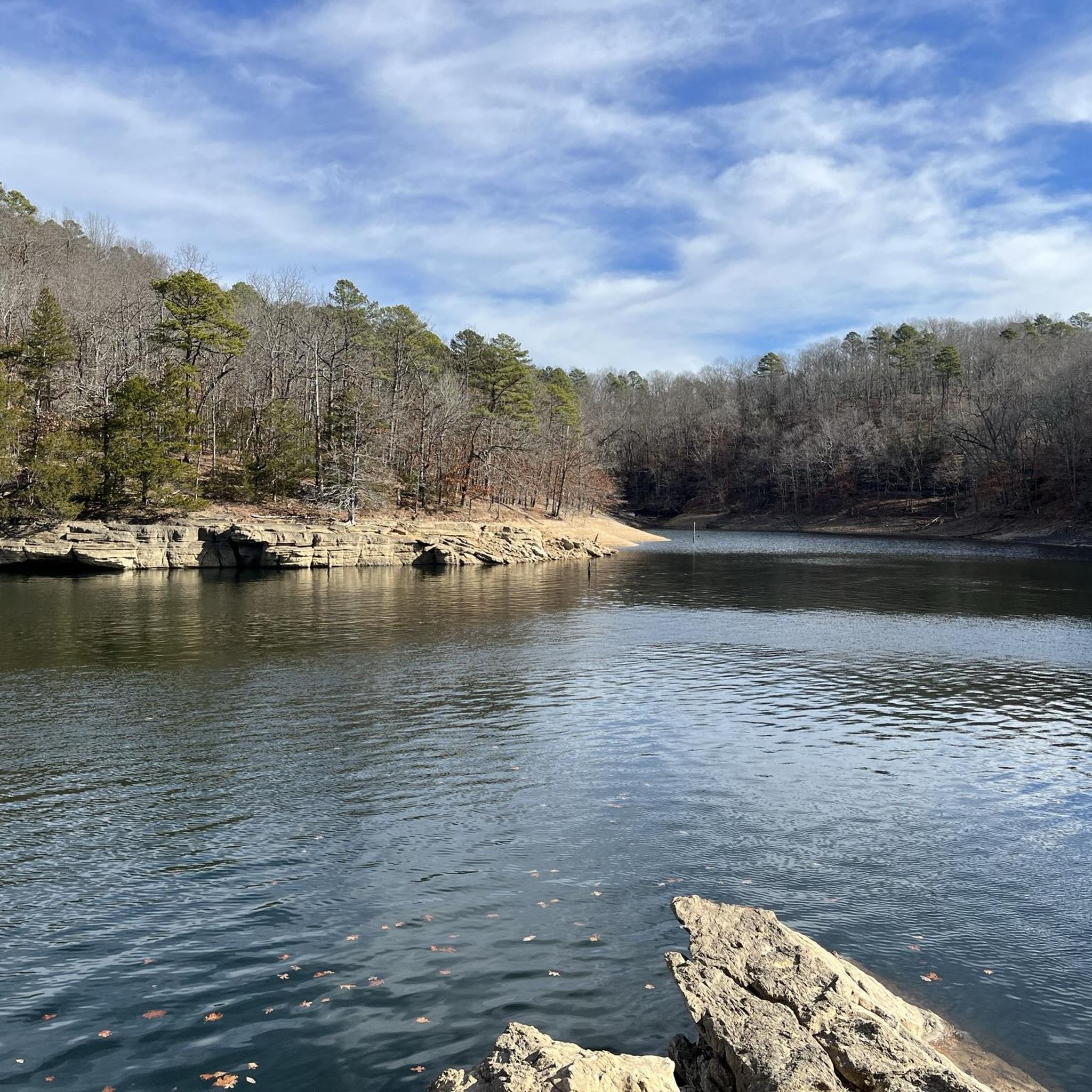
Lost Bridge North Park features campgrounds and the Lost Bridge Loop hiking trail along the banks of Beaver Lake. This park lies in the Ozark Mountains and has amenities like restrooms and picnic tables.
0
0

Scenic view of War Eagle Creek on the 6-mile War Eagle Valley Loop of the Hidden Diversity Trail.
0
0

Whitney Mountain rises above Beaver Lake providing epic views. On a clear day, you can enjoy fantastic panoramas and it's well worth the ride to the top. You can continue around the lake to do a full loop if you've got the time.
0
0
Frequently Asked Questions
Are there any easy, family-friendly hikes around Beaver Lake?
Yes, there are several options suitable for families. The Lake Atalanta loop from Rogers is a short and relatively flat walk perfect for all ages. For a slightly longer but still easy outing, the Bashore Ridge Loop Trail in Hobbs State Park offers a pleasant 4.2-mile (6.8 km) walk through the woods.
Can I bring my dog on the hiking trails?
Most trails in the Beaver Lake area, including those within Hobbs State Park-Conservation Area, are dog-friendly, but your dog must be kept on a leash at all times. Always check the specific regulations for the park or trail you plan to visit and be sure to bring water for your pet.
Where are the best places to start a hike around Beaver Lake?
Many excellent hikes begin within Hobbs State Park-Conservation Area, which is a highly regarded local favorite with a massive trail system. The park serves as the starting point for numerous routes through diverse terrain.
For a hike with great views, you can start from Lost Bridge North Park to access the trail to Whitney Mountain. Another popular starting point is the Shaddox Hollow Trailhead, which leads to a scenic loop with a steep descent into a beautiful hollow.
What is the best time of year to hike at Beaver Lake?
Spring and fall are ideal for hiking around Beaver Lake, offering pleasant temperatures and beautiful scenery. Spring brings blooming dogwoods and wildflowers, while fall showcases spectacular autumn foliage in the Ozark forests. Summer can be hot and humid, so plan for early morning hikes and bring plenty of water. Winter is also a great time to hike, as the leaves are off the trees, providing clearer views of the lake and bluffs.
Are there any circular or loop trails available?
Yes, the area has many excellent loop trails so you can end your hike where you started without retracing your steps. The War Eagle Valley Loop is a popular 6.6-mile (10.5 km) moderate circuit through a forested valley. For a more challenging loop with rewarding views, consider the Beaver Lake Loop to Whitney Mountain.
What are the trail conditions generally like?
The trails around Beaver Lake are generally well-maintained and clearly marked, especially within Hobbs State Park. You can expect a mix of dirt paths and rocky sections. Some trails, like the Shaddox Hollow trail, feature steep ascents and descents. After heavy rain, some low-lying areas can become muddy, so sturdy, waterproof footwear is always recommended.
Are there any trails with good views of the lake?
Definitely. Many trails offer stunning vistas of Beaver Lake's clear water and the surrounding landscape. The Beaver Lake Dam Overlook provides an easily accessible and impressive view of the dam and lake. For a view earned by a hike, the Pigeon Roost Trail features the Beaver Lake Overlook, a beautiful spot to see the water.
What kind of wildlife might I see while hiking?
The diverse habitats around Beaver Lake support a variety of wildlife. It's common to see white-tailed deer, squirrels, and a wide array of songbirds. If you're near the water, you might spot herons or even a bald eagle, especially during the winter months. Remember to observe wildlife from a distance and never feed the animals.
Where can I find good parking for the trails?
Most major trailheads have designated parking areas. Hobbs State Park-Conservation Area has a large visitor center with ample parking, providing access to its extensive trail network. Trailheads for specific routes, like the Shaddox Hollow Trailhead and Lost Bridge North Park, also have their own parking lots. It's always a good idea to arrive earlier on weekends, as popular spots can fill up.
What makes the landscape around Beaver Lake unique?
The region's geology is defined by its karst topography, which includes towering limestone bluffs, caves, and natural springs. Many trails wind along these impressive bluffs, offering dramatic views. The clear waters of the 28,000-acre lake itself are a central feature, creating a beautiful contrast with the dense hardwood forests of the Ozark Highlands. For more detail, you can explore this geological guide from the state of Arkansas.
Are there any trails that are good for both hiking and kayaking access?
Yes, many of the lakeside parks and trails offer opportunities to combine hiking with water activities. You can enjoy a hike and then launch a kayak from areas like Dam Site Lake Park or Lost Bridge North Park. The Shaddox Hollow Nature Trail includes a spur that leads directly to the lake shore, providing a scenic spot to rest or a potential access point for paddlers.
What do other hikers think of the trails around Beaver Lake?
The area is highly rated by the komoot community, with an average score of 4.5 stars. Hikers often praise the well-maintained trails, the beautiful views of the lake and limestone bluffs, and the peaceful atmosphere of the Ozark forests. The variety of trails, from easy strolls to more challenging climbs, is also frequently mentioned as a major positive.
Most popular routes around Beaver Lake

Get inspired with the komoot mobile app


Explore more
Browse the best Hikes in other regions.
