The best running trails around Albufeira de Vilarinho das Furnas
4.7
(3)
366
runners
20
runs
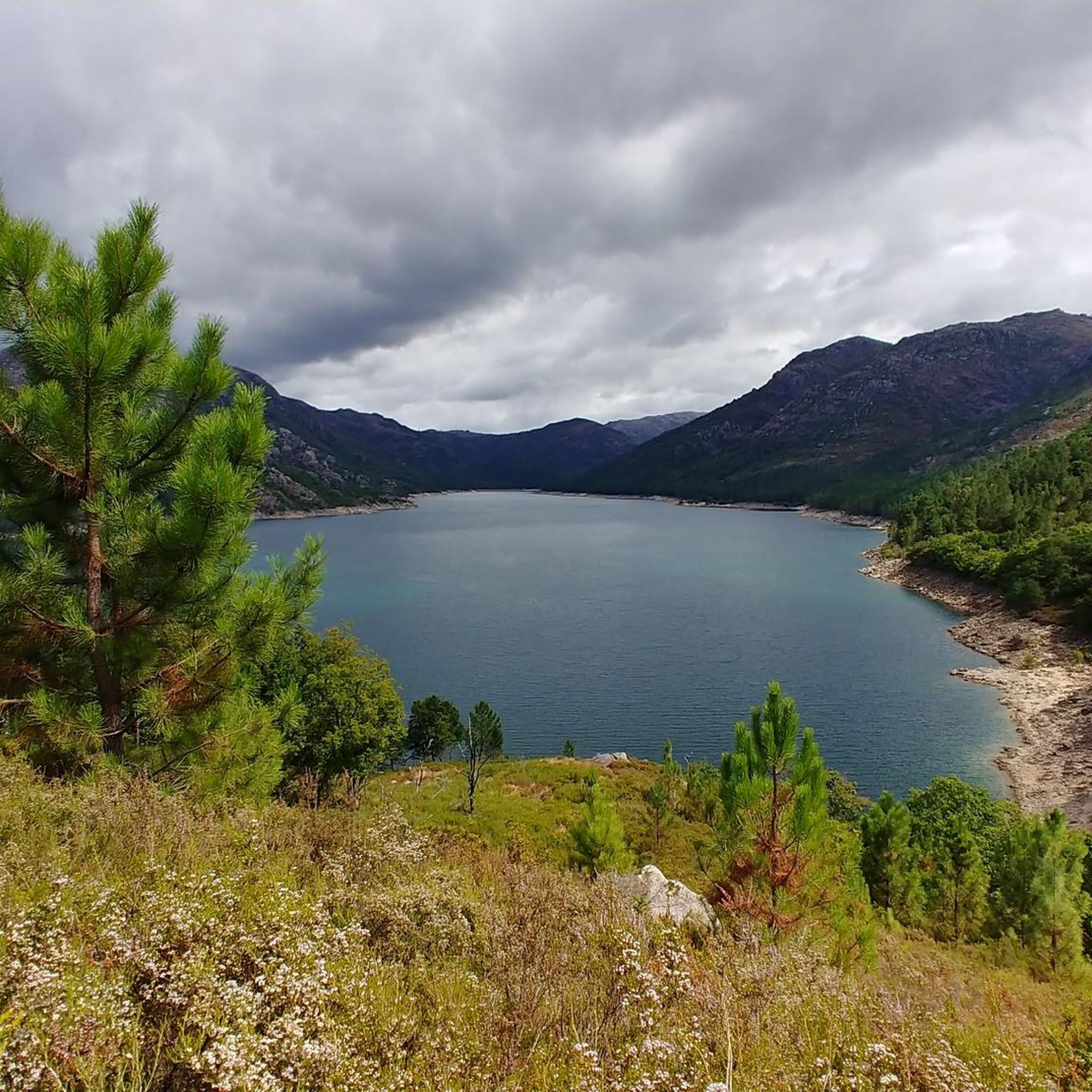
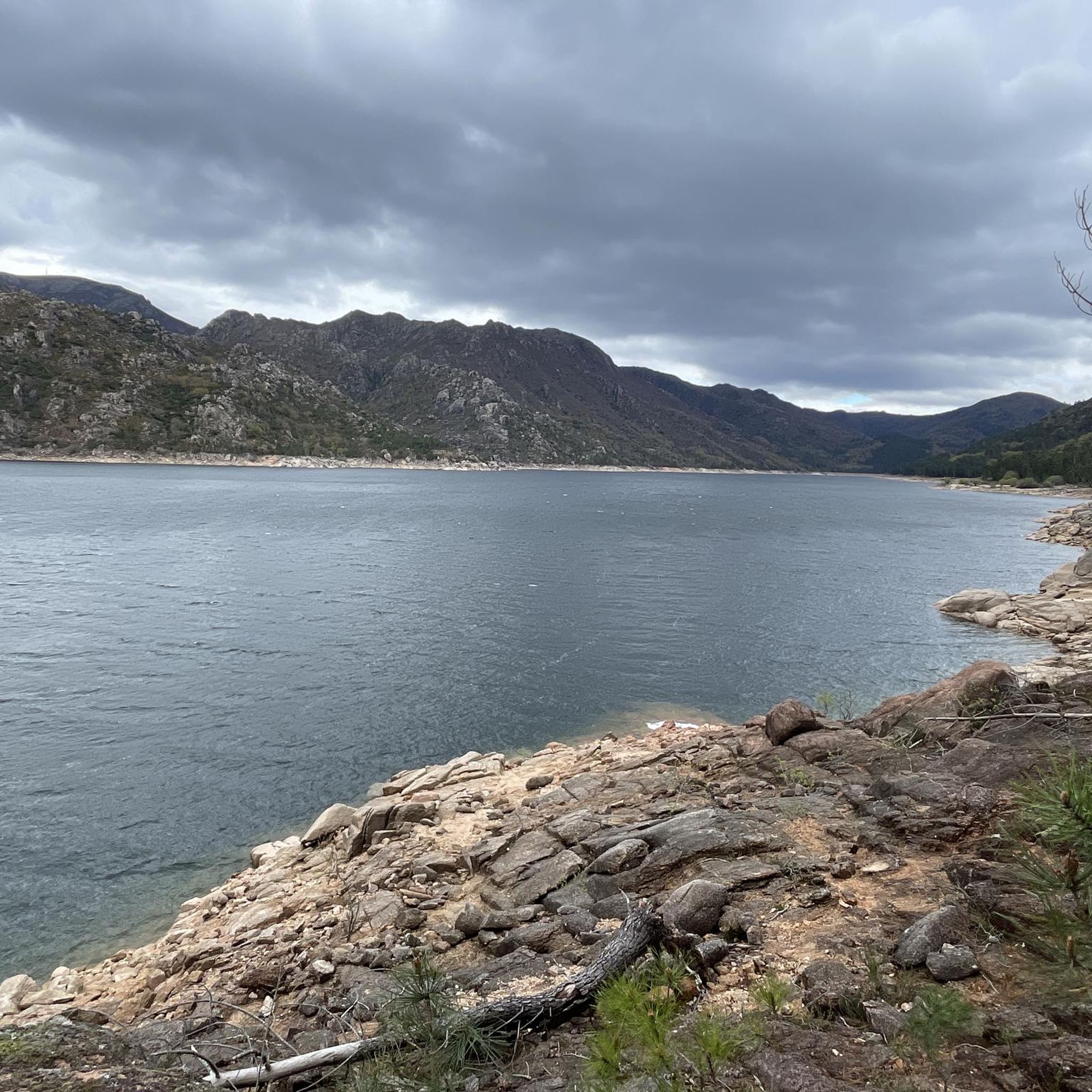
Jogging around Albufeira de Vilarinho das Furnas offers diverse routes within Portugal's Peneda-Gerês National Park. The region is characterized by the clear waters of its reservoir, framed by the Serra Amarela and Serra do Gerês mountains. Joggers can explore lush forests, including the ancient oak forest of Mata da Albergaria, and paths alongside the Homem River, which features various waterfalls and lagoons. The terrain varies from flatter reservoir-side paths to more challenging ascents into the surrounding mountains.
Best jogging routes…
Last updated: July 12, 2026
5.0
(1)
11
runners
17.6km
02:15
330m
330m
Hard run. Very good fitness required. Sure-footedness, sturdy shoes and alpine experience required.
6
runners
19.2km
02:56
1,020m
1,020m
Hard run. Very good fitness required. Mostly paved surfaces. Suitable for all skill levels.

Sign up for free
18
runners
Moderate run. Good fitness required. Mostly paved surfaces. Suitable for all skill levels.
6
runners
4.23km
00:32
100m
100m
Moderate run. Good fitness required. Mostly paved surfaces. Suitable for all skill levels.
15
runners
6.70km
01:03
390m
390m
Hard run. Very good fitness required. Mostly paved surfaces. Suitable for all skill levels.
Get access to more routes and recommendations from other explorers.
Sign up for free
Already have an account?
Our route recommendations are based on thousands of hikes, rides, and runs completed by other people on komoot.
Start today with a free account
Your next adventure awaits.
Login or Signup
Popular around Albufeira de Vilarinho das Furnas

Tips from the Community

The Chalcedony Trail (PR1 TBR – Trilho da Cidade da Calcedonia) is one of the most iconic routes in Peneda-Gerês National Park, located in Covide (Braga), within the municipality of Terras de Bouro. It leads to the ruins of the City of Chalcedony, an ancient pre-Roman hill fort high in the mountains. It offers panoramic views over the Homem River valley and the Gerês mountains. The trail passes through native forests, rocky areas, and natural viewpoints.
2
0
A spectacular rocky section where granite boulders rise like "sleeping giants" all around you. The trail ascends towards the peak of Curvaceira, at 919m, and offers panoramic views of the deep Covide Valley.
2
0

Beautiful, but crowded in July. There are nicer, less crowded swimming spots nearby.
0
0


Campo do Gerês is a picturesque village located in the heart of the Peneda-Gerês National Park. It is renowned as an ideal starting point for hiking and outdoor activities, offering access to trails, waterfalls and breathtaking views. The village itself retains a traditional atmosphere, with granite houses and a museum documenting local history, including Roman remains of the Via Nova (Geira).
0
0

The Calcedonia Crack is one of those passages that seems to have come straight out of an old fairy tale: a monumental crack between two granite giants. For those who like a challenge, the route involves climbing and jumping between huge blocks fitted together at the base. Going up is easier than going down: there is more support, more traction, and less hesitation. There is no need to cross it (the trail elegantly skirts the crack) but, for the more adventurous, facing this crack is almost a ritual: a mix of adrenaline, vertigo and raw landscape that leaves its mark on those who pass by.
1
1
As you climb, the granite blocks grow around you like sleeping giants. To the south, the Curvaceira rises up at 919 metres. To the north, the Covide valley stretches out below, green and deep. Here, the barrosãs roam freely among the rocks, but those who run know: this is the hard part. Tapered trails, serious ramps and rock that sometimes begs for a handhold on the ground. This is the mountain in its purest form, above 800 metres. Raw, beautiful and unforgettable.
1
1

We hiked the Covid loop (yellow and red lines) clockwise. The ascent was OK. The rocky landscape was spectacular. The Slut was also impressive, but considering the many rocks, it was just another somewhat more exclusive highlight among many. The descent, however...described in Komoot as well-maintained hiking trails, no special skills required. It's an overgrown trail with (very) high steps and scree sections. Very good fitness and surefootedness are required to safely navigate it. The less than three hours for the loop is also very ambitious. At the end of the descent, there was a dog park with some very aggressive dogs running loose on the trail; we felt like we barely made it through unscathed. Next time, I'd turn around at the Slut and take the same route back. Be sure to bring plenty of drinks. Great scenery, very tiring.
2
0
Frequently Asked Questions
How many running routes are available around Albufeira de Vilarinho das Furnas?
There are over 20 running routes available for you to explore around Albufeira de Vilarinho das Furnas. These routes offer a variety of experiences within the stunning Peneda-Gerês National Park.
What kind of terrain can I expect on the jogging trails?
The terrain varies significantly. You'll find flatter paths alongside the reservoir, offering scenic views of the clear waters and surrounding mountains. For those seeking a more rigorous workout, there are challenging ascents into the Serra Amarela and Serra do Gerês mountains. Many routes also wind through lush forests, including the ancient oak forest of Mata da Albergaria, and along the Homem River.
Are there any easy jogging routes suitable for beginners or families?
While many routes are rated moderate to difficult, there are options that can be enjoyed by families or those looking for an easier run. The Running loop from Campo do Gerês is a moderate 4.0-mile (6.5 km) trail that leads through varied terrain near the village, often completed in about 45 minutes. The Vilarinho das Furnas Linear Path, mentioned in regional research, is also an easy 5 km option from the dam.
Can I bring my dog on the running trails in this region?
Peneda-Gerês National Park generally allows dogs on trails, but they must be kept on a leash to protect wildlife and ensure the safety of other visitors. Always check specific trail regulations or local signage, especially in more sensitive natural areas like Mata da Albergaria, to ensure compliance.
Are there circular jogging routes available?
Yes, several circular routes are popular among runners. For instance, the São Miguel Waterfall loop from Campo do Gerês is a 10.9-mile (17.6 km) trail offering beautiful reservoir and natural landscapes. Another option is the Campo do Gerês village – Campo do Gerês Roman Road loop from Campo do Gerês, which is a moderate 8.3-mile (8.3 km) route.
What natural features or landmarks can I see along the jogging routes?
You'll encounter a wealth of natural beauty and historical landmarks. Many routes offer stunning views of the Albufeira de Vilarinho das Furnas reservoir itself. You can also discover waterfalls like the Cascata do Ribeiro de Gemesura, and ancient oak forests. The submerged village of Vilarinho da Furna, visible during low water levels, adds a unique historical element to runs along the reservoir's edge. You might also spot Roman milestones, such as the Roman Milestone XXX (Via Nova).
Is there parking available near the trailheads?
Yes, parking is generally available, particularly in and around Campo do Gerês, which serves as a common starting point for many trails. Specific parking information can often be found on local signage or detailed route descriptions.
What is the best time of year for running in Albufeira de Vilarinho das Furnas?
The region offers a dynamic visual experience throughout the year. Spring and autumn generally provide the most pleasant temperatures for running, with vibrant greens and changing foliage. Summer can be warm, but the lush forests like Mata da Albergaria offer shade. Winter brings cooler temperatures and potentially snow-capped peaks, offering a different, serene running experience, though some higher trails might be more challenging.
Do I need any special permits to jog within Peneda-Gerês National Park?
Generally, no specific permits are required for jogging on established trails within Peneda-Gerês National Park for recreational purposes. However, it's always advisable to check the official park website for any updated regulations, especially if you plan to venture into more restricted or sensitive areas, or for specific activities that might require authorization.
What do other runners enjoy most about jogging in Albufeira de Vilarinho das Furnas?
The area is highly rated by the komoot community, with an average score of 4.7 stars from numerous reviews. Runners often praise the stunning natural landscapes, the clear waters of the reservoir, and the diverse trail options that cater to different fitness levels. The blend of lush forests, mountain vistas, and unique attractions like the submerged village makes for a truly invigorating experience.
Are there any challenging running routes for experienced runners?
Absolutely. For experienced runners seeking a challenge, the region offers several difficult routes with significant elevation changes. The Louriça – Muro loop from Campo do Gerês is a difficult 12.1-mile (19.5 km) path featuring substantial climbs and panoramic mountain vistas. Another demanding option is the Trilho da Calcedónia (PR 1), a 6.7-mile (6.7 km) route with considerable elevation gain.
Can I access the jogging routes using public transport?
While direct public transport to all trailheads might be limited, the village of Campo do Gerês serves as a central hub and is accessible by some public transport options. From Campo do Gerês, many popular running routes are within easy reach. It's recommended to check local bus schedules or consider a combination of public transport and a short taxi ride for more remote starting points.
Most popular routes around Albufeira de Vilarinho das Furnas
Most popular attractions around Albufeira de Vilarinho das Furnas

Get inspired with the komoot mobile app


Explore more
Browse the best Running Trails & Routes in other regions.
