The best cycling routes around Mississauga
4.7
(207)
928
riders
81
rides
Touring cycling routes around Mississauga feature an extensive network of multi-use trails and bike routes, spanning over 400 kilometers. The city's terrain is characterized by the Credit River Valley, the Lake Ontario shoreline, and numerous urban nature preserves. These natural features provide a diverse landscape for cycling, ranging from scenic woodland paths to invigorating waterfront rides.
Best touring cycling routes around Mississauga
- The most popular touring cycling route is Humber Bay Arch Bridge – Sunnyside Pool loop from Clarkson, a 42.2 miles (67.9 km) trail that takes 3 hours 54 minutes to complete. This route connects waterfront parks and urban areas along the shoreline.
- Another top favourite among local touring cyclists is Etobicoke Creek Trail – Centennial Park loop from Dixie, a moderate 18.7 miles (30.1 km) path. This trail winds through parks and green corridors along the Etobicoke Creek.
- Local touring cyclists also love the Marie Curtis Park – Adamson Estate loop from Dixie, a 20.8 miles (33.5 km) trail leading through waterfront parks and historic estates, often completed in about 1 hour 56 minutes.
- Touring cycling around Mississauga is defined by the Credit River Valley, the Lake Ontario shoreline, and extensive multi-use trails. The network offers options for various ability levels, from easy paths to more challenging routes.
- The routes in Mississauga are highly rated by the komoot community with an average score of 4.8 stars from over 200 reviews. More than 1000 touring cyclists have used komoot to explore Mississauga's varied terrain.
Last updated: October 7, 2026
4.8
(46)
294
riders
68.3km
03:56
210m
210m
Moderate bike ride. Good fitness required. Mostly paved surfaces. Suitable for all skill levels.
4.9
(9)
49
riders
36.0km
02:07
140m
140m
Moderate bike ride. Good fitness required. Mostly paved surfaces. Suitable for all skill levels.

5.0
(5)
40
riders
Easy bike ride. Great for any fitness level. Mostly paved surfaces. Suitable for all skill levels.
4.7
(14)
26
riders
32.4km
01:57
90m
90m
Easy bike ride. Great for any fitness level. Mostly paved surfaces. Suitable for all skill levels.
4.8
(5)
24
riders
37.4km
02:10
160m
160m
Moderate bike ride. Good fitness required. Mostly paved surfaces. Suitable for all skill levels.
Get access to more routes and recommendations from other explorers.
Already have an account?
Our route recommendations are based on thousands of hikes, rides, and runs completed by other people on komoot.
Start today with a free account
Your next adventure awaits.
Tips from the Community

Adamson Estate is a peaceful heritage property right on the Lake Ontario shoreline, with mature trees, gardens and several historic buildings spread across the grounds. The main house dates from 1920, while the barn is even older, dating to around 1870. It’s a nice change of pace from the open waterfront, with quieter paths to wander before rejoining the Waterfront Trail.
0
0
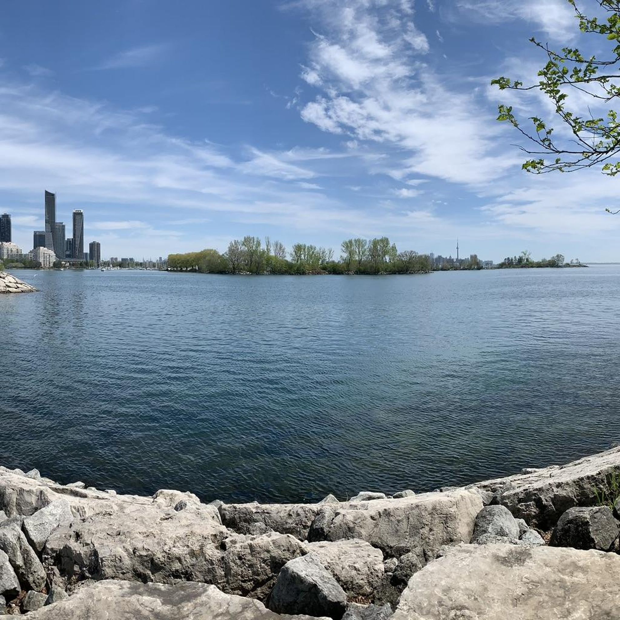
This section of Ontario’s Waterfront Trail keeps close to Lake Ontario as it links Lakefront Promenade Park with the neighbourhoods further west. The route is broad and mostly paved, passing small beaches, wooded pockets and stretches of open shoreline. It’s shared with cyclists, so keeping to the right is useful on busier days.
0
0

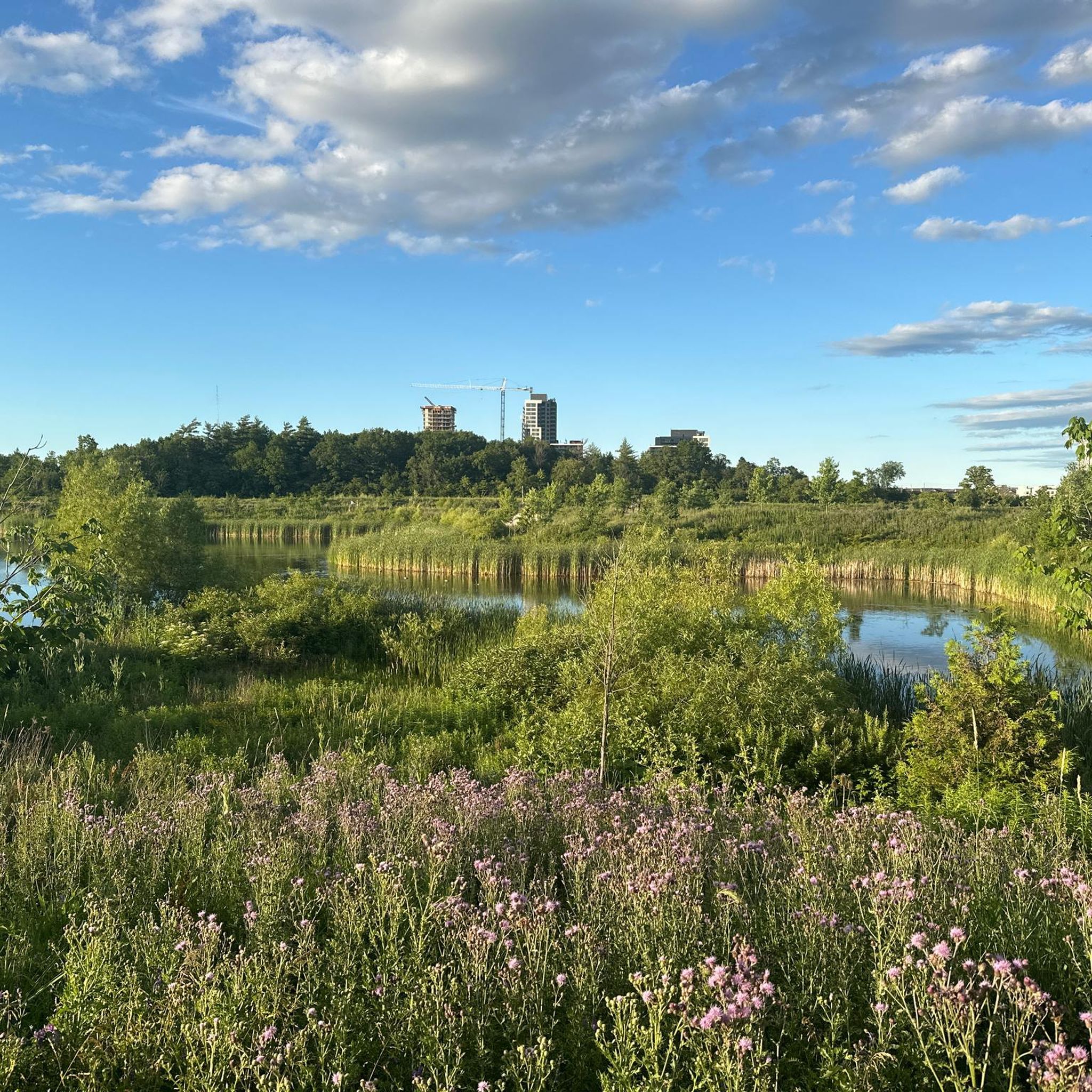
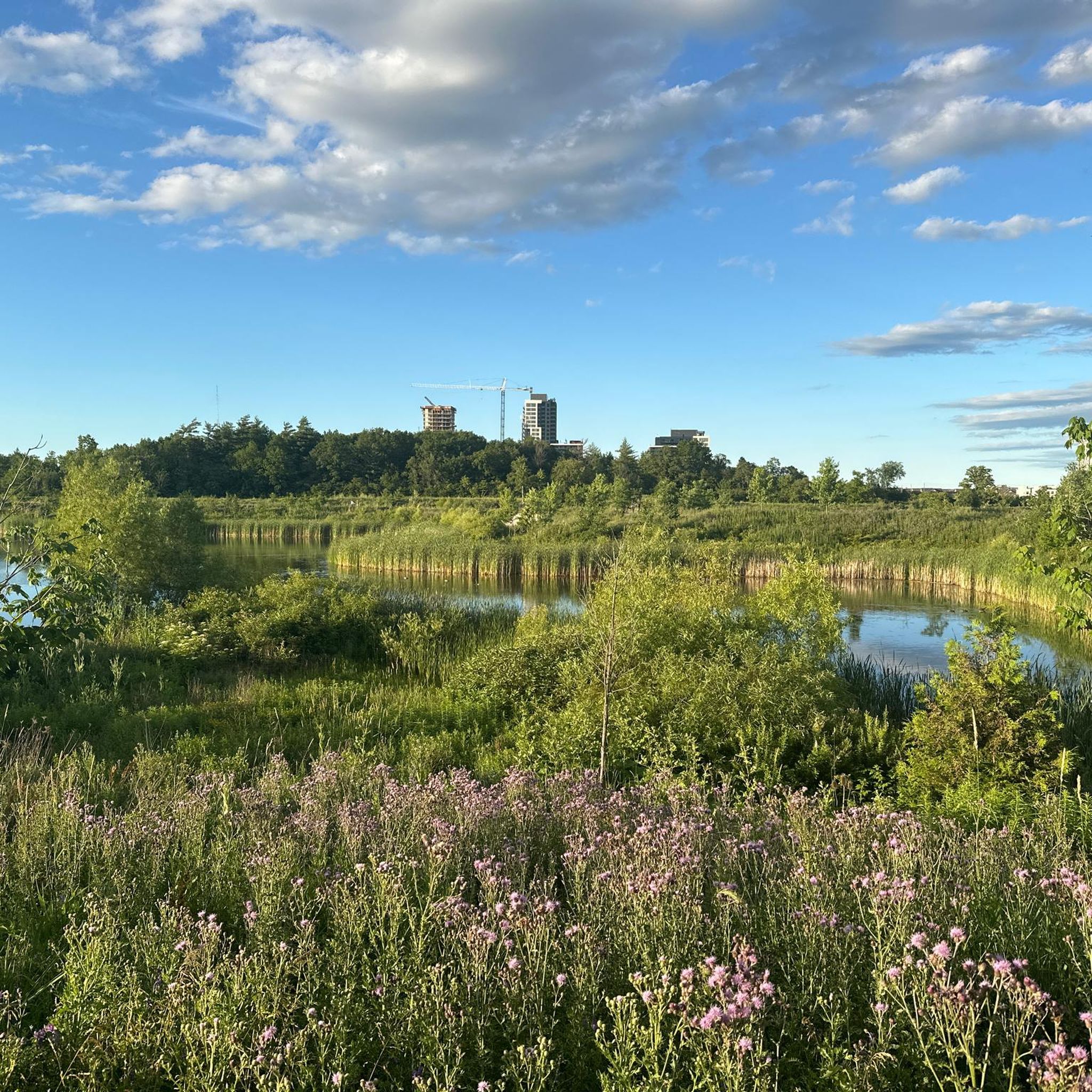
Lake Aquitaine was built for a recreational area that was developed around a stormwater management lake. It is the scenic 25-acre centrepiece now for Lake Aquitaine Park.
1
0

comfortable armchairs for a short rest and to enjoy the great view
0
0

The Princes' Gates are a historic landmark at Exhibition Place in Toronto, Ontario, Canada. These magnificent Beaux-Arts style gates were officially opened in 1927 to celebrate the 60th anniversary of the Canadian Confederation. They serve as an impressive entrance to the exhibition grounds. Source: Google AI
0
0

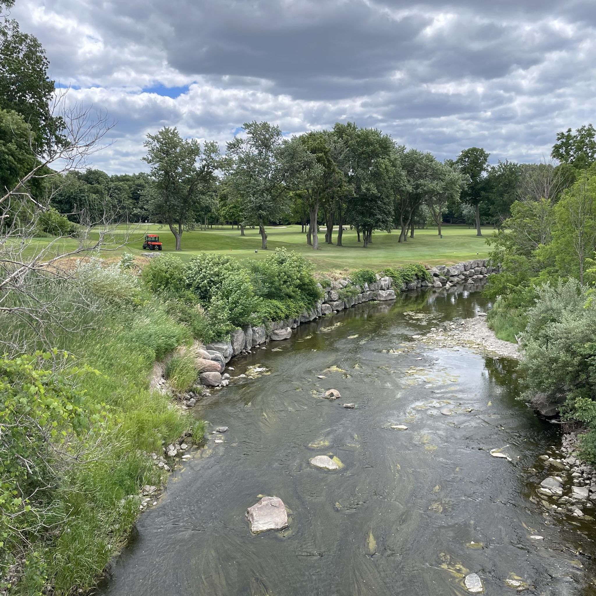
Etobicoke Creek flows south from the Oak Ridges Moraine to Lake Ontario, forming a natural boundary between Toronto and Mississauga along much of its course. The creek winds through a mix of wooded ravines, parkland, and urban areas, with sections that feel surprisingly quiet despite the surrounding city. Along its lower reaches, slower-moving water, small floodplains, and frequent green spaces make it a defining natural corridor in the western GTA.
0
0
Etobicoke Creek Trail follows Etobicoke Creek for roughly 10 kilometres through a long green corridor on Toronto’s western edge, connecting parks, neighbourhoods, and natural areas along its route. The paved multi-use path is mostly flat and easy, winding between wooded sections, open parkland, and occasional road crossings. Along the way, the creek remains a constant presence, with stretches of quiet water, small bridges, and pockets of wildlife breaking up the urban surroundings.
0
0

Plowman’s Park has large open fields for soccer and other sports. There are also updated playgrounds and paved walking and cycling paths that connect to other nearby parks.
0
0
Frequently Asked Questions
How many touring cycling routes are available in Mississauga?
Mississauga offers nearly 100 touring cycling routes, catering to various skill levels. The city boasts an extensive network of over 400 kilometers of bike lanes and multi-use trails.
What types of landscapes can I expect to see while cycling in Mississauga?
Touring cyclists in Mississauga can explore diverse landscapes, including scenic waterfront trails along Lake Ontario, winding paths through the Credit River and Etobicoke Creek valleys, and tranquil green spaces like Rattray Marsh Conservation Area. The routes often feature woodlands, meadows, and marsh ecosystems.
Are there any easy, family-friendly touring cycling routes in Mississauga?
Yes, Mississauga has many easy routes suitable for families. For instance, the Etobicoke Creek Trail loop from Silverthorn Collegiate Institute is an easy 19.6 km path. The city's extensive multi-use trails, particularly those along the Etobicoke Creek, are generally flat and scenic, making them ideal for leisurely rides.
What are some longer touring cycling routes for experienced riders?
For those seeking a longer ride, the Humber Bay Arch Bridge – Sunnyside Pool loop from Clarkson is a popular moderate route spanning 67.9 km. This route connects waterfront parks and urban areas along the Lake Ontario shoreline, offering a substantial touring experience.
What attractions or points of interest can I visit along the cycling routes?
Many routes pass by notable attractions. Along the waterfront, you might encounter the Humber Bay Arch Bridge or Sunnyside Pool. Inland, the Credit River Trail offers access to the Riverwood Conservancy and Erindale Park, both rich in natural beauty. Rattray Marsh Conservation Area is another unique wetland ecosystem worth exploring.
Are there any circular touring cycling routes in Mississauga?
Yes, many touring cycling routes in Mississauga are designed as loops. Examples include the Etobicoke Creek Trail – Centennial Park loop from Dixie, a moderate 30.1 km path, and the Marie Curtis Park – Adamson Estate loop from Dixie, an easy 33.5 km route.
What do other touring cyclists say about the routes in Mississauga?
The touring cycling routes in Mississauga are highly rated by the komoot community, with an average score of 4.8 stars from over 200 reviews. Cyclists often praise the well-maintained trails, diverse scenery, and the convenience of connecting various parks and natural areas.
Is it possible to access touring cycling trails in Mississauga using public transport?
Mississauga's extensive trail network is often accessible via public transport. Many routes start or pass near bus stops and GO Transit stations, especially those along the waterfront or major river valleys like the Credit River and Etobicoke Creek, making it convenient to reach starting points without a car.
Where can I find parking for touring cycling routes in Mississauga?
Many of Mississauga's parks and trailheads offer dedicated parking facilities. For example, parks like Erindale Park, Jack Darling Memorial Park, and Lakefront Promenade Park, which are integrated into the cycling network, provide ample parking for visitors looking to access the trails.
What is the best time of year to go touring cycling in Mississauga?
The best time for touring cycling in Mississauga is typically from spring to fall (May to October). During these months, the weather is generally pleasant, and the natural landscapes are vibrant. The city also hosts Community Rides during this period, offering guided cycling experiences.
Are there any hidden gems or less-known scenic routes for touring cyclists?
Beyond the main trails, exploring sections of the Credit River Trail that wind through areas like the Riverwood Conservancy can offer a more secluded experience. Osprey Marsh Loop Trail, accessible via the Lisgar Meadow Brook Trail, is another hidden gem for wildlife viewing and tranquil rides away from busier paths.
Most popular routes around Mississauga
Most popular attractions around Mississauga

Get inspired with the komoot mobile app


Explore more
Browse the best Cycling routes in other regions.
