The best walks and hikes around Storekrækkja
4.6
(225)
970
hikers
17
hikes
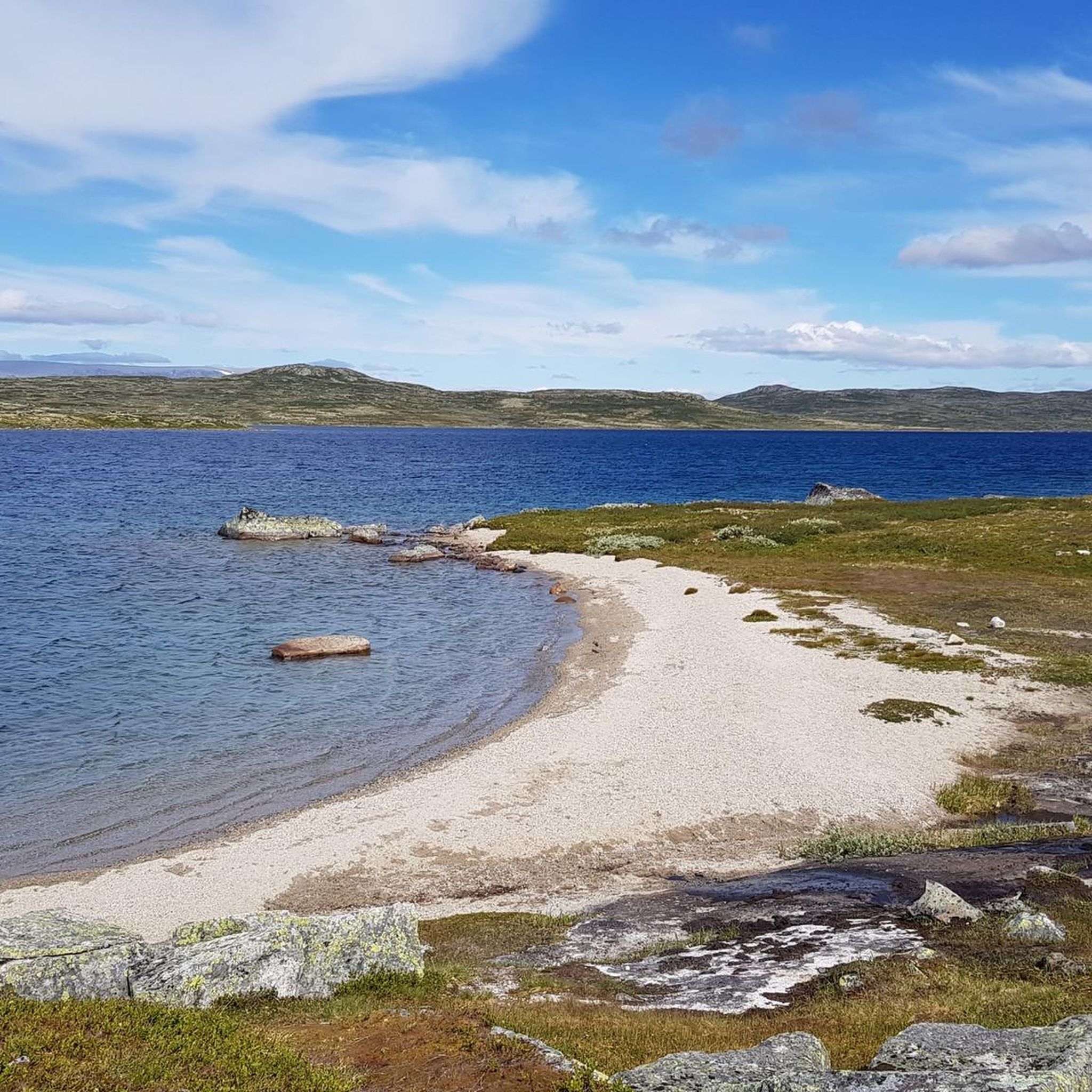
Hiking around Storekrækkja offers access to the expansive Hardangervidda plateau, characterized by wide open spaces, fells, and a distinct light gray landscape of grass, hills, and scattered rocks. Storekrækkja Lake is a central feature, with trails often following its shores, which include areas with fine pebble beaches. The region's terrain varies from flat, winding paths through meadows to areas with lush forests and crystal-clear lakes. Numerous streams and bodies of water crisscross the area, contributing to its diverse natural environment.
…Last updated: August 19, 2026
4.7
(96)
341
hikers
11.9km
03:27
140m
140m
Moderate hike. Good fitness required. Mostly accessible paths. Sure-footedness required.
4.7
(96)
340
hikers
12.1km
03:29
140m
140m
Moderate hike. Good fitness required. Mostly accessible paths. Sure-footedness required.

Sign up for free
4.2
(5)
56
hikers
19.7km
06:43
410m
330m
Hard hike. Very good fitness required. Mostly accessible paths. Sure-footedness required.
4.6
(5)
40
hikers
14.9km
04:59
180m
280m
Moderate hike. Good fitness required. Mostly accessible paths. Sure-footedness required.
5.0
(4)
30
hikers
5.22km
01:35
110m
130m
Moderate hike. Great for any fitness level. Mostly accessible paths. Sure-footedness required.
Get access to more routes and recommendations from other explorers.
Sign up for free
Already have an account?
Our route recommendations are based on thousands of hikes, rides, and runs completed by other people on komoot.
Start today with a free account
Your next adventure awaits.
Login or Signup
Popular around Storekrækkja

Other adventures around Storekrækkja

Tips from the Community

This stretch of the trail rewards hikers with excellent views across Drageidfjorden to the north. From here, head west for Kjeldebu, south for Halne Fjellstugu and just a short distance northeast for Krækkja.
0
0

This is such a quaint bridge. It crosses a beautiful connecting stream that joins Storekrækkja and Drageidfjorden lakes. The views out over the plateau to the distant snow-speckled hills are super nice.
0
0
The "SignaTUR" MASSIV hike is the longest of Norway's premier long-distance hiking trails operated by the Norwegian Trekking Association (DNT). Covering 350 kilometres and having 11,000 metres of ascent, it also travels through four iconic mountain landscapes. This hike is a gruelling physical and mental hut-to-hut or wild-camp challenge. Hikers normally hike it north to south and travel through three national parks and a protected landscape area: Breheimen - Jotunheimen - Skarvheimen (protected landscape) - Hardangervidda This section is over the vast and remote Hardangervidda plateau, the largest of its kind in Europe, with a cold, year-round alpine climate. As remote as it is, you will find well-marked trails and a wide range of serviced and self-service DNT cabins.
0
0

Stigstuv Lodge is a privately owned mountain cambin located high up on the vast Hardangervidda mountain plateau in Norway. It's a base for hiking in the summer and skiing in the winter, offering accommodation, meals, and access to a wide, tranquil, and beautiful high-mountain wilderness.
0
0

The DNT Fjällstation Krækkja is a full-board hostel during the season, where you can sleep and enjoy breakfast and dinner, as well as various other items during the day, such as cakes/waffles and soup. It's also a great place to take a break. Krækkja is the oldest cabin on the Hardangervidda plateau, having opened in 1879. The cabin is beautifully situated by Lake Storkrækkja with a view of Hallingskarvet. Families with children, retirees, cabin hikers, and day trippers all come here.
0
0

At Easter, many people enjoy hiking from hut to hut on the Hardangervidda.
0
2

Kjeldebu consists of several, fairly large cabins and is actually designed for larger groups such as school classes. It's not far from here (just under 8 km) to the Rv7 and thus to a bus stop. A large provision store can be found in the hut in the middle of the "settlement", which also contains the rooms for the hut warden and the sleeping quarters for hikers with dogs. Water can be found a few meters further along the river, otherwise the cabins are equipped with wood stoves and gas cookers. There is even some light through a photovoltaic system, batteries and LED spots.
1
0

Incredibly beautiful cabin with very nice people.
0
0
Frequently Asked Questions
What kind of terrain can I expect when hiking in Storekrækkja?
Storekrækkja is located within the expansive Hardangervidda National Park, characterized by wide open fells and a distinct light gray landscape of grass, hills, and scattered rocks. While much of the terrain is relatively flat, trails playfully wind through meadows and alongside numerous crystal-clear lakes and streams. You'll find a mix of open plateau views and areas with lush forests.
Are there any easy hiking trails suitable for beginners or families in Storekrækkja?
Yes, Storekrækkja offers several easy trails. For instance, the Old Road Bridge at Skaupsjøen loop from Borgund is an easy 2.9 km route with minimal elevation gain, perfect for a leisurely stroll. In total, there are 4 easy routes available, making it accessible for various fitness levels.
Are there any circular walks around Storekrækkja Lake?
Yes, circular walks around Storekrækkja Lake are a highlight of the area. A popular option is the Loop hike around Storekrækkja on the Hardangervidda plateau, which is 11.9 km long and offers extensive views across the open plateau and around the lake. Another excellent choice is Around Storekrækkja Lake, a 12.0 km path providing continuous views of the lake and its surrounding fells.
What is the best time of year to go hiking in Storekrækkja?
The Hardangervidda region, including Storekrækkja, is best enjoyed for hiking during the warmer months, typically from late spring to early autumn. This period offers the most favorable weather conditions and ensures trails are clear of snow. The landscape is particularly inviting for a meditative hiking experience during these seasons.
Are there any notable landmarks or points of interest along the hiking trails?
While Storekrækkja is known for its expansive natural beauty, the Krækkja cabin, a guarded hut located directly on the shore of Storekrækkja, serves as a significant landmark and a convenient stop for hikers. The Hårteigen peak, known as the 'Signpost in the West,' is also a striking feature visible from much of the Hardangervidda, offering a fixed orientation point.
Can I bring my dog on the hiking trails in Storekrækkja?
Hardangervidda National Park has specific regulations regarding dogs. Generally, dogs are allowed but must be kept on a leash, especially during certain periods to protect wildlife, particularly nesting birds and grazing reindeer. It's always best to check the latest national park regulations before your visit to ensure a pleasant and compliant hike with your dog.
How many hiking routes are available in Storekrækkja?
There are 16 hiking routes available in Storekrækkja. These routes cater to various skill levels, including 4 easy, 10 moderate, and 2 difficult trails, ensuring options for everyone from casual walkers to experienced mountaineers.
What do other hikers enjoy most about hiking in Storekrækkja?
The area is highly rated by the komoot community, with an average score of 4.6 stars from over 180 reviews. Hikers often praise the quiet, expansive landscape that invites a meditative experience, the well-marked trails, and the stunning views across the Hardangervidda plateau and Storekrækkja Lake.
Are there any trails that feature sandy beaches or unique water features?
Yes, the shores of Storekrækkja Lake feature fine pebble beaches that almost look like sandy beaches, offering picturesque spots. Additionally, the Sandy Beach on Skaupsjøen Lake – Bridge loop from Fagerheim is a moderate trail that specifically highlights a sandy beach on Skaupsjøen Lake, providing a unique water feature experience.
Where can I find parking for hiking trails in Storekrækkja?
Many popular hikes, including the loop around Storekrækkja, often start from areas like Fagerheim Fjellstugu, which typically offers parking facilities. It's advisable to check specific starting points for individual routes for detailed parking information.
Are there any challenging hikes in Storekrækkja for experienced hikers?
Yes, for experienced hikers seeking a challenge, Storekrækkja offers 2 difficult routes. While the region is known for its meditative, less altitude-focused trails, these more demanding options provide rugged terrain and longer distances to test your endurance within the Hardangervidda landscape.
What is the typical duration for a moderate hike in Storekrækkja?
Moderate hikes in Storekrækkja typically range from 3 to 3.5 hours. For example, the Loop hike around Storekrækkja on the Hardangervidda plateau takes approximately 3 hours 27 minutes, while the Svonuten – Fagerheim Fjellstugu loop from Borgund is often completed in about 3 hours 4 minutes.
Most popular routes around Storekrækkja

Get inspired with the komoot mobile app


Explore more
Browse the best Hikes in other regions.
