The best cycling routes in Carter County
5.0
(10)
122
riders
13
rides
Touring cycling in Carter County offers diverse terrain, characterized by the Appalachian foothills, the Watauga River, and Watauga Lake. The region features significant elevation changes around Roan Mountain, providing challenging road cycling experiences. Cyclists can also find flatter routes along river valleys and dedicated rail-trails, traversing forests and open landscapes. This area combines natural features with established cycling infrastructure.
Best touring cycling routes in Carter County
- The most popular touring cycling route is Tweetsie Trail and Watauga River Loop, a 26.9 miles (43.4 km) trail that takes 2 hours 42 minutes to complete. This route combines a historic rail-trail with scenic river views.
- Another top favourite among local touring cyclists is Hollows of Stoney Creek Road loop from Elizabethton, a moderate 18.0 miles (28.9 km) path. It features rural roads with rolling hills and forested sections.
- Local touring cyclists also love the Watauga Dam and Watauga Dam Visitor Center loop from Watauga Valley, a 18.6 miles (29.9 km) trail leading through the Cherokee National Forest, often completed in about 2 hours 8 minutes.
- Touring cycling in Carter County is defined by mountain ascents, river valleys, and forested roads. The network offers options for moderate to difficult rides, catering to various skill levels.
- The routes in Carter County are highly rated by the komoot community with an average score of 5.0 stars from over 1 review. More than 10 touring cyclists have used komoot to explore Carter County's varied terrain.
Last updated: October 11, 2026
43.4km
02:43
350m
360m
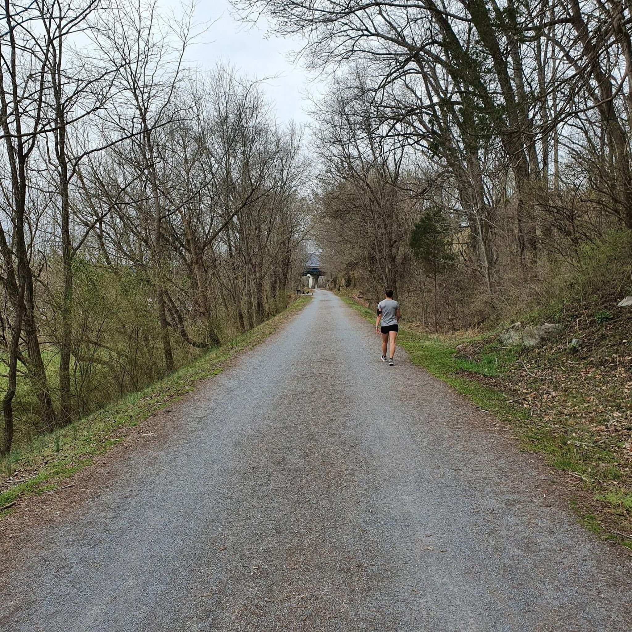
The Tweetsie Trail and Watauga River Loop offers a delightful touring cycling experience, blending the smooth, crushed-stone surface of the historic Tweetsie Trail with scenic stretches along the Watauga River. You'll pedal through shaded woodlands, open pastures, and past the iconic Elizabethton Covered Bridge, enjoying a diverse landscape that changes with the seasons. The route provides a moderate challenge, covering 27.0 miles (43.4 km) with 1162 feet (354 metres) of elevation gain, making it a rewarding ride for those who appreciate both natural beauty and a touch of history.
Planning your visit is straightforward, with the trail being well-maintained and offering amenities like restrooms and water fountains, especially near Elizabethton. If you're traveling light, bike rentals are available in Johnson City, providing a convenient starting point for your journey. The varied terrain, from flat rail-trail sections to rolling rural roads, means a gravel bike or hybrid is a great choice, ensuring comfort and capability throughout the approximately 2 hours and 42 minutes ride.
This loop is steeped in local heritage, following the path of the former East Tennessee & Western North Carolina Railroad, affectionately known as the "Tweetsie." Beyond the cycling, you can explore historical sites like Fort Watauga and Sycamore Shoals State Historic Park, which are easily accessible from the trail. It's a fantastic way to combine a good workout with a journey through Northeast Tennessee's past, offering more than just a ride but an immersive cultural experience.
1
riders
28.9km
01:48
280m
280m
The Hollows of Stoney Creek Road loop offers a delightful touring cycling experience through the picturesque countryside surrounding Elizabethton. You'll primarily ride on smooth, paved surfaces, passing through areas like Willow Springs Road and the notably charming Dry Hollow Road, which is known for its quiet stretches and lovely scenery. The route provides pleasant natural views, especially vibrant with fall foliage in autumn, making it a rewarding journey for those who appreciate scenic rides.
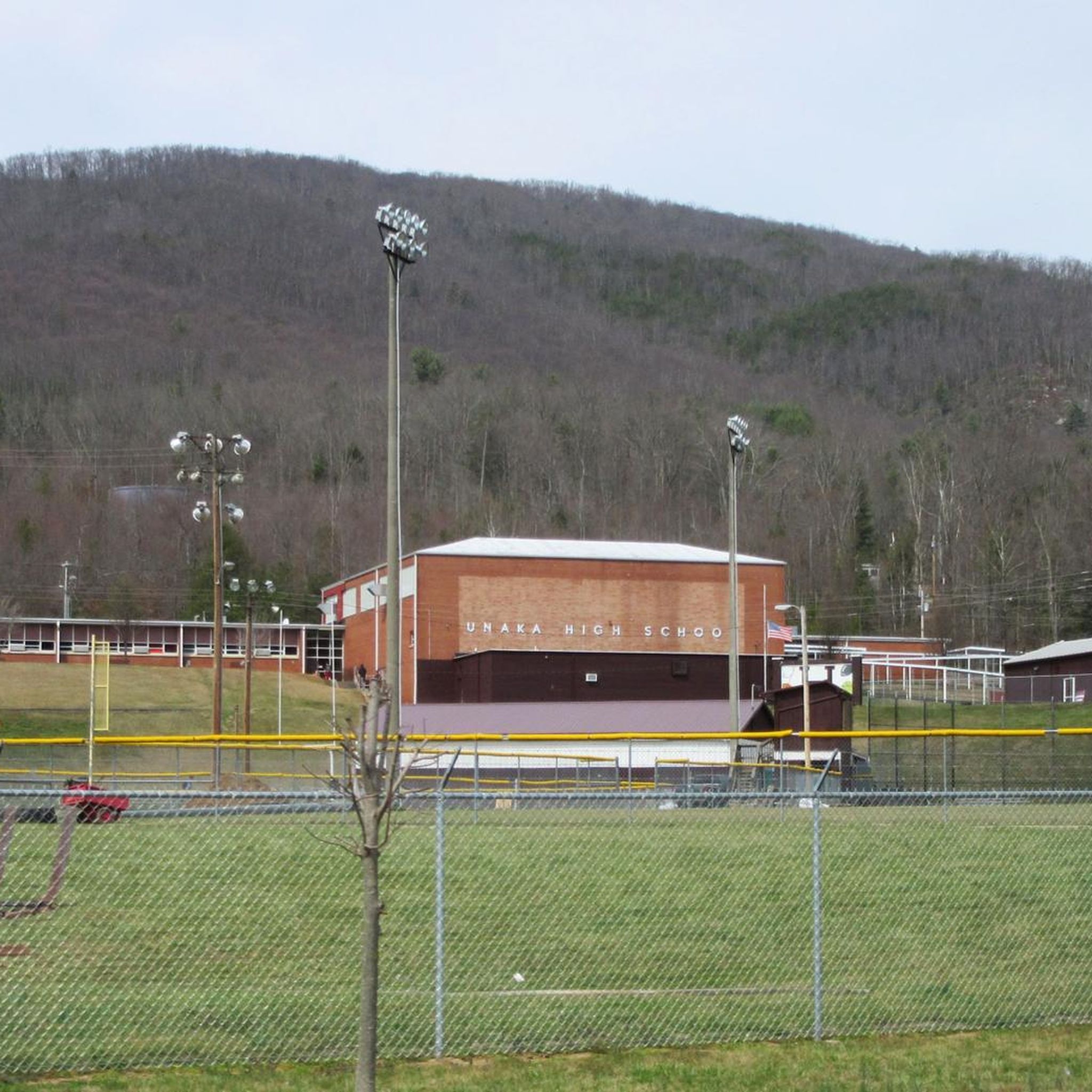
This moderate 18.0-mile (28.9 km) loop involves 932 feet (284 metres) of elevation gain and typically takes about 1 hour and 48 minutes to complete. Cyclists with good fitness will find it a suitable challenge. You can easily access the route with parking available near Unaka High School in Elizabethton, making planning your visit straightforward.
Notably, approximately 48% of this route overlaps with sections of the longer Stateline Tour, offering a taste of that extended adventure. The Hollows of Stoney Creek Road loop is an excellent choice for experienced cyclists seeking a well-maintained, scenic ride in the Elizabethton area, providing a great way to explore the region's natural beauty without venturing onto unpaved trails.

1
riders
28.5km
01:54
430m
430m
The Powder Mary Loop from Lyons Field Park offers a varied touring cycling experience, blending smooth paved sections with some challenging unpaved singletrack. You'll navigate through pleasant natural surroundings, including light forests and foothills meadows, typical of the Lyons area. The route's mix of surfaces and elevation ensures a dynamic ride, keeping you engaged from start to finish.
This moderate 17.7-mile (28.5 km) loop features a notable 1408 feet (429 metres) of elevation gain, which typically takes around 1 hour and 54 minutes to complete. The trail starts conveniently from Lyons Field Park. While specific parking details aren't provided, planning your visit during good weather is recommended to fully enjoy the diverse terrain and scenery.
Lyons is a recognized hub for cycling, offering routes that ascend into the Rocky Mountains or cruise through eastern plains. The Powder Mary Loop contributes to this reputation, providing a moderately challenging option for touring cyclists. Its combination of length, elevation, and varied terrain makes it a comprehensive choice for exploring the natural beauty around Lyons.
2
riders
29.9km
02:08
520m
520m
If you're up for a serious pedal, the Watauga Dam and Watauga Dam Visitor Center loop from Watauga Valley delivers a challenging touring cycling experience. This difficult 18.6-mile (29.9 km) route takes you through the scenic Appalachian Mountains, offering expansive views of Watauga Lake, Tennessee's highest-elevated reservoir, and the surrounding Cherokee National Forest. You'll encounter a significant 1711 feet (522 metres) of elevation gain, making it a demanding ride that typically takes around 2 hours and 7 minutes.
For planning your visit, you'll find convenient parking at the Watauga Dam Visitor Center, which is also a good resource for local information. The visitor center is usually open from 9 AM to 5 PM, so it's best to plan your ride within these hours. While much of the route is paved, be prepared for consistent climbing throughout, as the mountainous terrain ensures a demanding workout.
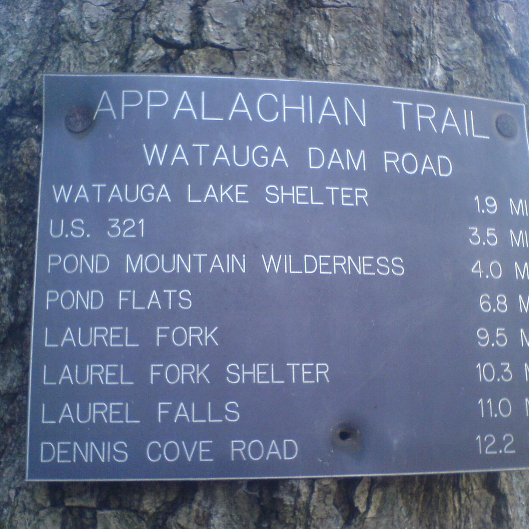
One of the standout features of this route is the Watauga Dam itself, a 318-foot high engineering marvel that's listed on the National Register of Historic Places. Uniquely, the iconic Appalachian Trail crosses directly over the crest of the dam, offering a dramatic perspective of both the structure and the vast Watauga Lake. This blend of natural beauty and impressive engineering makes the loop a memorable ride for those with very good fitness.
40.6km
02:36
420m
410m
The Siam and Blue Springs loops offer a rewarding touring cycling experience around Elizabethton, blending natural beauty with historical interest. You'll pedal through diverse landscapes, encountering scenic overlooks and the iconic Elizabethton Covered Bridge, a true highlight of the journey. This moderate route spans 25.2 miles (40.6 km) with 1362 feet (415 metres) of elevation gain, typically taking around 2 hours and 35 minutes, making it a great option for those seeking a substantial ride with varied scenery.
When planning your visit, be aware that while much of the route is paved, some segments may include unpaved sections. For this reason, a touring bike equipped with more robust tires is advisable to handle the mixed surfaces comfortably. Convenient general parking is available in Elizabethton, providing easy access to the start of the loops.
What sets this route apart is its unique combination of a challenging workout and picturesque surroundings, offering a genuine taste of the region's character. The presence of the historic Elizabethton Covered Bridge adds a significant cultural element, making the Siam Blue Springs bike trail landmarks viewpoints natural features a memorable ride for cyclists exploring the area.
16.7km
01:04
160m
160m
If you're looking for a pleasant, accessible touring cycling route near Elizabethton, Tennessee, the Blue Springs loop from Unaka High School is a solid choice. This route offers a moderate ride, covering 10.4 miles (16.7 km) with a gentle 537 feet (164 metres) of elevation gain, making it suitable for a relaxed outing. You can expect a mix of local roads, potentially including sections of Blue Springs Road, providing a straightforward and enjoyable experience for cyclists of varying skill levels. It's a great way to get some fresh air without committing to a long or strenuous journey, typically taking about 1 hour and 3 minutes to complete.
Planning your ride is simple, as parking is readily available at Unaka High School, which serves as both the start and end point for the loop. There are no permits or fees required for this local touring cycling route. For the most comfortable experience, consider cycling during the cooler parts of the day, especially in warmer months, and always check the local weather forecast for Elizabethton, TN. This route is particularly appealing for those seeking family-friendly cycling options or a quick spin after work.
While specific historical or ecological details for this exact Blue Springs loop are not widely documented, the Unaka region of Tennessee is known for its natural beauty and outdoor recreation opportunities. This route provides a glimpse into the local landscape, offering a contrast to the more rugged mountain biking and gravel trails found elsewhere in the Unaka area. It's a testament to how local roads can be pieced together to create enjoyable cycling routes, providing a quiet alternative to more well-known trails.
46.3km
03:00
620m
620m
The Stateline Tour Loop offers a challenging touring cycling experience, winding through a landscape that includes highlights like The Watershed Trails and Simerly Creek Road. With 28.8 miles (46.3 km) of riding and a substantial 2039 feet (621 metres) of elevation gain, this route is rated difficult and demands good fitness. Expect a rewarding journey through varied terrain, perfect for cyclists seeking a serious workout and a sense of achievement.
When planning your ride, ensure you're prepared for a 3-hour effort. While specific trailhead parking details aren't provided, it's always best to arrive early, especially on weekends, to secure a spot. Carry plenty of water and snacks, and check the weather forecast, as conditions can change quickly in areas with significant elevation changes. This route is best enjoyed during temperate seasons to avoid extreme heat or cold.
This area is known for its diverse cycling opportunities, catering to various skill levels, though the Stateline Tour Loop itself leans towards the advanced. The presence of Limestone Cove Recreation Area nearby suggests amenities might be accessible, making it a good base for exploring other routes or for post-ride recovery. The region's natural beauty, even without specific details for this exact loop, promises a scenic backdrop to your challenging ride.
54.4km
03:24
610m
610m
The Stateline Tour Loop offers a diverse and challenging touring cycling experience through picturesque mountainous landscapes. You'll navigate significant elevation gains and varied terrain, with forested sections giving way to views of clear waters and unique rock formations. It's a route designed to immerse you in the natural beauty of the region, providing a continuous scenic backdrop for your ride.
Planning your ride on this difficult 33.8-mile (54.4 km) loop, which includes 2007 feet (612 metres) of elevation gain and takes about 3 hours and 23 minutes, requires good preparation. Ensure you have adequate hydration and check weather conditions, as the demanding nature of the route means you'll want to avoid extremes. While specific parking details are not listed, arriving early is always a good idea for any popular cycling route.
This area is notable for its blend of challenging climbs and stunning natural features, making it a favorite among touring cyclists. The combination of Lake Tahoe's clear waters, majestic mountainous terrain, and dense forests creates a highly engaging environment. You'll find the cycling terrain around Stateline to be well-regarded for its diverse offerings, from easy lakeside paths to strenuous mountain climbs.
46.8km
03:11
740m
740m
For touring cyclists in Hampton, Tennessee, the Tiger Creek Road, Ripshin Lake loop offers a truly challenging yet rewarding experience through forested mountains. You'll navigate winding roads, with the highlight being the steep ascent of Tiger Creek Road, known for its significant gradients. The route then brings you past the tranquil Ripshin Lake, offering scenic views, especially during autumn, and follows Roaring Creek with its charming waterfalls.
This difficult 29.1-mile (46.8 km) route, with its 2420 feet (738 metres) of elevation gain, is best undertaken by experienced riders. Expect to spend around 3 hours and 10 minutes in the saddle. While Ripshin Lake is private, the road provides excellent viewing opportunities; consider an early start to avoid the heat on the climbs and to fully appreciate the quiet roads.
The area is characterized by its natural beauty, with dense forests and mountain streams defining much of the journey. The relative lack of traffic on Tiger Creek Road enhances the feeling of immersion in nature, making it a prime choice for those seeking solitude and a strenuous workout away from busier routes in Carter County.
31.8km
02:01
330m
330m
The Hampton to Gap Creek Road loop from Elizabethton offers a delightful touring cycling experience, guiding you through a landscape rich with green pastures and charming old country homes. You'll navigate winding roads that transition from open countryside to forested sections, with the route touching on Gap Creek Road, known for its connection to the flatter Tweetsie Trail. This blend of terrain ensures a varied ride, showcasing the natural beauty of the region around Elizabethton.
This moderate 19.8-mile (31.8 km) cycling route features 1081 feet (329 metres) of elevation gain, typically taking about 2 hours and 1 minute to complete. It's a great option for cyclists looking for a rewarding ride that isn't overly strenuous but still provides a good workout. Parking can generally be found in Elizabethton, a town known for its cycling-friendly infrastructure, making it a convenient starting point for your adventure.
Beyond the ride itself, the area is steeped in history and natural charm, with landmarks like the Elizabethton Covered Bridge adding to the scenic appeal. This loop provides a fantastic way to explore the diverse cycling opportunities in Washington and Carter County, offering a taste of both challenging ascents and more relaxed sections, perfect for a day out on two wheels.
Get access to more routes and recommendations from other explorers.
Already have an account?
Our route recommendations are based on thousands of hikes, rides, and runs completed by other people on komoot.
Start today with a free account
Your next adventure awaits.




Other adventures in Carter County

Tips from the Community

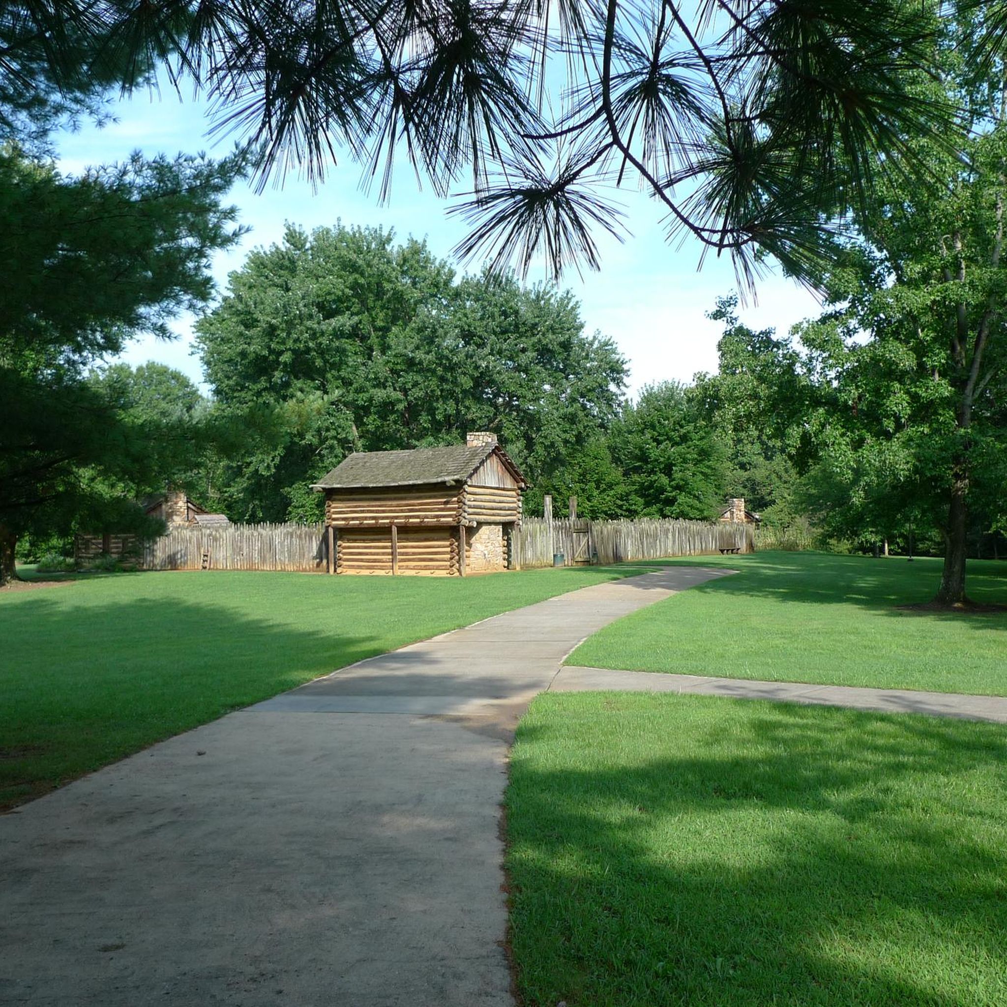
Fort Watauga is a historic fortification constructed by early frontier settlers in the Watauga region during the late 18th century. It served as a key defensive outpost designed to protect the community from external threats. It is now open to visitors who want to learn more about the history of the local area.
0
0
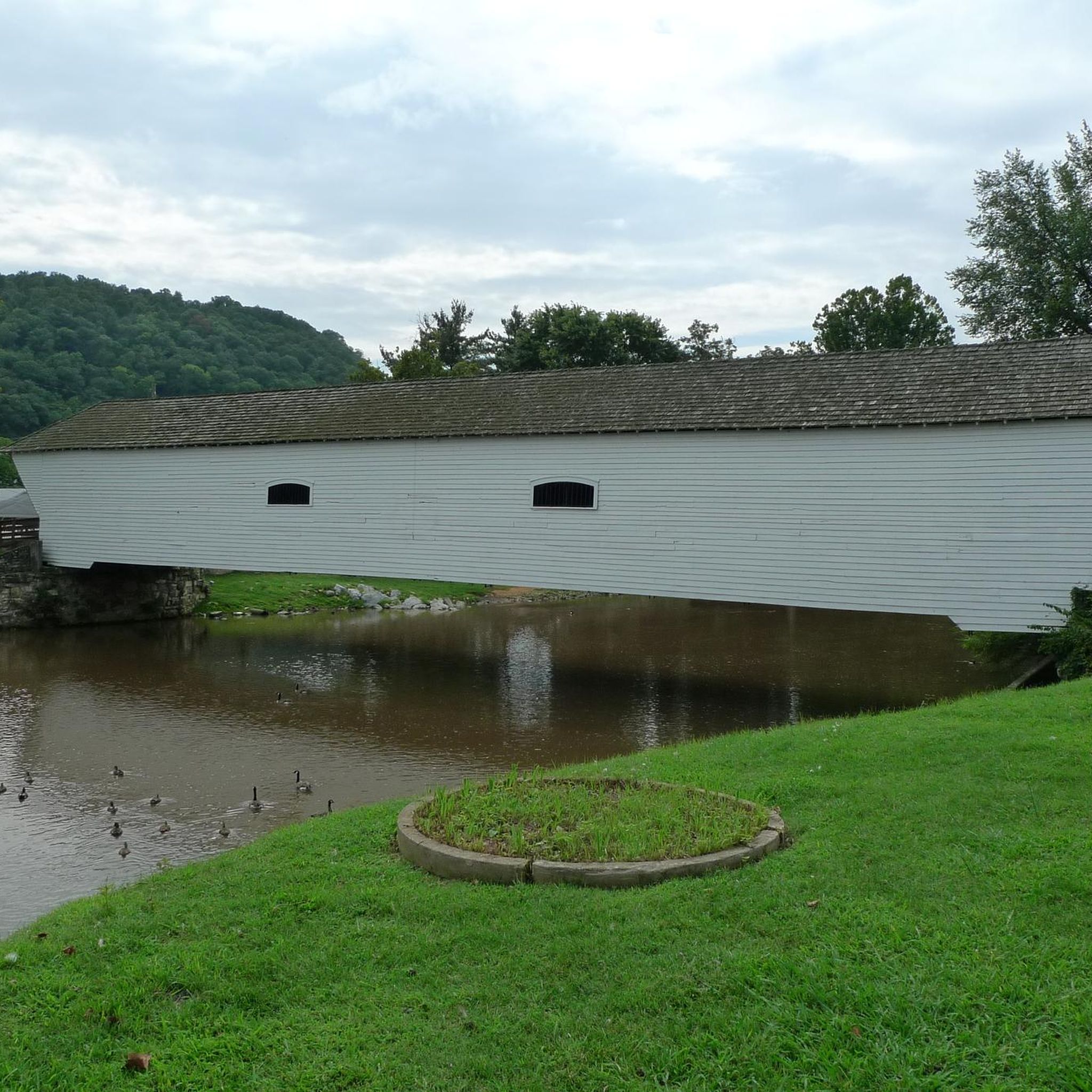
The Elizabethton Covered Bridge, was built in 1882 over the Doe River It is a 154-foot-long truss bridge that has survived numerous floods, including the 1901 flood and Hurricane Helene in 2024. It is closed to vehicles but open to pedestrians and cyclists.
0
0

Gap Creek Road offers a nice alternative to Mary Patton Highway. It is much smaller and less traffic. It also a small country road instead of a highway. It is not as quick as Mary Patton Highway and the highway does have a large shoulder but I find it nicer.
0
0
There are two large parking lots at this location. One is specifically for Harmon Park where you will find a nice covered picnic area and a playground for children. The other seems to be for the Carter Compassion Center and a Historical Train. The Carter Compassion Center, located between the two parking lots, is a non-profit that works to alleviate poverty in the area. At the far end of the parking lot you will find a plaque and an old train engine. The plaque gives you information about the history of trains in this area. This is an interesting place to visit or just park your car before a ride.
0
0
US E 19 runs on one side of the Doe River and the Old Railroad Grade Road on the other. If you are cycling, the Old Railroad Grade Road is the best option with the river on one side and the mountains on the other. There is very little traffic and you can avoid the noise and cars of US E 19.
0
0
Tiger Creek Road is a classic cycling road for this area. It is a winding mountain road with forest all around and not too much traffic. If climbing it, be warned, there are some pretty steep sections. It is fun either up or down.
0
0
Ripshin Lake is a beautiful lake right next to the Roaring Creek Road. The lake and the land around it is private so there isn't a park or swimming area but the view of the lake is really nice, especially in the fall with the changing colors of the leaves.
0
0
Fort Watauga is actually a reconstruction of the original fort that was here. Each year there are several different educational events that take place here. Sycamore Shoals State Historic Park surrounds the fort and is also interesting to visit. It is not far off the Tweetsie Trail, making it an easy and interesting stop while out on a bike.
0
0
Frequently Asked Questions
How many touring cycling routes are available in Carter County?
Carter County offers a diverse selection of over 10 touring cycling routes. These routes cater to various skill levels, ranging from moderate to difficult, allowing cyclists to explore the region's unique landscapes.
What is the best time of year for touring cycling in Carter County?
The spring and fall seasons are generally ideal for touring cycling in Carter County. During these times, the weather is typically mild, and the natural scenery, such as the rhododendron gardens on Roan Mountain or the changing leaves, is particularly vibrant. Summers can be warm, while winters may bring colder temperatures and potential for snow at higher elevations.
What are the general difficulty levels of touring cycling routes in Carter County?
The touring cycling routes in Carter County offer a range of difficulties. You'll find 8 moderate routes and 4 difficult routes. The terrain varies from gradual rail-trails to challenging mountain ascents, ensuring options for different fitness levels.
Are there any rail-trails suitable for touring cyclists in Carter County?
Yes, the Tweetsie Trail is a prominent 10-mile crushed gravel rail-trail connecting Johnson City and Elizabethton. It's a popular choice for touring cyclists due to its gradual tread, historical markers, and amenities. You can experience a longer ride by combining it with river views on the Tweetsie Trail and Watauga River Loop.
Can I find routes with significant elevation changes for a challenging ride?
Absolutely. Carter County, particularly around Roan Mountain, is known for its significant elevation changes. Routes like the Tiger Creek Road, Ripshin Lake loop from Hampton or the Watauga Dam and Watauga Dam Visitor Center loop from Watauga Valley offer substantial climbs and rewarding views, catering to cyclists seeking a more demanding experience.
Are there touring cycling routes that offer scenic views of lakes or rivers?
Yes, several routes provide beautiful water views. The Tweetsie Trail and Watauga River Loop follows the Watauga River, and the Watauga Dam and Watauga Dam Visitor Center loop from Watauga Valley offers stunning vistas of Watauga Lake and the Watauga Dam.
Are there any circular touring cycling routes in Carter County?
Many of the touring cycling routes in Carter County are designed as loops, providing a convenient way to start and end your ride at the same point. Examples include the Hollows of Stoney Creek Road loop from Elizabethton and the Powder Mary Loop from Lyons Field Park.
What natural landmarks or attractions can I see along touring cycling routes in Carter County?
Carter County's routes often pass by significant natural features. You can encounter waterfalls like Turn for Jones Falls, enjoy views of Watauga Lake, or cycle through areas with views of Roan Mountain. The region's dense forests and diverse ecosystems also offer opportunities for wildlife viewing.
Are there any historical sites or points of interest accessible by bike?
Yes, the Tweetsie Trail itself is a historical site, following the path of the historic ET&WNC Railroad. Informational markers along the trail detail the area's past. Additionally, the Mountain River Trail, Sycamore Shoals State Historic Area is another point of interest that can be incorporated into your cycling exploration.
What do other touring cyclists enjoy the most about touring cycling in Carter County?
The komoot community highly rates the touring cycling experience in Carter County, with an average score of 5.0 stars. Cyclists often praise the diverse terrain, from the scenic rail-trails to the challenging mountain roads, and the beautiful natural landscapes including river valleys and forested sections.
Are there any touring cycling routes suitable for families or beginners?
While many routes in Carter County feature rolling hills or significant elevation, the Tweetsie Trail offers a relatively flat and well-maintained surface, making it an excellent option for families or beginner touring cyclists. Its crushed gravel surface and amenities provide a comfortable and accessible ride.
Where can I find parking for touring cycling routes in Carter County?
Many popular cycling areas, such as the Tweetsie Trail, offer dedicated paved parking at their trailheads. For other routes, parking is often available at local parks or designated pull-offs, though it's always advisable to check specific route details for the most convenient parking options.
Most popular routes in Carter County
Most popular attractions in Carter County

Get inspired with the komoot mobile app


Didn’t find what you were looking for?
Check out more Cycling routes throughout Carter County below and find the perfect route in your destination.
Explore more
Browse the best Cycling routes in other regions.
