The best cycling routes around Étang De Llat
4.3
(81)
2,185
riders
22
rides
Touring cycling routes around Étang De Llat offer a diverse landscape centered on a large saltwater lagoon. This region features a slender coastal strip, known as the lido, separating the lagoon from the Mediterranean Sea, providing routes with views of both. Cyclists can also find paths winding through vineyards and along greenways converted from old railway lines. The area's unique ecosystem supports varied wildlife, making for scenic and engaging rides.
Best touring cycling routes around Étang De Llat
- The most…
Last updated: July 4, 2026
4.5
(6)
41
riders
20.4km
01:45
440m
440m
Moderate bike ride. Good fitness required. Mostly paved surfaces. Suitable for all skill levels.
5.0
(1)
26
riders
15.4km
01:09
340m
340m
Hard bike ride. Good fitness required. You may need to push your bike for some segments of this route.

Sign up for free
16
riders
12.7km
01:21
270m
270m
Moderate bike ride. Good fitness required. Mostly paved surfaces. Suitable for all skill levels.
2.0
(1)
5
riders
10.8km
01:05
170m
170m
Moderate bike ride. Good fitness required. Mostly paved surfaces. Suitable for all skill levels.
5.0
(1)
9
riders
12.0km
00:51
240m
240m
Moderate bike ride. Good fitness required. Mostly paved surfaces. Suitable for all skill levels.
Get access to more routes and recommendations from other explorers.
Sign up for free
Already have an account?
Our route recommendations are based on thousands of hikes, rides, and runs completed by other people on komoot.
Start today with a free account
Your next adventure awaits.
Login or Signup

Tips from the Community


Located inconspicuously next to the road, a small Stations of the Cross lead to Mount Calvary. A magnificent view from the top.
0
0

Well, starting from Font Romeu and breaking legs from Mont Louis
0
0


The Col de la Calvaire de Font Romeu is a mountain pass in French Cerdanya, next to the town and ski resort of Font Romeu. This port connects the Bolquère valley with the Cerdanya valley. The port is within the same town of Font Romeu, next to the station's ski lifts. There are many slopes to reach Col de la Calvaire: - the western slope that starts from Ur is approximately 16 km and crosses the town of Targasone and the Col d'Egat. It is a very steep climb along a road in perfect condition, although on holidays there is a lot of traffic. - The southern slope starts from Llívia and crosses Estavar and joins the previous one at the Col d'Egat. Unlike the first, the first section of the climb is very hard, with several horseshoe curves and with wonderful views of the entire Cerdanya and the Tosa d'Alp. - The eastern slope stops at Olette, and after approximately 28 km it reaches the top of the pass, passing through the town of Mont-Louis and Bolquère. It is a very steep climb, like the first, on a road in perfect condition but with a lot of traffic. I don't like going up here. - the eastern slope that starts from Olette and passes through the Col de la Perche, reaching the town of Font-Romeu and from there to the top. Of all the slopes, the one I like the most is the slope that starts from Llívia and crosses Estavar.
0
0

Beautiful refuge to rest and gain strength, the starting point of an emblematic route that visits multiple lakes and can culminate with the imposing Carlit.
1
0

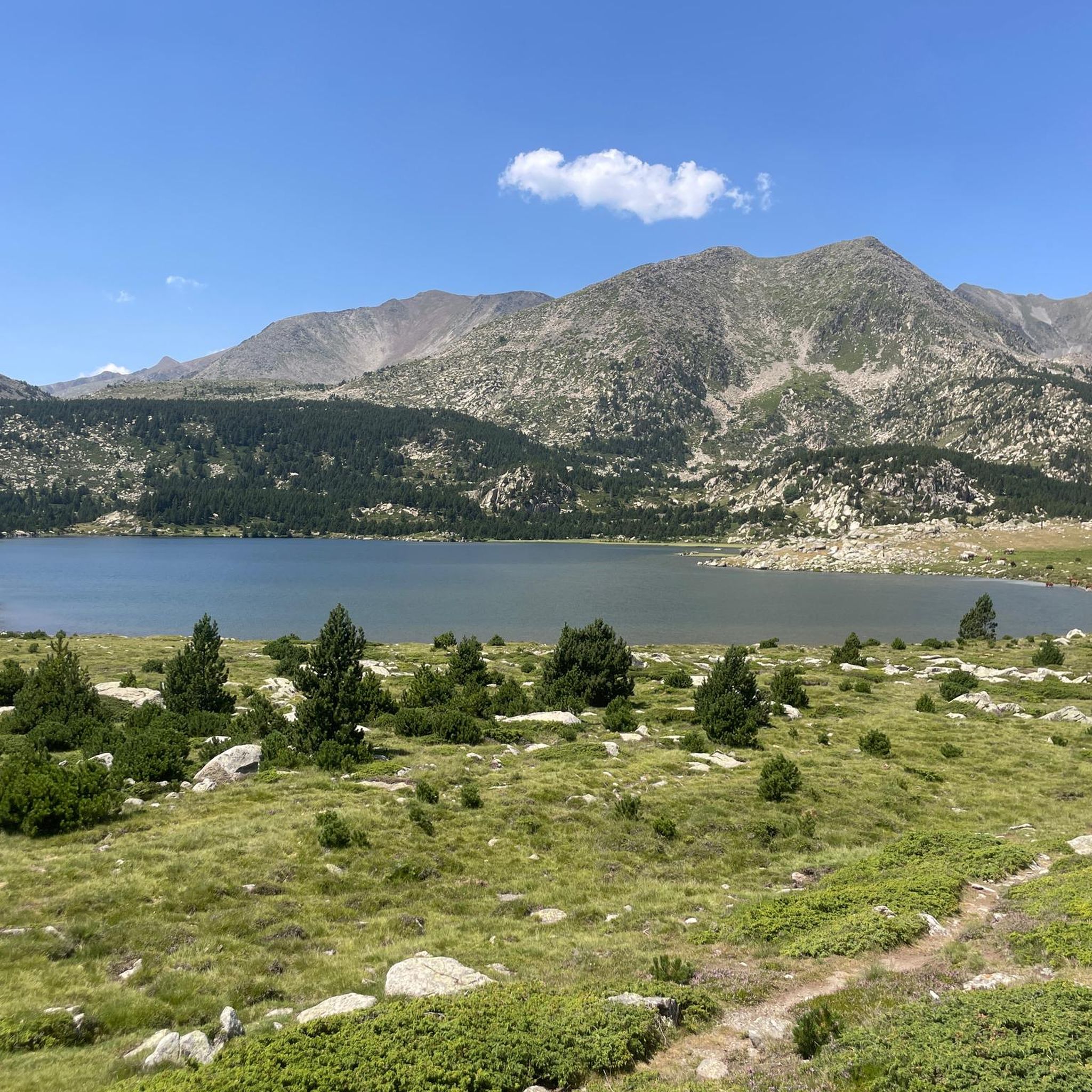
Raco Lake is one of the Estanys dels Esquits. It is surrounded by a large meadow of tall grass which makes it particularly beautiful and unique.
1
0
The renovated refuge offers services and facilities that match the natural site in which it is located. Everything is perfect! Summer and winter alike, you will find 19 places in the dormitory. You can also pitch your tent (by reservation). In addition to this, you will find free bivouac areas around the refuge. Furthermore, the refuge provides a water point and outdoor dry toilets. Note that there is no shower. A catering service is also available for lunch and dinner (a single service at a fixed time). In the evening, a single communal meal.
1
0
Frequently Asked Questions
How many touring cycling routes are available around Étang De Llat?
There are over a dozen touring cycling routes available around Étang De Llat, offering a variety of experiences for different skill levels. You'll find options ranging from moderate loops to more challenging climbs.
What kind of terrain can I expect on touring cycling routes around Étang De Llat?
The touring cycling routes around Étang De Llat offer a diverse landscape. You can expect paths along saltwater lagoon shores and coastal paths along the lido, which separates the lagoon from the Mediterranean Sea. Some routes also wind through vineyards and along greenways. The area features both moderate climbs and more challenging ascents, providing varied terrain for cyclists.
What is the best time of year for touring cycling around Étang De Llat?
While the guide doesn't specify the absolute best time, regions with coastal and lagoon features, like Étang De Llat, often offer pleasant cycling conditions in spring and autumn. These seasons typically provide comfortable temperatures, avoiding the peak heat of summer and the colder, potentially wetter conditions of winter.
Are there any circular touring cycling routes in the area?
Yes, many of the touring cycling routes around Étang De Llat are designed as loops. For example, the Bouillouses Refuge – Lac du Raco loop from Lac des Bouillouses is a popular circular route, as is the Idyllic landscapes loop from Pic de la Calma.
What are some of the more challenging touring cycling routes around Étang De Llat?
For those seeking a challenge, the Col de la Perche (1,579 m) – Font-Romeu loop from Targasonne is a difficult 15.7-mile (25.3 km) path offering significant elevation gain and panoramic views. Another challenging option is the Col du Calvaire (Font-Romeu) – Font-Romeu loop from La Calme.
Are there any family-friendly touring cycling routes in Étang De Llat?
While specific 'family-friendly' routes aren't detailed, the region offers routes with varying difficulty levels. Look for routes described as 'easy' or 'moderate' with less elevation gain, which would be more suitable for families. The presence of greenways and coastal paths often indicates flatter, more accessible terrain.
What do other touring cyclists enjoy most about cycling in Étang De Llat?
The area is highly rated by the komoot community, with an average score of 4.3 stars from over 70 reviews. Reviewers often praise the diverse scenery, which includes saltwater lagoon shores, coastal paths, and routes through vineyards, as well as the variety of options for different ability levels.
Are there opportunities to see natural features or landmarks along the routes?
Yes, the region's unique ecosystem supports varied wildlife, making for scenic and engaging rides. The routes themselves traverse distinct landscapes like the saltwater lagoon, coastal lido, and vineyards. While specific landmarks aren't listed in the guide data, the diverse terrain ensures plenty of natural beauty to observe.
Where can I find parking for touring cycling routes in Étang De Llat?
Specific parking locations are not detailed in the guide. However, for routes starting from towns or popular points like Lac des Bouillouses or Targasonne, there are typically designated parking areas. It's advisable to check local information for specific starting points of your chosen route.
Are there any less crowded touring cycling routes around Étang De Llat?
While the guide highlights popular routes, exploring some of the less-trafficked paths through vineyards or smaller greenways might offer a quieter experience. The Sheepfold of the Jasse d'Amunt – La Calme Cottage loop from La Calme could be an option for a more serene ride, as it's a moderate route that might be less frequented than the most popular loops.
Can I find cafes or accommodation along the touring cycling routes?
The guide does not explicitly list cafes or accommodation along the routes. However, given that many routes pass through or near towns and villages, it is likely you will find amenities in these areas. For example, routes around Font-Romeu or near Lac des Bouillouses would likely have facilities available.
Most popular routes around Étang De Llat

Get inspired with the komoot mobile app


Explore more
Browse the best Cycling routes in other regions.
