The best running trails around Lai da Sontga Maria
113
runners
15
runs
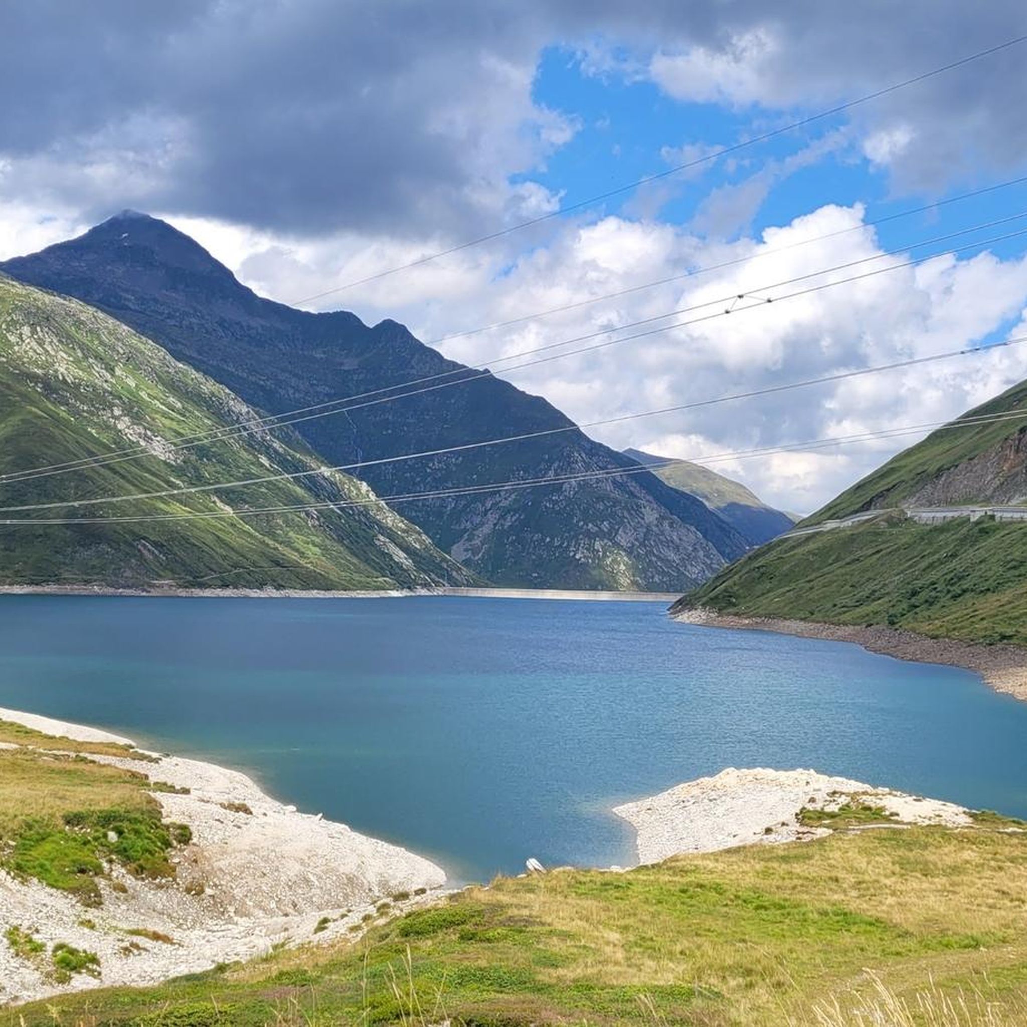
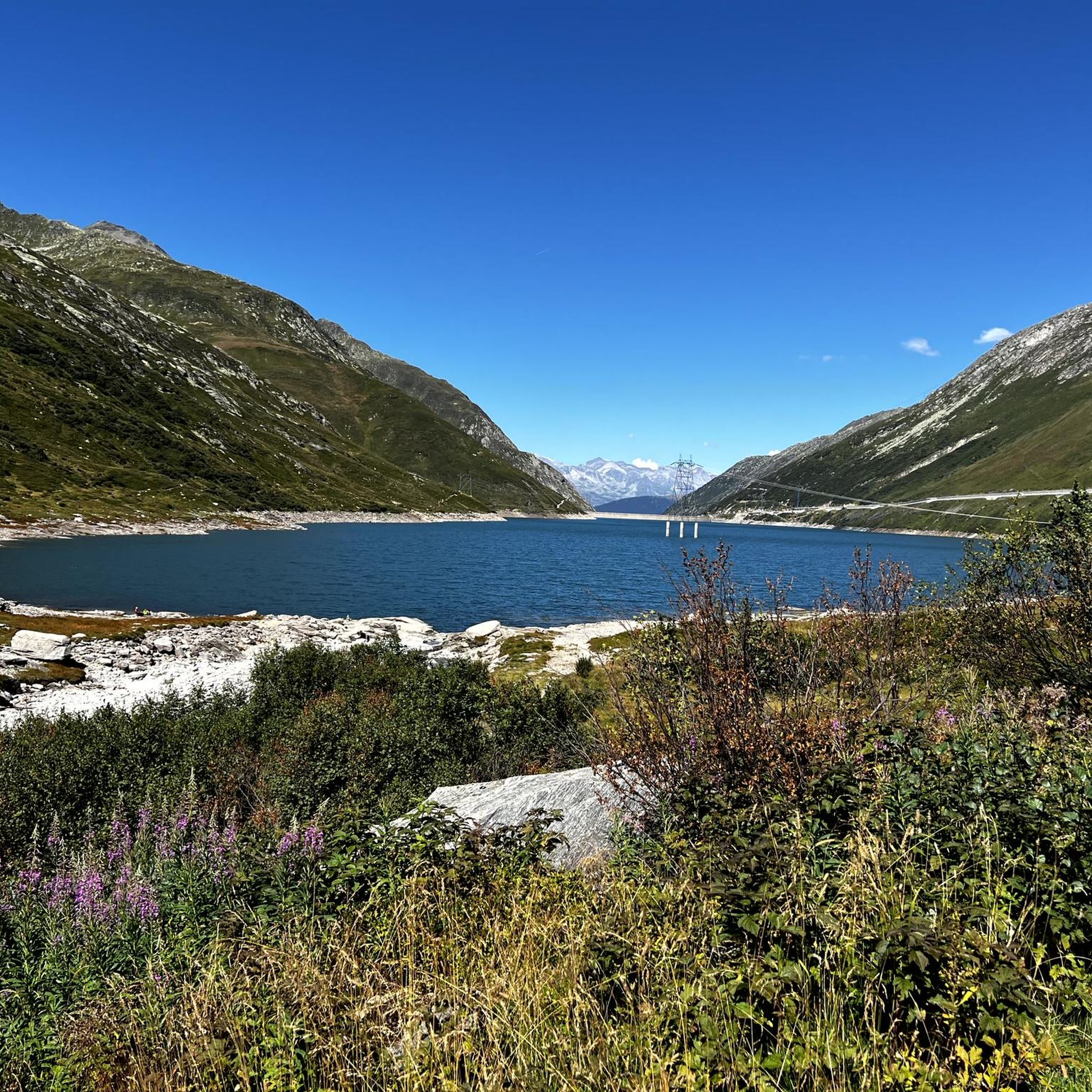
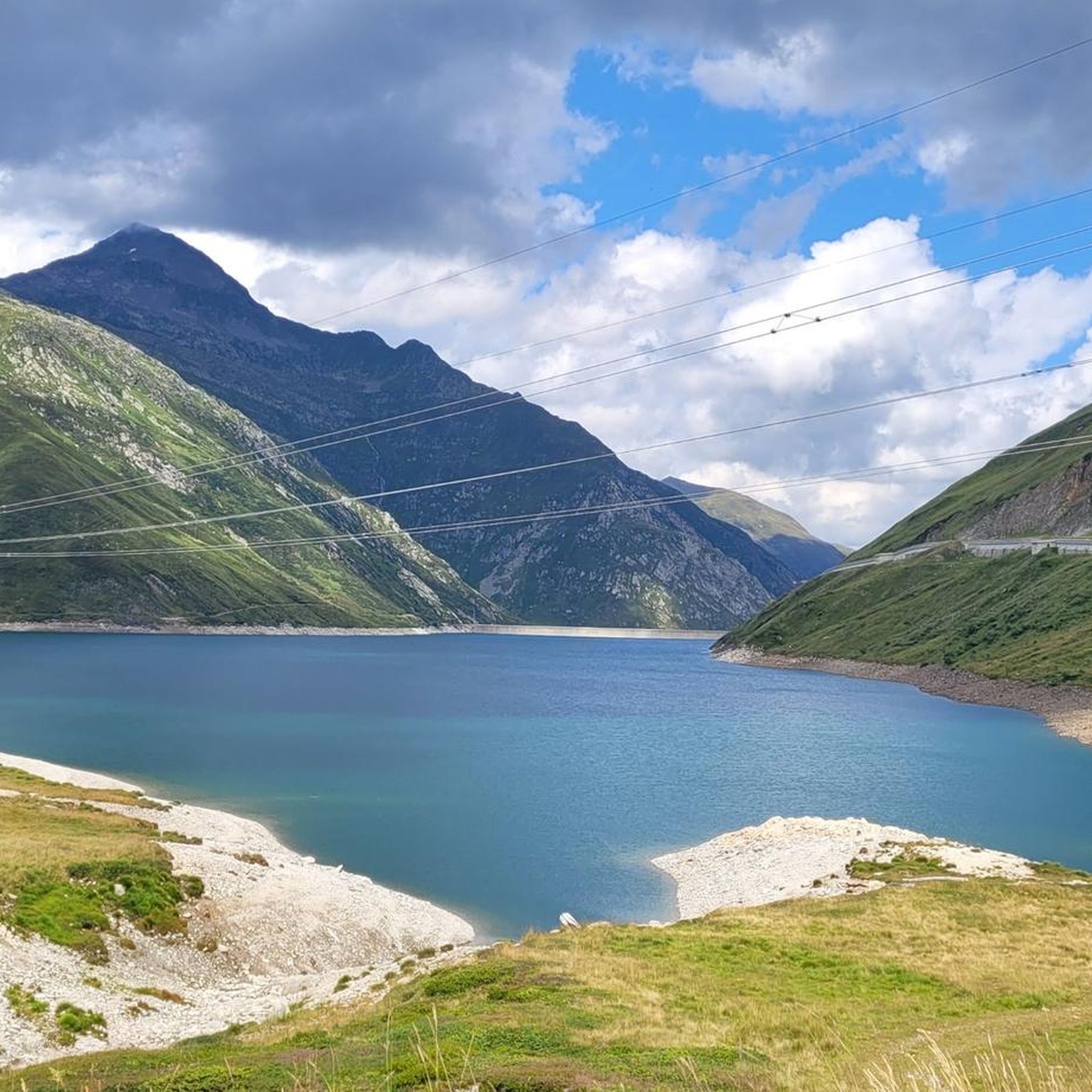
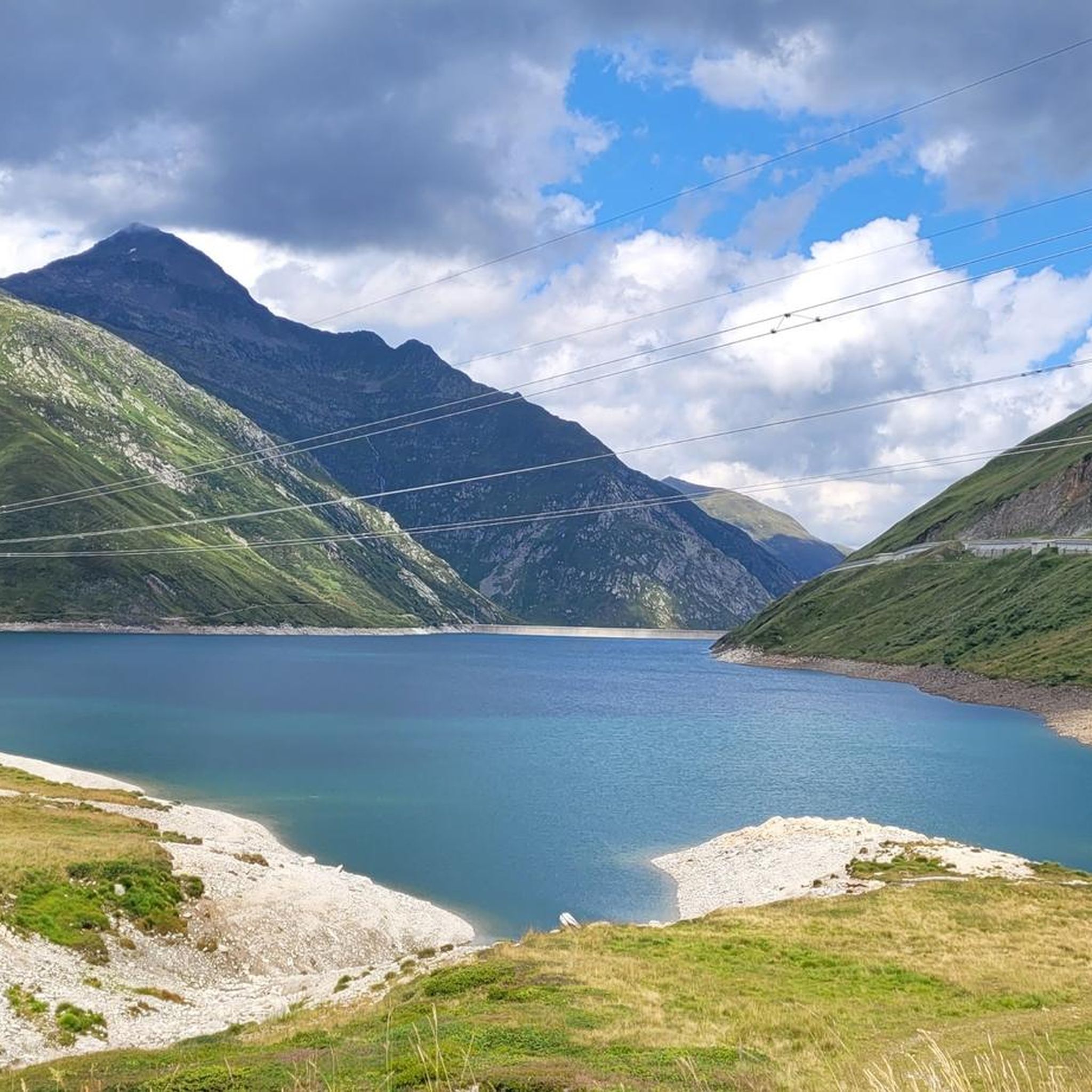
Jogging around Lai da Sontga Maria offers routes through an alpine landscape characterized by mountain passes, high-altitude lakes, and valleys. The region features varied terrain, from moderate paths around the lake to more challenging ascents over mountain passes. Runners can expect to encounter a mix of open alpine meadows and sections with significant elevation changes.
Best jogging routes around Lai da Sontga Maria
- The most popular jogging route is Lucomagno - Gana Negra Pass Loop, a 6.1 miles (9.9…
Last updated: October 10, 2026
1
runners
9.89km
01:57
660m
660m
Hard run. Very good fitness required. Sure-footedness, sturdy shoes and alpine experience required.
10
runners
9.34km
01:03
130m
130m
Moderate run. Good fitness required. Mostly paved surfaces. Suitable for all skill levels.

11
runners
8.88km
01:03
180m
180m
Moderate run. Good fitness required. Mostly accessible paths. Some sure footedness required.
6
runners
Hard run. Very good fitness required. Sure-footedness, sturdy shoes and alpine experience required.
6
runners
15.7km
02:26
620m
620m
Hard run. Very good fitness required. Sure-footedness, sturdy shoes and alpine experience required.
Get access to more routes and recommendations from other explorers.
Already have an account?
Our route recommendations are based on thousands of hikes, rides, and runs completed by other people on komoot.
Start today with a free account
Your next adventure awaits.
Tips from the Community

A really beautiful pass! And also for hiking from the pass summit: many possibilities.
0
0


Scenic pass that is opened all year round (closes at 6pm in winter). There is hardly any traffic which makes cycling very nice and plenty of opportunities to take pictures. We crossed the pass in early May when there was still plenty of snow up there. The change in scenery where it was all green at Disentis and slowly turning white as we climbed higher... and very quickly turned to green as we rolled down on the south side to Biasca was breathtaking.
1
1

The Lucomagno is one of the most famous Alpine passes in Switzerland. It is located between the cantons of Ticino and Grisons, at an altitude of 1,926 meters. The name seems to derive from the Latin "locus magnus", meaning "large, open place". It is often tackled in the professional race of the Tour of Switzerland.
3
0

The black rocks are really wonderful to look at. Was one of the highlights of my tour.
2
0

Lukmanier Pass When the Disentis monastery was founded around 720, the Lukmanier Pass, which could be crossed without great difficulty and was also considerably lower than the other passes in the Alps, became very important. During the Staufer period, it was considered the most important north-south connection to Italy. However, it quickly lost this role to the Gotthard and Splügen passes. In 1374, the Disentis monastery built the "Hospezi S. Maria" with a chapel on the top of the pass. Both had to make way for the construction of the reservoir in 1964. The new hospice at the current location was inaugurated on August 1, 1965 and the chapel in 1967. The Lukmanier Pass played an important role in the choice of the route of an Alpine railway at times, because the planners assumed that it would be possible to build it without an expensive summit tunnel. In 1869, however, the decision was made in favor of the Gotthard railway. Between 1872 and 1877, a modern road was built over the Lukmanier. With the construction of the "Lai da Sontga Maria" reservoir in the 1960s, the road on the Graubünden side had to be relocated to a gallery. The importance of a supra-regional transport axis ended with the opening of the motorway tunnel through the Gotthard. Tourism in the Surselva began to suffer greatly as a result, especially as the pass was closed during the winter from 1980 onwards. On the initiative of the municipality of Disentis and the Surselva mountain railways in particular, the "Pro Lucmagn" association was founded, which has been responsible for ensuring that the Lukmanier pass remains open for as long as possible in winter since 2005. The canton, district, municipalities and tourism in both Graubünden and Ticino provide the finances. The five-year trial phase was positive. This project has been secured for the long term since 2011. Clearly to the benefit of tourism in the Surselva as well as in the Blenio Valley. Text / Source: Interest Group for Alpine Passes IAP, PO Box 11, 6491 Realp https://www.alpen-paesse.ch/de/alpenpaesse/lukmanierpass/
12
2

The Lukmanier Pass is located at almost 2,000 m above sea level between the Swiss cantons of Ticino and Grisons. It can be reached by crossing the Blenio valley which is the sunniest of the Swiss ones, therefore called "Valle del Sole".
1
0
Here you run on a narrow path that crosses soft green meadows and fragile sharp rocks.
1
0
Frequently Asked Questions
How many running routes are available around Lai da Sontga Maria?
There are 15 dedicated running routes around Lai da Sontga Maria, offering a variety of experiences for different fitness levels. These routes range from moderate loops to more challenging mountain runs.
Are there any easy or beginner-friendly running routes in the Lai da Sontga Maria area?
While most routes in the region are considered difficult due to the alpine terrain, there are 3 moderate running paths. One such option is the Lukmanier Pass – Lake of St. Mary loop from Passo del Lucomagno, which offers a more gentle elevation profile with scenic views.
What is the typical distance for running trails near Lai da Sontga Maria?
The running trails around Lai da Sontga Maria vary in length. For example, the Lukmanier Pass – Lake of St. Mary loop is about 5.6 miles (9.0 km), while the Uomo Pass (2,218 m) – Lake of St. Mary loop extends to approximately 9.7 miles (15.7 km).
Are there any circular running routes around Lai da Sontga Maria?
Yes, many of the routes in the area are circular, allowing you to start and finish at the same point. Examples include the popular Lucomagno - Gana Negra Pass Loop and the Lukmanier Pass summit – Lukmanier Pass loop from Hospezi S. Maria.
What kind of terrain can I expect on the running trails?
The terrain around Lai da Sontga Maria is predominantly alpine, characterized by mountain passes, high-altitude lakes, and valleys. You'll encounter a mix of open alpine meadows and sections with significant elevation changes, offering a challenging yet rewarding running experience.
What do other runners enjoy about jogging in Lai da Sontga Maria?
More than 100 runners have used komoot to explore the varied terrain around Lai da Sontga Maria. They often praise the stunning alpine scenery, the challenge of the mountain passes, and the tranquility of the high-altitude lakes.
Are there any running routes that offer particularly good viewpoints?
Many routes provide excellent viewpoints of the surrounding alpine landscape. The Lukmanier Pass – Lake of St. Mary loop, for instance, offers continuous views of the lake and the majestic peaks. The Suspension Bridge in Ticino – View of Val Bedretto loop also promises impressive vistas.
Is it possible to run in the Lai da Sontga Maria region during winter?
Winter running in this high-alpine region can be challenging due to snow and ice. While some lower-altitude paths might be accessible, many mountain passes and higher trails will be covered. It's crucial to check local conditions, avalanche warnings, and trail accessibility before attempting any winter runs.
Are the running trails around Lai da Sontga Maria suitable for families?
Given the predominantly difficult and moderate ratings, with significant elevation changes, most routes are better suited for experienced runners. However, families with older, active children might enjoy shorter, less strenuous sections or the moderate loops like the Lukmanier Pass summit – Lukmanier Pass loop, provided they are well-prepared for alpine conditions.
Can I bring my dog on the running trails?
Generally, dogs are permitted on trails in the Swiss Alps, but it's essential to keep them on a leash, especially in areas with grazing livestock or protected wildlife. Always ensure your dog is fit enough for the challenging alpine terrain and carry enough water for both of you.
Are there any cafes or refreshment stops along the running routes?
While the routes primarily traverse natural alpine landscapes, you might find occasional mountain huts or guesthouses (like Hospezi S. Maria, a common starting point) that offer refreshments. It's always advisable to carry your own water and snacks, especially on longer or more remote trails, as facilities can be sparse.
What is the best time of year to go running around Lai da Sontga Maria?
The best time for running in this high-alpine region is typically from late spring to early autumn (June to September), when the snow has melted, and the weather is more stable. During these months, trails are generally clear, and the alpine meadows are in full bloom, offering pleasant conditions and stunning scenery.
Most popular routes around Lai da Sontga Maria

Get inspired with the komoot mobile app


Explore more
Browse the best Running Trails & Routes in other regions.
