The best cycling routes around Lai da Sontga Maria
4.1
(39)
937
riders
5
rides
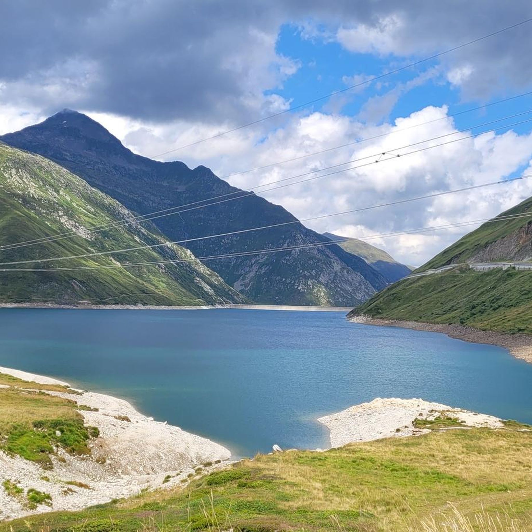
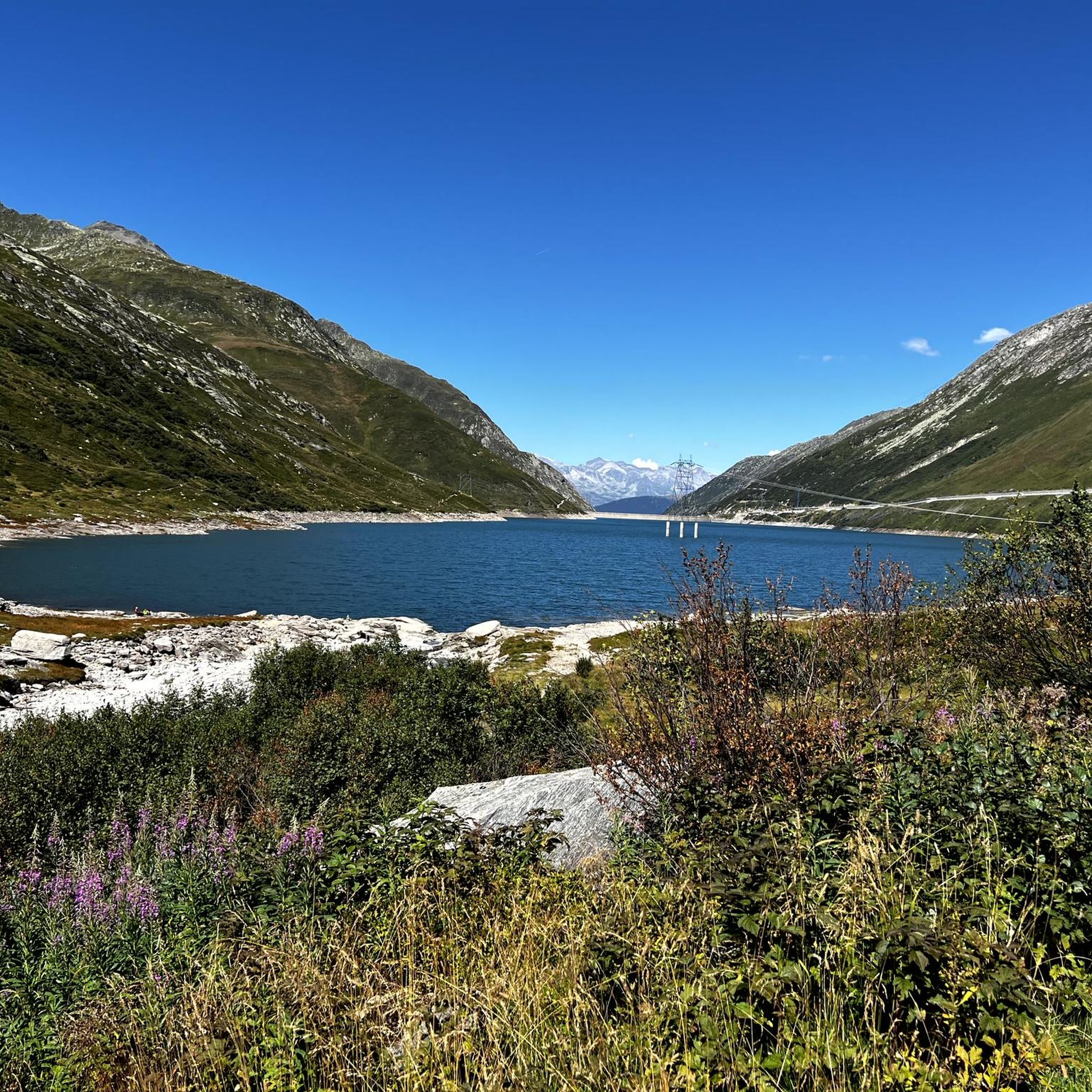
Touring cycling around Lai da Sontga Maria is centered on an artificial lake at 1,908 meters elevation, surrounded by high alpine peaks such as Scopi (3,190 m) and Piz Gannaretsch (3,040 m). The region features the Santa Maria arch dam and the Lukmanier Pass road along its eastern shore, offering varied terrain from paved surfaces to unpaved segments. This high-altitude environment provides challenging routes with significant elevation gains.
Best touring cycling routes around Lai da Sontga Maria
- The most popular…
Last updated: October 10, 2026
4.2
(5)
51
riders
36.7km
03:06
1,260m
1,260m
Hard bike ride. Very good fitness required. Mostly paved surfaces. Suitable for all skill levels.
23
riders
13.1km
01:10
520m
520m
Hard bike ride. Very good fitness required. Mostly paved surfaces. Suitable for all skill levels.

8
riders
11.3km
01:17
500m
500m
Hard bike ride. Very good fitness required. Mostly paved surfaces. Suitable for all skill levels.
4.6
(5)
62
riders
41.7km
03:23
1,270m
1,280m
Hard bike ride. Very good fitness required. Mostly paved surfaces. Suitable for all skill levels.
2.5
(2)
163
riders
53.5km
04:01
1,320m
1,320m
Hard bike ride. Very good fitness required. Mostly paved surfaces. Suitable for all skill levels.
Our route recommendations are based on thousands of hikes, rides, and runs completed by other people on komoot.
Start today with a free account
Your next adventure awaits.
Tips from the Community

You can swim in the pool at the foot of the waterfalls. The water was still quite cold at the end of May, it must be wonderful in midsummer. Between the waterfall and the river Ticino there is a nice park area with several grills, ideal for lingering.
0
0

Leave your bike at the Dazio Grande and with a short detour in a few minutes you will be at the Gole del Piottino, an incredible canyon with walls tens of meters high
0
0
A remote village where time has stood still
0
0

Sedrun, in the heart of the Tujetsch Valley, is an unmissable stop along the Senda Sursilvana. Splendid hiking trails depart from here, passing through forests, mountain pastures, and spectacular Alpine panoramas. It's the ideal spot for those who love walking in the unspoiled nature of the Surselva.
2
0

A very clean town and well-designed areas.
4
0
This monastery has something to offer, I even attended the service which was in German.
4
0

Nice place and good restaurants
0
0

Frequently Asked Questions
How many touring cycling routes are available around Lai da Sontga Maria?
There are 5 touring cycling routes documented on komoot for the Lai da Sontga Maria region. These routes are primarily designed for experienced cyclists due to their challenging nature.
What is the typical difficulty level for touring cycling routes in this area?
The touring cycling routes around Lai da Sontga Maria are generally considered difficult. They feature significant elevation gains and descents, often exceeding 1,000 meters, and traverse mountainous terrain. For example, the Piumogna Waterfall – Osco loop from Faido involves over 1,200 meters of ascent.
Are there any circular touring cycling routes in Lai da Sontga Maria?
Yes, several routes are designed as loops, allowing you to start and finish in the same location. Examples include the challenging Lukmanier Pass summit – Lukmanier Pass loop from Posteggio Centro Sci Nordico Campra and the Carì Mountain Village – Scenic viewpoint loop from Faido.
What are some notable landmarks or viewpoints along the cycling routes?
The region is rich in natural and historical landmarks. You'll cycle past the impressive Santa Maria arch dam, which holds back the artificial Lai da Sontga Maria. The routes also offer views of majestic peaks like Scopi and Piz Gannaretsch. The Lukmanier Pass itself is a significant historical crossing, and you might encounter sections near the Rein da Medel, a tributary of the Anterior Rhine. The Piumogna Waterfall – Osco loop from Faido also takes you past the Piumogna Waterfall.
Is touring cycling around Lai da Sontga Maria suitable for families or beginners?
Given that all listed touring cycling routes are rated as difficult with substantial elevation changes, they are generally not recommended for families with young children or beginner cyclists. The terrain often includes challenging climbs and descents, requiring good fitness and cycling experience.
What is the best time of year for touring cycling in this high-altitude region?
Due to its high-altitude location (Lai da Sontga Maria is at 1,908 meters above sea level), the best time for touring cycling is typically during the warmer months, from late spring through early autumn. This avoids snow and ice on the passes and ensures more favorable weather conditions. Always check local weather forecasts before heading out.
Are there any dog-friendly touring cycling routes in the area?
While the routes themselves don't have specific restrictions against dogs, the challenging nature and high-altitude environment mean you should consider your dog's fitness and ability to handle long, strenuous rides. Some routes may include unpaved sections. Always ensure your dog is well-hydrated and protected from the elements.
Where can I find parking for touring cycling routes near Lai da Sontga Maria?
Many routes start from villages or specific points where parking might be available. For instance, the Lukmanier Pass summit – Lukmanier Pass loop starts from Posteggio Centro Sci Nordico Campra, which suggests parking facilities. When planning your tour, check the specific route details on komoot for recommended starting points and parking information.
What kind of terrain can I expect on the touring cycling routes?
The terrain around Lai da Sontga Maria is diverse. While many sections are well-paved and easy to ride, some routes may include unpaved segments, adding to the adventure. Expect significant ascents and descents as you navigate the alpine landscape and high mountain passes.
What do other touring cyclists say about the routes in Lai da Sontga Maria?
The touring cycling routes in Lai da Sontga Maria are highly rated by the komoot community, with an average score of 4.25 stars from over 7 reviews. Cyclists often praise the breathtaking alpine scenery, the challenge of the high mountain passes, and the unique experience of cycling around the reservoir.
Are there any options for public transport to access the cycling routes?
The Lukmanier Pass road, which runs along the eastern shore of Lai da Sontga Maria, is a key access point. Public transport options, such as post buses, typically operate along major pass roads during the warmer months. It's advisable to check current schedules and bike transport policies with local public transport providers like PostBus Switzerland for specific routes and timings.
Are there any longer touring cycling routes for multi-day trips?
While the listed routes are primarily day trips, some, like the Piottino Gorge – Osco loop from Quinto (41.5 km with over 1,200m elevation gain), offer a substantial challenge. For multi-day trips, you could link several routes or explore longer regional touring routes that incorporate the Lukmanier Pass area, potentially extending into the canton of Ticino to the south.
Most popular routes around Lai da Sontga Maria

Get inspired with the komoot mobile app


Explore more
Browse the best Cycling routes in other regions.
