The best cycling routes around Embalse de Contreras
4.7
(5)
56
riders
10
rides
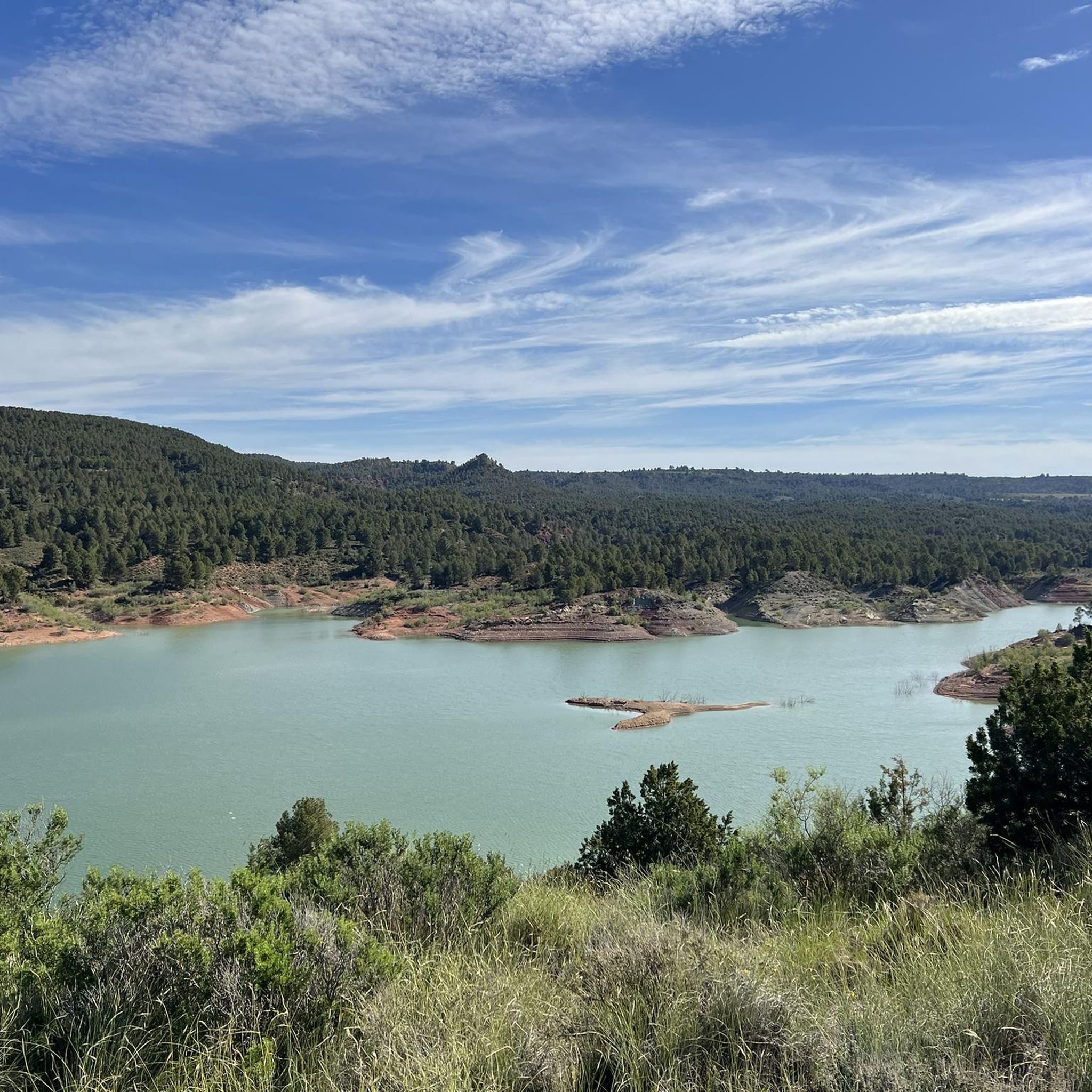
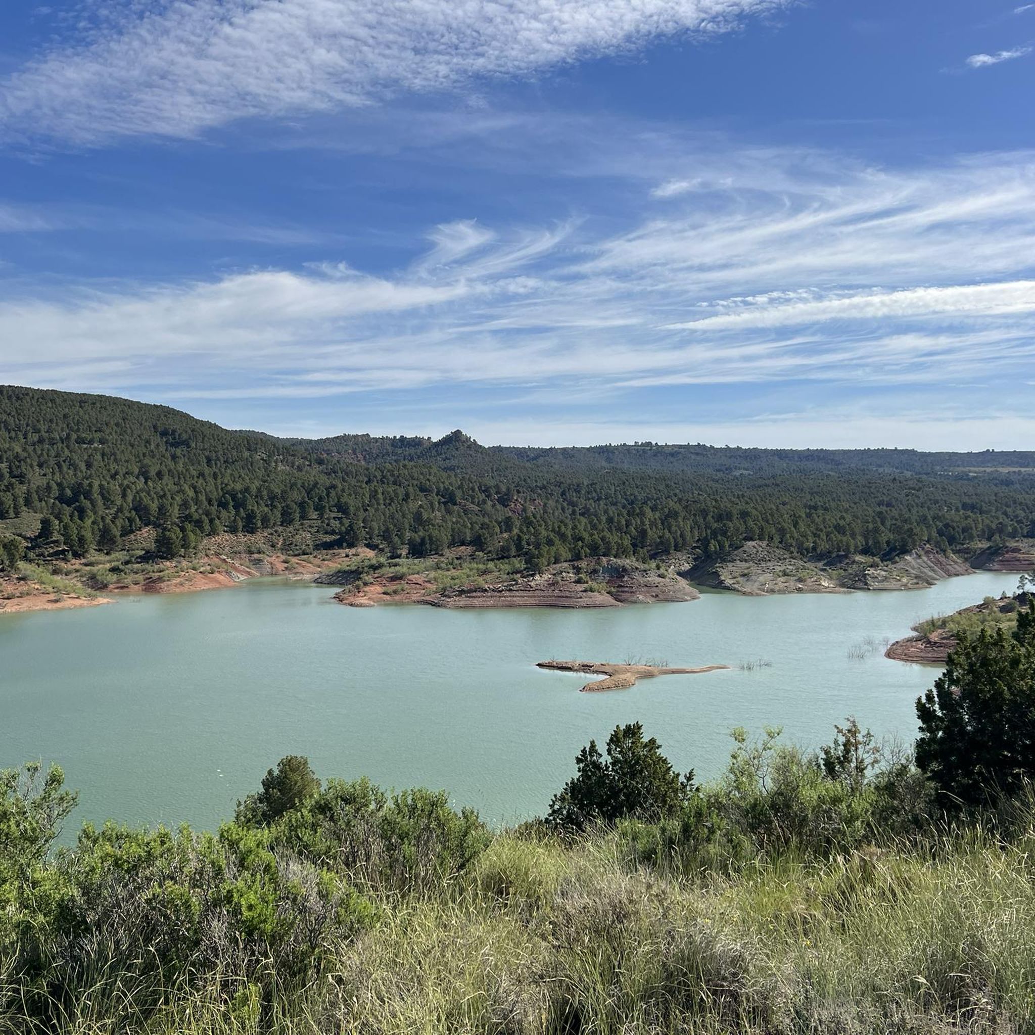
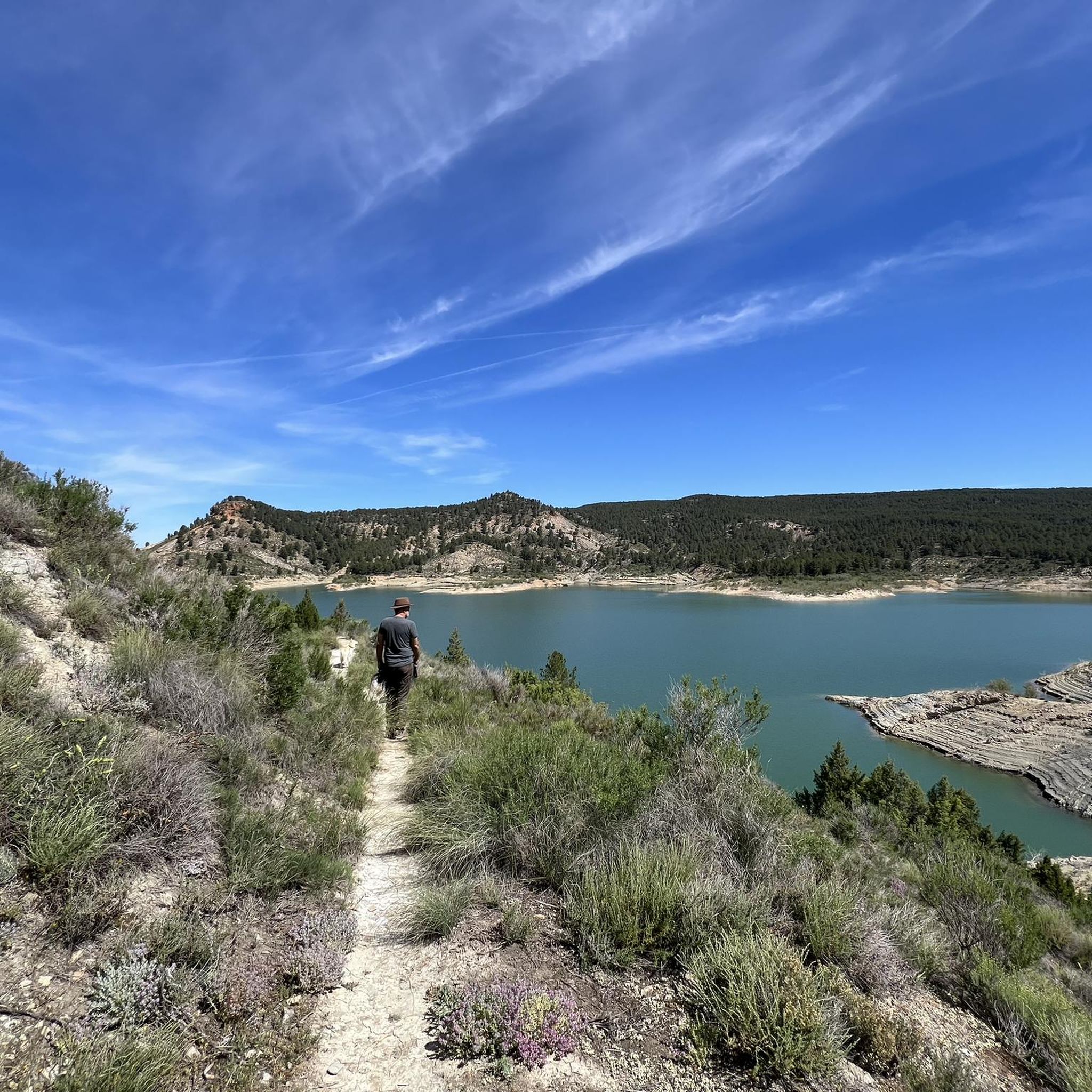
Touring cycling around Embalse de Contreras offers routes through a landscape defined by the reservoir's clear, turquoise waters and the dramatic gorges of the Hoces del Cabriel Natural Park. This region, part of the UNESCO Cabriel Valley Biosphere Reserve, features striking geological formations like "Los Cuchillos del Cabriel" and vertical stone ridges carved by the Cabriel River. The terrain transitions from rolling valleys and vineyards to grain fields and olive groves, providing varied scenery for cyclists. The area is characterized…
Last updated: June 24, 2026
2
riders
33.5km
03:15
760m
760m
This difficult 20.8-mile gravel cycling route in Parque Natural Hoces de Cabriel offers stunning views of the Cabriel River and Cuchillos de
5.0
(3)
14
riders
29.0km
02:03
550m
550m
Hard bike ride. Very good fitness required. Mostly paved surfaces. Suitable for all skill levels.

Sign up for free
6
riders
Moderate bike ride. Good fitness required. Mostly paved surfaces. Suitable for all skill levels.
5
riders
Moderate bike ride. Good fitness required. Mostly paved surfaces. Suitable for all skill levels.
50.5km
03:57
850m
850m
Hard bike ride. Very good fitness required. Mostly paved surfaces. Suitable for all skill levels.
Get access to more routes and recommendations from other explorers.
Sign up for free
Already have an account?
Our route recommendations are based on thousands of hikes, rides, and runs completed by other people on komoot.
Start today with a free account
Your next adventure awaits.
Login or Signup
Tips from the Community

Beautiful viewpoint of the dam, the river and the factory.
11
0
The Contreras dam (Embalse de Contreras) is a 129-meter-high arch dam built in 1972. Located on the border of the provinces of Cuenca (Castilla-La Mancha) and Valencia, the dam spans the Cabriel and Guadazaón rivers. The reservoir serves mainly for water supply, flood protection, and irrigation.
10
1
Some houses are still inhabited!!
0
0
Villargordo del Cabriel is a municipality in the Requena-Utiel region, in the province of Valencia. The town is located on the banks of the Cabriel River and is on the border between Castilla-La Mancha and the Valencia region. One of the biggest tourist attractions is the beautiful nature, which is remarkably well preserved.
14
0
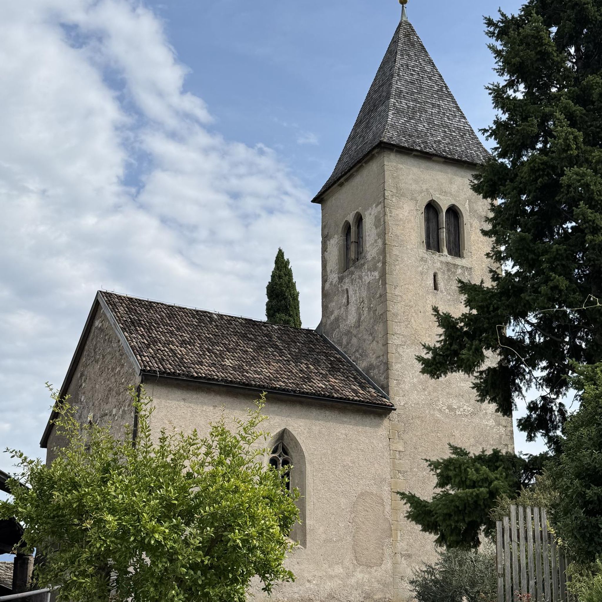
Small village in a beautiful setting, with a central square, a small shop and a huge church.
13
0

The road between Cardenete and Enguídanos, in the Serranía Baja region of Cuenca, is one of the most beautiful stretches in this area. Although not officially designated as a "scenic road," the route is featured on hiking and cycling itineraries that highlight its stunning landscapes, rivers, gorges, mountains, and natural monuments.
3
0
Viewpoint next to the old N-III highway After passing the engineer's house, a turnoff leads to the viewpoint located above the old N-III highway. Sweeping views of the reservoir from a high, accessible point.
4
0
Hiking: Popular routes, such as the "Engineer's House" trail, offer viewpoints overlooking the reservoir and the Cabriel River gorges. Guided tours: Occasionally, the Hydrographic Confederation and the Villargordo Town Council organize tours and talks in the village of Contreras. Historic roads: The abandoned section of the old N-III highway and the Contreras Hills attract engineering enthusiasts, with their original 20th-century asphalt and signage.
8
0
Frequently Asked Questions
What kind of terrain can I expect when touring cycling around Embalse de Contreras?
The terrain around Embalse de Contreras is quite varied, offering a mix of landscapes. You'll encounter rolling valleys, extensive vineyards, and grain fields, transitioning to olive groves. The routes also feature dramatic geological formations like "Los Cuchillos del Cabriel" and vertical stone ridges carved by the Cabriel River, especially within the Hoces del Cabriel Natural Park. Expect some challenging climbs and descents as all listed touring cycling routes are rated as difficult.
Are there any circular touring cycling routes available?
Yes, many of the touring cycling routes around Embalse de Contreras are designed as loops. For example, you can explore the Cuchillos de Contreras and Moluengo Peak Loop, which is 33.5 km long, or the Contreras Dam – Cabriel Valley Viewpoint loop from Villargordo del Cabriel, covering 28.5 km. Another option is the Contreras Viewpoint – Contreras Inn loop from Sendero de Los Cuchillos del Cabriel, which is 29.0 km.
What natural features or landmarks can I see along the touring cycling routes?
Touring cycling routes in this region offer stunning views of the Embalse de Contreras's clear, turquoise waters and the dramatic gorges of the Hoces del Cabriel Natural Park. You'll pass by impressive geological formations such as "Los Cuchillos del Cabriel" and enjoy panoramic views of the Cabriel Valley from various viewpoints, like Peñas Blancas. The landscape also features tall pine trees, vineyards, and diverse flora and fauna, as it's part of the UNESCO Cabriel Valley Biosphere Reserve.
What is the best time of year to go touring cycling in Embalse de Contreras?
The region around Embalse de Contreras is suitable for touring cycling during many months of the year. However, to avoid the intense heat of summer, spring (April to June) and autumn (September to October) generally offer the most pleasant temperatures for longer rides. These seasons also showcase the natural beauty of the area with vibrant foliage or blooming landscapes.
Are there any family-friendly touring cycling routes in the area?
All the touring cycling routes listed for Embalse de Contreras are currently rated as difficult due to their elevation gain and distance. While the region offers diverse terrain, these specific routes might be challenging for younger children or families looking for very easy, flat paths. It's advisable to check individual route details for suitability based on your family's experience level.
What are the options for parking when visiting Embalse de Contreras for cycling?
While specific parking locations are not detailed for every route, towns like Villargordo del Cabriel, which serves as a starting point for routes like the Contreras Dam – Cabriel Valley Viewpoint loop, typically offer parking facilities. For routes starting from more remote areas, look for designated parking spots or check local information for the nearest villages. One route specifically mentions starting from Aparcamiento de emergencia Vialidad Invernal Minglanilla.
Can I find accommodation or places to eat near the touring cycling routes?
Yes, the area around Embalse de Contreras offers amenities for visitors. You can find lodging, camping options, restaurants, and cafes in nearby towns and villages. These services are particularly available along established cycling routes and in towns like Villargordo del Cabriel, Motilla de Palancar, and Enguídanos, which serve as common starting points or pass-through locations for cyclists.
What is the difficulty level of touring cycling routes around Embalse de Contreras?
The touring cycling routes around Embalse de Contreras are generally considered challenging. All the routes listed in this guide are rated as difficult, featuring significant elevation gains and distances. For instance, the Cardenete from Enguídanos — circular by Víllora route covers over 50 km with substantial climbing.
Is it possible to reach Embalse de Contreras by public transport for cycling?
Reaching Embalse de Contreras directly by public transport can be challenging, as it's a natural area. While there might be bus services to nearby towns like Villargordo del Cabriel from larger cities like Valencia or Cuenca, direct connections to specific trailheads are limited. It's advisable to check local bus schedules for the closest towns and plan for a short ride or taxi to your starting point if relying on public transport.
What do other touring cyclists say about the routes in Embalse de Contreras?
The touring cycling routes in Embalse de Contreras are highly regarded by the komoot community, holding an average rating of 4.5 stars from several reviews. Cyclists often praise the breathtaking views of the reservoir and the Cabriel Valley, the dramatic geological formations, and the varied terrain that makes for an engaging and challenging ride. Many appreciate the natural beauty and tranquility of the UNESCO Cabriel Valley Biosphere Reserve.
Are there opportunities for water activities at Embalse de Contreras in addition to cycling?
Absolutely! The Embalse de Contreras is popular for a variety of water sports. You can enjoy fishing, kayaking, paddleboarding (SUP), and boating on its clear, turquoise waters. The Cabriel River, which feeds the reservoir, also offers opportunities for rafting, providing a refreshing complement to your touring cycling adventures.
Can I bring my dog on the touring cycling routes around Embalse de Contreras?
The Embalse de Contreras area, including parts of the Hoces del Cabriel Natural Park, is generally welcoming to dogs. However, specific regulations regarding dogs on cycling trails within the natural park or protected areas may apply, such as keeping them on a leash. It's always recommended to check the latest guidelines for the Hoces del Cabriel Natural Park to ensure a pleasant and compliant experience for you and your pet.
How many touring cycling routes are available in the Embalse de Contreras region?
There are over 5 touring cycling routes available in the Embalse de Contreras region, all of which are rated as difficult. These routes offer varied distances and challenges, allowing cyclists to explore the diverse landscapes of the area.
Most popular routes around Embalse de Contreras
Most popular attractions around Embalse de Contreras

Get inspired with the komoot mobile app


Explore more
Browse the best Cycling routes in other regions.
