The best road cycling routes around Lac de Sylans
4.2
(104)
2,143
riders
96
rides
Road cycling around Lac de Sylans offers diverse terrain within the Ain department of France, characterized by its pure, low-mineral waters and a backdrop of the Jura Mountains. The region features scenic lakeside roads, winding through the dramatic Nantua water gap, a geological formation from the last glacial era. Cyclists can expect varied elevation profiles, from flatter sections circling the lake to more challenging climbs in the surrounding foothills and forested areas. This protected natural site provides a tranquil environment…
Last updated: July 11, 2026
46
riders
54.0km
02:40
730m
730m
Moderate road ride. Good fitness required. Some segments of this route may be unpaved and difficult to ride.
7
riders
22.8km
01:22
510m
510m
Moderate road ride. Good fitness required. Mostly well-paved surfaces and easy to ride.

Sign up for free
3.5
(4)
62
riders
50.5km
02:34
840m
830m
Moderate road ride. Good fitness required. Mostly well-paved surfaces and easy to ride.
5.0
(5)
33
riders
52.4km
02:37
840m
840m
Moderate road ride. Good fitness required. Mostly well-paved surfaces and easy to ride.
16
riders
62.5km
03:09
1,020m
1,020m
Hard road ride. Very good fitness required. Mostly well-paved surfaces and easy to ride.
Get access to more routes and recommendations from other explorers.
Sign up for free
Already have an account?
Our route recommendations are based on thousands of hikes, rides, and runs completed by other people on komoot.
Start today with a free account
Your next adventure awaits.
Login or Signup

Tips from the Community

The Lac de Nantua is a superb body of water of 141 hectares. In the heart of the Jura, it offers an ideal setting for practicing a multitude of sports. It is even possible to swim in its waters.
1
0
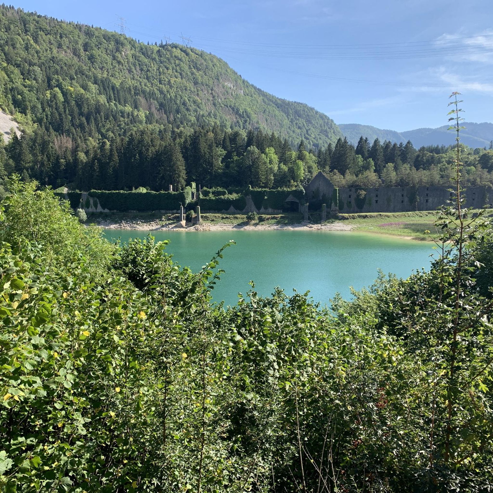
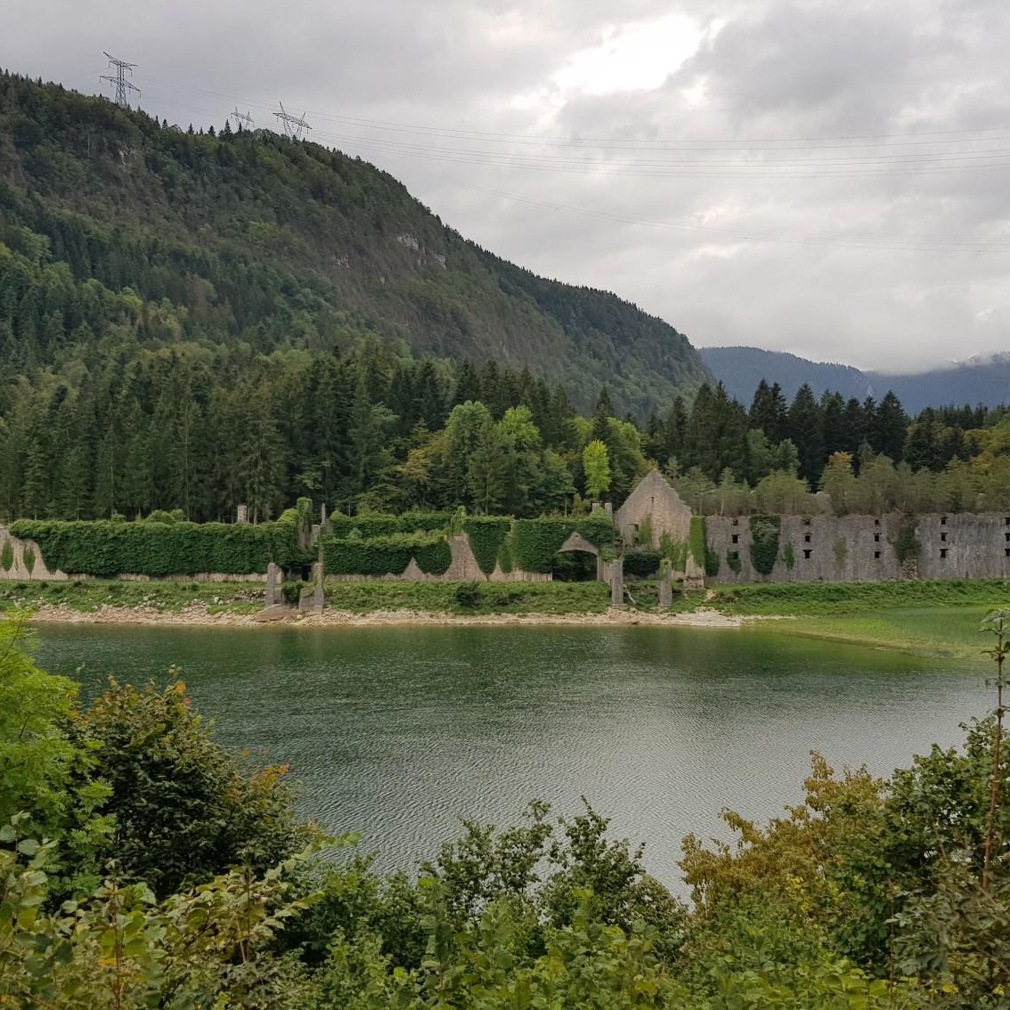
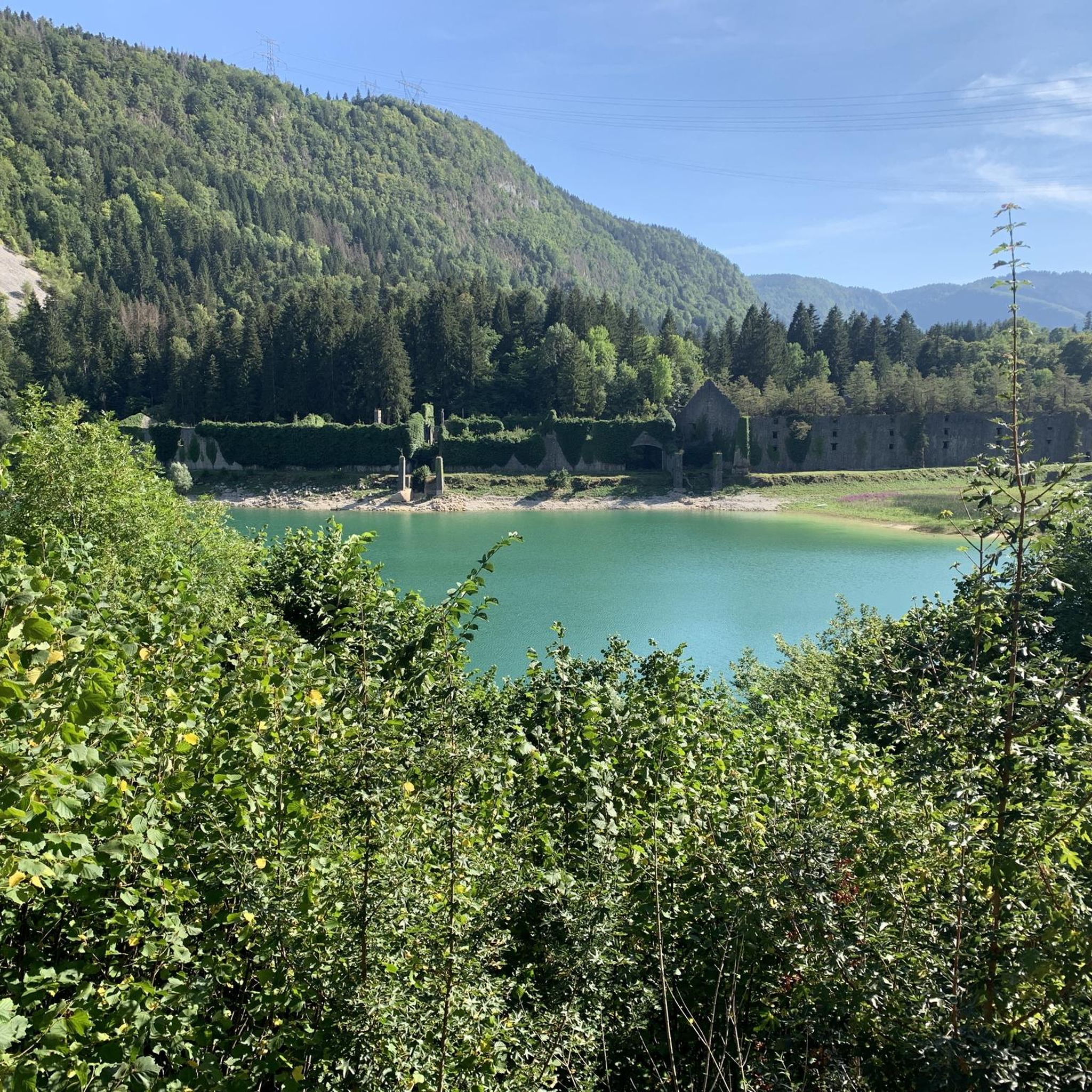
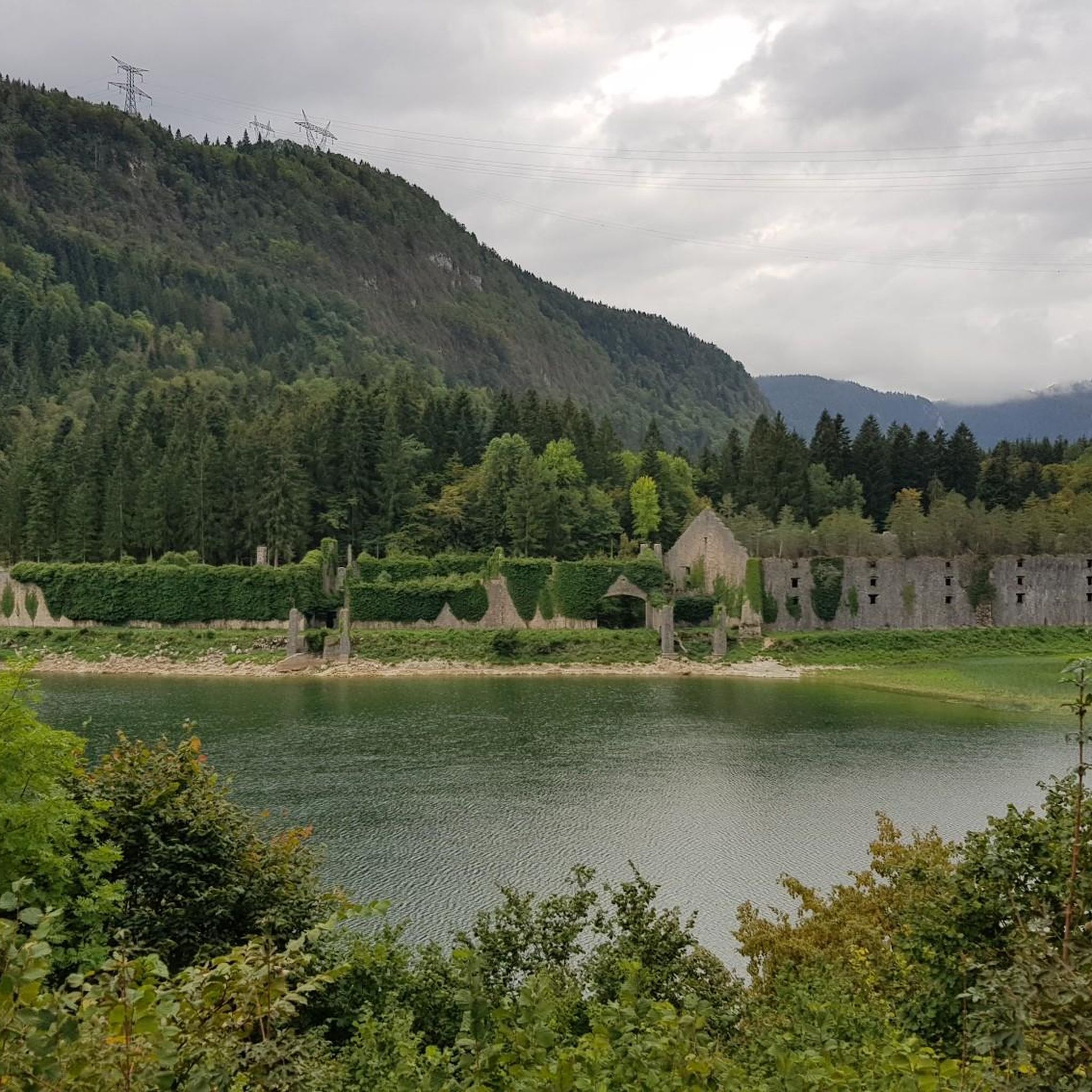
The Peney viewpoint overlooks Lake Sylans, on which it offers a beautiful view. Classified since 1909, one can distinguish on its banks the ruins of the old ice factories which commercialized the ice extracted from the lake until 1917. The passage is located at the level of the tunnel of the same name.
0
0
The Marron ponds are named after a family from Brénod, it is not a reference to the color of the water. Only one of them remains filled with water all year round. This one served as a water reserve and fishing spot for the monks of the Meyriat abbey. In spring, a multitude of water lilies cover the surface.
0
0

Here is the route for the ascent of the Col de Cuvillat starting from Champdor
1
0

Beautiful, simple, easy walk; lots of traffic noise on the "road" section, a bit of a shame, but the color of the water is magical
1
0

The Col de Cuvillat connects Brénod to Champdor in the heart of Haut-Bugey. Easily accessible, it winds through forests and high-altitude meadows and reaches an altitude of 1,073 meters.
0
1
Beautiful castle in Champdor which sometimes hosts events.
1
0
Frequently Asked Questions
What kind of terrain can I expect when road cycling around Lac de Sylans?
Road cycling around Lac de Sylans offers a diverse range of terrain. You'll find scenic lakeside roads with stunning views of the pure, clear waters, especially within the dramatic Nantua water gap. The routes also extend into the foothills of the Jura Mountains, providing varied elevation profiles from flatter sections around the lake to more challenging climbs through forested areas and charming villages.
Are there road cycling routes suitable for beginners or those looking for an easy ride?
Yes, Lac de Sylans offers routes for various fitness levels. While many routes involve elevation, there are options suitable for beginners. For instance, komoot lists 4 easy road cycling routes and 42 moderate routes. These typically feature less elevation gain, allowing for a more relaxed experience while still enjoying the beautiful scenery.
What are some challenging road cycling routes for experienced riders in the Lac de Sylans area?
Experienced road cyclists will find plenty of challenging options around Lac de Sylans, with 51 difficult routes available on komoot. A notable challenging route is the View of Lake Nantua – Col de Bérentin loop from Les Neyrolles, which is a demanding 121.0 miles (194.7 km) path featuring significant elevation gain and panoramic views of Lake Nantua and surrounding mountain passes.
What unique natural features can I see while road cycling near Lac de Sylans?
The region is rich in unique natural features. You'll cycle along the banks of Lac de Sylans, known for its exceptionally pure, low-mineral waters. The lake itself is nestled within the dramatic Nantua water gap, a geological formation from the last glacial era. The surrounding Jura Mountains provide a backdrop of 'wild yet welcoming landscapes' and lush forests, offering a tranquil and immersive cycling experience.
Are there any historical points of interest along the road cycling routes?
Yes, a significant historical point of interest is the ruins of the 19th-century ice harvesting factory located on the shores of Lac de Sylans. This unique site speaks to the lake's past importance and the region's climate, offering a fascinating stop during your ride.
How many road cycling routes are available in the Lac de Sylans region?
There are nearly 100 road cycling routes available in the Lac de Sylans region on komoot, with a total of 97 tours. These routes cater to various skill levels, including easy, moderate, and difficult options, ensuring there's a ride for everyone.
What do other road cyclists say about their experience in Lac de Sylans?
The road cycling routes in Lac de Sylans are highly rated by the komoot community, with an average score of 4.4 stars from over 80 reviews. Cyclists often praise the scenic lakeside roads, the varied terrain, and the tranquil environment provided by this protected natural site.
Can I find routes that offer views of other lakes besides Lac de Sylans?
Yes, many routes in the area offer views of other beautiful lakes. For example, the Lake Genin – Lake Genin loop from Charix provides views of Lake Genin, and several routes, like the Lake Nantua – View of Lake Nantua loop from Le Poizat-Lalleyriat, feature stunning vistas of Lake Nantua.
Are there any road cycling routes that pass through charming villages?
The Jura Mountains region, where Lac de Sylans is situated, is known for its 'charming villages'. Many road cycling routes will take you through these picturesque settlements, offering opportunities to experience local ambiance, find refreshments, or simply enjoy the quaint architecture.
What is the typical duration for a road cycling tour around Lac de Sylans?
The duration of road cycling tours around Lac de Sylans varies greatly depending on the route's distance and difficulty. For instance, a moderate route like the Lake Genin – Lake Genin loop from Charix (14.2 miles) typically takes about 1 hour 22 minutes, while a longer moderate route such as the Lake Nantua – Lac de Nantua loop from Nantua (33.1 miles) might take around 2 hours 33 minutes.
Is the area around Lac de Sylans suitable for road cycling with children or as a family?
While the region offers varied terrain, including some challenging climbs, there are also easier routes with minimal elevation gain that could be suitable for families or cycling with children. It's recommended to check the difficulty grade and elevation profile of specific routes on komoot to find the most appropriate options for a family ride.
Are there opportunities for other outdoor activities besides road cycling in the Lac de Sylans area?
Yes, the protected natural site around Lac de Sylans offers more than just cycling. You can find hiking trails along the lake's banks, and the lake itself is popular for fishing, with abundant pike, carp, and bream. This makes it a versatile destination for combining your cycling trip with other outdoor pursuits.
Most popular routes around Lac de Sylans

Get inspired with the komoot mobile app


Explore more
Browse the best Road cycling routes in other regions.
