The best running trails around Aguasal
33
runners
11
runs
Jogging around Aguasal offers a variety of routes through the region's flat to gently rolling terrain. The landscape is characterized by river paths, agricultural fields, and scattered pine forests, providing a mix of open views and shaded sections. Elevation changes are generally modest, with some routes featuring small hills. The area provides accessible running opportunities for various fitness levels.
Best jogging routes around Aguasal
- The most popular jogging route is Sendero del río Eresma (PRC-VA 42) — circular desde Hornillos…
Last updated: July 1, 2026
Moderate run. Good fitness required. Mostly accessible paths. Some sure footedness required.
22
runners
17.8km
01:59
320m
320m
Hard run. Very good fitness required. Mostly paved surfaces. Suitable for all skill levels.

Sign up for free
4
runners
5.05km
00:36
10m
10m
Moderate run. Good fitness required. Mostly paved surfaces. Suitable for all skill levels.
4
runners
7.88km
00:55
50m
50m
Moderate run. Good fitness required. Mostly paved surfaces. Suitable for all skill levels.
5.0
(1)
2
runners
8.15km
00:55
20m
20m
Moderate run. Good fitness required. Mostly paved surfaces. Suitable for all skill levels.
Get access to more routes and recommendations from other explorers.
Sign up for free
Already have an account?
Our route recommendations are based on thousands of hikes, rides, and runs completed by other people on komoot.
Start today with a free account
Your next adventure awaits.
Login or Signup
Tips from the Community

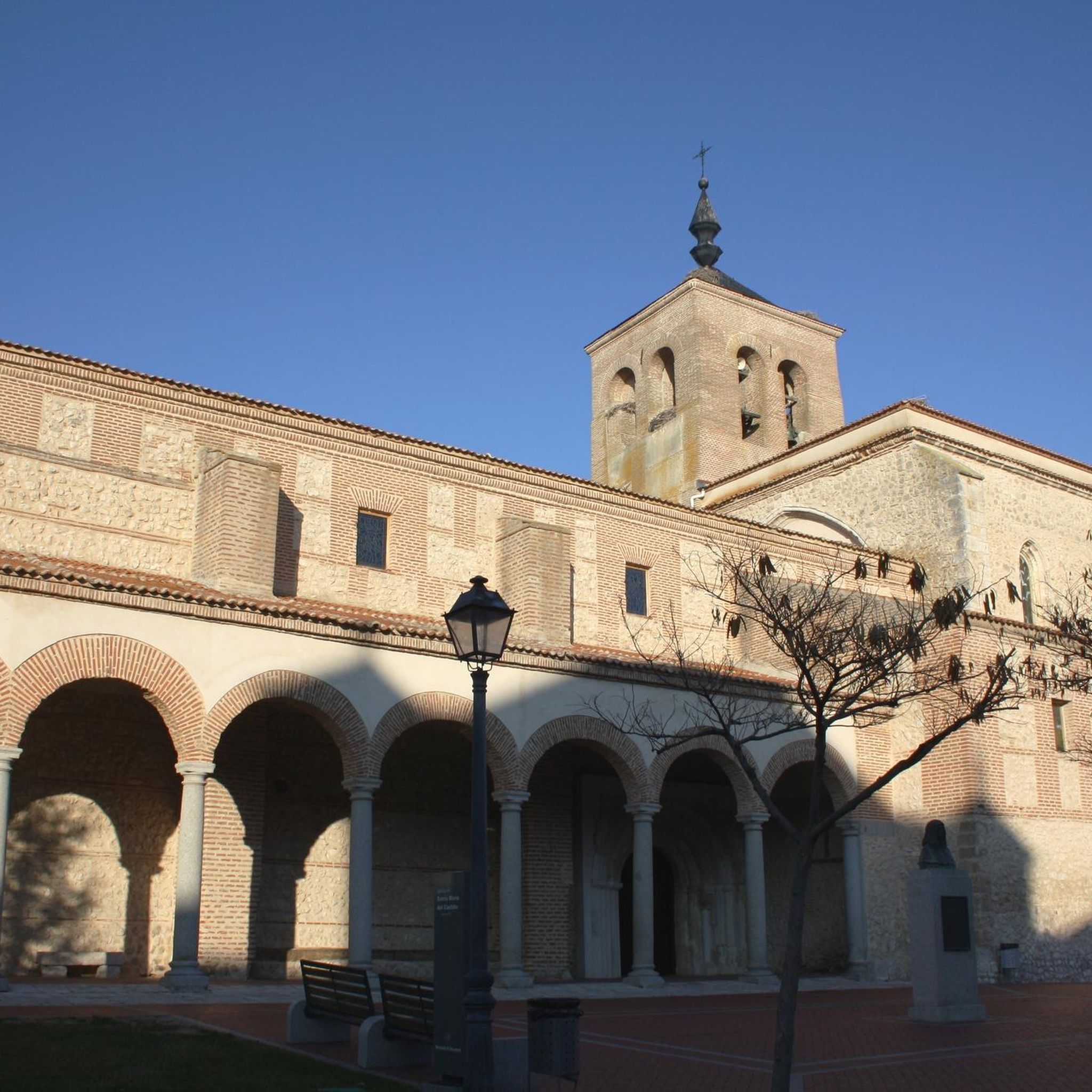
The strategic town of Íscar in the region of Tierra de Pinares. The city has a defensive castle on top of a hill that dominates the city and the landscape around it with a history of Moorish and Christian heritage.
1
1

Bridge dating from the XVI-XVII century was a location on the Camino Real de Toledo. Legend has it that a bandit known as Luís Candelas along with his gang used a hidden cave near the bridge to, from above, control the stages that came to cross the bridge and assault them to obtain their loot.
0
0

Due to its strategic location, it was also a meeting point for bandits, smugglers and highway robbers, highlighting above all Luis Candelas (1804-1837)
9
0
Built by Francisco Praves (1585-1637) in the 17th century, it is built entirely in stone and has the following dimensions: a width of 4.5 meters, a height of 9 meters visible and a length of about 75 meters including the bridge itself. said and the retaining wall on both sides of the river.
9
0
Frequently Asked Questions
How many running routes can I find around Aguasal?
There are 5 dedicated running routes available around Aguasal, catering to various fitness levels. These routes offer a mix of riverside paths, open fields, and pine woodlands.
Are there any easy or beginner-friendly jogging paths in Aguasal?
While there are no routes specifically graded as 'easy' in this selection, several moderate routes are suitable for beginners or those looking for a less strenuous run. For example, the Sendero del río Eresma (PRC-VA 42) — circular desde Hornillos de Eresma is a moderate 5.2-mile (8.4 km) trail that follows the Eresma river with modest elevation changes.
What is the typical length and duration of running routes near Aguasal?
Running routes around Aguasal vary in length. You can find shorter loops like the Running loop from La Zarza, which is 3.1 miles (5.1 km) and takes about 36 minutes. Longer, more challenging options, such as the Íscar Castle – Pico de la Muela loop from Íscar, extend to 11.1 miles (17.9 km) and can take around 2 hours to complete.
Are there any circular running routes in the Aguasal area?
Yes, many of the running routes around Aguasal are circular, offering convenient start and end points. A popular option is the Sendero del río Eresma (PRC-VA 42) — circular desde Hornillos de Eresma, which provides a scenic riverside loop.
What kind of terrain can I expect on the jogging trails around Aguasal?
The terrain around Aguasal is generally flat to gently rolling. You'll encounter a mix of river paths, agricultural fields, and scattered pine forests. Elevation changes are typically modest, though some routes, like the Íscar Castle – Pico de la Muela loop from Íscar, include more challenging ascents.
What are the best seasons for running in Aguasal?
Spring and autumn are generally ideal for running in Aguasal, offering mild temperatures and pleasant scenery. Summers can be hot, especially at midday, so early morning or late evening runs are recommended. Winters are typically cool, but the region's relatively flat terrain makes it accessible for running, though you should be prepared for colder conditions.
Are there any interesting landmarks or attractions to see along the running routes?
Yes, several routes pass by or offer views of notable attractions. For instance, the Íscar Castle – Pico de la Muela loop from Íscar provides views of Íscar Castle. Other nearby points of interest include the Historic Center of Olmedo and the Mediana Bridge, which can be explored in conjunction with your run.
Is parking available near the trailheads for running routes in Aguasal?
Parking is generally available in the towns and villages where the routes begin, such as Hornillos de Eresma, Íscar, La Zarza, and Olmedo. It's advisable to check local signage for specific parking regulations and availability before your run.
Can I bring my dog on the running trails around Aguasal?
Most outdoor trails in the region are dog-friendly, provided your dog is kept on a leash and you clean up after them. Always be mindful of local regulations, especially when passing through agricultural areas or near livestock.
What do other runners enjoy most about jogging in Aguasal?
Runners frequently praise the varied landscape, which includes peaceful river paths, expansive open fields, and shaded pine woodlands. The accessibility of routes for different ability levels and the opportunity to explore the region's natural beauty are also highly valued by the komoot community.
Are there any less crowded running trails in Aguasal?
For a potentially quieter experience, consider routes that are slightly further from the main towns or those that explore more remote agricultural areas. The Cárcava Grande loop from Olmedo or the PInar de Pericote loop from Olmedo might offer a more serene running environment, especially during off-peak hours.
Most popular attractions around Aguasal

Get inspired with the komoot mobile app


Explore more
Browse the best Running Trails & Routes in other regions.
