The best walks and hikes around Aguasal
5.0
(3)
9
hikers
7
hikes
Hiking around Aguasal features trails primarily along riverbanks and through agricultural landscapes, with routes often connecting local towns and natural features. The region is characterized by generally low elevation gains, making many routes accessible. Trails often follow the Eresma River, providing opportunities for riverside walks.
Best hiking trails around Aguasal
- The most popular hiking route is Sendero del río Eresma (PRC-VA 42) — circular desde Hornillos de Eresma, a 5.1 miles (8.2 km) trail that takes 2 hours 6…
Last updated: June 29, 2026
5.0
(1)
3
hikers
8.21km
02:06
30m
30m
Moderate hike. Good fitness required. Easily-accessible paths. Suitable for all skill levels.
5.0
(1)
1
hikers
17.1km
04:24
90m
90m
Moderate hike. Good fitness required. Easily-accessible paths. Suitable for all skill levels.

Sign up for free
5.0
(1)
1
hikers
12.5km
03:12
50m
50m
Moderate hike. Good fitness required. Easily-accessible paths. Suitable for all skill levels.
2.78km
00:44
20m
20m
Easy hike. Great for any fitness level. Easily-accessible paths. Suitable for all skill levels.
4
hikers
20.6km
05:23
160m
160m
Hard hike. Very good fitness required. Easily-accessible paths. Suitable for all skill levels.
Get access to more routes and recommendations from other explorers.
Sign up for free
Already have an account?
Our route recommendations are based on thousands of hikes, rides, and runs completed by other people on komoot.
Start today with a free account
Your next adventure awaits.
Login or Signup

Tips from the Community

Next to the Sacedón Hermitage, in Pedrajas de San Esteban, near the Eresma River, stands a colossal, centuries-old pine tree on which a life-size human figure has been installed, representing a pine harvester, as a tribute to this profession, so closely linked to the town of Pedrajas, the Piñon region. It's striking to compare the impressive size of the pine tree with the small size of the person.
0
0
A simple shrine dedicated to the Virgin of Sacedón, located in a pleasant spot next to the Eresma River, on the old Royal Road from Madrid to Valladolid, now the Camino de Santiago from Madrid. Pilgrimage on the Monday of the Octave of Easter.
0
0

Bridge dating from the XVI-XVII century was a location on the Camino Real de Toledo. Legend has it that a bandit known as Luís Candelas along with his gang used a hidden cave near the bridge to, from above, control the stages that came to cross the bridge and assault them to obtain their loot.
0
0
Example of Mudejar art that penetrates the narrow and labyrinthine streets of Olmedo. This double arch from the 13th-16th century is one of the two survivors that remain in Olmedo from the seven original entrances.
2
0
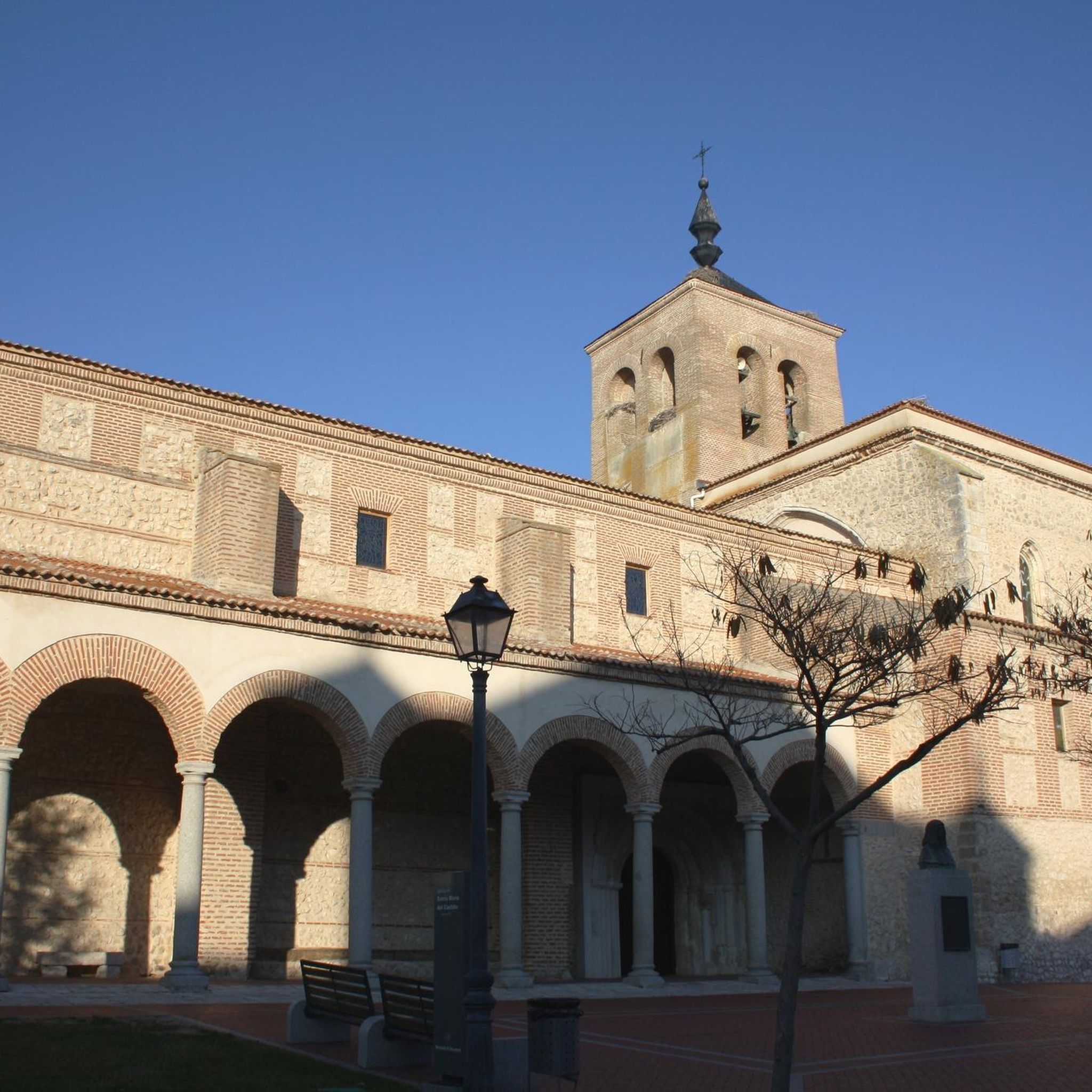
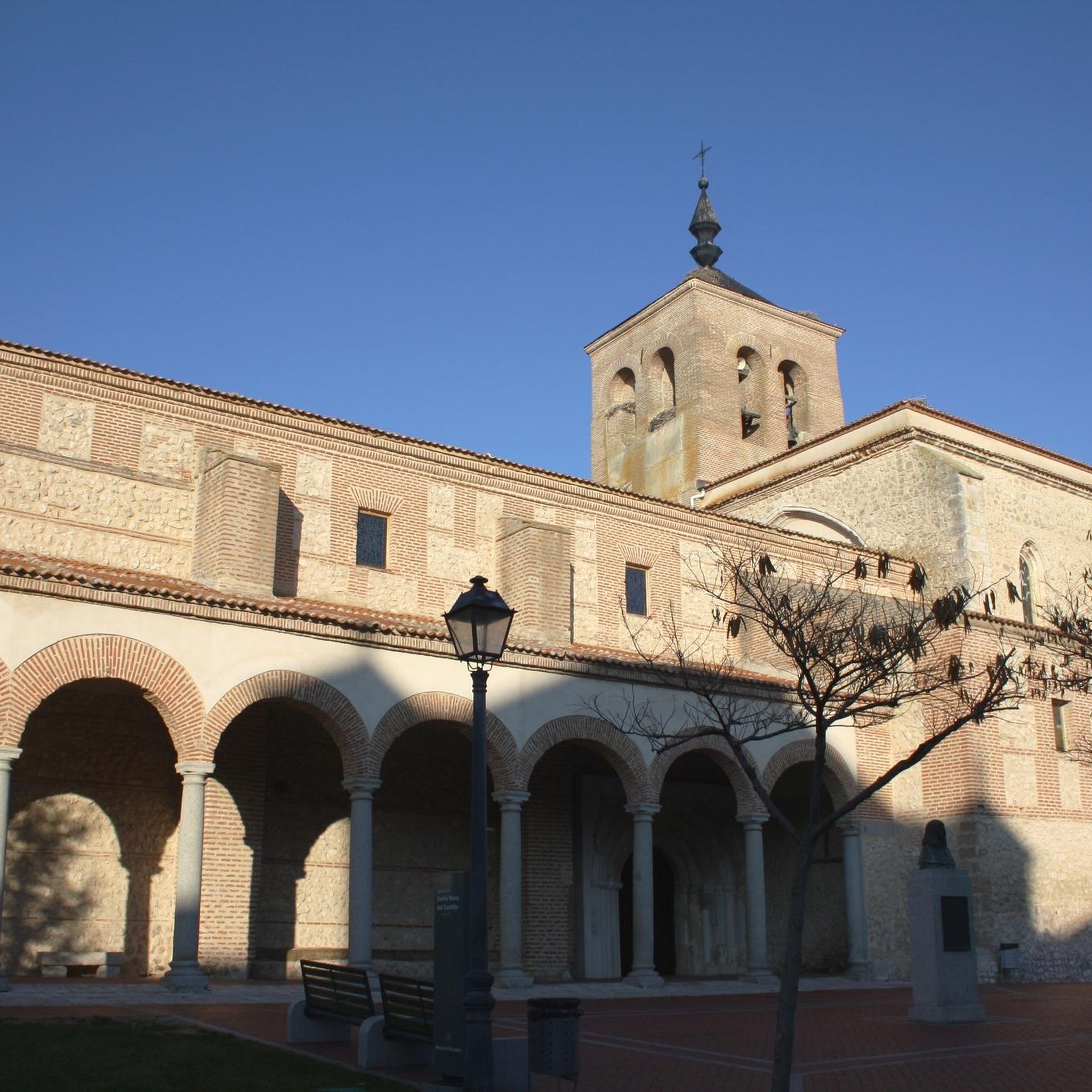
Catholic temple in the town of Olmedo dating from the 12th century in a Romanesque style although it was renovated in the Mudejar style in the 15th century and later in the 16th century in the Gothic style.
2
0
Religious sanctuary dating from the 13th century in the town of Olmedo. It is a good example of Mudejar architecture, which is why we can find a representation in the Mudejar theme park, at the entrance to this town.
2
0
Landscaped park where we find representations of Mudejar art constructions on a 1:8 scale. This park wants to publicize Mudejar art, an artistic style that occurred in the Christian kingdoms of Spain between the 12th and 16th centuries with great influence from Muslim art. Rates and schedules can be seen here: https://www.olmedo.es/pasionmudejar/varios.php?art_id=267
2
0
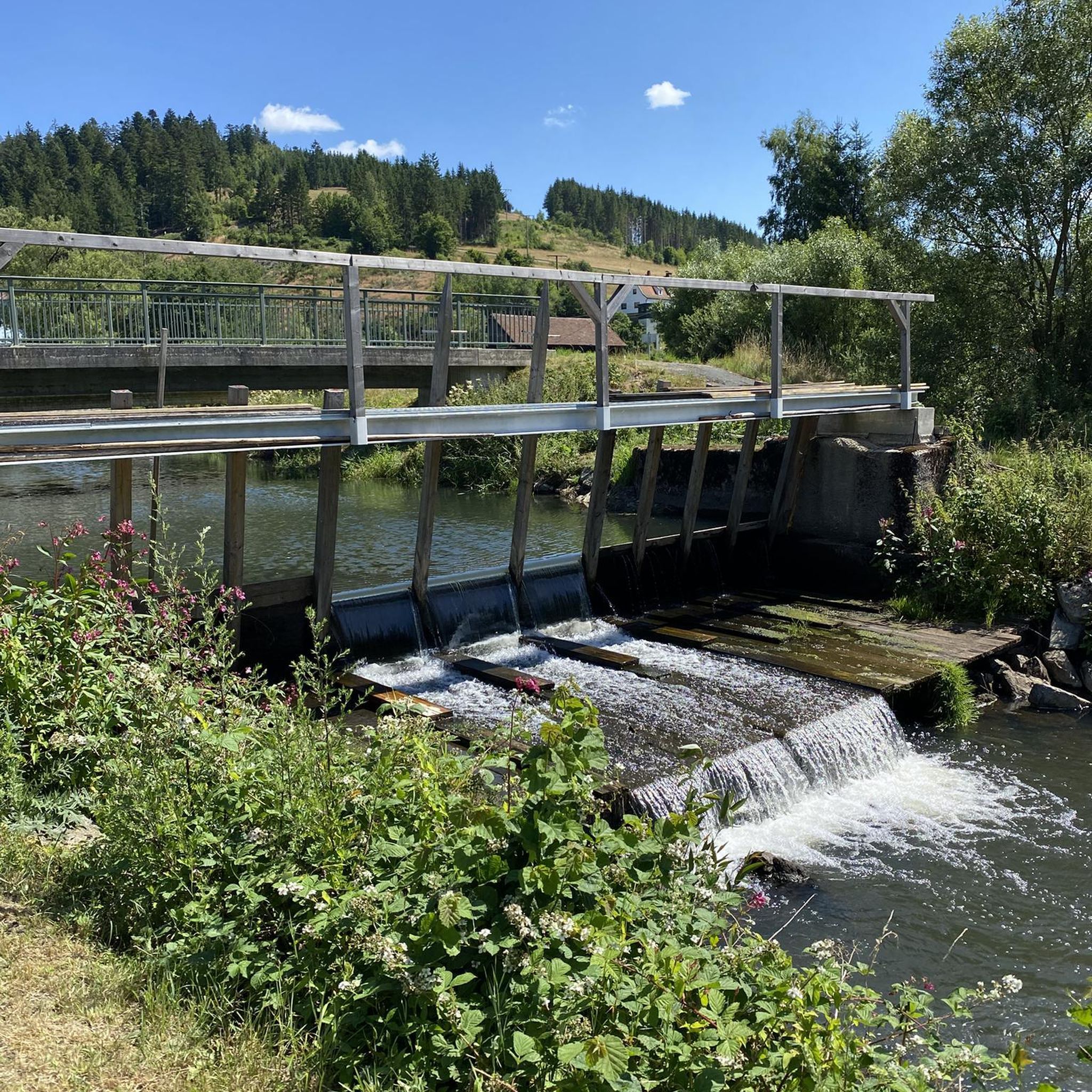
Small dam with a power switchboard next to the remains of a medieval bridge.
2
0
Frequently Asked Questions
How many hiking trails are available around Aguasal?
Aguasal offers a selection of 6 hiking trails, ranging from easy strolls to more challenging routes. These trails often follow riverbanks and traverse agricultural landscapes, connecting local towns and natural features.
Are there easy hiking options suitable for beginners in Aguasal?
Yes, Aguasal has accessible paths and routes with generally low elevation gains, making them suitable for various fitness levels. An easy option is the City tour through Olmedo — circular from the Parque Temático de Mudéjar, which is 1.7 miles (2.8 km) long and takes about 44 minutes.
Can I find circular hiking routes in Aguasal?
Many of the trails in Aguasal are circular, offering convenient starting and ending points. For example, the popular Sendero del río Eresma (PRC-VA 42) — circular desde Hornillos de Eresma is a 5.1-mile loop along the Eresma River.
What kind of natural features can I expect to see on hikes in Aguasal?
The region is characterized by riverine paths, open countryside, and agricultural landscapes. While the primary attraction is the Aguasal Waterfall, trails also offer views of the Eresma River and lead through areas connecting historical towns. The Presa de Alcazaren by the senda del Ermitaño (PRC-VA 66) — circular from Pedrajas de San Esteban leads to the Alcazaren Dam.
Are there any family-friendly hiking trails in Aguasal?
Yes, the generally low elevation gains and well-maintained paths make many routes suitable for families. The City tour through Olmedo — circular from the Parque Temático de Mudéjar is a short, easy option perfect for a family outing.
What are the typical durations for hikes in Aguasal?
Hiking durations in Aguasal vary significantly. Shorter routes, like the city tour through Olmedo, can be completed in under an hour, while longer moderate trails, such as On the banks of the Eresma River — circular from Alcazarén, can take around 3 hours and 12 minutes.
What do other hikers enjoy most about hiking in Aguasal?
The komoot community rates the routes in Aguasal highly, with an average score of 5.0 stars. Hikers often appreciate the accessible paths, the tranquil riverside walks, and the opportunity to explore historical towns like Olmedo.
Are there any historical landmarks or attractions near the hiking trails?
Yes, several historical sites are close to the hiking trails. You can explore the Historic Center of Olmedo and its City Walls. Other notable attractions include Íscar Castle and the Mediana Bridge.
What is the most challenging hike available in Aguasal?
For those seeking a more strenuous experience, the Hiking loop from Pedrajas de San Esteban is classified as difficult. This route covers approximately 12.8 miles (20.5 km) and involves a significant elevation gain, requiring good fitness and sturdy shoes.
Are the hiking trails in Aguasal suitable for dogs?
While specific regulations for dogs on trails are not provided, many outdoor areas in Spain are generally dog-friendly, especially on leash. It's always advisable to check local signage or specific route details for any restrictions before heading out with your dog.
What kind of elevation changes can I expect on Aguasal's hiking trails?
Aguasal offers trails with varying elevation gains. Many routes feature gentle inclines, with some having less than 100 feet of elevation gain. However, more strenuous options, like the Hiking loop from Pedrajas de San Esteban, can involve over 500 feet of ascent, demanding good physical condition.
Most popular attractions around Aguasal

Get inspired with the komoot mobile app


Explore more
Browse the best Hikes in other regions.
