The best walks and hikes around El Madroño
4.2
(87)
369
hikers
29
hikes
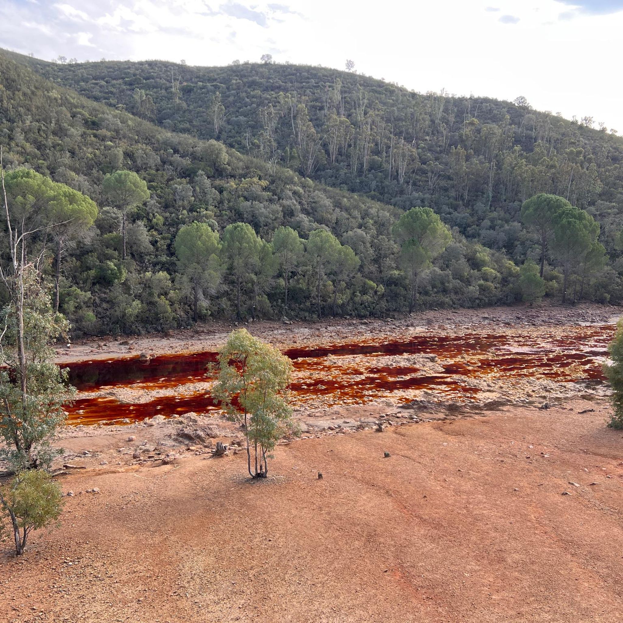
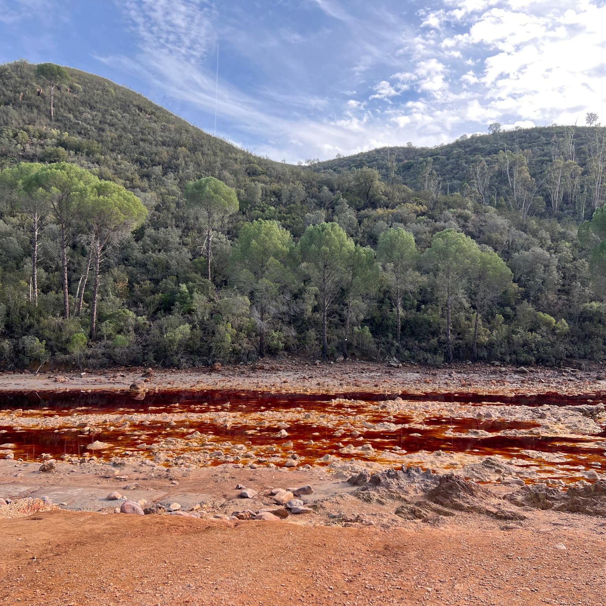
Hiking around El Madroño offers exploration of the Sierra de Aracena foothills, characterized by picturesque mountain scenery. The region is notable for the distinctive reddish landscapes shaped by the Río Tinto, a river known for its ancient mining history. Diverse flora, including the namesake madroño trees, contributes to the natural environment. Unique geological formations, such as the rock engravings at Cerro de El Riscal, are also present.
Best hiking trails around El Madroño
- The most popular hiking route is Río Tinto Mining Train Trail, a 5.9 miles (9.5 km) trail that takes 2 hours 35 minutes to complete, following the historic railway lines.
- Another top favourite among local hikers is Río Tinto Greenway Loop, a moderate 5.1 miles (8.3 km) path. This route offers views of the unique "Martian-like" terrain along the Río Tinto.
- Local hikers also love the On the banks of the Riotinto along the old railway, a 5.6 miles (9.0 km) trail leading through the distinctive Río Tinto landscape, often completed in about 2 hours 36 minutes.
- Hiking around El Madroño is defined by the Sierra de Aracena foothills, the reddish Río Tinto landscapes, and areas rich in madroño trees. The network of trails offers options for easy paths to more challenging routes, catering to various ability levels.
- The routes in El Madroño are highly rated by the komoot community with an average score of 4.1 stars from over 70 reviews. More than 330 hikers have used komoot to explore El Madroño's varied terrain.
Last updated: August 31, 2026
4.5
(13)
38
hikers
9.46km
02:36
150m
150m
Moderate hike. Good fitness required. Easily-accessible paths. Suitable for all skill levels.
4.7
(6)
12
hikers
8.25km
02:21
190m
190m
Moderate hike. Good fitness required. Easily-accessible paths. Suitable for all skill levels.

Sign up for free
5.0
(1)
2
hikers
9.00km
02:36
210m
210m
Moderate hike. Good fitness required. Easily-accessible paths. Suitable for all skill levels.
18.7km
05:15
370m
370m
Hard hike. Very good fitness required. Easily-accessible paths. Suitable for all skill levels.
23.4km
06:45
590m
590m
Hard hike. Very good fitness required. Easily-accessible paths. Suitable for all skill levels.
Get access to more routes and recommendations from other explorers.
Sign up for free
Already have an account?
Our route recommendations are based on thousands of hikes, rides, and runs completed by other people on komoot.
Start today with a free account
Your next adventure awaits.
Login or Signup
Tips from the Community

Impressive images from the river.
2
0
Of course the views are curious, a little sad but curious.
2
0

Views of one of the meanders formed by the Rio Tinto as it passes through the municipality of Berrocal.
1
1
Old railway line that was used for just over a century until 1984 to transport the minerals extracted in the Riotinto-Nerva mining basin.
1
1
Religious sanctuary of the town of Berrocal. Said congregation was divided into two buildings that represented two sides, the one above and the one below. That is why we still find the Hermitage of the Brotherhood of the Santa Cruz de Abajo and the one above.
1
1

Very nice vantage point with picnic area.
1
0

Old station that is located a few kilometers from the town of Nerva and that was used to transport the materials extracted from the mine.
1
0
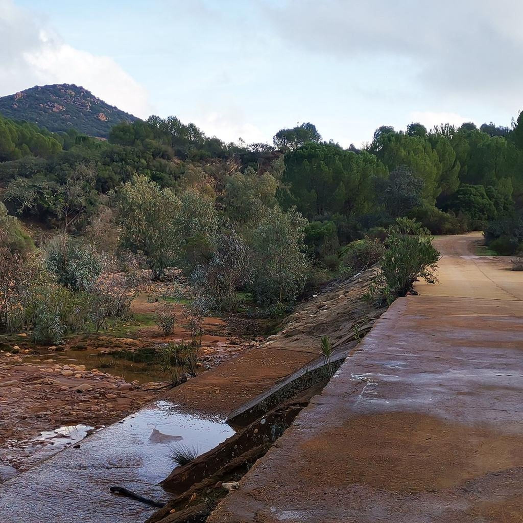
Road that passes through where there are the train tracks that brought the materials that came out of the mines to the town of Nerva. These tracks are currently still used by the tourist train that runs there, but the path allows you to see them perfectly as well as the river that is nearby.
3
0
Frequently Asked Questions
What types of hiking trails can I expect around El Madroño?
El Madroño offers a diverse range of hiking trails, from easy paths suitable for all abilities to more challenging routes requiring good physical condition. You'll find paths winding through the picturesque Sierra de Aracena foothills and along the distinctive reddish landscapes shaped by the Río Tinto. There are 5 easy routes, 20 moderate routes, and 4 difficult routes available.
Are there any trails that showcase the unique reddish landscapes of the Río Tinto?
Yes, several trails highlight the unique 'Martian-like' terrain of the Río Tinto. For a moderate experience, consider the Río Tinto Greenway Loop, which offers views of this distinctive landscape. Another option is Río Tinto Mining Train Trail, which follows historic railway lines through the area.
What natural attractions or landmarks can I see while hiking in El Madroño?
The region boasts several unique natural and historical landmarks. You can explore the rock engravings at Cerro de El Riscal or visit the extraordinary Encina de los Perros Natural Monument, an immense tree providing significant shade. Along the Río Tinto, you might encounter the Source of the Río Tinto, the Corta Atalaya Mine, or the Peña del Hierro.
Are there any long-distance or more challenging hikes in the area?
For those seeking a more challenging experience, El Madroño offers routes like the El Madroño Miners' Trail, which is nearly 19 km long and considered difficult. Another demanding option is the Berrocal - El Madroño – circular by the Río Tinto and Arroyo del Gallego, spanning over 23 km.
What is the best time of year to go hiking in El Madroño?
El Madroño is ideal for hiking due to its tranquil natural surroundings. While specific seasonal data isn't provided, regions in southern Spain generally offer pleasant hiking conditions during spring (March-May) and autumn (September-November) when temperatures are milder. Summers can be very hot, and winters are typically mild.
Are there any circular hiking routes available?
Yes, circular routes are available for hikers. The Río Tinto Greenway Loop is a popular moderate circular path. For a longer, more challenging option, consider the Berrocal - El Madroño – circular by the Río Tinto and Arroyo del Gallego.
What makes the flora of El Madroño unique?
The region is named after the abundant presence of strawberry trees (madroños), or Arbutus unedo, which produce edible red berries. Beyond these, the area boasts rich flora, including cork oaks and holm oaks, contributing to a diverse and picturesque natural environment.
What do other hikers say about the trails in El Madroño?
The routes in El Madroño are highly rated by the komoot community, with an average score of 4.1 stars from over 70 reviews. Hikers often praise the unique landscapes, the peaceful environment, and the variety of trails available.
Are there options for easy or beginner-friendly hikes?
Yes, El Madroño has 5 easy routes suitable for beginners or those looking for a relaxed walk. These paths allow visitors to immerse themselves in the nature and peace of the area without requiring extensive physical exertion.
Is there public transport or parking available for hikers in El Madroño?
While specific details on public transport routes are not provided, El Madroño is a small town, and parking is generally available within or near the town center, often serving as a starting point for many trails. It's advisable to check local information upon arrival for the most convenient parking spots.
What is the overall number of hiking trails in the El Madroño area?
There are 29 hiking trails available around El Madroño, offering a wide variety of options for different skill levels and preferences.
Can I find trails that follow historical paths or old railway lines?
Yes, the region's mining history is reflected in some trails. The Río Tinto Mining Train Trail follows historic railway lines, offering a glimpse into the past while enjoying the unique landscape. Similarly, On the banks of the Riotinto along the old railway also utilizes old railway paths.
Most popular attractions around El Madroño

Get inspired with the komoot mobile app


Explore more
Browse the best Hikes in other regions.
