The best walks and hikes around El Ordial
4.5
(49)
469
hikers
19
hikes
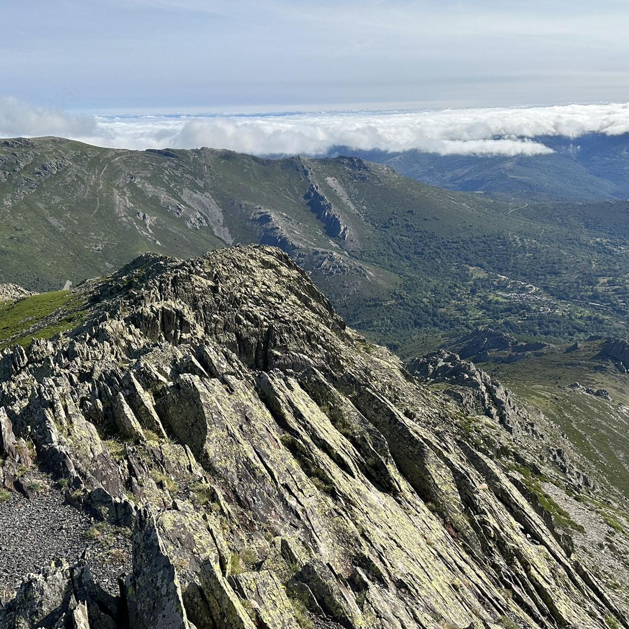
Hiking around El Ordial offers exploration within the mountainous landscapes of the Sierra Norte de Guadalajara region. The area is characterized by its diverse relief, ranging from gently sloping areas to more mountainous zones, with features like meadows, hills, ravines, and streams. It lies at the foot of the Sierra del Alto Rey, known for its folded geological formations primarily composed of slate. The landscape includes trees such as junipers and holm oaks.
Best hiking trails around El Ordial
- The…
Last updated: July 1, 2026
3.6
(5)
47
hikers
Hard hike. Very good fitness required. Mostly accessible paths. Sure-footedness required.
3
hikers
16.4km
05:30
630m
640m
Hard hike. Very good fitness required. Mostly accessible paths. Sure-footedness required.

Sign up for free
4.8
(4)
13
hikers
Hard hike. Very good fitness required. Mostly accessible paths. Sure-footedness required.
3.3
(3)
14
hikers
12.6km
04:00
440m
440m
Moderate hike. Good fitness required. Mostly accessible paths. Sure-footedness required.
5.0
(1)
9
hikers
10.1km
03:19
410m
410m
Moderate hike. Good fitness required. Mostly accessible paths. Sure-footedness required.
Get access to more routes and recommendations from other explorers.
Sign up for free
Already have an account?
Our route recommendations are based on thousands of hikes, rides, and runs completed by other people on komoot.
Start today with a free account
Your next adventure awaits.
Login or Signup


Tips from the Community

From Valverde, you can enjoy stunning views of Ocejón Peak, especially from the hiking trails that depart from the town.
4
0
The climb to Pico Ocejón via the eastern slope is a popular route that begins in Valverde de los Arroyos. This route is known for its spectacular scenery and the opportunity to enjoy nature at its best.
4
0
The most popular route to ascend Pico Ocejón begins in Valverde de los Arroyos and is known for its scenic beauty and moderate difficulty. The hike is approximately 14.74 km and typically takes around 6 hours with stops. Along the way, hikers can enjoy spectacular views and the rich biodiversity of the area.
6
0

Magnificent waterfalls. Worth a visit. Just 3 km from the village.
0
0
A spectacular waterfall just a short distance from the village of Valverde de los Arroyos. It is worth visiting.
0
0
The climb is hard, but it is worth it. Although we were not lucky enough to see all the scenery that should be seen from that height. The descent is almost harder than the ascent.
1
0
A picturesque village among the black villages of Guadalajara. The food is great and it is a good starting point for hiking and mountain biking excursions.
1
0
This place is ideal for enjoying a day outdoors, as it has picnic and barbecue areas.
4
0
Frequently Asked Questions
How many hiking trails are available around El Ordial?
There are over 20 hiking trails around El Ordial, offering a variety of experiences within the mountainous landscapes of the Sierra Norte de Guadalajara region.
What kind of terrain can I expect on hikes in El Ordial?
Hikes around El Ordial feature diverse terrain, from gently sloping areas to more mountainous zones. You'll encounter folded geological formations primarily composed of slate, along with meadows, hills, ravines, and streams. The landscape is characterized by trees such as junipers and holm oaks.
Are there any challenging hikes for experienced trekkers?
Yes, El Ordial offers several challenging routes. For instance, the Pico del Alto Rey — circular via the old path of Alto Rey from Bustares is a difficult 10.2-mile path ascending to Pico del Alto Rey, providing panoramic views. Another difficult option is the Despeñalagua Waterfall – Valverde de los Arroyos loop from Valverde de los Arroyos, which covers 15.5 miles with significant elevation gain.
Are there any easy or moderate hiking options suitable for beginners?
Yes, there are options for various skill levels. While many routes are moderate to difficult, you can find easier sections or shorter loops. For example, the Between hills – Almiruete loop from Almiruete is a moderate 7.8-mile trail through varied terrain, often completed in about 4 hours.
What natural features or landmarks can I see while hiking in El Ordial?
The region is rich in natural beauty and historical sites. You can explore the Sierra del Alto Rey with its impressive peaks like Alto Rey Peak (1,858 m), offering panoramic views. The Pico Ocejón is another prominent summit. Hikers can also visit the Despeñalagua Waterfall, or discover the 13th-century Romanesque Church of San Sebastián in El Ordial itself, and a Roman bridge in the vicinity.
Are there any circular hiking routes in the area?
Yes, several routes are designed as circular walks, allowing you to start and end in the same location. The Almiruete loop from Almiruete is a moderate 10-kilometer circular trail. Another option is the Pico Ocejon via the Chorrera Despenalagua - circular from Valverde de los Arroyos, a more difficult 7-mile loop.
What do other hikers enjoy most about hiking in El Ordial?
The hiking trails around El Ordial are highly rated by the komoot community, with an average score of 4.6 stars from over 60 reviews. Hikers often praise the diverse mountainous terrain, the unique slate formations, and the peaceful woodlands featuring junipers and holm oaks.
Is El Ordial a good destination for family-friendly hikes?
While many routes involve significant elevation, there are options that families can enjoy. Look for shorter, less strenuous sections or trails with minimal elevation gain. The varied landscape with meadows and streams can be engaging for children.
Are dogs allowed on the hiking trails in El Ordial?
Generally, dogs are welcome on hiking trails in natural areas like El Ordial, especially if kept on a leash. However, it's always advisable to check local regulations or specific trail signs, particularly in protected areas, to ensure compliance and respect for wildlife.
What is the best time of year to go hiking in El Ordial?
The best time to hike in El Ordial is typically during spring and autumn when the weather is milder and the natural scenery is vibrant. Summer can be hot, especially at lower elevations, while winter may bring snow to the higher peaks of the Sierra del Alto Rey, offering different challenges and beautiful snowy landscapes.
Are there viewpoints along the trails offering panoramic vistas?
Absolutely. The region is known for its impressive views. Ascents to peaks like Alto Rey Peak (1,858 m) offer panoramic vistas of the Sierra del Ocejón, Pico del Lobo, and even parts of the Madrid sierra on clear days. The 'Old Way of Alto Rey' from Bustares is specifically noted for its constant spectacular mountain views.
Is there parking available near the trailheads?
Information on specific parking facilities for each trailhead can vary. However, in small municipalities like El Ordial and surrounding villages, you can typically find parking in or near the town centers, which often serve as starting points for local routes. It's recommended to check specific route details for parking suggestions.
Most popular attractions around El Ordial

Get inspired with the komoot mobile app


Explore more
Browse the best Hikes in other regions.
