The best running trails around Monte Ceresa
164
runners
13
runs
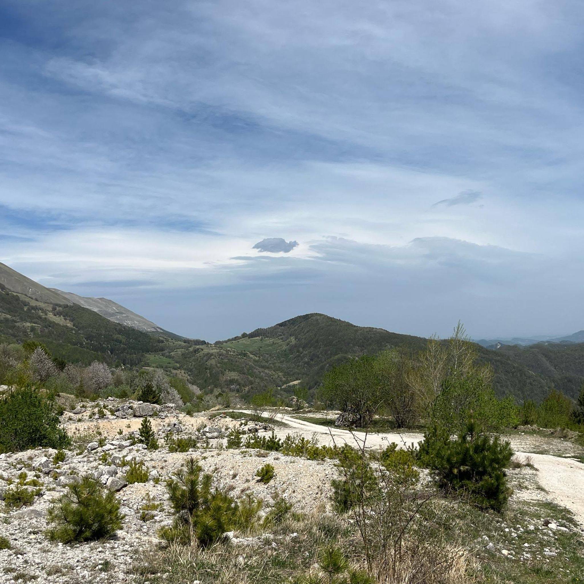
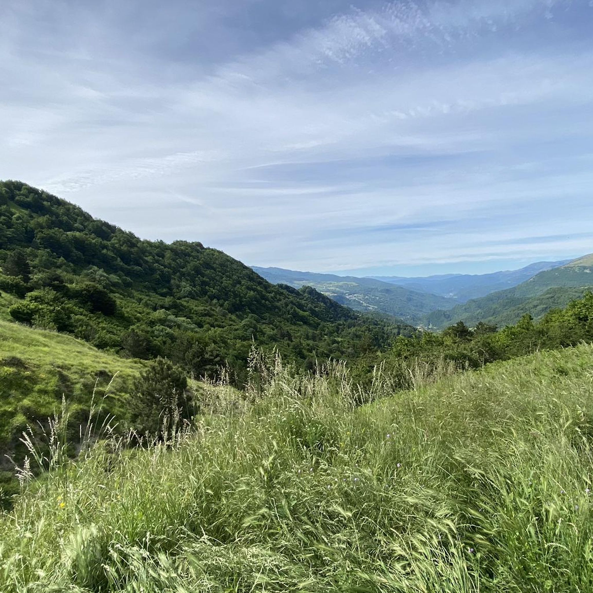
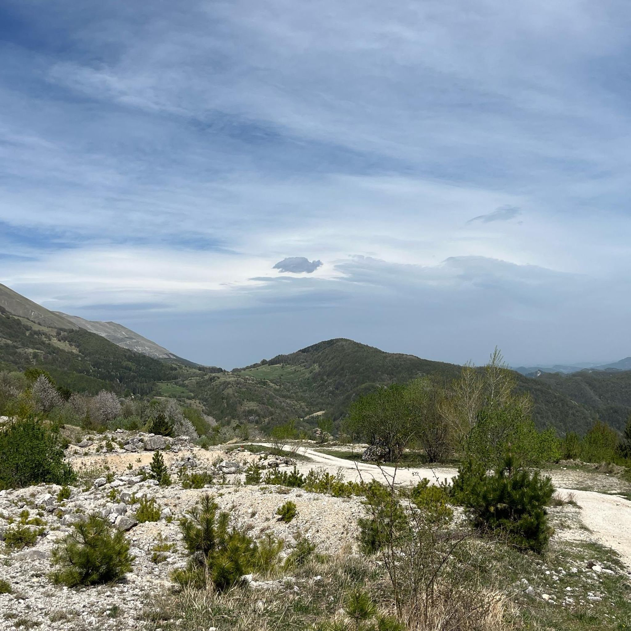
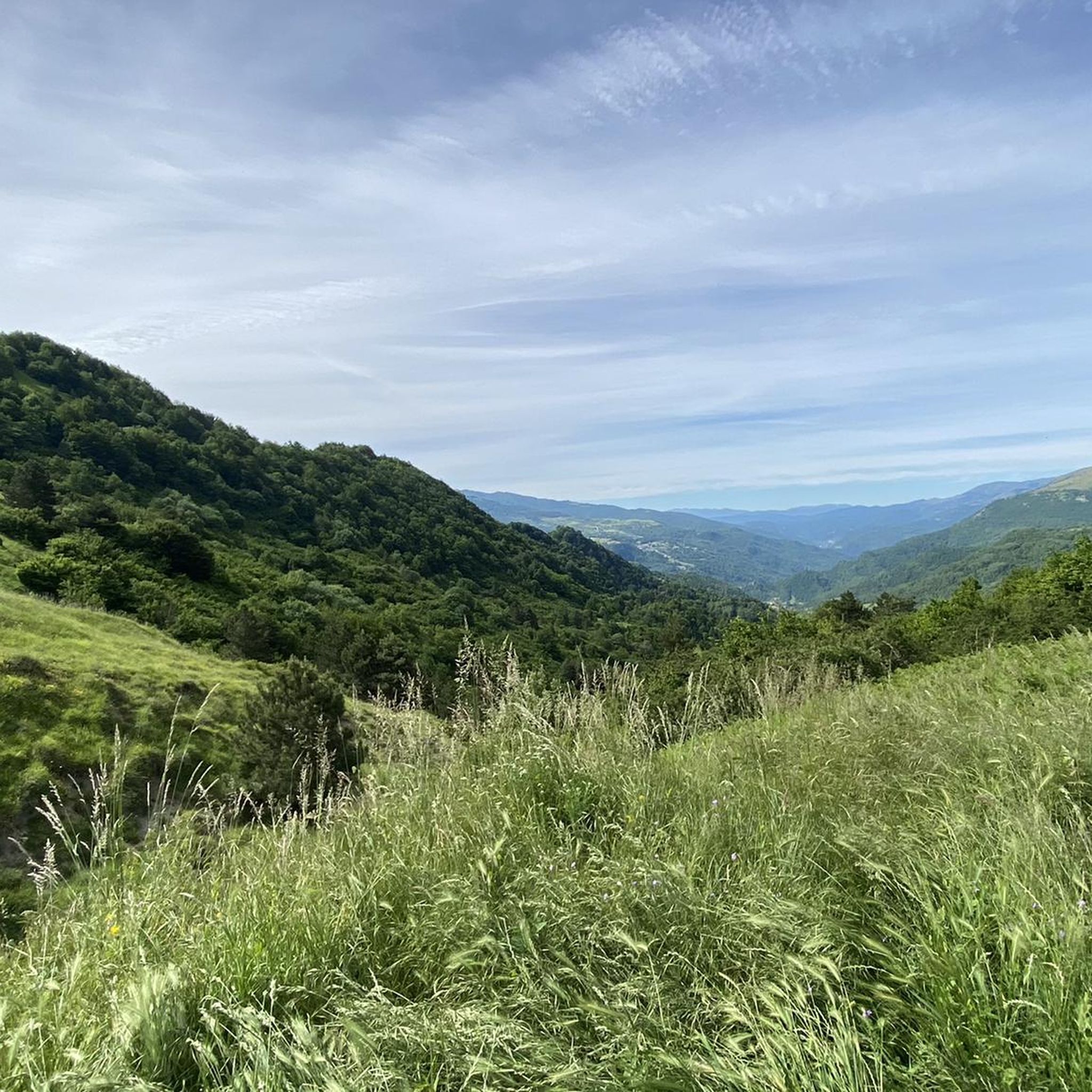
Jogging routes around Monte Ceresa traverse a diverse landscape within Italy's Apennine Mountains, offering a mix of environments for runners. The region is characterized by expansive prairies, mixed forests, and ancient beech woods, providing varied terrain. With elevations reaching up to 1494 meters, the area features both gradual ascents and more challenging inclines, catering to different fitness levels. This extensive trail network allows for immersive runs through a pristine mountainous setting.
Best jogging routes around Monte Ceresa
- The most popular…
Last updated: June 24, 2026
5.05km
00:36
130m
130m
Jog the moderate 3.1-mile Tallacano-Poggio Rocchetta Trail, gaining 433 feet with panoramic views and waterfalls.
3
runners
10.1km
01:24
440m
440m
Hard run. Very good fitness required. Mostly paved surfaces. Suitable for all skill levels.

Sign up for free
6.28km
00:44
200m
200m
Jog the moderate Piana di Forcella loop tour, covering 3.9 miles (6.3 km) with 655 feet (200 metres) of elevation gain in about 44 minutes.
25
runners
28.3km
04:16
1,310m
1,310m
Hard run. Very good fitness required. Sure-footedness, sturdy shoes and alpine experience required.
9
runners
22.0km
03:02
950m
950m
Hard run. Very good fitness required. Mostly paved surfaces. Suitable for all skill levels.
Get access to more routes and recommendations from other explorers.
Sign up for free
Already have an account?
Our route recommendations are based on thousands of hikes, rides, and runs completed by other people on komoot.
Start today with a free account
Your next adventure awaits.
Login or Signup

Tips from the Community


Stunning environment, full of history. Trail for refined palates
0
0

If you are looking for a cool place to escape the summer heat, the Forcella waterfalls are your refuge! I'm right next to Acquasanta Terme, just 14 kilometers from Ascoli Piceno. It is the paradise to relax and have a good swim. Near the Mulino Pompili, surrounded by dense greenery, you will find a crystalline natural pool. And look at the show: the stream creates waterfalls and postcard landscapes along its course!
2
0

Bring a swimsuit and the stozza (the sandwich)
0
0

Acquasanta Terme is a municipality in the province of Ascoli Piceno within the Gran Sasso and Monti della Laga National Park. It is known for its thermal baths, which exploit the beneficial properties of the sulphurous waters, and the municipal area is rich in history and nature, with evidence from the Roman, medieval and Renaissance periods, and with mountain and river landscapes of great beauty.
1
0

This waterfall is fed by the Agore ditch, which starts from the north, from about 800 meters high, to reach the point here, about 675 meters.
1
0
The Grotta del Petrienno is about 60 meters wide, and has a depth of about 15 meters. To access you pass under the waterfall.
2
0
Poggio Rocchetta has played a significant role in controlling the surrounding area in different historical periods. Interesting is his place on the Ascolani castle committee in the 14th century, his participation in papal rebellions in the 16th and 19th centuries, and his involvement in the resistance to Italian unification under the Piedmontese army. Unfortunately it was damaged by a series of earthquakes that started in 2016 and access to the area is currently restricted.
1
0
Frequently Asked Questions
How many running routes are available around Monte Ceresa?
Komoot offers around 10 dedicated running routes in the Monte Ceresa area. These routes traverse diverse landscapes, from open prairies to ancient beech woods, providing a variety of experiences for runners.
What kind of terrain can I expect on the jogging routes in Monte Ceresa?
Jogging routes around Monte Ceresa feature a varied terrain, including expansive prairies, mixed forests, and spectacular ancient beech woods. You'll find a blend of open-air runs with panoramic views and shaded paths through immersive natural environments. The elevation changes range from gradual ascents to more challenging inclines, catering to different fitness levels.
What are the best times of year for running in Monte Ceresa?
The most favorable times for outdoor activities, including jogging, in Monte Ceresa are typically during spring and autumn. During these seasons, the weather conditions are generally mild and pleasant, making for comfortable runs amidst the region's natural beauty.
Are there routes suitable for beginners or less experienced runners?
While many routes in Monte Ceresa are classified as difficult due to significant elevation changes, there are also moderate options available. For example, the Tallacano-Poggio Rocchetta Trail is a moderate 3.1-mile (5.1 km) route with varied terrain and manageable elevation changes, suitable for those looking for a less strenuous run.
What makes Monte Ceresa a unique place for running?
Monte Ceresa, often referred to as part of the 'Appennino perduto' (lost Apennines), offers a unique running experience due to its position as a buffer zone between the Sibillini and Laga National Parks. This creates a rich biodiversity and a comprehensive network of trails through diverse ecosystems, including ancient beech woods and vast prairies, providing both physical challenge and natural immersion.
Are there any circular running routes in Monte Ceresa?
Yes, Monte Ceresa offers several circular running routes. A popular option is the Great Ring of the Ascolani Villages Loop, which is 3.9 miles (6.3 km) long and takes you through mixed forests and open prairies. Another challenging circular route is the Monte Civita loop from Arquata del Tronto, offering panoramic views.
Can I bring my dog on the running trails?
Generally, dogs are welcome on trails in the Apennine Mountains, including Monte Ceresa. However, it's always advisable to keep your dog on a leash, especially in areas with wildlife or near livestock, and to check for any specific local regulations or protected areas that might have restrictions. Always practice Leave No Trace principles.
Are there any long-distance running options for experienced trail runners?
Absolutely. For experienced trail runners seeking a significant challenge, routes like the Tallacano Village – Poggio Rocchetta loop from Acquasanta Terme offer a substantial distance of 28.6 miles (28.6 km) with considerable elevation gain, providing a demanding and rewarding experience through the mountainous landscape.
What kind of natural features or viewpoints can I expect to see while running?
Monte Ceresa's primary draw is its inherent natural beauty. As you run, you'll encounter expansive prairies offering panoramic views, dense mixed forests, and spectacular ancient beech woods. The diverse ecosystems, influenced by its location between the Sibillini and Laga National Parks, provide opportunities to observe local flora and fauna within a pristine mountainous setting.
Is there public transport access to the Monte Ceresa running trails?
Information on direct public transport access specifically to the trailheads around Monte Ceresa is limited. It is generally recommended to use a car to reach the starting points of many routes in this mountainous region of the Apennines for greater flexibility.
Are there any permits required for jogging on the trails?
Based on available information, there are no specific permits mentioned as being required for general jogging or hiking on the trails of Monte Ceresa. However, it's always good practice to respect local regulations and any signage you may encounter on the trails, especially within or near national park boundaries.
What are the typical elevation changes on Monte Ceresa running routes?
The running routes around Monte Ceresa feature varied elevation changes, reflecting the mountainous terrain. You can expect anything from moderate ascents, such as the 132 meters on the Tallacano-Poggio Rocchetta Trail, to significant climbs exceeding 900 meters on more difficult routes like the Tallacano Village loop from Acquasanta Terme, providing options for all levels of challenge.
Most popular routes around Monte Ceresa

Get inspired with the komoot mobile app


Explore more
Browse the best Running Trails & Routes in other regions.
