The best cycling routes around Parco Naturale Regionale del Beigua
4.3
(1029)
9,645
riders
258
rides
Touring cycling around Parco Naturale Regionale del Beigua offers routes through a diverse landscape where the Ligurian Apennines meet the sea. This UNESCO Global Geopark features significant geological formations, including deep valleys and high mountains, with Monte Beigua reaching 1,287 meters. The terrain encompasses high-altitude prairies, dense forests, and rocky outcrops, providing varied environments for cycling. Routes often present panoramic views of the Ligurian coastline and the surrounding mountain ranges.
Best touring cycling routes around Parco Naturale Regionale del Beigua
…Last updated: July 13, 2026
4.7
(69)
571
riders
25.8km
01:39
170m
170m
Moderate bike ride. Good fitness required. Mostly paved surfaces. Suitable for all skill levels.
4.8
(16)
122
riders
Hard bike ride. Very good fitness required. Mostly paved surfaces. Suitable for all skill levels.

Sign up for free
4.0
(2)
101
riders
86.7km
06:02
1,350m
1,350m
Hard bike ride. Very good fitness required. Mostly paved surfaces. Suitable for all skill levels.
4.0
(3)
94
riders
25.6km
01:35
170m
170m
Moderate bike ride. Good fitness required. Mostly paved surfaces. Suitable for all skill levels.
5.0
(1)
56
riders
85.0km
06:32
2,150m
2,150m
Hard bike ride. Very good fitness required. Mostly paved surfaces. Suitable for all skill levels.
Get access to more routes and recommendations from other explorers.
Sign up for free
Already have an account?
Our route recommendations are based on thousands of hikes, rides, and runs completed by other people on komoot.
Start today with a free account
Your next adventure awaits.
Login or Signup
Popular around Parco Naturale Regionale del Beigua

Tips from the Community

The Church of San Martino is one of the main places of worship located in the hamlet of the same name in the municipality of Stella (SV), Liguria. It represents one of the five historic centers ("stars") of the Savona area and has its origins in local religious tradition, dedicated to Saint Martin of Tours, a bishop known for his charitable gesture of carrying his cloak.
7
0
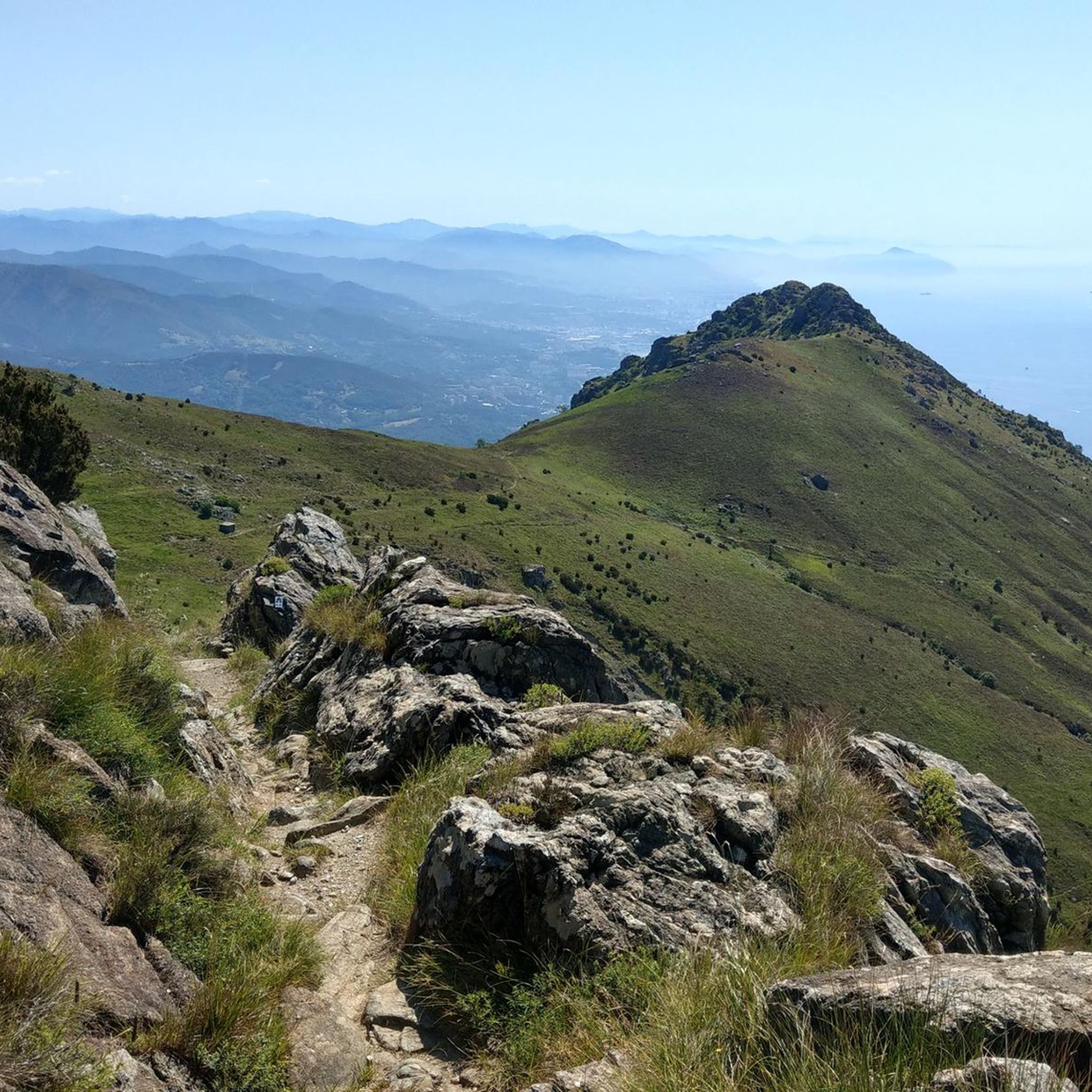
Mount Beigua is a mountain range in the Ligurian Apennines, 1,287 meters above sea level, located on the Ligurian-Po watershed. It is the highest peak of the so-called "Beigua group," which includes nearby Mount Grosso, Mount Ermetta, and Bric Veciri.
11
0

Very nice and well-maintained rest area.
3
1

In the beating heart of Celle Ligure, Piazza del Popolo welcomes visitors with its vibrant simplicity. Paved with typical Ligurian cobblestones, known as "rissëu," and dominated by the façade of the Church of Nostra Signora della Consolazione, this square is a true open-air living room. It's the place where evening strolls come alive, where the scent of the sea mingles with that of coffee in the historic cafés. A small stage for daily life, framed by colorful facades, it captures the most authentic and welcoming essence of the seaside village.
0
0


Is it all passable or are there some closed sections? Thanks
0
0

cycle path interrupted after Cogoleto towards Varazze, a real shame
0
0
Frequently Asked Questions
How many touring cycling routes are available in Parco Naturale Regionale del Beigua?
There are over 230 touring cycling routes available in Parco Naturale Regionale del Beigua, offering a wide range of options for different skill levels and preferences. The komoot community has explored more than 7000 of these routes.
What is the overall difficulty level of touring cycling routes in Parco Naturale Regionale del Beigua?
The routes in Parco Naturale Regionale del Beigua cater to various abilities. You'll find approximately 23 easy routes, 69 moderate routes, and 140 difficult routes, ensuring there's a suitable option whether you're looking for a relaxed ride or a challenging ascent.
What makes touring cycling in Parco Naturale Regionale del Beigua unique?
Parco Naturale Regionale del Beigua is a UNESCO Global Geopark known for its dramatic landscape where high mountains meet the Ligurian Sea. This unique geography offers breathtaking panoramic views of the coastline, the Alpine arc, and even the Po Valley on clear days. The park features diverse ecosystems, from high-altitude prairies to dense forests, and significant geological formations like the Val Gargassa, often called the 'Grand Canyon of Liguria'.
When is the best time of year to go touring cycling in Parco Naturale Regionale del Beigua?
The park's climate is influenced by both mountain and coastal conditions. Spring and autumn generally offer pleasant temperatures for touring cycling, with less heat than summer and fewer chances of snow than winter in higher elevations. Always check the local weather forecast before heading out, especially for mountain routes where conditions can change rapidly.
Are there any challenging touring cycling routes with significant elevation gain?
Yes, many routes in Parco Naturale Regionale del Beigua feature substantial elevation gains. For instance, the Eremo del Deserto di Varazze – Lungomare Europa Coastal Path loop from San Martino is a difficult 43 km route with over 760 meters of ascent, offering a good workout and rewarding views.
Are there any family-friendly touring cycling routes in the park?
For a more relaxed and family-friendly experience, consider routes along the coast. The scenic coastal path connecting Varazze to Cogoleto, which primarily follows a disused railway line, is ideal for leisurely rides. While not explicitly listed in the top routes, similar coastal sections can be found on routes like the Lungomare Europa Coastal Path – Passeggiata Aldo Moro loop from Arenzano, which is a moderate 23.4 km route.
What kind of landmarks or natural features can I expect to see along the touring cycling routes?
Touring cycling routes in Parco Naturale Regionale del Beigua offer a wealth of natural and cultural sights. You might encounter impressive peaks like Monte Beigua or Monte Reixa, charming historic towns, and unique geological formations. The park also features ancient archaeological evidence, such as petroglyphs.
Are there any circular touring cycling routes available?
Yes, many touring cycling routes in the region are designed as loops, allowing you to start and end at the same point. An example is the Eremo del Deserto di Varazze – Church of San Martino, Stella loop from Arenzano, a difficult 47.1 km route that takes you through varied landscapes.
Where can I find parking for touring cycling routes in Parco Naturale Regionale del Beigua?
Parking availability varies depending on the specific starting point of your chosen route. Many towns and villages within and around the park, such as Arenzano, Varazze, Cogoleto, and Sassello, offer public parking facilities. It's advisable to check specific parking options for your chosen route's trailhead in advance.
Can I access touring cycling routes in Parco Naturale Regionale del Beigua using public transport?
Public transport access to the park's cycling routes is possible, particularly to coastal towns like Varazze, Arenzano, and Cogoleto, which are served by train lines. From these points, you can often connect to routes that venture into the park. For routes deeper within the park, bus services might be available, but they are less frequent, so planning ahead is essential.
Are there places to eat or stay near the touring cycling routes?
Yes, the region offers various amenities for cyclists. Charming towns like Sassello, Varazze, Arenzano, and Cogoleto have restaurants, cafes, and accommodation options. Within the park itself, refuges such as Argentea Hut and Rifugio Pratorotondo provide places for refreshment or an overnight stay, especially useful for longer tours.
What do other touring cyclists enjoy most about touring cycling in Parco Naturale Regionale del Beigua?
The area is highly rated by the komoot community, with an average score of 4.3 stars from over 700 reviews. Reviewers often praise the stunning panoramic views where mountains meet the sea, the diverse natural environments, and the variety of routes that cater to different skill levels, from challenging mountain ascents to scenic coastal paths.
Most popular routes around Parco Naturale Regionale del Beigua
Most popular attractions around Parco Naturale Regionale del Beigua

Get inspired with the komoot mobile app


Explore more
Browse the best Cycling routes in other regions.
