Parc national du Mercantour (cœur)
Parc national du Mercantour (cœur)
The best walks and hikes around Parc national du Mercantour (cœur)
4.5
(11649)
83,669
hikers
198
hikes
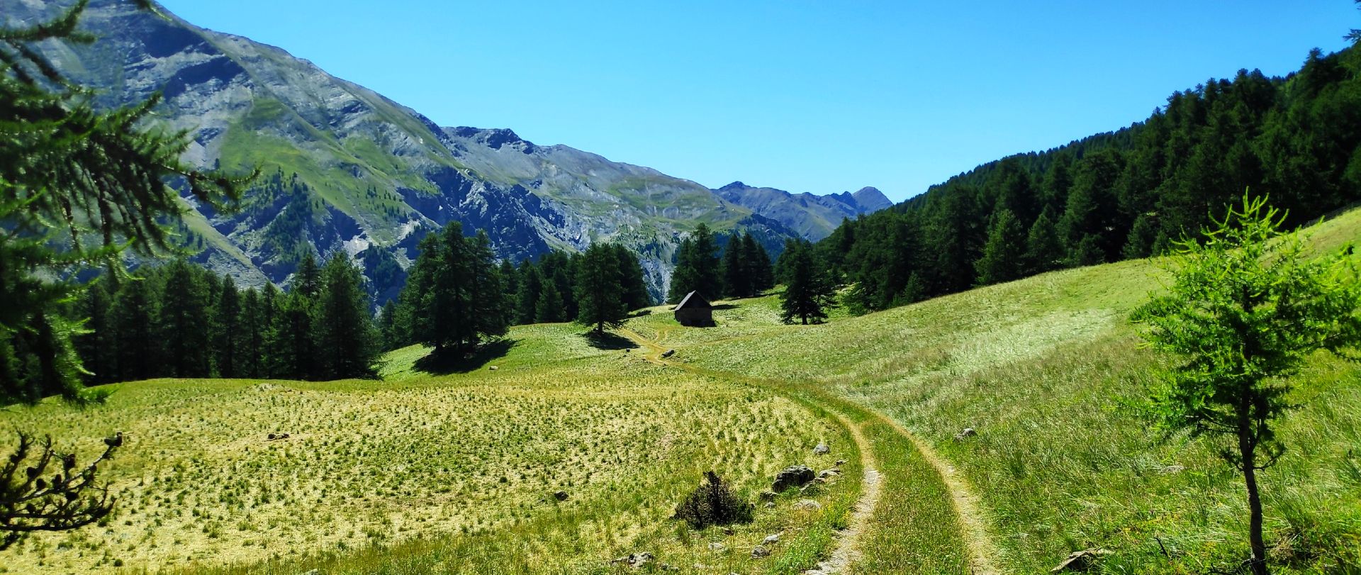
Hiking trails around Parc national du Mercantour (cœur) traverse a landscape characterized by dramatic altitude changes, from deep forested valleys to towering peaks over 3,000 meters. The region features diverse geological formations, including limestone massifs and red-rock valleys, alongside numerous glacial lakes and crystal-clear springs. Hikers will encounter extensive larch, fir, and spruce forests, as well as alpine meadows.
Best hiking trails around Parc national du Mercantour (cœur)
- The most popular hiking route is Lacs de la petite Cayolle et des Garrets – loop in the heart of the Mercantour National Park, a 5.6 miles (9.1 km) trail that takes 3 hours 28 minutes to complete. This difficult route explores high-altitude lakes within the park's core zone.
- Another top favourite among local hikers is Allos Lakes Loop, a difficult 9.8 miles (15.8 km) path. This trail offers views of Lac d'Allos, Europe's largest natural high-altitude lake, amidst alpine scenery.
- Local hikers also love the M11 trail to Col de la Finestra from San Giacomo, a 12.7 miles (20.5 km) trail leading through mountain passes and valleys, often completed in about 7 hours 22 minutes.
- Hiking around Parc national du Mercantour (cœur) is defined by towering peaks, deep forested valleys, and glacial lakes. The extensive network of trails offers options for various ability levels, from gentle walks to challenging treks.
- The routes in Parc national du Mercantour (cœur) are highly rated by the komoot community with an average score of 4.7 stars from over 1500 reviews. More than 16000 hikers have used komoot to explore Parc national du Mercantour (cœur)'s varied terrain.
Last updated: August 30, 2026
4.9
(73)
595
hikers
Hard hike. Good fitness required. Sure-footedness, sturdy shoes and alpine experience required.
4.9
(31)
508
hikers
15.8km
05:47
900m
900m
Hard hike. Very good fitness required. Sure-footedness, sturdy shoes and alpine experience required.

Sign up for free
4.7
(119)
568
hikers
20.5km
07:22
1,240m
1,240m
Hard hike. Very good fitness required. Mostly accessible paths. Sure-footedness required.
4.6
(48)
456
hikers
14.2km
05:00
600m
600m
Hard hike. Very good fitness required. Mostly accessible paths. Sure-footedness required.
4.9
(18)
231
hikers
17.5km
06:26
980m
980m
Hard hike. Very good fitness required. Mostly accessible paths. Sure-footedness required.
Get access to more routes and recommendations from other explorers.
Sign up for free
Already have an account?
Our route recommendations are based on thousands of hikes, rides, and runs completed by other people on komoot.
Start today with a free account
Your next adventure awaits.
Login or Signup
Popular around Parc national du Mercantour (cœur)

Europe Trail (GR 5) – Hike from Nice to Saint-Étienne-de-Tinée

Hike from Saint-Étienne-de-Tinée to Briançon – Europe Trail (GR 5)

Crossing the Mercantour National Park – GR 52

Mountains and marmots — France’s Ubaye trail (GR 56)

High mountain escapades — 15 peaks over 3,000m in the Alps

MigrAction – Generations in Motion

France — two weeks of hiking at its best!

Seven MTB routes in the Southern Alps – nature, passes and valleys
MTB Tour of the Ubaye Valley – La Transubayenne

The most beautiful MTB and hiking tours in the French Maritime Alps
Other adventures around Parc national du Mercantour (cœur)


Tips from the Community

Starting point for many hikes, both towards the Soria Ellena refuge and the Pagarì refuge valley
0
0

Mont Pelat (3051 m) is one of the most striking peaks in the French Mercantour massif. From the summit, an impressive panoramic view opens up over the Maritime Alps to the Mediterranean Sea. Popular ascent routes lead up from Lac d'Allos. Sure-footedness and good physical condition are required for this scenic mountain tour.
0
0

The Vallon du Lauzanier is a magnificent space, little frequented in winter
0
0

Hill located on the Italian-French border
0
0

Nothing exceptional, but worth seeing.
0
0

Beautiful place with this little bridge over the river where you can also swim, usually there is a shepherd with hundreds of sheep.
0
0

https://youtu.be/c_jtRRcON1s?si=vmfymVyHAvlCwn5I Easy to reach if you're coming from Oronaye
0
0

From this plateau, you can reach several destinations. The closest is the Soria Ellena refuge, 5 minutes away.
0
0
Frequently Asked Questions
How many hiking trails are available in Parc national du Mercantour (cœur)?
There are over 180 hiking routes in Parc national du Mercantour (cœur), offering a wide range of experiences from gentle walks to challenging treks. The komoot community has explored these trails over 16,000 times.
What kind of natural features can I expect to see while hiking in Mercantour National Park?
Parc national du Mercantour (cœur) boasts diverse and dramatic landscapes. You'll encounter towering peaks, deep forested valleys, and unique geological formations like the red-rock Gorges de Daluis. The park is also home to numerous sparkling glacial lakes, such as Lake Allos, Europe's largest natural high-altitude lake, and the beautiful Vens Lakes, surrounded by lush alpine scenery.
Are there any easy or family-friendly hiking options in Parc national du Mercantour (cœur)?
Yes, while many trails are challenging, there are 18 easy routes suitable for families or those seeking a more relaxed experience. These paths often traverse beautiful larch forests and alpine meadows, providing accessible ways to enjoy the park's natural beauty.
What are some notable landmarks or points of interest along the hiking trails?
Hikers can discover several unique landmarks. The Vallée des Merveilles is famous for its nearly 40,000 prehistoric rock engravings. You might also encounter stunning high-altitude lakes like Lac du Lauzanier or Lac de Trécolpas. Mountain passes such as Cayolle Pass and Col de la Bonette offer remarkable panoramic views.
What is the best time of year to hike in Parc national du Mercantour (cœur)?
The best time for hiking is generally from late spring to early autumn (June to September) when trails are clear of snow and alpine flora is in bloom. Higher altitude routes, however, may retain snow into early summer. The park's diverse vegetation, including larch forests, offers beautiful colors in autumn.
Are there any circular hiking routes in the Mercantour National Park?
Yes, the park offers several circular routes. One popular option is the Circuit of the 4 Lakes, which takes you through picturesque lake scenery. Another is the Lacs de la petite Cayolle et des Garrets – loop, exploring high-altitude lakes in the heart of the park.
What kind of wildlife can I expect to see in Parc national du Mercantour (cœur)?
Mercantour is a haven for wildlife. You might spot chamois, ibex, mouflons, and marmots in higher altitudes. Red deer, roe deer, and wild boars inhabit the lower forests. Birdwatchers can look for golden eagles, black grouse, and bearded vultures. The gray wolf has also made a comeback in the massif.
What do other hikers enjoy most about hiking in Parc national du Mercantour (cœur)?
The area is highly rated by the komoot community, with an average score of 4.7 stars from over 1,500 reviews. Hikers often praise the stunning and diverse landscapes, the extensive network of well-maintained trails, and the opportunities to encounter unique wildlife and geological formations.
Are there any challenging or advanced hiking trails for experienced hikers?
Absolutely. The park is known for its challenging routes, with 100 trails rated as difficult. For instance, the Allos Lakes Loop is a demanding 15.8 km path with significant elevation gain, offering spectacular views of Lac d'Allos. The M11 trail to Col de la Finestra is another challenging option, covering over 20 km through mountain passes.
Can I find any routes that feature waterfalls or significant waterways?
While specific waterfall routes are not highlighted, the park is rich in waterways and glacial lakes. The Lauzanier Valley, carved by glaciers, features the hidden Lac de Lauzanier, and the Verdon Gorge, though slightly outside the core zone, is renowned for its striking turquoise-green river. Many trails follow streams and rivers through deep valleys.
Are there any long-distance hiking routes that pass through Parc national du Mercantour (cœur)?
Yes, the park is traversed by significant long-distance routes. The GR®5, linking Lake Léman to the Mediterranean, and the GR®52, known as the Grande Traversée du Mercantour, are challenging multi-day itineraries that cross high-altitude lakes and unique geological formations within the park.
What are the typical elevation changes on hikes in Mercantour National Park?
The terrain in Mercantour National Park varies dramatically in altitude, from 300 to over 3,000 meters. Hikers can expect significant elevation changes, with many difficult routes featuring ascents of 900 meters or more. For example, the Lac de Vens loop involves nearly 1,000 meters of ascent.
Most popular routes around Parc national du Mercantour (cœur)
Most popular attractions around Parc national du Mercantour (cœur)

Get inspired with the komoot mobile app


Explore more
Browse the best Hikes in other regions.
