The best walks and hikes around Reserva de la Biosfera de Babia
4.6
(488)
4,142
hikers
46
hikes
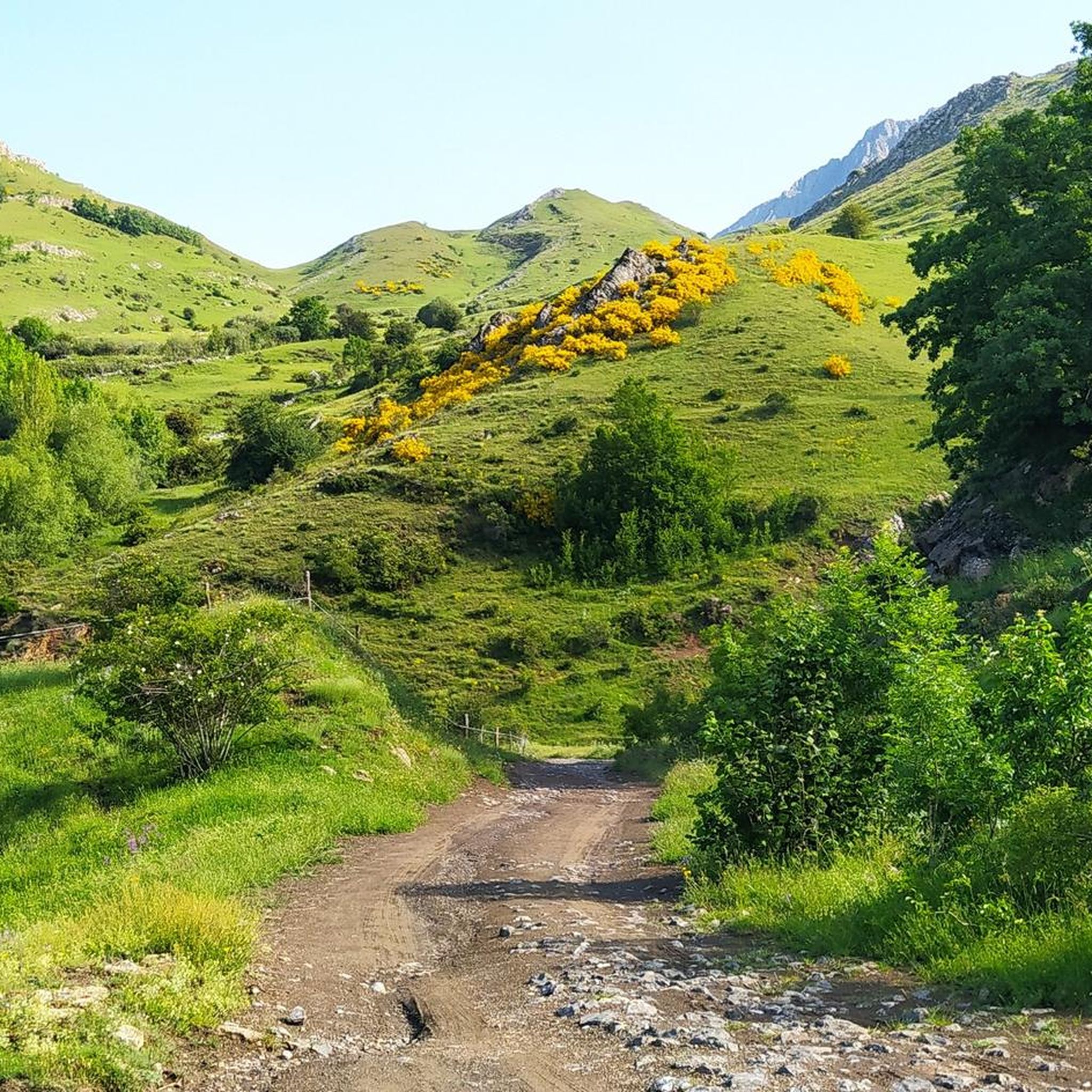
Hiking around Reserva de la Biosfera de Babia offers diverse trails within a UNESCO Biosphere Reserve in the Cantabrian Mountains. The region features high mountains, rocky slopes, and peaks often exceeding 2,000 meters, alongside glacial formations, chasms, and lakes. River valleys and meadows at over 1,000 meters provide varied terrain, with the Sil River flowing through the central part. The landscape is characterized by a mix of Atlantic and Mediterranean ecosystems, supporting diverse flora including beech and oak forests.
Best hiking trails around Reserva de la Biosfera de Babia
- The most popular hiking route is Peña Orniz through the Fuentes del Sil - from La Cueta through the Babia y Luna Natural Park, a difficult 9.5 miles (15.3 km) trail that takes 6 hours 6 minutes to complete. This route traces the initial section of the Sil River to its source at the base of Peña Orniz.
- Another top favourite among local hikers is Peña Chana y Laguna de las Verdes – circular desde Torre de Babia, a difficult 9.0 miles (14.5 km) path. This circular route from Torre de Babia offers views of glacial formations and leads to Laguna de las Verdes.
- Local hikers also love the Royal Trail of Puerto de Ventana, a 5.3 miles (8.5 km) trail leading through mountainous terrain, often completed in about 2 hours 26 minutes.
- Hiking around Reserva de la Biosfera de Babia is defined by high mountain peaks, glacial lakes, and river valleys. The network offers options for different ability levels, from moderate paths to challenging ascents.
- The routes in Reserva de la Biosfera de Babia are highly rated by the komoot community with an average score of 4.7 stars from over 200 reviews. More than 1900 hikers have used komoot to explore Reserva de la Biosfera de Babia's varied terrain.
Last updated: July 7, 2026
4.9
(78)
442
hikers
7.72km
02:32
320m
320m
Moderate hike. Good fitness required. Mostly accessible paths. Sure-footedness required.
4.3
(6)
41
hikers
Hard hike. Very good fitness required. Mostly accessible paths. Sure-footedness required.

Sign up for free
3.0
(1)
15
hikers
14.5km
05:39
820m
820m
Hard hike. Very good fitness required. Mostly accessible paths. Sure-footedness required.
4.0
(2)
32
hikers
20.3km
07:02
1,040m
1,040m
This difficult 12.6-mile circular hike from Torrestío offers panoramic views of Lago de la Cueva and the Sierra de los Bígaros ridge.
5.0
(2)
17
hikers
8.46km
02:26
200m
200m
Hike Pico el Comal from Puerto de Ventana, a moderate 5.3-mile route in Parque Natural de Las Ubiñas-La Mesa with panoramic views.
Get access to more routes and recommendations from other explorers.
Sign up for free
Already have an account?
Our route recommendations are based on thousands of hikes, rides, and runs completed by other people on komoot.
Start today with a free account
Your next adventure awaits.
Login or Signup
Popular around Reserva de la Biosfera de Babia

12 hiking gems throughout Spain
Along a Roman road to Asturias in Spain – Camino Real de la Mesa (GR 101)

Height Challenges — Ports in Castilla y León

TransCantabrica – Extreme mountain biking in northern Spain
MTB Trails around Reserva de la Biosfera de Babia
Road Cycling Routes around Reserva de la Biosfera de Babia
Running Trails around Reserva de la Biosfera de Babia
Cycling around Reserva de la Biosfera de Babia
Other adventures around Reserva de la Biosfera de Babia


Tips from the Community

The pass is now paved and can be driven on by car.
1
0

During the mining era, this pass served as a discreet link between mines on either side, and minimal traces of old cart and mule traffic remain, though they don't coincide with the current road. From above, the wind is almost constant, and the view towards the Saliencia lakes has that air of a "natural viewpoint" before the term even existed. It's perfect to mark on Komoot as a key point on your route due to its spaciousness, its somewhat hidden history, and its character as a natural border.
1
0

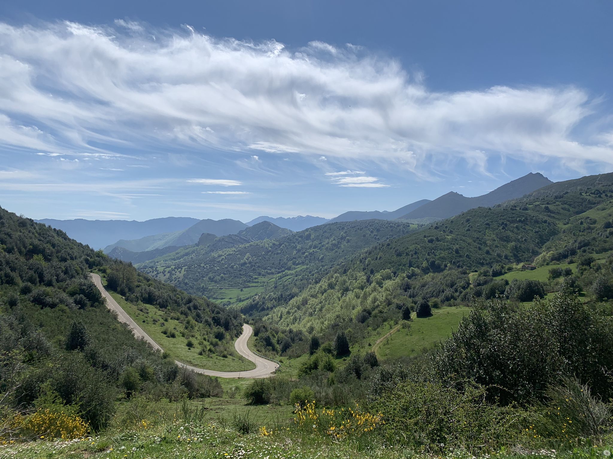
Puerto de Ventana is a mountain pass located in the Cantabrian Mountains, between the Principality of Asturias and the province of León. It lies at an altitude of 1,587 meters and connects the municipality of San Emiliano in León with the Asturian municipality of Teverga. From the pass, you can enjoy a breathtaking view of the San Emiliano Valley, known as Babia de Yuso.
2
0

Beautiful port with very very hard climbs on both sides.
1
0
Beautiful, impressive environment.
1
0
Impressive views, both for Leonese lands and Asturian lands. The climbs on both slopes are very difficult, but spectacular, and are worth it.
0
0
A Portal to another dimension, Get off the bike and give yourself 20 minutes!
1
0

Also known as Black Lake, you are facing the deepest lake in Asturias, as it can reach up to 9 meters deep. In the same valley of Lake Cerveriz, it is the basin of natural origin with the highest flow in this region.
1
0
Frequently Asked Questions
How many hiking trails are available in Reserva de la Biosfera de Babia?
There are over 45 hiking trails in Reserva de la Biosfera de Babia. These include a variety of options, with 2 easy routes, 29 moderate routes, and 15 difficult routes, catering to different experience levels.
What kind of landscapes can I expect to see while hiking in Reserva de la Biosfera de Babia?
Hikers in Reserva de la Biosfera de Babia will encounter dramatic mountainous terrain with peaks often exceeding 2,000 meters, such as Peña Ubiña and Peña Orniz. The landscape also features spectacular glacial formations, chasms, gorges, and glacial lakes like Las Verdes Lagoon and Lake Chao. Additionally, you'll find vast river valleys and meadows, particularly in the central part where the Sil River flows.
Are there any circular hiking routes in Reserva de la Biosfera de Babia?
Yes, there are circular routes available. For example, the Peña Chana y Laguna de las Verdes – circular desde Torre de Babia is a difficult 14.5 km path that offers views of glacial formations and leads to Laguna de las Verdes.
What are some notable natural attractions or landmarks to look out for on the trails?
The region is rich in natural landmarks. You can explore glacial lakes such as Las Verdes Lagoon near Torre de Babia, Laguna Grande, and Lake Chao in Riolago de Babia. Significant mountain passes like La Cubilla Pass and Ventana Pass offer impressive views. The source of the Sil River, at the base of Peña Orniz Summit, is another key natural feature.
What is the best time of year to go hiking in Reserva de la Biosfera de Babia?
The best time for hiking in Reserva de la Biosfera de Babia is generally from late spring to early autumn (May to October) when the weather is milder and trails are more accessible. During these months, you can fully appreciate the diverse flora and fauna, and the high mountain passes are typically clear of snow. Winter hiking is possible but requires specific gear and experience due to snow and ice conditions.
Are there any family-friendly hiking options in the reserve?
While many routes involve mountainous terrain, there are easier paths suitable for families. The reserve features river valleys and meadows at over 1,000 meters, which can offer less strenuous walks. Look for routes categorized as 'easy' or 'moderate' for suitable family outings.
What kind of wildlife can I expect to see while hiking?
Reserva de la Biosfera de Babia is home to a rich variety of wildlife. Keep an eye out for species such as the Cantabrian brown bear, wolf, roe deer, wild boar, and chamois. Birdwatchers might spot golden eagles, Egyptian vultures, and griffon vultures soaring above the peaks.
Are dogs allowed on the hiking trails in Reserva de la Biosfera de Babia?
Generally, dogs are allowed on trails in the reserve, but it's crucial to keep them under control, preferably on a leash, especially in areas with livestock or wildlife. As a Biosphere Reserve, protecting the natural environment and its inhabitants is a priority. Always check local signage for specific restrictions or protected areas.
Is public transport available to reach trailheads within the reserve?
Public transport options within the Reserva de la Biosfera de Babia are limited. It is generally recommended to use a car to access various villages and trailheads. Some local bus services might connect larger towns, but direct access to many hiking starting points often requires private transportation.
Are there any villages nearby where I can find services like cafes or accommodation?
Yes, the region has numerous villages that offer services. Towns like Riolago de Babia, Torre de Babia, and those within the municipalities of Cabrillanes and San Emiliano often provide accommodation, cafes, and restaurants. These villages also preserve traditional architecture, adding a cultural element to your visit.
What do other hikers say about their experience in Reserva de la Biosfera de Babia?
The hiking experience in Reserva de la Biosfera de Babia is highly rated by the komoot community, with an average score of 4.7 stars from over 200 reviews. Hikers often praise the stunning panoramic views from the high peaks, the unique glacial landscapes, and the sense of tranquility found in its diverse ecosystems.
Are there any permits required for hiking in Reserva de la Biosfera de Babia?
For general hiking on established trails within Reserva de la Biosfera de Babia, permits are typically not required. However, if you plan to engage in specific activities like climbing in certain protected zones or accessing private lands, it's advisable to check with local authorities or park management for any specific regulations.
Most popular routes around Reserva de la Biosfera de Babia
Most popular attractions around Reserva de la Biosfera de Babia

Get inspired with the komoot mobile app


Explore more
Browse the best Hikes in other regions.
