The best road cycling routes around Alamedilla
5.0
(3)
98
riders
12
rides
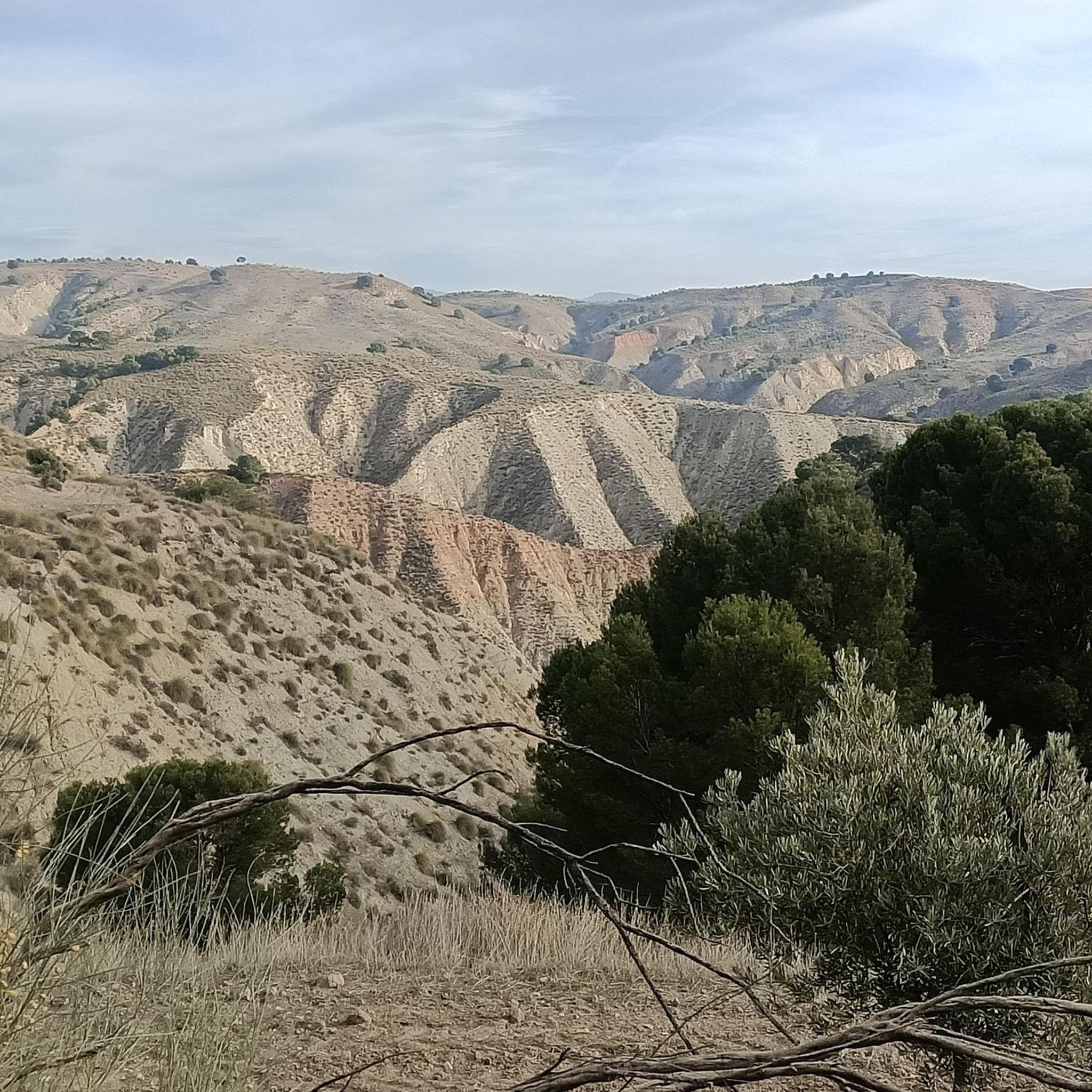
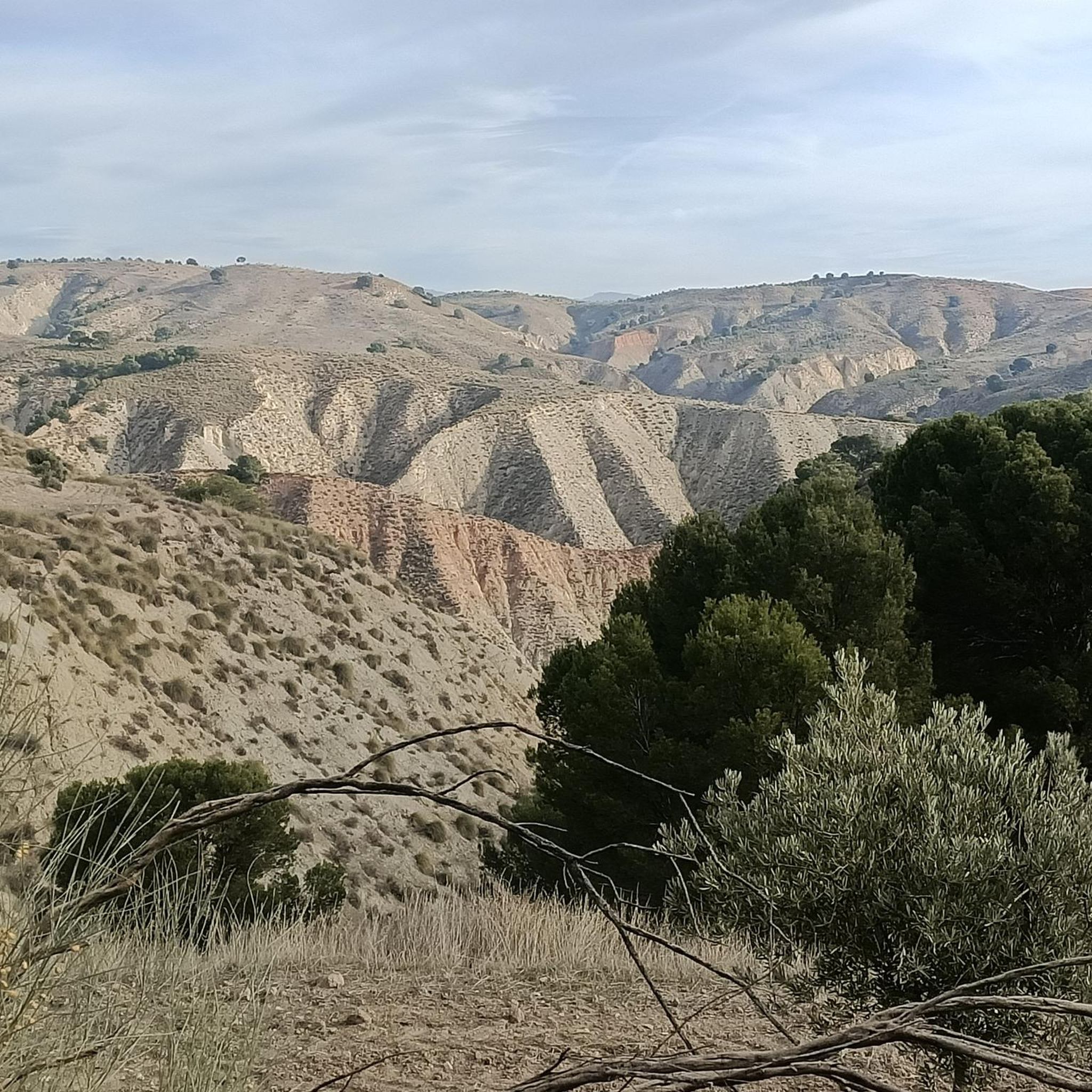
Road cycling routes around Alamedilla traverse a diverse landscape within the Geopark of Granada, characterized by the Guadahortuna riverbed and significant geological features. The region offers varied terrain, including areas with notable elevation changes such as the Piedra de la Solana, which rises to 1233 meters above sea level. Cyclists can encounter both natural formations and historical landmarks, including the impressive Puente del Hacho. These features contribute to a range of road cycling experiences.
Best road cycling routes around Alamedilla
…Last updated: July 10, 2026
5.0
(1)
8
riders
Hard road ride. Very good fitness required. Mostly well-paved surfaces and easy to ride.
6
riders
58.8km
02:15
810m
810m
Moderate 36.5-mile road cycling from Dehesas de Guadix through Granada Geopark's Badlands, Río Fardes, and Acequia del Toril.

Sign up for free
5.0
(1)
6
riders
79.2km
03:36
920m
920m
This difficult 49.2-mile road cycling route, Barranco del Enebro y Río de Guadahortuna, offers a challenging ride with 3019 feet of elevatio
21
riders
67.0km
03:13
660m
660m
Moderate road ride. Good fitness required. Some segments of this route may be unpaved and difficult to ride.
19
riders
108km
05:04
1,100m
1,100m
Hard road ride. Very good fitness required. Some segments of this route may be unpaved and difficult to ride.
Get access to more routes and recommendations from other explorers.
Sign up for free
Already have an account?
Our route recommendations are based on thousands of hikes, rides, and runs completed by other people on komoot.
Start today with a free account
Your next adventure awaits.
Login or Signup
Popular around Alamedilla
Tips from the Community

Guadix is an ancient city located in the heart of the province of Granada. Famous for its unique dwellings excavated in the rock, the so-called "cave houses", which house a significant part of its population, it offers a lunar landscape of chimneys and whitewashed facades emerging from the clayey terrain. Its imposing Renaissance cathedral and its Arab alcazaba are silent witnesses to the rich history that has marked this land since Roman times.
0
0

Overlooking the desert landscape of Guadix, Spain. Cerro de la Bala viewpoint, cave houses and dry hills.
7
0

Sights in the small town of Guadix include the cave dwelling district, the cathedral and the Moorish castle, which is closed due to extensive renovation work. The cave district Barrio de las Cuevas with its two viewpoints is worth a visit. From there you have a magnificent view of the snow-white facades of the entrances to the cave dwellings with their mushroom-shaped chimneys, of the city of Guadix with the Alcazaba and the surrounding hills and mountains.
1
0

Impressive road that passes by the Río Fardes and through this canyon that has been created by the same river that at times, even seems far away. It's worth getting there!
3
0

Special natural source that is many decades old and continues to grow due to natural lime deposits from the water.
2
0

The Acequia del Toril is a porous limestone aqueduct, more than 1.5 km long and more than 10 meters high at some points. Its natural construction over millennia has been used since prehistoric times to supply a settlement from one of the eight nearby hot springs. This meandering geological formation, with walls up to three meters thick, remains an impressive testament to natural engineering and human use of water.
4
0
Special natural phenomenon that goes back to the first people and beyond. An old calcareous spring that has been building itself for many thousands of years to the wall it has become today. At the top, the water still flows abundantly through the source. The water is still clearly visible on the road side, as the surrounding ground is even higher.
1
0

Perfect bar-restaurant to eat breakfast, lunch or dinner, really good prices and huge portions of food. They have from fried fish, to meat and sandwiches. A nice place to start and end your ride at Guadix
1
0
Frequently Asked Questions
What kind of terrain can I expect on road cycling routes around Alamedilla?
Road cycling routes around Alamedilla, particularly in the Granada Province, traverse a diverse landscape within the Geopark of Granada. You can expect varied terrain, including significant elevation changes, such as around the Piedra de la Solana, which rises to 1233 meters. The area features both natural formations and historical landmarks, offering a mix of challenging climbs and scenic stretches. Routes around Salamanca, on the other hand, often feature scenic agricultural areas and gentle gradients along the River Tormes, with generally well-paved surfaces.
Are there road cycling routes suitable for beginners or those looking for an easier ride?
While many routes in the Alamedilla area are classified as difficult, there are options for moderate ability levels. For example, the Dehesas de Guadix - Villanueva - Pedro Martínez Loop is a moderate 58.8 km path that provides a balanced ride through varied terrain. Another moderate option is the Mirador de la Magdalena – Cave Quarter, Guadix loop from Pedro Martínez, covering 67 km.
What are some notable landmarks or viewpoints I can see while cycling in Alamedilla?
The Alamedilla region offers several interesting landmarks and viewpoints. A prominent feature is the impressive Puente del Hacho, an iron bridge designed by Gustave Eiffel's studio and declared a national historic monument. You can also explore the unique geological formations of the Geopark of Granada, including the Winding Road Through Geoparque de Granada and the Travertine Spring Wall. Other points of interest include the Parish Church of Santa Ana and the Acequia del Toril.
Are there any circular road cycling routes available in Alamedilla?
Yes, several circular road cycling routes are available. A popular option is Surrounding the Rio Guadahortuna — circular via Alamedilla and Dehesas de Guadix, a difficult 79.9 km trail. Another local favorite is the Alamedilla and Puente del Hacho Loop, which is 79.2 km long and also classified as difficult.
What is the best time of year to go road cycling in Alamedilla?
Given Alamedilla's location in the Granada Province, which is part of the Geopark of Granada, the region generally experiences a Mediterranean climate. Spring and autumn typically offer the most pleasant temperatures for cycling, avoiding the intense heat of summer and the cooler, potentially wetter conditions of winter. These seasons provide ideal weather for tackling routes with significant elevation changes and enjoying the diverse landscapes.
What do other road cyclists say about their experience in Alamedilla?
The road cycling routes around Alamedilla are highly rated by the komoot community, with an average score of 5.0 stars from over 3 reviews. Cyclists often praise the varied terrain and the unique geological formations of the Geopark of Granada, as well as the presence of significant historical landmarks like the Puente del Hacho, which add to the riding experience.
Are there any routes with significant elevation gain for experienced cyclists?
Absolutely. The Alamedilla area, particularly in the Granada Province, is known for its challenging routes with considerable elevation gain. For instance, the Surrounding the Rio Guadahortuna — circular via Alamedilla and Dehesas de Guadix route features over 900 meters of ascent. Another demanding option is the Alamedilla and Puente del Hacho Loop, with over 900 meters of elevation gain. For the most challenging climbs, consider the Fardes River – Cave Quarter, Guadix loop from Alicún de Ortega, which boasts nearly 1100 meters of elevation gain over its 107.9 km.
Can I find places to rest or refuel along the road cycling routes?
While specific cafes or pubs directly on every route are not detailed, the region around Alamedilla in Granada Province is dotted with small towns and villages. These often provide opportunities for cyclists to find local establishments for refreshments. Similarly, routes originating near La Alamedilla in Salamanca would have access to amenities within and around the city.
What are the general distances of road cycling routes in Alamedilla?
The road cycling routes around Alamedilla vary in distance, catering to different preferences. You can find routes ranging from moderate distances of around 58 km, such as the Dehesas de Guadix - Villanueva - Pedro Martínez Loop, to longer and more challenging rides like the Surrounding the Rio Guadahortuna — circular via Alamedilla and Dehesas de Guadix at nearly 80 km. The longest route listed is the Fardes River – Cave Quarter, Guadix loop from Alicún de Ortega, which spans almost 108 km.
Are there any natural monuments or unique geological features to explore near the cycling paths?
Yes, the Alamedilla area is rich in natural monuments and unique geological features, being part of the Geopark of Granada. Cyclists can encounter highlights such as the Acequia del Toril, the Alicún de las Torres Thermal Springs, and the impressive Travertine Spring Wall. The entire region offers a unique 'cultural landscape of the desert' with diverse biological interest.
What are the general difficulty levels of road cycling routes in Alamedilla?
The road cycling routes around Alamedilla primarily cater to moderate and difficult ability levels. There are approximately 4 moderate routes and 8 difficult routes available. This means cyclists can find options for a challenging workout or a more balanced ride, but there are no routes specifically classified as easy.
Most popular routes around Alamedilla
Most popular attractions around Alamedilla

Get inspired with the komoot mobile app


Explore more
Browse the best Road cycling routes in other regions.
