The best walks and hikes around La Granada De Río-Tinto
3.9
(69)
253
hikers
22
hikes
Hiking around La Granada De Río-Tinto offers varied terrain within the Huelva province, characterized by rolling hills and the historical Río Tinto river basin. The landscape features extensive Mediterranean vegetation, including holm oaks, cork oaks, pine, and eucalyptus trees. Hikers can expect trails that navigate through natural areas, sometimes revealing views of the unique reddish-hued river, a phenomenon caused by mineral deposits. The region's geology, including its historic mining district, contributes to its distinct appearance, making it a notable destination…
Last updated: July 4, 2026
4.4
(12)
37
hikers
9.46km
02:36
150m
150m
Moderate hike. Good fitness required. Easily-accessible paths. Suitable for all skill levels.
4.5
(8)
34
hikers
4.99km
01:27
140m
140m
Easy hike. Great for any fitness level. Easily-accessible paths. Suitable for all skill levels.

Sign up for free
1.0
(1)
7
hikers
14.5km
04:04
290m
290m
Moderate hike. Good fitness required. Easily-accessible paths. Suitable for all skill levels.
5.0
(3)
9
hikers
Easy hike. Great for any fitness level. Easily-accessible paths. Suitable for all skill levels.
4.0
(2)
6
hikers
Moderate hike. Good fitness required. Easily-accessible paths. Suitable for all skill levels.
Get access to more routes and recommendations from other explorers.
Sign up for free
Already have an account?
Our route recommendations are based on thousands of hikes, rides, and runs completed by other people on komoot.
Start today with a free account
Your next adventure awaits.
Login or Signup
Tips from the Community

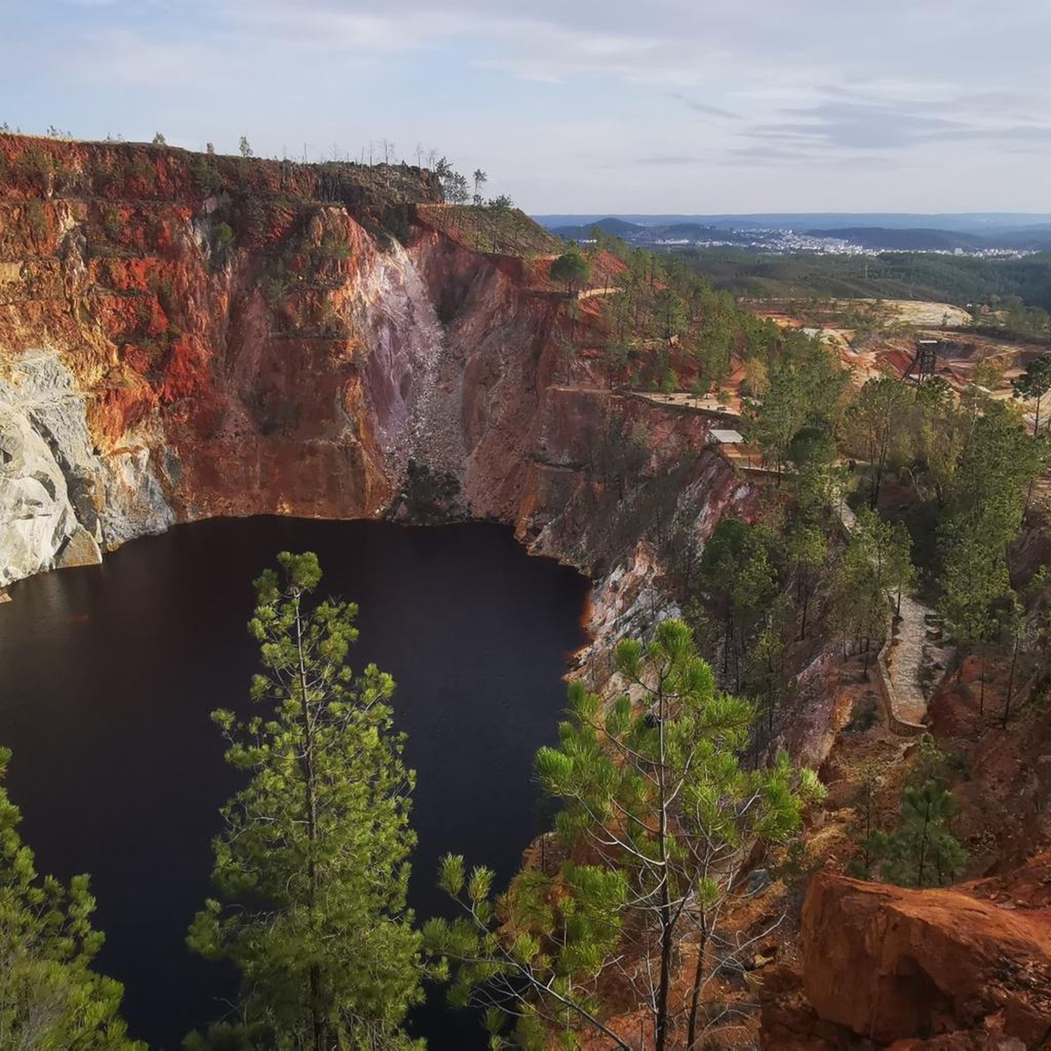
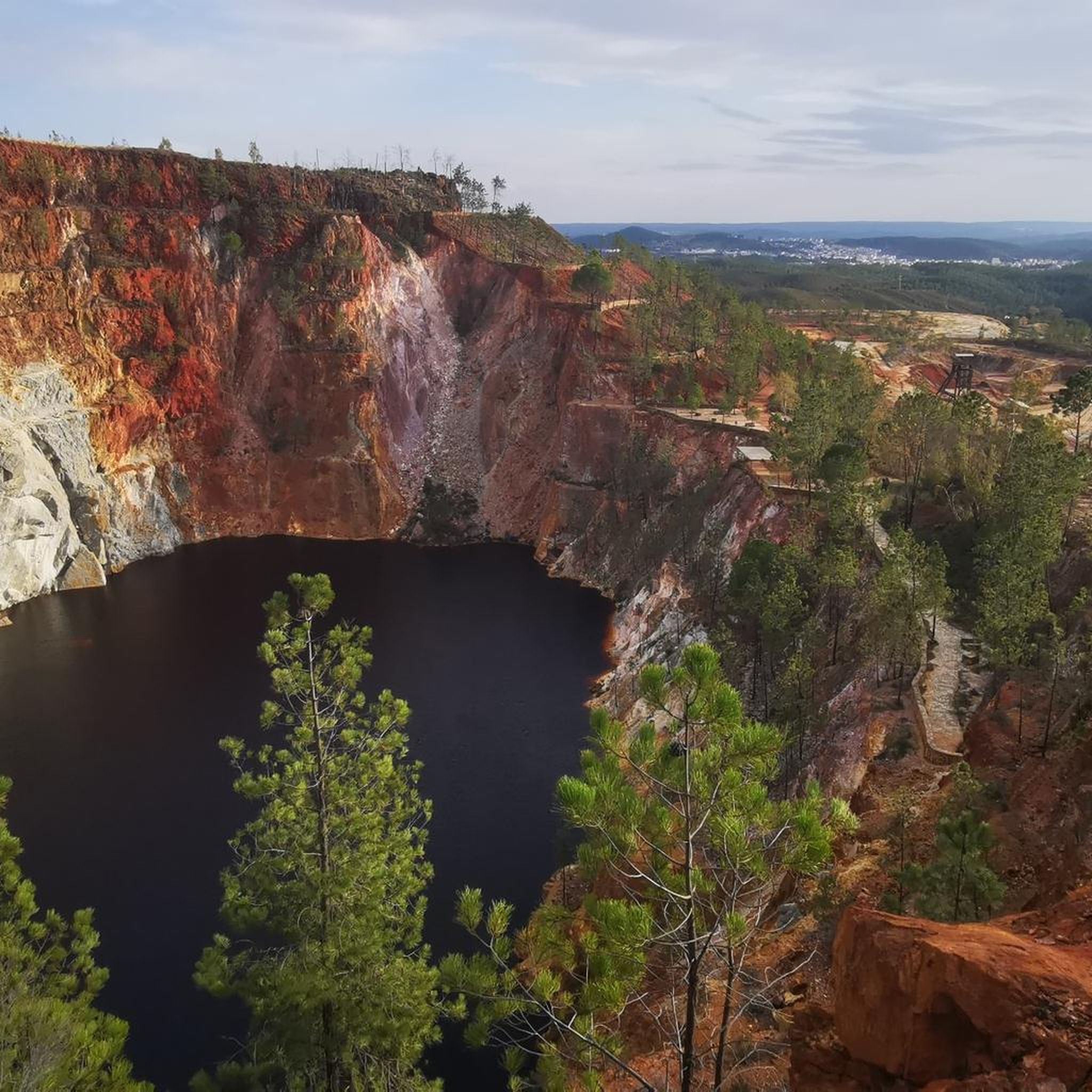
The Peña del Hierro Viewpoint, located in Nerva (Huelva), is part of the Riotinto Mining Park and offers one of the most impressive views of the source of the Tinto River, as well as the mining crater of the old pyrite mine.
1
0
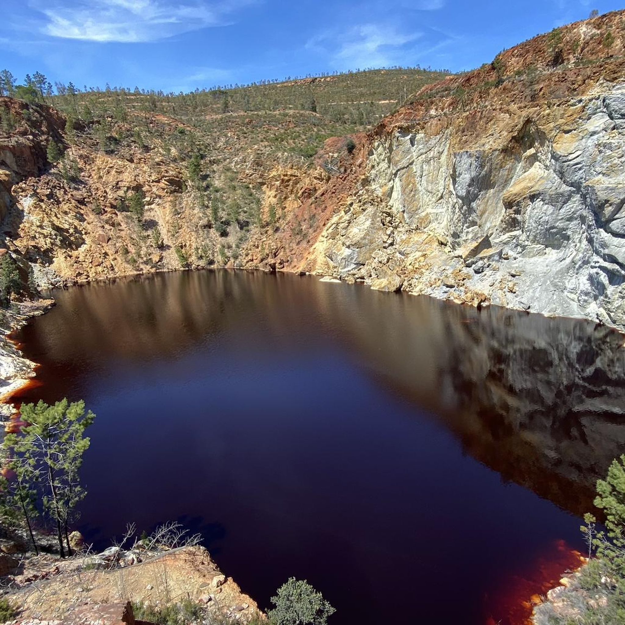
The source of the Tinto River is located in the municipality of Nerva, in the province of Huelva, Andalusia, and is one of the most unique landscapes in Europe due to its reddish color and its scientific and geological value.
1
0
The Hermitage of Santa Bárbara is located at the top of the Sierra de Santa Bárbara, in Higuera de la Sierra. Although the hermitage is unfinished, it has become one of the best viewing points for contemplating the town and its surroundings.
2
0
The Hermitage of Santa Bárbara is located at the top of the Sierra de Santa Bárbara, in Higuera de la Sierra. Although the hermitage is unfinished, it has become one of the best viewing points for contemplating the town and its surroundings.
2
0

The Church of San Sebastián was built on the old hermitage of San Sebastián. It was completed in 1746 and features beautiful altarpieces that were built at the same time as the church was built. It is located in front of the town hall.
1
0
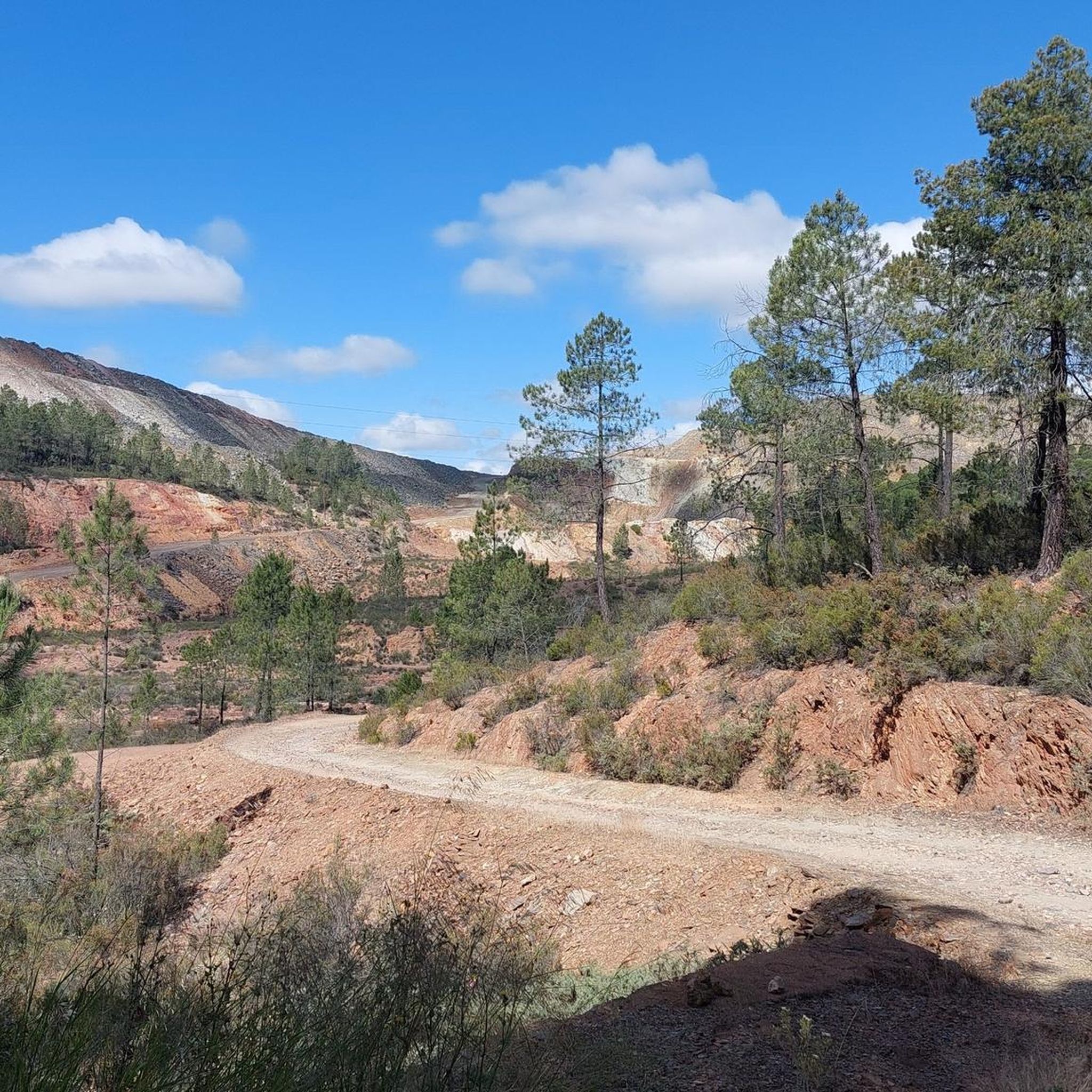
An approximately 3 kilometer long circular route leads around the natural monument Montera de Gossan. Don't miss it because of the beautiful views.
0
0

Of course the views are curious, a little sad but curious.
2
0

Also known as the Padre Caro mountain range, it indicates the source of the Río Tinto which runs through the interior of Huelva for about 100 km until it reaches the Odiel River. Its name is due to the reddish color of its waters, caused by the weathering of minerals with a high content of heavy metal sulfides that were found and exploited in various deposits along the riverbed.
0
0
Frequently Asked Questions
How many hiking trails are available in La Granada De Río-Tinto?
There are over 20 hiking trails in La Granada De Río-Tinto, offering a variety of options for different skill levels. This includes 7 easy routes, 12 moderate routes, and 1 more challenging trail.
What kind of terrain can I expect on hikes around La Granada De Río-Tinto?
The terrain around La Granada De Río-Tinto is characterized by rolling hills, Mediterranean scrub, and pine forests. You'll find trails that navigate through natural areas, sometimes revealing views of the unique reddish-hued Río Tinto river basin, which is a defining feature of the region's geology.
Are there easy hikes suitable for beginners in La Granada De Río-Tinto?
Yes, La Granada De Río-Tinto offers several easy hikes perfect for beginners. There are 7 routes specifically categorized as easy, providing gentle paths through local woodlands and open fields, ideal for a relaxed outdoor experience.
Are there family-friendly hiking options in La Granada De Río-Tinto?
Many of the easier trails in La Granada De Río-Tinto are suitable for families. These routes typically follow gentle paths and offer a pleasant way to explore the natural surroundings together without significant challenges. Look for routes marked as 'easy' for the best family experience.
Can I bring my dog on the hiking trails in La Granada De Río-Tinto?
Generally, dogs are welcome on many hiking trails in La Granada De Río-Tinto. However, it's always recommended to keep them on a leash, especially in areas with wildlife or near livestock, and to check for any specific local regulations or protected areas that might have restrictions.
What interesting sights or landmarks can I see near the hiking trails?
The region around La Granada De Río-Tinto is rich in unique sights. You can explore the fascinating Grotto of the Marvels, witness the distinctive Source of the Río Tinto, or visit the impressive Corta Atalaya Mine. The Aracena Castle also offers panoramic views.
Are there any circular hiking routes in La Granada De Río-Tinto?
Yes, you can find several circular hiking routes in La Granada De Río-Tinto. These routes are popular as they allow you to start and end your hike at the same point, offering a convenient way to explore the diverse landscapes without retracing your steps.
What is the best time of year to go hiking in La Granada De Río-Tinto?
The best time to hike in La Granada De Río-Tinto is typically during the spring (March to May) and autumn (September to November). During these seasons, the weather is milder and more pleasant, avoiding the intense heat of summer and the cooler, sometimes wetter, conditions of winter.
Is there wildlife to observe while hiking in La Granada De Río-Tinto?
The diverse Mediterranean landscape of La Granada De Río-Tinto provides habitats for various wildlife. While hiking, you might spot birds of prey, small mammals, and a variety of insects and reptiles. Early mornings or late afternoons are often the best times for wildlife observation.
Where can I find parking for hiking trails in La Granada De Río-Tinto?
Parking for hiking trails in La Granada De Río-Tinto is generally available in or near the main village and at common trailheads. It's advisable to check specific route descriptions or local signage for designated parking areas before you set out.
What should I wear or bring for hiking in this region?
For hiking in La Granada De Río-Tinto, wear comfortable, layered clothing suitable for the season, sturdy hiking shoes, and bring plenty of water, especially during warmer months. Sun protection (hat, sunscreen) is also recommended, along with a map or GPS device.
What do other hikers enjoy most about the trails in La Granada De Río-Tinto?
The hiking trails in La Granada De Río-Tinto are highly rated by the komoot community, with an average score of 3.9 stars from over 60 reviews. Hikers often praise the varied terrain, the unique reddish hues of the Río Tinto landscape, and the peaceful atmosphere of the Mediterranean scrub and pine forests.
Most popular routes around La Granada De Río-Tinto
Most popular attractions around La Granada De Río-Tinto

Get inspired with the komoot mobile app


Explore more
Browse the best Hikes in other regions.
