The best MTB trails around Torrevelilla
4.5
(6)
103
riders
25
rides
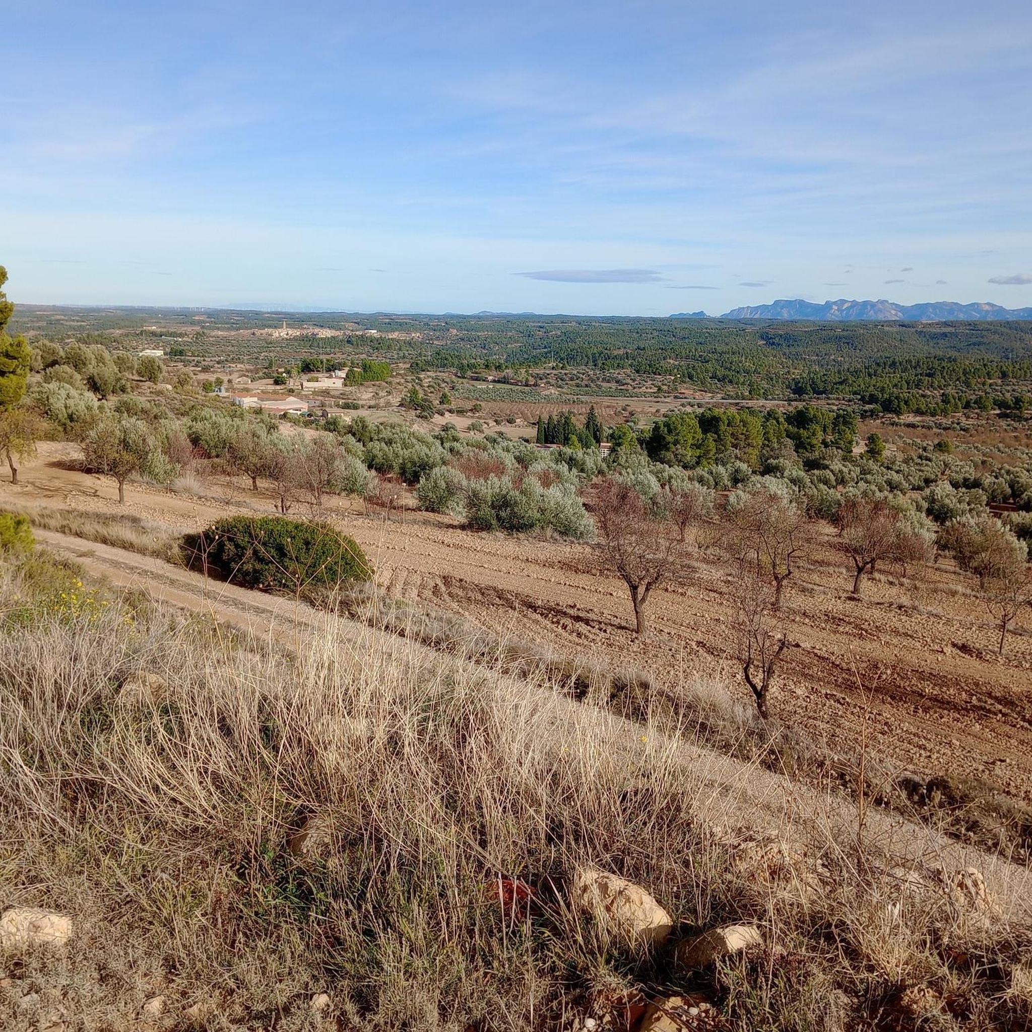
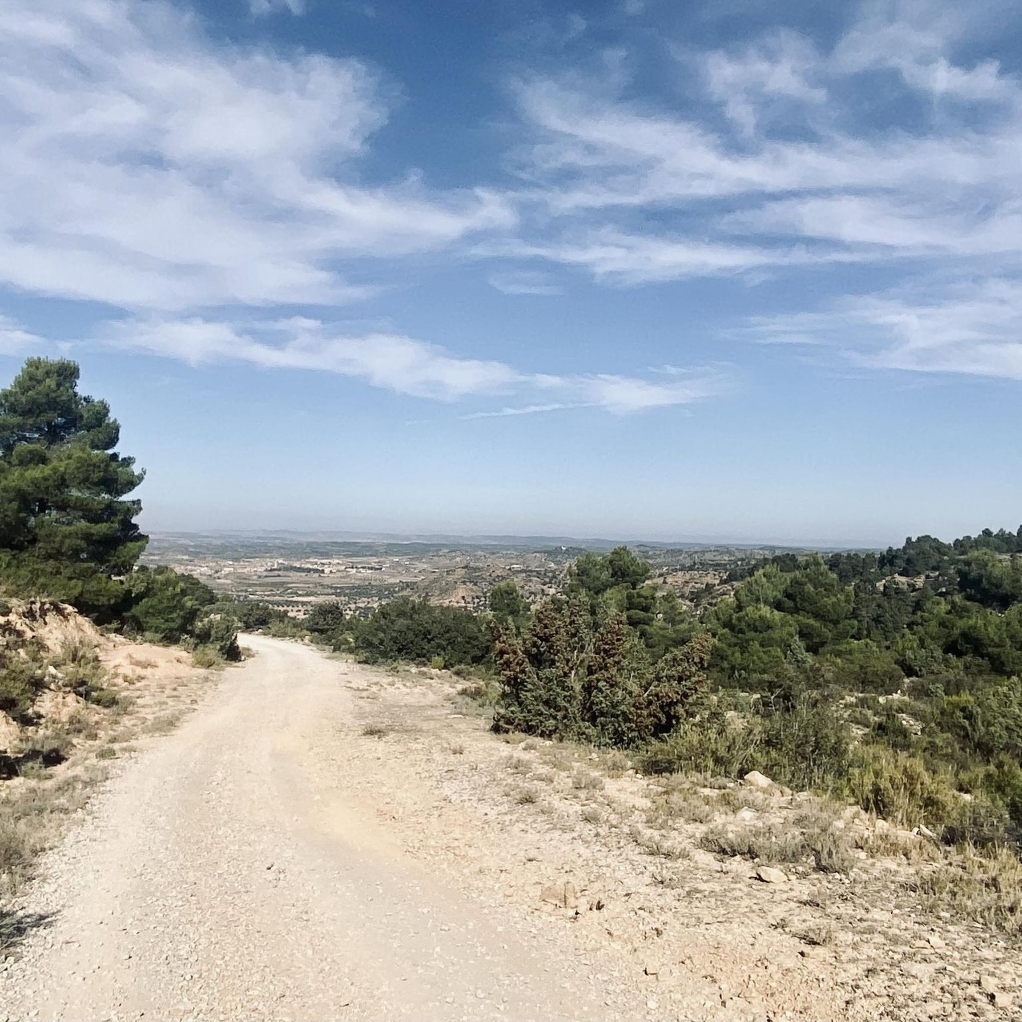
Mountain biking around Torrevelilla offers diverse natural landscapes, situated in Spain's Bajo Aragón region between the Guadalope and Mezquín river basins. The terrain ranges from higher elevations with dense pine and oak forests, part of the Sierra de La Ginebrosa, to lower, flatter areas characterized by extensive agricultural lands including cereal, olive, and almond groves. This variety provides different riding experiences, from scenic routes along riparian ecosystems to trails with panoramic views from viewpoints like the Pilón de Torrevelilla.
Best…
Last updated: July 1, 2026
3.5
(2)
15
riders
47.0km
02:56
300m
310m
Moderate mountain bike ride. Good fitness required. Suitable for all skill levels.
10
riders
44.3km
04:32
1,010m
1,020m
Hard mountain bike ride. Very good fitness required. Suitable for all skill levels.

Sign up for free
5.0
(1)
5
riders
33.4km
03:12
630m
630m
Moderate mountain bike ride. Good fitness required. Suitable for all skill levels.
7
riders
17.7km
01:51
490m
490m
Moderate mountain bike ride. Good fitness required. Suitable for all skill levels.
4.0
(1)
6
riders
48.1km
04:22
780m
780m
Moderate mountain bike ride. Good fitness required. Suitable for all skill levels.
Get access to more routes and recommendations from other explorers.
Sign up for free
Already have an account?
Our route recommendations are based on thousands of hikes, rides, and runs completed by other people on komoot.
Start today with a free account
Your next adventure awaits.
Login or Signup


Tips from the Community

I didn't take any photos, because once you get in, you don't know how to stop, it's so much fun...
0
0
S3.- A very fun trail, avoiding terraces, banked curves, slides, jumps...very fast and clean
0
0
S2-3.-Progress along a clean path, almost along the crest of the mountain range, passing by parapets from the civil war. Thanks to Josep, among others, for recovering this area. It is fast and very enjoyable, with stretches of flow, rock garden, bedrock... and so we reach the final part, a stretch of cobbled path, very pretty, with easy steps.
0
0

One of the overwhelming corners of this wooded Sierra.
0
0
Magnificent hostel and restaurant run by Norma and her husband with exceptional treatment and care for clients.
0
0

The Calatravos castle is today a national tourist stop. Its oldest part dates back to the 13th century, although the cloister and palace date from the 14th century. The outer wall was renovated in the 19th century.
0
0

Seems to be officially closed but someone was so friendly to break the gate…
1
0

Close to the town of Alcañíz we find what is called the Desierto de Calanda, to the south of the aforementioned town. Between these two towns there is this set of fields and barren spaces where it has a resemblance to a desert, without high vegetation and almost infinite horizons.
0
0
Frequently Asked Questions
How many mountain bike trails are there around Torrevelilla?
There are over 15 mountain bike trails around Torrevelilla, offering a range of experiences from moderate to difficult. The region's diverse landscapes, from river basins to pine and oak forests, provide varied terrain for mountain bikers.
What is the best time of year for mountain biking in Torrevelilla?
The Teruel province, where Torrevelilla is located, generally offers good conditions for mountain biking for much of the year. Spring and autumn are often ideal, with pleasant temperatures and lush landscapes. Summers can be hot, especially in lower agricultural areas, while higher elevations might offer cooler rides. Winters are generally mild but can see colder temperatures in the Sierra de La Ginebrosa.
Are there any family-friendly mountain bike routes in Torrevelilla?
While the guide primarily features moderate and difficult routes, the region's varied terrain includes flatter agricultural lands and conditioned trails along the Mezquín River that could be suitable for families. For specific family-friendly options, it's best to check individual route details for elevation and technical difficulty.
Can I bring my dog on the mountain bike trails around Torrevelilla?
Many natural areas in Spain, including those around Torrevelilla, are generally dog-friendly, especially on trails. However, it's always recommended to keep dogs on a leash, particularly in areas with wildlife or livestock, and to check local regulations for specific trails or protected areas like the LIC Río Mezquín y Oscuros. Always ensure your dog is well-behaved and that you carry water for them.
Are there any circular mountain bike routes available?
Yes, many of the routes around Torrevelilla are designed as loops. For example, the Alcañiz – Estanca de Alcañiz loop from Castelserás is a popular circular route navigating through agricultural landscapes. Another option is the Mountainbike loop from La Cañada de Verich, which offers a mix of forest and open terrain.
What kind of terrain can I expect on the mountain bike trails?
The terrain around Torrevelilla is highly varied. You'll encounter dense pine and oak forests in higher elevations like the Sierra de La Ginebrosa, extensive agricultural lands with cereal, olive, and almond groves in flatter areas, and riparian forests along the Mezquín River. Routes can range from smooth paths to more challenging sections with elevation changes, characteristic of the Bajo Aragón region.
What natural features or viewpoints can I see while mountain biking?
The region offers several scenic spots. The Pilón de Torrevelilla, at 890 meters high, provides magnificent panoramic views of the surrounding pine and oak forests. The Mezquín River basin features valuable riparian ecosystems. You might also encounter the Equinox Tunnel or the historical Desert Convent of Calanda on some routes.
Where can I find parking for mountain biking in Torrevelilla?
While specific parking areas for individual trailheads in Torrevelilla are not detailed, towns in the region, such as Alcañiz, Castelserás, or Belmonte de San José, typically offer public parking facilities. It's advisable to check local town centers or the starting points of specific routes for convenient parking options.
Are there any difficult mountain bike trails for experienced riders?
Yes, Torrevelilla offers routes suitable for experienced riders. For instance, the Plaça Major de Fornols – Hostal Villa de Cerollera loop from Fórnoles is classified as difficult, featuring significant elevation gain and challenging terrain over its 53 km distance. Overall, the guide includes 2 difficult routes out of 17 total.
What do other mountain bikers enjoy most about mountain biking in Torrevelilla?
The area is highly rated by the komoot community, with an average score of 4.7 stars. Reviewers often praise the diverse natural landscapes, the mix of forest sections and open terrain, and the opportunity to explore both historical areas and natural environments. The variety of routes, from river basins to pine-covered mountainsides, is also a frequently highlighted aspect.
Are there any routes that pass through historical areas?
Yes, some routes integrate historical elements into the natural landscape. The Hostal Villa de Cerollera – Trenches Trail loop from Belmonte de San José / Bellmunt de Mesquí, for example, leads through historical areas and natural landscapes, offering a blend of cultural and outdoor experiences.
What is the longest mountain bike route listed in this guide?
The longest route featured in this guide is the Plaça Major de Fornols – Hostal Villa de Cerollera loop from Fórnoles, which covers a distance of approximately 53 kilometers (32.9 miles) and is classified as difficult.
Most popular attractions around Torrevelilla

Get inspired with the komoot mobile app


Explore more
Browse the best MTB trails in other regions.
