The best running trails around Humilladero
82
runners
6
runs
Jogging around Humilladero offers diverse natural landscapes, from the foothills of the Sierra de Humilladero to tranquil agricultural areas. The region is characterized by olive groves, cereal fields, and the proximity to significant natural reserves like Laguna de la Ratosa and Fuente de Piedra Lagoon. These natural features provide varied terrain, including gentle rural paths and more challenging routes with elevation in the Sierra. The area's network of routes allows for exploration of its peaceful and open environment.
Best jogging…
Last updated: October 14, 2026
15.8km
02:00
320m
320m
Hard run. Very good fitness required. Mostly paved surfaces. Suitable for all skill levels.
47
runners
4.99km
00:33
50m
50m
Easy run. Great for any fitness level. Mostly paved surfaces. Suitable for all skill levels.

22
runners
10.3km
01:08
230m
230m
Moderate run. Good fitness required. Mostly paved surfaces. Suitable for all skill levels.
3
runners
Moderate run. Good fitness required. Mostly paved surfaces. Suitable for all skill levels.
5
runners
4.79km
00:35
10m
10m
Easy run. Great for any fitness level. Mostly paved surfaces. Suitable for all skill levels.
Our route recommendations are based on thousands of hikes, rides, and runs completed by other people on komoot.
Start today with a free account
Your next adventure awaits.
Tips from the Community

Fuente de Piedra is a charming village whose name derives from an ancient spring believed to possess healing powers. The area was already settled in Roman times, and the spring was then referred to as "Fons Divinus." In the Middle Ages, a small settlement grew up around the spring, which later acquired its present name. During the 18th and 19th centuries, Fuente de Piedra was a renowned spa town thanks to its mineral waters, until the spring dried up. Today, the village's name evokes this past, while its history remains closely intertwined with the use and veneration of the water.
1
0
The Laguna de Fuente de Piedra is the largest natural lagoon in Andalusia and an important wetland in the northwest of the province of Málaga. It is best known for its large colony of greater flamingos, which nest here in spring and provide one of the region's most impressive natural spectacles. The shallow salt lagoon also attracts nearly 200 species of birds and is an important resting place for migratory birds. Surrounded by salt marshes, reed beds, and Mediterranean vegetation, the area offers ideal conditions for wildlife. A visitor center provides information about the flora and fauna, while birdwatching platforms and guided tours offer nature lovers exciting insights. The lagoon is an ideal spot for nature photography amidst a fascinating landscape. The Laguna de Fuente de Piedra is also an ideal destination for cyclists who want to combine nature experiences with physical activity. The area offers a variety of cycling routes of varying difficulty levels, leading through the picturesque landscape and along the largest natural lagoon in Andalusia. The “José Antonio Valverde” visitor center serves as a good starting point for cycling tours and offers information about the flora and fauna of the region.
4
0


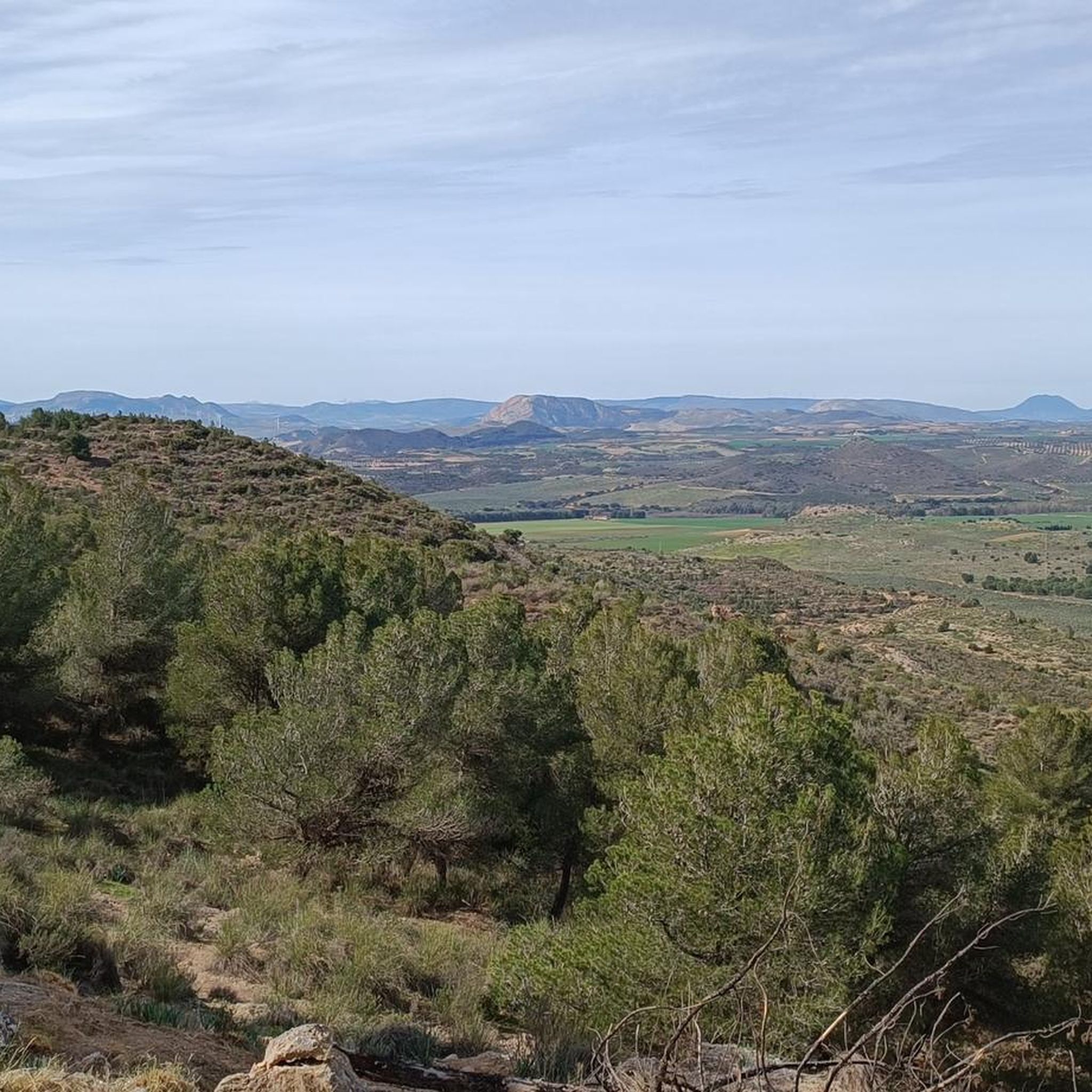
The Cerro del Palo Viewpoint is located in the northeast of the Fuente de Piedra Lagoon, one of the largest saline-lagoon complexes on the Iberian Peninsula. This lagoon, with 1,365 hectares, constitutes the base level and natural drainage of an endorheic basin (closed depression) of 153 km². Its morphology of shallow waters, exposure to the wind and marked seasonal character, conditioned by rainfall, make it a unique place.
1
0
The Fuente de Piedra Lagoon is a wetland located in the Antequera region, in the municipality of Fuente de Piedra, in Spain. It is the largest salt lagoon in Andalusia, 6.5 km long (northeast-southwest) and 2.5 km wide (northwest-southeast). Together with the Gallocanta lagoon, it represents one of the two large lagoons remaining on the Iberian Peninsula. It constitutes the most important enclave where the common flamingo breeds regularly, with the Fuente de Piedra nesting colony, along with the one in the Camargue, being the most relevant in the Western Mediterranean and Northwest Africa.
2
0

It is the largest salt lagoon on the Iberian Peninsula. It has a large population of flamingos, being one of the most important in Spain. It is an ideal place to observe these curious birds, as well as other migratory species.
0
0

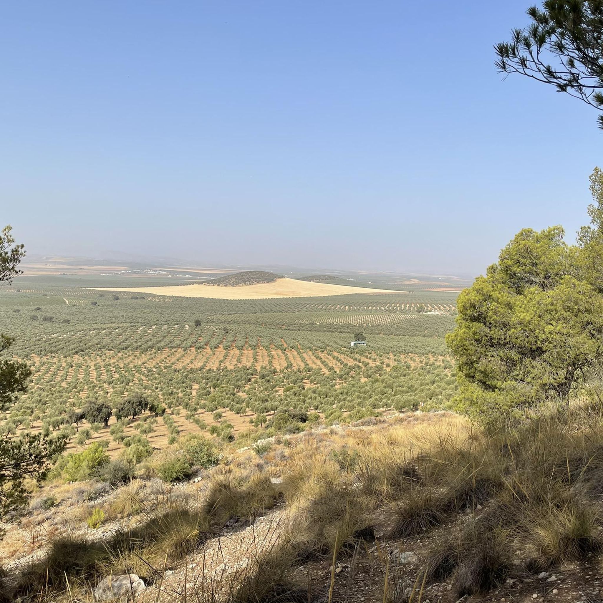
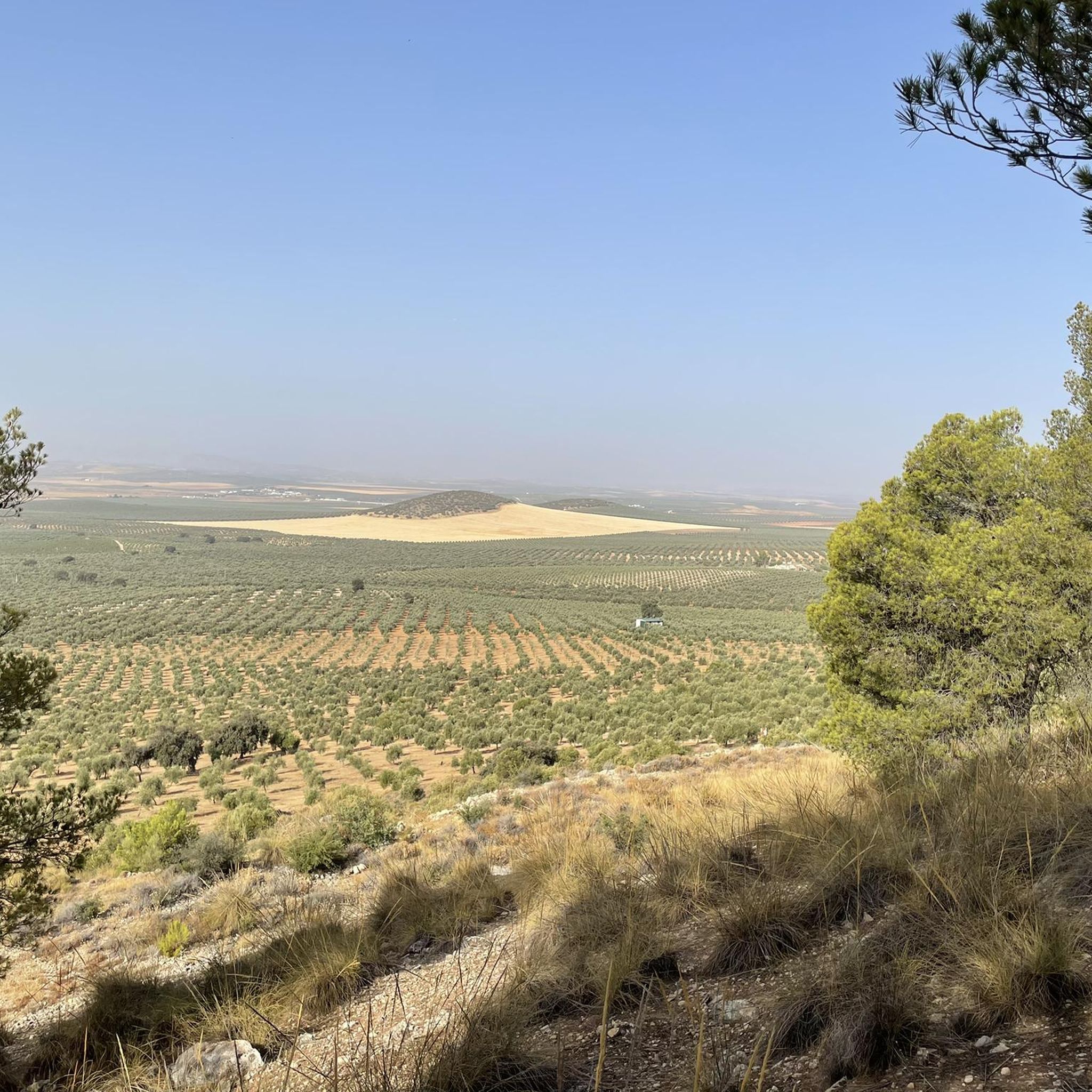
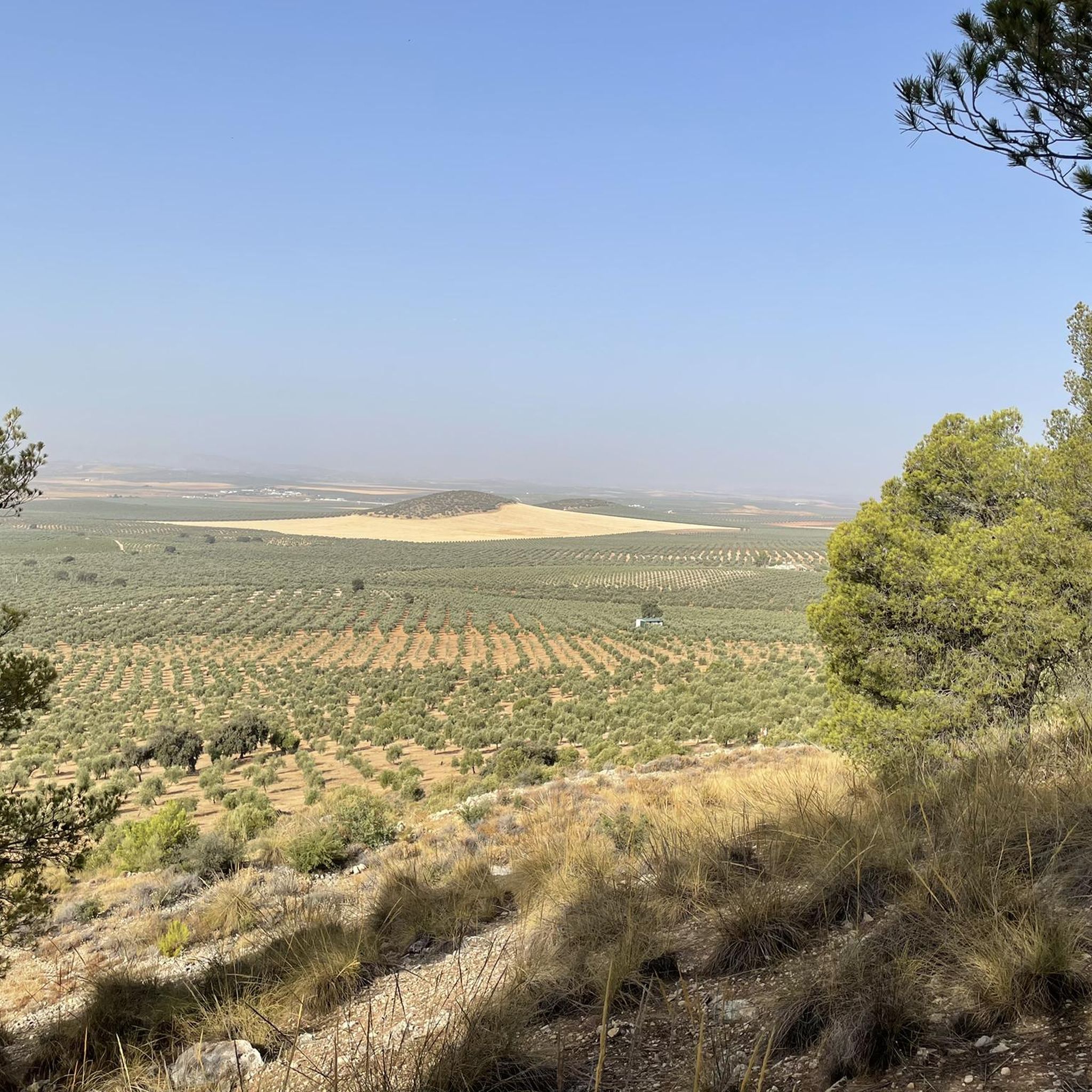
Beautiful valley through which the Río Genil runs and which offers a wide view of this area that is above the arrival of the reservoir.
0
0
In one of the gorges in this area of the Embalse de Malpasillo Natural Park we find views of Cerro del Pinar, on the other side of the Río Genil.
0
0
Frequently Asked Questions
What kind of terrain can I expect on running routes around Humilladero?
Running routes around Humilladero offer a diverse mix of terrain. You'll find paths through tranquil agricultural areas, predominantly olive groves and cereal fields, which are generally flat. For more challenging runs, the foothills of the Sierra de Humilladero provide routes with significant elevation changes and mountain trails. The area also features serene landscapes around lagoons like Fuente de Piedra Lagoon and La Ratosa Lagoon, offering a mix of well-maintained roads and natural paths.
Are there any easy running routes suitable for beginners in Humilladero?
Yes, Humilladero offers easy running paths perfect for beginners or those looking for a relaxed jog. For instance, the Running loop from Humilladero is an easy 4.7 km (2.9 miles) route with minimal elevation gain, making it a great option to start exploring the area's natural beauty.
What are some longer running trails in the Humilladero area?
For those seeking a longer challenge, the Genil River Valley Loop from Corcoya is a difficult 15.8 km (9.8 miles) route that offers a substantial workout through varied terrain. Another good option for a longer run is the Running loop from Vertedero de Residuos tóxicos, a moderate 11.8 km (7.3 miles) path.
What natural features or landmarks can I see while jogging around Humilladero?
Jogging around Humilladero allows you to experience several notable natural features and landmarks. You can run near the vast Fuente de Piedra Lagoon, famous for its flamingos, or the serene La Ratosa Lagoon. The Sierra de Humilladero provides panoramic views from peaks like Pico Pollo and El Puntal. You might also encounter the Arroyo del Pontón gorge or historical religious buildings like the Hermitage of Our Lady of Fuensanta.
Are there any family-friendly running routes in Humilladero?
While specific 'family-friendly' designations aren't always available, routes with lower difficulty and shorter distances are generally suitable. The Running loop from Humilladero, an easy 4.7 km (2.9 miles) route, would be a good choice for families looking for a gentle run or walk together. The agricultural landscapes also offer peaceful, open environments away from heavy traffic.
What is the best time of year to go running in Humilladero?
The best time to go running in Humilladero is generally during the spring (March to June) and autumn months. Spring offers pleasant temperatures and the chance to see flamingos at Fuente de Piedra Lagoon. Autumn provides cooler weather ideal for longer runs. Summers can be very hot, so early morning or late evening runs are advisable, while winters are mild but can be damp.
Are there circular running routes available in Humilladero?
Yes, many of the running routes in Humilladero are designed as loops, offering a convenient way to start and finish in the same location. Examples include the Genil River Valley Loop from Corcoya, the Running loop from Vertedero de Residuos tóxicos, and the Running loop from Mollina, all of which are circular.
What do other runners say about the running trails in Humilladero?
The running trails in Humilladero are highly regarded by the komoot community, with an average score of 5.0 stars from reviews. Runners often praise the diverse natural landscapes, from the peaceful olive groves to the more challenging mountain foothills, and the opportunities to explore significant natural reserves like the lagoons.
Are there any running routes that offer panoramic views?
Absolutely. For panoramic views, consider routes that venture into the Sierra de Humilladero. From peaks like Pico Pollo (628 meters) and El Puntal (680 meters), you can enjoy breathtaking vistas of the Fuente de Piedra Lagoon Natural Reserve and the Vega de Antequera. The recreational area of 'La Sierrecilla' also offers great vantage points.
How many running routes are available around Humilladero?
There are several dedicated running routes around Humilladero, with komoot featuring at least 5 distinct trails. These range in difficulty and length, providing options for various fitness levels and preferences.
Are there dog-friendly running routes in Humilladero?
While specific regulations for dogs on trails can vary, many of the rural paths and agricultural tracks around Humilladero are generally suitable for running with dogs, provided they are kept under control. Always ensure to respect local wildlife, especially around natural reserves like the lagoons, and clean up after your pet.
Are there running routes accessible by public transport in Humilladero?
Humilladero is a small town, and while local buses connect it to larger towns, direct public transport access to specific trailheads might be limited. It's advisable to check local bus schedules to Humilladero itself, and then plan your run from the town center or a short walk to a nearby route. Many routes, like the Running loop from Humilladero, start directly from the town.
Where can I find parking for running trails in Humilladero?
For routes starting directly from Humilladero, you can typically find street parking within the town. For routes that begin outside the main town, such as those leading to the lagoons or into the Sierra, there are often small parking areas or roadside spots available near trailheads. It's always a good idea to check the specific route details on komoot for recommended starting points and parking information.
Most popular routes around Humilladero
Most popular attractions around Humilladero

Get inspired with the komoot mobile app


Explore more
Browse the best Running Trails & Routes in other regions.
