The best road cycling routes around Esparragosa De Lares
25
riders
7
rides
Road cycling routes around Esparragosa De Lares are set within Extremadura's Siberia region, a designated Biosphere Reserve. The terrain features a mix of flatlands and undulating sections, bordered by mountain ranges. Cyclists encounter expansive reservoirs like Embalse de La Serena and Embalse del Zújar, alongside distinctive geological formations such as Cerro Masatrigo. The area offers varied topography suitable for diverse cycling experiences.
Best road cycling routes around Esparragosa De Lares
- The most popular road cycling route is Orellana la Vieja…
Last updated: May 20, 2026
120km
05:43
1,430m
1,430m
This difficult 74.8-mile road cycling route climbs to the Castle of Puebla de Alcocer, offering panoramic views over the Embalse de Orellana
9
riders
81.9km
04:03
1,170m
1,170m
Hard road ride. Very good fitness required. Some segments of this route may be unpaved and difficult to ride.

Sign up for free
7
riders
Moderate road ride. Good fitness required. Some segments of this route may be unpaved and difficult to ride.
3
riders
71.5km
03:19
780m
790m
Moderate road ride. Good fitness required. Some segments of this route may be unpaved and difficult to ride.
2
riders
85.5km
03:50
850m
850m
Moderate road ride. Good fitness required. Mostly well-paved surfaces and easy to ride.
Get access to more routes and recommendations from other explorers.
Sign up for free
Already have an account?
Our route recommendations are based on thousands of hikes, rides, and runs completed by other people on komoot.
Start today with a free account
Your next adventure awaits.
Login or Signup
Popular around Esparragosa De Lares
Tips from the Community

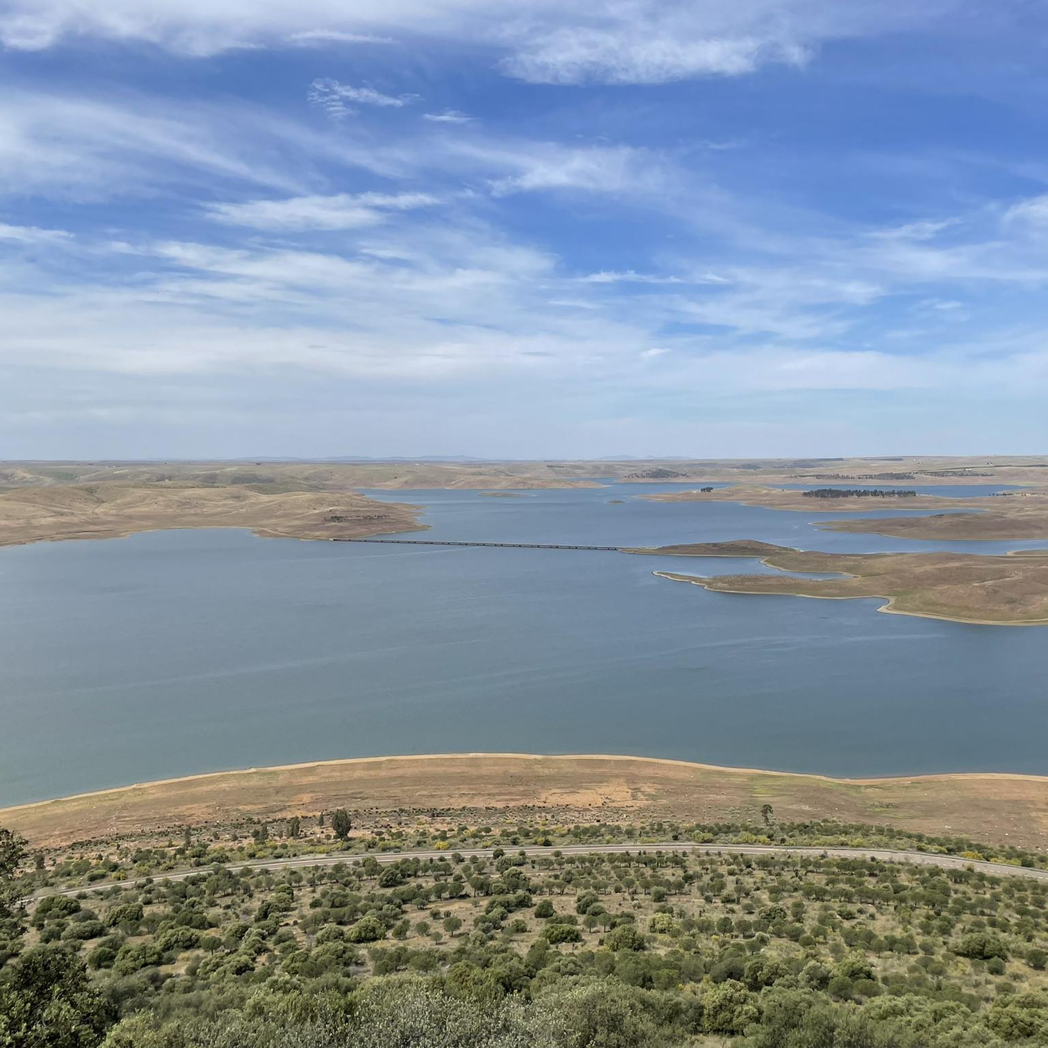
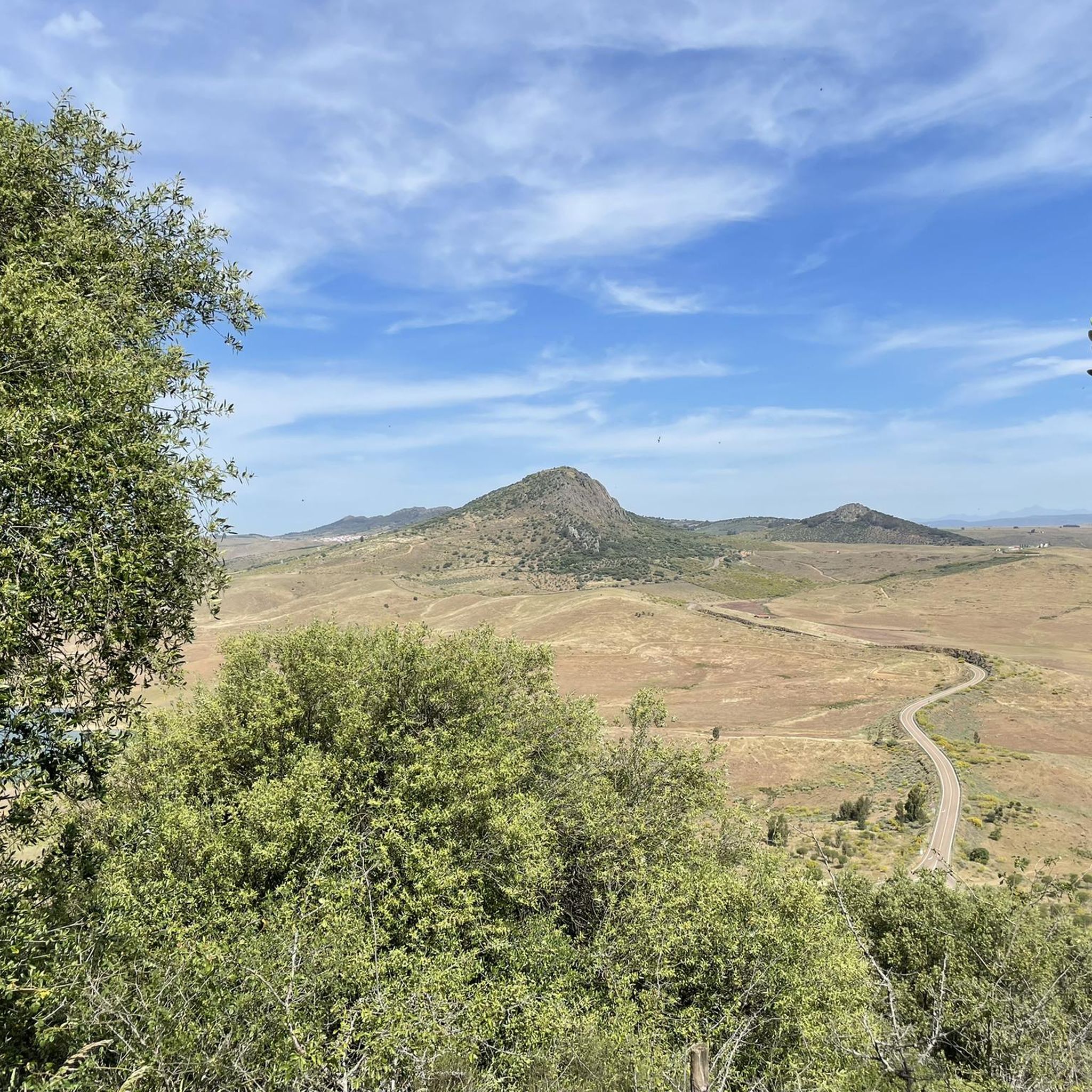
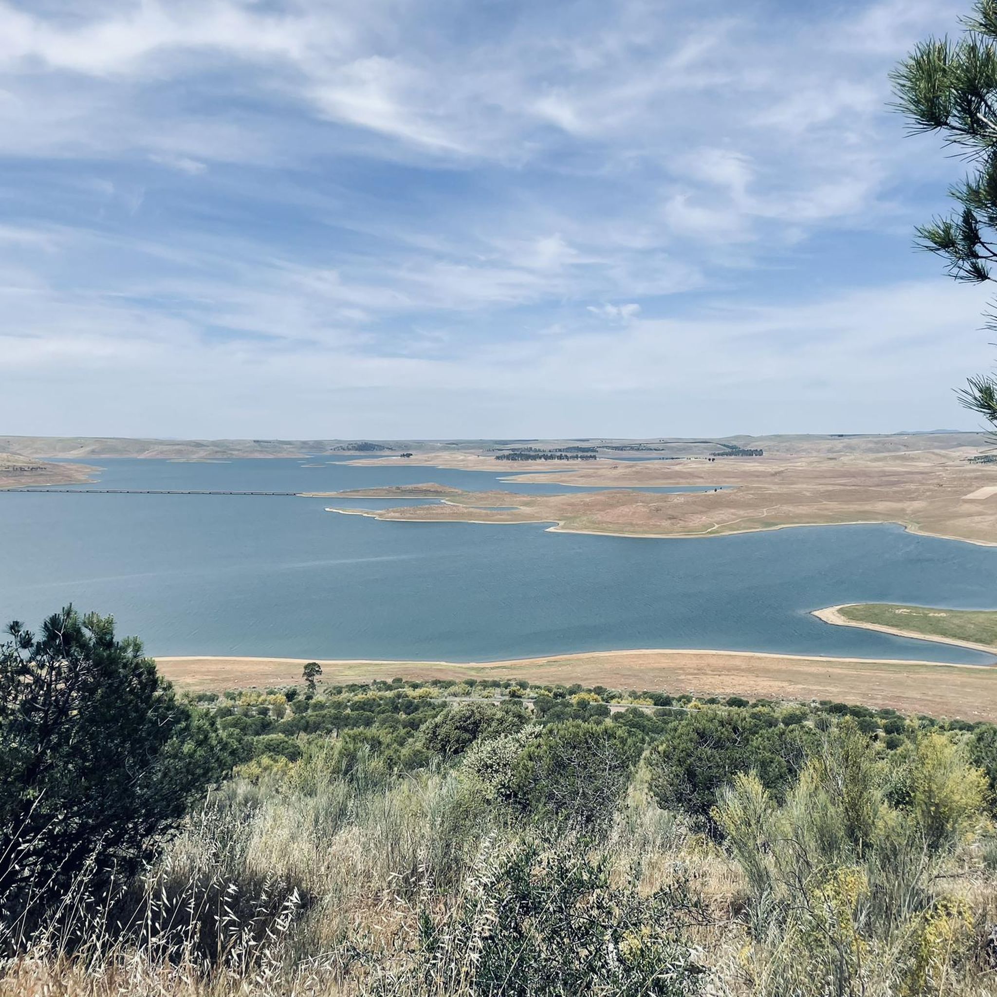
The best views in the La Siberia Extremeña region
0
0

The castle sits atop a hill in Puebla de Alcocer (Badajoz, Extremadura), approximately 550 meters above sea level. Its origins date back to the 12th and 13th centuries, possibly built upon the site of an earlier Mudéjar fortress. It was remodeled in 1445 after being donated to Don Gutierre de Sotomayor, Master of the Order of Alcántara, by King John II of Castile. At the end of the 15th century, it passed to Doña Elvira de Zúñiga, as reflected in the coat of arms on the keep.
2
0
It is a mountain pass that connects areas of the Sierra de los Villares and Mirabueno. It is part of old livestock routes such as the Cañada Real Segoviana, historically used for transhumance. Landscapes: Sierras de Mirabueno and Los Villares, with forests and landscapes such as Tabla Corta (Boquerón Park) on the Guadalemar River. Ideal for hiking, cycling, and nature photography.
11
0
Cerro Masatrigo is a hill located in the municipality of Esparragosa de Lares. This hill is known for its almost perfect conical shape, which has earned it the nickname "the magic mountain." It rises 501 meters above sea level and 161 meters above the surrounding terrain. After the construction of the La Serena Dam, Cerro Masatrigo became a peninsula surrounded by the waters of the reservoir.
1
0
Cerro Masatrigo is a hill located in the municipality of Esparragosa de Lares. This hill is known for its almost perfect conical shape, which has earned it the nickname "the magic mountain." It rises 501 meters above sea level and 161 meters above the surrounding terrain. After the construction of the La Serena Dam, Cerro Masatrigo became a peninsula surrounded by the waters of the reservoir.
6
0
The castle of Puebla de Alcocer is an imposing fortress built during the 12th and 13th centuries, and remodeled in the 15th century by Don Gutierre de Sotomayor, master of the Order of Alcántara. It is located in an elongated rocky mass, at the highest point of Puebla de Alcocer, from where the movements of the adversaries were monitored for kilometers around. Today, the regions of La Serena and La Siberia can be seen, and the fortification can be seen from various points.
6
0

Zarza-Capilla is a small town in the La Serena valley. One of the most interesting monuments in the town is the 16th century Church of Saint Bartholomew.
1
1

Beautiful town that is located at the foot of a small hill called Pinguta del Morro and that is also located south of the Río Siruela.
1
0
Frequently Asked Questions
How many road cycling routes are available in the Esparragosa de Lares area?
There are 7 road cycling routes around Esparragosa de Lares listed on komoot, offering a variety of experiences for cyclists. These routes range from moderate to difficult, showcasing the diverse terrain of the Extremadura's Siberia region.
What kind of terrain can I expect when road cycling around Esparragosa de Lares?
The region offers a mix of flatlands and undulating sections, bordered by impressive mountain ranges. You'll encounter expansive reservoirs like Embalse de La Serena and Embalse del Zújar, alongside distinctive geological formations such as Cerro Masatrigo. This varied topography provides options for both gentle rides and more challenging ascents.
Are there routes suitable for beginners or those looking for an easier ride?
While many routes feature significant elevation, there are 3 moderate routes available. For example, the Castle of Puebla de Alcocer – Castillo de Puebla de Alcocer loop from Talarrubias is a moderate 31.6-mile (50.9 km) trail, offering a less strenuous option through rolling hills.
What are some challenging road cycling routes in the region?
For experienced cyclists seeking a challenge, there are 4 difficult routes. The Orellana la Vieja and Castillo de Puebla de Alcocer Loop is a demanding 74.8-mile (120.4 km) route with significant elevation gain, offering views of the Orellana la Vieja reservoir and Puebla de Alcocer Castle.
What natural landmarks or viewpoints can I see along the cycling routes?
Many routes offer stunning views of the region's natural beauty. You can cycle past the immense Embalse de La Serena and Embalse del Zújar. A notable highlight is Cerro Masatrigo, an almost conical hill rising dramatically from the La Serena reservoir, which is a declared Natural Monument. The View of Cerro Masatrigo – Capilla and its Castle loop from Puebla de Alcocer route specifically offers views of this unique feature.
Are there any historical sites or castles to explore while cycling?
Yes, the region is rich in history. Several routes pass by historical landmarks. For instance, the Orellana la Vieja and Castillo de Puebla de Alcocer Loop offers views of the Castle of Puebla de Alcocer. The Sierra de Lares also features the ruins of an ancient Arab castle at its summit, providing a historical backdrop to your ride.
Are there any circular road cycling routes available?
Yes, many of the routes in the area are designed as loops, allowing you to start and end at the same point. Examples include the View of Cerro Masatrigo – Capilla and its Castle loop from Puebla de Alcocer and the Castle of Puebla de Alcocer – Castillo de Puebla de Alcocer loop from Talarrubias.
What is the best time of year to go road cycling in Esparragosa de Lares?
Esparragosa de Lares, located in Extremadura, generally experiences hot summers. Spring and autumn typically offer more pleasant temperatures for road cycling, with milder weather making longer rides more comfortable. Winter can also be suitable, though days are shorter.
What are the typical distances and durations for road cycling routes here?
Routes vary significantly in length and duration. You can find rides like the moderate Castle of Puebla de Alcocer – Castillo de Puebla de Alcocer loop from Talarrubias, which is 31.6 miles (50.9 km) and takes about 2 hours 32 minutes. For longer excursions, the difficult Orellana la Vieja and Castillo de Puebla de Alcocer Loop spans 74.8 miles (120.4 km) and typically requires around 5 hours 43 minutes.
What makes the region around Esparragosa de Lares unique for road cycling?
The region's uniqueness stems from its location within a Biosphere Reserve, offering a remote and wild environment. The combination of vast reservoirs like La Serena, the distinctive Cerro Masatrigo, and the undulating terrain of La Siberia Extremeña creates a constantly changing and picturesque backdrop for cyclists, blending natural beauty with challenging routes.
Are there any routes that offer views of the large reservoirs?
Absolutely. The area is defined by its impressive reservoirs. Many routes provide panoramic views of the Embalse de La Serena and Embalse del Zújar. The Orellana la Vieja and Castillo de Puebla de Alcocer Loop, for example, offers views of the Orellana la Vieja reservoir, while the View of Cerro Masatrigo – Capilla and its Castle loop from Puebla de Alcocer provides stunning vistas of the La Serena reservoir.
What is the average difficulty level of road cycling routes in this area?
The road cycling routes around Esparragosa de Lares are generally geared towards moderate to difficult skill levels. Out of the 7 routes available, 3 are classified as moderate and 4 as difficult, indicating a preference for cyclists who enjoy a challenge and significant elevation changes.
Most popular routes around Esparragosa De Lares
Most popular attractions around Esparragosa De Lares

Get inspired with the komoot mobile app


Explore more
Browse the best Road cycling routes in other regions.
