The best walks and hikes around Montcusel
4.4
(548)
2,886
hikers
148
hikes
Hiking around Montcusel offers access to the Jura mountains, characterized by dense forests, verdant valleys, and expansive plateaus. The region features significant water bodies, including Lac Vouglans and Lac de Coiselet, alongside notable waterfalls like the Hérisson waterfall and the Gorges de la Langouette. Numerous viewpoints provide vistas of the surrounding cliffs and lakes, contributing to a diverse hiking landscape.
Best hiking trails around Montcusel
- The most popular hiking route is Combe Waterfall loop from Dortan, a 5.2 miles (8.3 km) trail that takes about 2 hours 49 minutes to complete. This moderate route features a significant elevation gain of over 1300 feet (400 meters).
- Another top favourite among local hikers is Montcusel Church – View of Chancia loop from Montcusel, an easy 3.4 miles (5.4 km) path. This route offers views of the local church and the Chancia area, typically completed in about 1 hour 37 minutes.
- Local hikers also love the Gouffre Vincent loop from Dortan, a 2.7 miles (4.3 km) trail leading through varied terrain, often completed in about 1 hour 38 minutes.
- Hiking around Montcusel is defined by dense forests, scenic lake views, and impressive waterfalls and gorges. The network of trails offers options for various ability levels, from easy walks to more demanding treks.
- The routes in Montcusel are highly rated by the komoot community with an average score of 4.4 stars from more than 400 reviews. More than 2000 hikers have used komoot to explore Montcusel's varied terrain.
Last updated: June 27, 2026
4.0
(1)
19
hikers
8.29km
02:49
400m
410m
Moderate hike. Good fitness required. Easily-accessible paths. Suitable for all skill levels.
3.9
(25)
96
hikers
3.50km
01:09
150m
150m
Easy hike. Great for any fitness level. Easily-accessible paths. Suitable for all skill levels.

Sign up for free
3.8
(5)
22
hikers
18.7km
05:47
550m
550m
Hard hike. Very good fitness required. Mostly accessible paths. Sure-footedness required.
4.0
(5)
16
hikers
5.45km
01:37
170m
170m
Easy hike. Great for any fitness level. Easily-accessible paths. Suitable for all skill levels.
5.0
(1)
13
hikers
3.84km
01:13
150m
150m
Easy hike. Great for any fitness level. Easily-accessible paths. Suitable for all skill levels.
Get access to more routes and recommendations from other explorers.
Sign up for free
Already have an account?
Our route recommendations are based on thousands of hikes, rides, and runs completed by other people on komoot.
Start today with a free account
Your next adventure awaits.
Login or Signup

Tips from the Community

Demanding ascent for beginners, difficult passage for a few meters (cable handrail)
0
0

You think of a castle but only stones - but still a fantastic view
0
0
You think castle but only stones - But fantastic view
0
0

In addition to its view of Lake Coiselet, the Oliferne peak is distinguished by a strange sculpture which stands in the middle of the ruins, like a guardian watching over a castle.
0
0

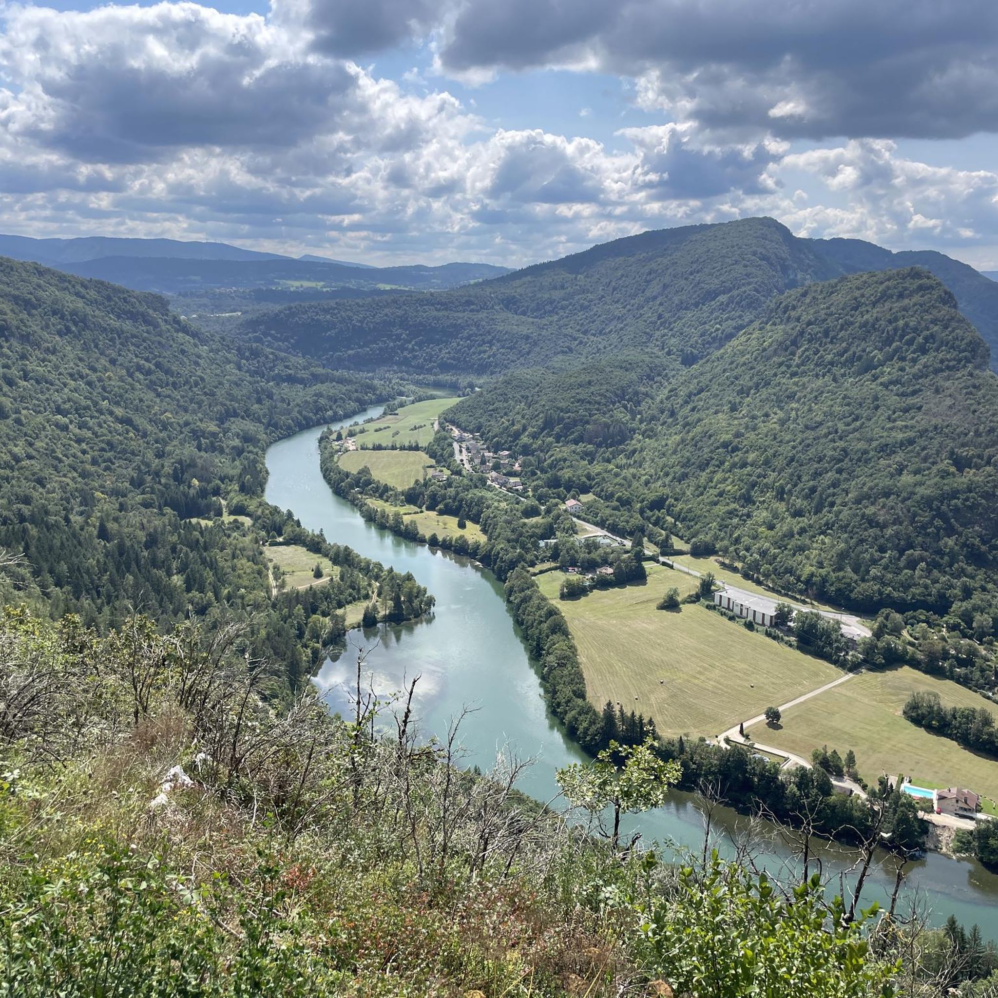
From the ruins of Oliferne Castle, perched on a rocky spur in the Jura Mountains, you can enjoy breathtaking views of the Ain Valley and beyond. Once a medieval fortress, its ruined walls and towers now blend into the rugged landscape. Its strategic position allowed it to control access to the region, making it a must-see when hiking the Pic d'Oliferne.
1
0
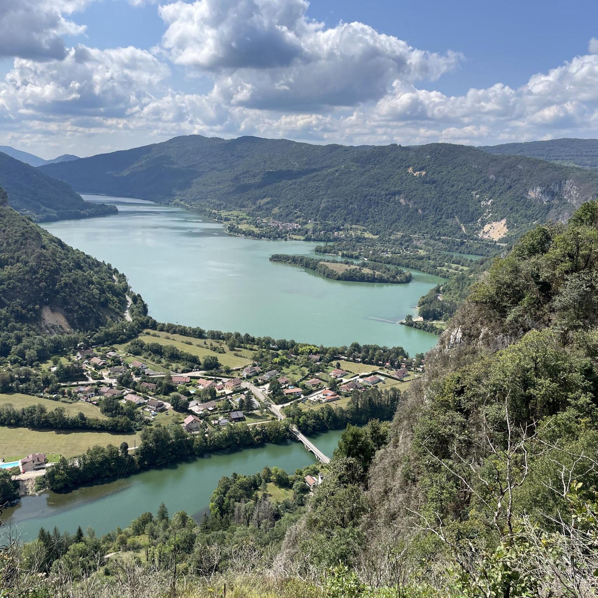
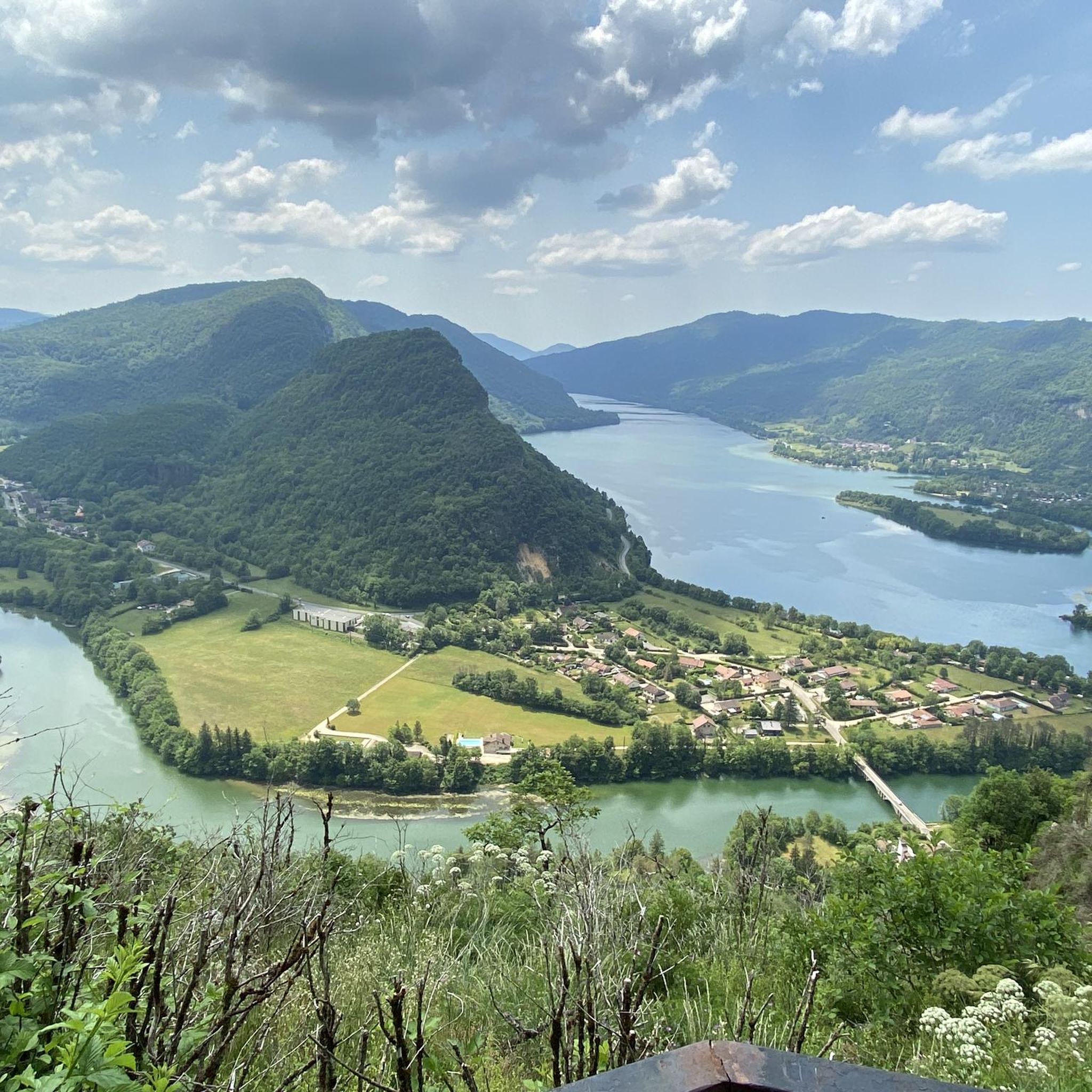
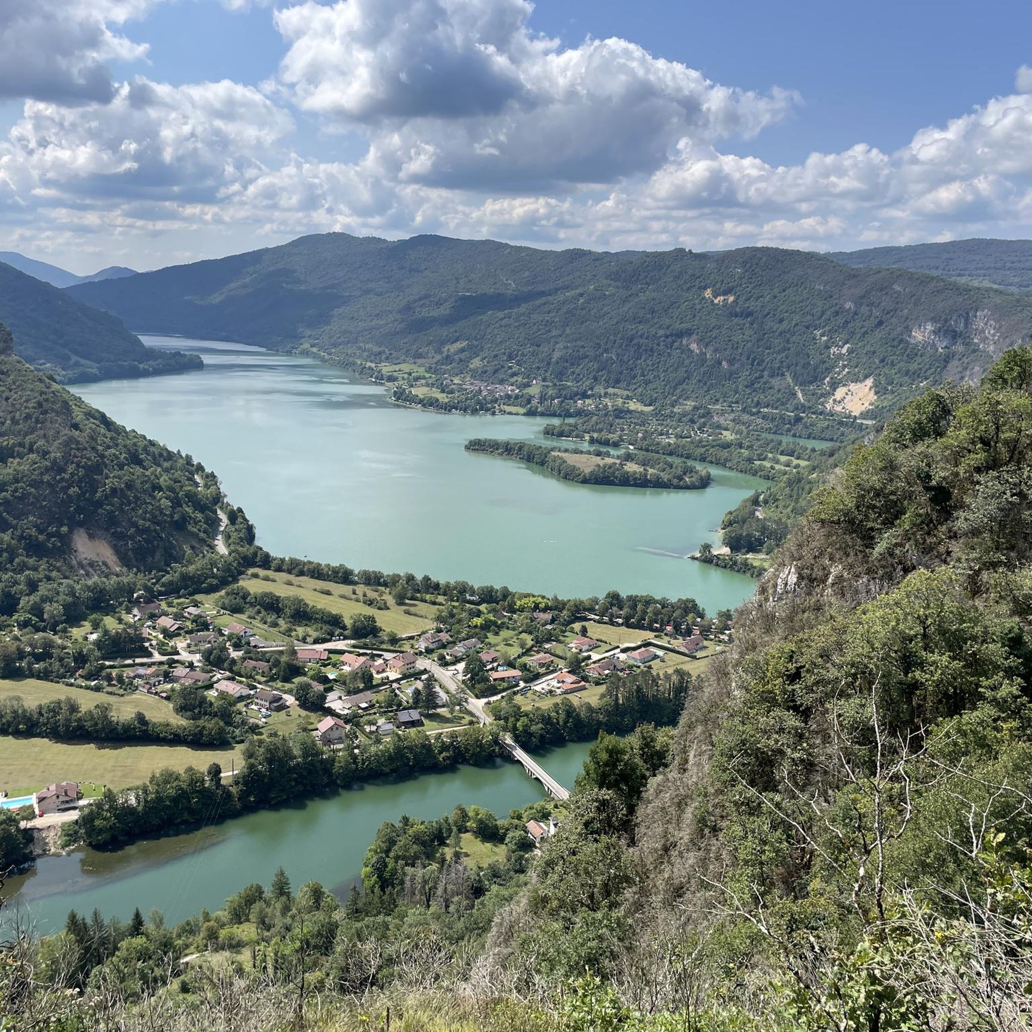
At 807 meters above sea level, this peak offers breathtaking views of lakes and tree-covered mountains.
3
0
So many things to see from here! A beautiful view of Lake Coiselet and the Bienne valley. From here, you can also see the village of Chancia and the peak of Oliferne.
2
0
A small summit that offers a magnificent view of Lake Coiselet!
2
0
Frequently Asked Questions
How many hiking trails are available around Montcusel?
There are over 140 hiking trails around Montcusel, catering to various skill levels. You'll find a diverse network of paths, from easy walks to more demanding treks through dense forests, verdant valleys, and expansive plateaus.
What kind of terrain can I expect on Montcusel's hiking trails?
Hiking around Montcusel offers a varied landscape, characterized by dense forests, verdant valleys, and expansive plateaus within the Jura mountains. You'll encounter trails alongside stunning lakes like Lac Vouglans and Lac de Coiselet, as well as paths leading to impressive waterfalls and gorges.
Are there any family-friendly hiking options in Montcusel?
Yes, Montcusel offers several accessible trails suitable for families. The Montcusel Church – View of Chancia loop from Montcusel is an easy 3.4-mile (5.4 km) path. Additionally, the Circuit des Cinq Fontaines, located near Montcusel, is known for its natural springs and cascades, making it ideal for families.
Can I bring my dog on the hiking trails in Montcusel?
Many trails in the Montcusel region are dog-friendly, allowing you to explore the natural beauty with your canine companion. It's always recommended to keep dogs on a leash and to check specific trail regulations or local signage for any restrictions before you go.
Are there any circular hiking routes in Montcusel?
Yes, Montcusel features several circular hiking routes. Popular options include the Combe Waterfall loop from Dortan, a moderate 5.2-mile (8.3 km) trail, and the Plage de Chancia loop from Chancia, an easy 2-mile (3.2 km) route.
What natural landmarks or viewpoints can I see while hiking in Montcusel?
Montcusel is rich in natural landmarks and offers numerous viewpoints. You can visit the impressive Moulin de Vulvoz Waterfall, or enjoy panoramic views from the Chancia Viewpoint. The region is also known for its stunning lakes, including Lac Vouglans and Lac de Coiselet, with views like the View of Lac de Vouglans.
What do other hikers enjoy most about hiking in Montcusel?
The hiking trails in Montcusel are highly rated by the komoot community, with an average score of 4.4 stars from over 400 reviews. Hikers often praise the diverse terrain, from dense forests to scenic lake views, and the impressive waterfalls and gorges that define the region.
Are there any historical or cultural attractions near the hiking trails?
Beyond its natural beauty, Montcusel and its surroundings offer points of historical interest. You can explore the Oliferne Castle Ruins, or visit the Saint Romain de Roche Chapel and the Church of Saint-Hymetière. The impressive Vouglans Dam also provides a notable historical and technical point of interest.
What is the best time of year to go hiking in Montcusel?
Montcusel offers beautiful hiking opportunities throughout much of the year. Spring and autumn provide pleasant temperatures and vibrant scenery, with lush greenery or colorful foliage. Summer is also popular, especially for trails near lakes and waterfalls, though it can be warmer. Winter hiking is possible, but some trails may be challenging due to snow and ice.
Where can I find parking for hiking trails in Montcusel?
Parking is generally available at trailheads or in nearby villages like Montcusel and Dortan, which serve as starting points for many routes. For example, the Gouffre Vincent loop from Dortan starts from Dortan, where you can typically find parking facilities.
Are there any easy hiking trails for beginners in Montcusel?
Yes, Montcusel has over 50 easy hiking trails perfect for beginners or those looking for a relaxed walk. The Chancia Viewpoint loop from Chancia is an easy 2.4-mile (3.8 km) trail that offers scenic views without significant elevation gain.
Most popular routes around Montcusel
Most popular attractions around Montcusel

Get inspired with the komoot mobile app


Explore more
Browse the best Hikes in other regions.
