Attractions and Places To See around Hartmannswiller - Top 20
Best attractions and places to see around Hartmannswiller include a blend of historical landmarks, cultural sites, and natural beauty. Situated on the Alsace Wine Route at the foot of the Vosges mountains, the area offers diverse landscapes. Visitors can explore significant historical sites and enjoy the scenic Alsatian environment. The region provides opportunities for both cultural insights and outdoor activities.
Best attractions and places to see around Hartmannswiller
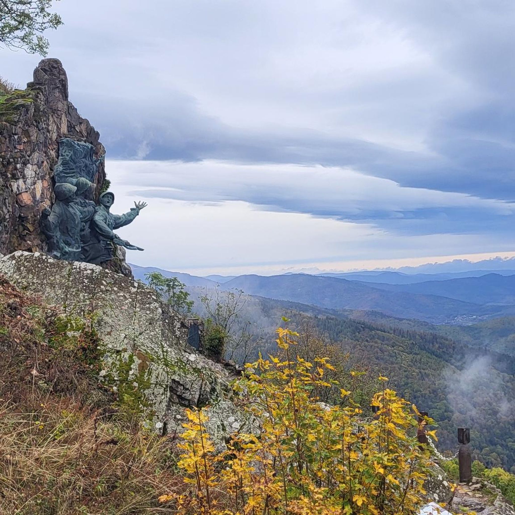
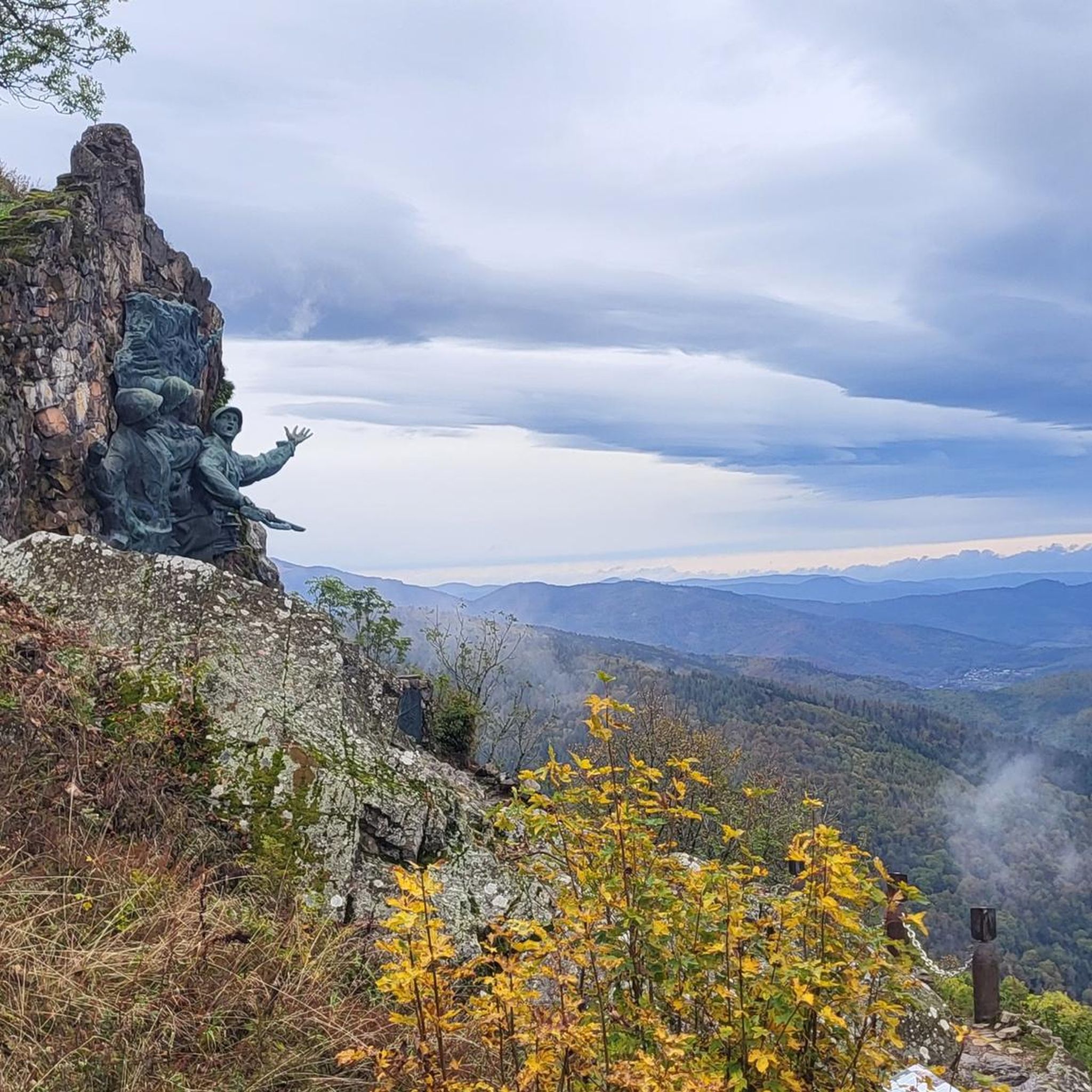
- The most popular attractions is Grand Ballon, a summit that offers a panoramic view and is the highest mountain in the Vosges Mountains. A monument to the Blue Devils, a mountain infantry battalion during World War I, stands on its summit.
- Another must-see spot is Ballon Lake, a lake embedded in a glacial cirque. This natural feature serves as a drinking water reservoir and flood retention basin for the Lauchtal.
- Visitors also love Viewpoint at the summit of Vieil Armand, a viewpoint on the Hartmannswillerkopf. This site was bitterly contested during World War I due to its strategic location and offers views of the Alsatian and Upper Rhine plains.
- Hartmannswiller is known for its historical sites, natural features, and cultural attractions. The area offers a variety of places to see, from World War I battlefields to scenic mountain lakes and trails.
- The attractions around Hartmannswiller are appreciated by the komoot community, with more than 1100 upvotes and over 860 photos shared by visitors.
Last updated: October 9, 2026
Grand Ballon
Highlight • Summit
In 1927, a monument to the Blue Devils (French: Diables bleus), a mountain infantry battalion during World War I, was erected. It was destroyed by the Germans in September 1940 and reconstructed by the sculptor Bouret in October 1960. A radar station has stood on the summit since 1997, serving civilian aviation during approaches to the airports of Strasbourg and Basel-Mulhouse.
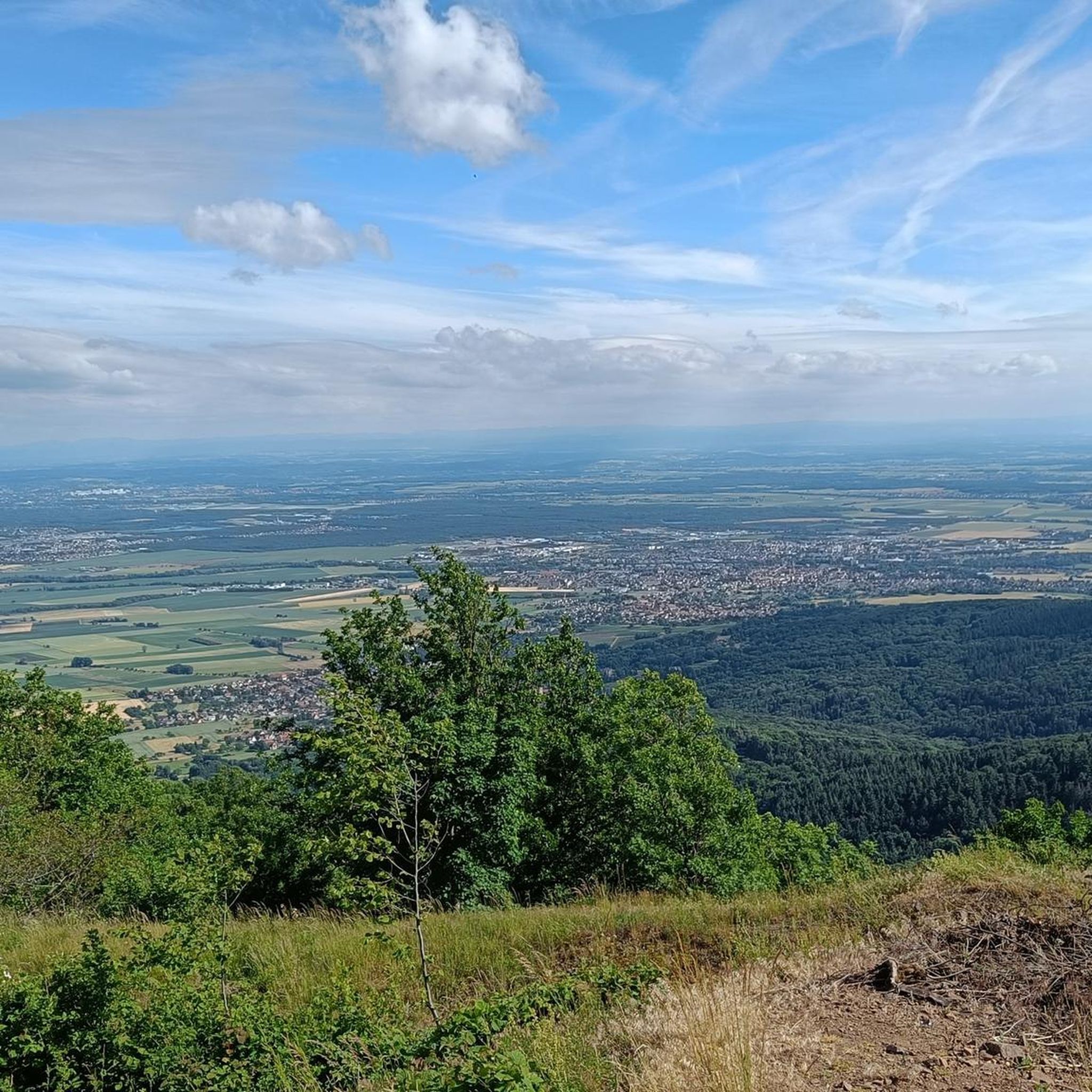
On clear days, you can see far into the Rhine Valley and the Alps.
Translated by Google •
Tip by

Grand Ballon
Highlight • Summit
Translated by Google •
Tip by

Sign up now to discover places like this
Get recommendations on the best single tracks, peaks, & plenty of other exciting outdoor places.
Panoramic view from the Grand Ballon summit
Highlight • Summit
Translated by Google •
Tip by

Beautiful trail to the Grand Ballon
Highlight (Segment) • Trail
Translated by Google •
Tip by
Haag Pass
Highlight • Mountain Pass
Originally, it was laid out by French troops as a supply route during the First World War. Today, in the snow-free months, it is mainly visitors to the Vosges who travel on it. It runs for 75 km from Col du Bonhomme in the north via Col de la Schlucht, Hohneck, Markstein, Grand Ballon and Cernay to Thann in the south.
The route passes several sites from the First World War and touches the highest mountain in the Vosges, the Grand Ballon.
Mostly deciduous and mixed forests line the road, or there are wonderful views of the wooded slopes of the Vosges, the Rhine plain and the Black Forest opposite. On a clear day the view extends as far as the Swiss Alps and Montblanc.
On nice days it is very popular with bikers with and without motor, and hikers get their money's worth on the left and right of the road.
Many convertible tours are also made here, which come from all regions of Europe.
The Ferme, (cozy Alsatian country inns), which can be found along the entire route, offer refreshment opportunities.
Translated by Google •
Tip by

Sign up for free to discover even more attractions around Hartmannswiller.
Already have an account?
Start today with a free account
Your next adventure awaits.
Tips from the Community

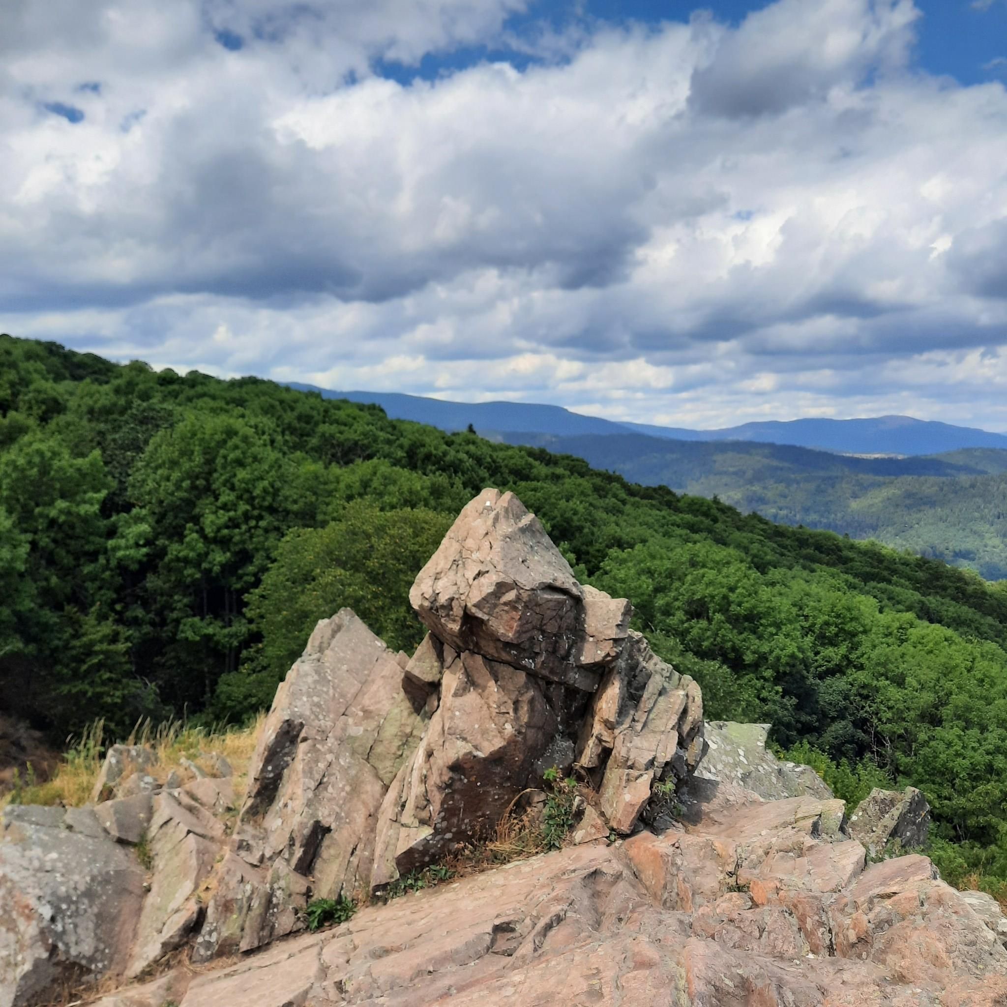
When you drive from the Route des Crêtes towards Le Grand Ballon, you pass the Col du Haag (1233 m) almost unnoticed. Yet, this pass marks a special point on the southern flank of the highest mountain in the Vosges. Here, steep roads from the Thurdal leave the wooded slopes and reach the open heights of the massif. From the col, a typical Vosges landscape unfolds with mountain meadows, scattered farms, and sweeping views. The proximity of the Grand Ballon is felt everywhere: the imposing summit towers above the pass and forms the natural goal of the final climbing kilometers. For cyclists, the Col du Haag is mainly known as the point where difficult climbs from the valleys converge before the road continues to rise to the highest point of the Vosges.
6
0

Magnificent views of the valleys and the opposite mountain ranges of the Vosges and fantastic vistas across the Rhine plain to the Black Forest and, in good weather, even to the snow-capped peaks of the Alps!
5
0

It's an ideal starting point for hikes to the Grand Ballon, the Storkenkopf, and many more. Here you can enjoy a hearty meal before or after a hike.
4
0
Breathtaking panoramic views across the Rhine plain to the Black Forest, and on clear days, even the Alps. Highly recommended.
4
0

To the north you can still see the Kaiserstuhl
4
0
Great 360 degree panorama. Overview of the entire region
5
0

rather inconspicuous col that is easily missed.
4
0
Belongs on every bucket list. In good weather with extraordinary visibility.
5
0
Frequently Asked Questions
What are the most significant historical sites to visit around Hartmannswiller?
The most significant historical site is undoubtedly the Hartmannswillerkopf, also known as Vieil Armand. This promontory was the scene of brutal battles during World War I, and visitors can explore preserved trenches, bunkers, and a national monument. Additionally, the Hartmannswillerkopf Franco-German Historial of World War I museum provides a comprehensive overview of the conflict. Other historical sites include the 15th-century Fortified Cemetery and the Saint-Blaise Church in the village.
Are there opportunities for hiking and outdoor activities near Hartmannswiller?
Yes, the area around Hartmannswiller, nestled at the foot of the Vosges mountains, offers numerous hiking and mountain biking circuits. You can explore trails on the Hartmannswillerkopf battlefield itself, or venture further into the Vosges. For more detailed routes, you can find various options for Mountain Hikes around Hartmannswiller, including trails to the Grand Ballon.
What natural features can I explore in the Hartmannswiller region?
Beyond its historical significance, the Hartmannswillerkopf is a rocky spur offering commanding views over the Alsatian plain. The region is also part of the famous Alsace Wine Route, surrounded by fertile hills and vineyards. A notable natural highlight is Ballon Lake, a beautiful lake embedded in a glacial cirque at the foot of the Grand Ballon.
What is the best time of year to visit Hartmannswiller for outdoor activities?
The snow-free months are generally the best time to visit for outdoor activities like hiking and cycling. The Route des Crêtes, which passes near Hartmannswiller, is particularly popular during these periods. While winter hiking is possible, some routes and roads may be inaccessible due to snow. Clear days offer the best panoramic views from sites like the Grand Ballon.
Are there any family-friendly attractions or activities in Hartmannswiller?
Yes, families can enjoy exploring the natural surroundings. Ballon Lake is considered family-friendly, offering a beautiful setting. For a unique experience, a geocaching discovery circuit is available in the area. Additionally, the village hosts a popular festival with a soapbox race and games for children on the first Sunday of September.
Where can I find panoramic views around Hartmannswiller?
For breathtaking panoramic views, head to the Grand Ballon, the highest mountain in the Vosges, which offers extensive views into the Rhine Valley and even the Alps on clear days. The Viewpoint at the summit of Vieil Armand (Hartmannswillerkopf) also provides strategic views of the Alsatian and Upper Rhine plains.
What kind of cycling routes are available near Hartmannswiller?
The region offers a variety of cycling routes, from moderate vineyard tours to more challenging mountain climbs. You can find options for Cycling around Hartmannswiller, including routes that take you through the Alsace Wine Route and up to passes like Col Amic and the Grand Ballon.
Is there a museum dedicated to the history of Hartmannswillerkopf?
Yes, the Hartmannswillerkopf Franco-German Historial of World War I is located near the battlefield. This museum offers a comprehensive overview of World War I, focusing on the events at Hartmannswillerkopf, with interactive multimedia presentations, artifacts, and films. It serves as a site of remembrance and education, promoting Franco-German reconciliation.
What are some unique cultural insights I can gain in Hartmannswiller?
Beyond the major historical sites, Hartmannswiller retains its authentic charm with old houses featuring 16th and 17th-century lintel doors. You can also discover numerous rural crosses and fountains in the narrow streets. The village is part of a 'Country of Art and History' Tourist and Heritage Circuit, offering a guided way to explore its local heritage.
Where can I park when visiting the Hartmannswillerkopf battlefield and museum?
There is a parking lot located directly at the Hartmannswillerkopf Franco-German Historial of World War I, making it convenient to access both the museum and the battlefield trails.
Are there any challenging hiking trails in the Hartmannswiller area?
Yes, the Vosges mountains offer challenging trails for experienced hikers. Routes leading to the Grand Ballon, such as the 'Beautiful trail to the Grand Ballon', can be demanding. You can find difficult mountain hikes and MTB trails listed in the Mountain Hikes around Hartmannswiller and MTB Trails around Hartmannswiller guides.
What is the significance of the Alsace Wine Route in relation to Hartmannswiller?
Hartmannswiller is situated directly on the famous Alsace Wine Route. This means the village is surrounded by picturesque vineyards and offers easy access to wine-tasting opportunities and scenic drives through the region's wine-producing areas. It's an ideal spot for enjoying the scenic Alsatian landscape and its culinary traditions.
Most popular routes around Hartmannswiller
Most popular attractions around Hartmannswiller

Get inspired with the komoot mobile app


Explore more
Still not found the Highlight you’re looking for? See guides of the top attractions in other regions:
