The best running trails around La Buissière
4.3
(119)
5,441
runners
393
runs
Jogging routes around La Buissière offer diverse terrain across various regions, from the Grésivaudan valley in Isère, France, to the wetlands of Wallonia, Belgium. The area in Isère is characterized by riverside paths along the Isère river and routes extending into the foothills of the Chartreuse massif, providing both flat and more challenging options. In Loiret, France, joggers can explore marked trails through an arboretum and along riverbanks. The Labuissière Nature Reserve in Belgium features signposted trails through marshes and…
Last updated: July 1, 2026
4.0
(1)
25
runners
12.4km
01:39
500m
500m
Hard run. Very good fitness required. Sure-footedness, sturdy shoes and alpine experience required.
14
runners
5.21km
00:35
70m
70m
Moderate run. Good fitness required. Mostly paved surfaces. Suitable for all skill levels.

Sign up for free
8
runners
4.91km
00:31
30m
30m
Easy run. Great for any fitness level. Mostly paved surfaces. Suitable for all skill levels.
8
runners
4.93km
00:31
30m
30m
Easy run. Great for any fitness level. Mostly paved surfaces. Suitable for all skill levels.
3.5
(2)
9
runners
6.67km
00:41
20m
20m
Moderate run. Good fitness required. Mostly paved surfaces. Suitable for all skill levels.
Get access to more routes and recommendations from other explorers.
Sign up for free
Already have an account?
Our route recommendations are based on thousands of hikes, rides, and runs completed by other people on komoot.
Start today with a free account
Your next adventure awaits.
Login or Signup

Tips from the Community

In the heart of Chapareillan, the Saint-Blaise and Notre-Dame church blends Romanesque, Gothic, and modern elements. Remodeled several times, it retains a massive square bell tower and a sober interior. From the forecourt, the view opens onto the reliefs of the Chartreuse massif.
1
0

Hiking mainly in the forest which climbs well at the start!
0
0

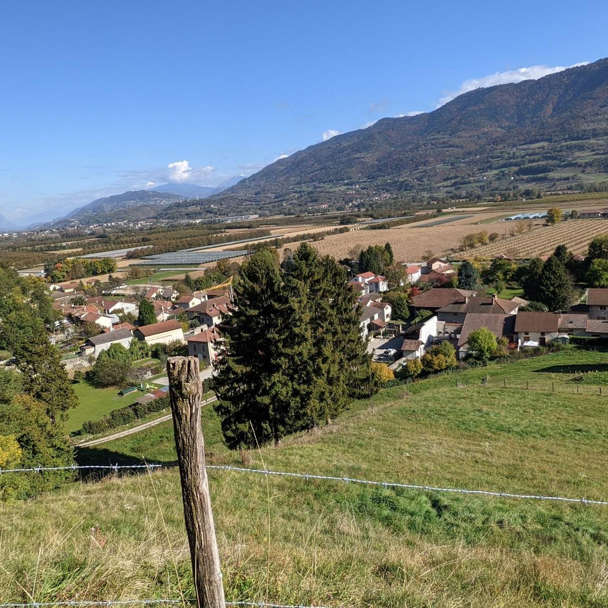
The small hamlet of Bellecombe offers superb views of the Belledonne chain. There are several public fountains.
0
0

Fort-Barraux is one of the oldest defensive places in the Alps, it dates from the 16th century. It is a bastioned fortification, characterized by its star shape.
1
0
Frequently Asked Questions
How many running routes are available around La Buissière?
There are over 380 diverse running routes around La Buissière, catering to various skill levels. You'll find everything from easy, flat paths to more challenging trails with significant elevation gain.
Are there easy running routes suitable for beginners in La Buissière?
Yes, La Buissière offers a good selection of easy running routes. Approximately 30 routes are classified as easy, providing gentle terrain ideal for beginners or those seeking a relaxed jog. For example, the Running loop from La Buissière is a moderate 4.1-mile (6.7 km) option with minimal elevation changes.
Can I find circular running routes in the La Buissière area?
Absolutely. Many of the running paths around La Buissière are circular, offering convenient loop experiences. A popular choice is the Cross of La Crosse loop from La Buissière, a 3.2-mile (5.2 km) trail that takes you through varied local terrain.
What kind of natural landmarks or viewpoints can I expect on the running trails?
The region around La Buissière offers diverse scenery. In the Isère department, you can enjoy views of the Grésivaudan valley and the Chartreuse massif foothills. Trails like the Belvédère de Bellecombe loop from Barraux offer panoramic vistas from the Bellecombe belvedere. Additionally, you can explore nearby natural attractions such as the Crêt du Poulet or various waterfalls like the Saint-Même Cirque Waterfalls.
Are there family-friendly running paths in La Buissière?
Yes, the diverse terrain of La Buissière includes options suitable for families. The Loiret department, for instance, features marked trails through an arboretum and along riverbanks, which can be very pleasant for a family run. The Labuissière Nature Reserve in Belgium also has a flat towpath along the Sambre river, perfect for a relaxed family outing.
Are dogs allowed on the running routes around La Buissière?
While specific regulations can vary by location within the broader La Buissière region (Isère, Loiret, or Wallonia), many natural areas in France and Belgium generally welcome dogs on trails, often requiring them to be on a leash. It's always best to check local signage or specific route descriptions for any restrictions before heading out with your dog.
What is the best season for running in La Buissière?
The best season for running in La Buissière largely depends on your preference for terrain and weather. Spring and autumn offer pleasant temperatures and vibrant scenery, ideal for exploring both riverside paths and more mountainous routes. Summer can be warm, especially in the valleys, making early morning or late evening runs more comfortable. Winter running is possible, particularly on lower elevation paths, but higher routes might require appropriate gear for colder conditions.
Are there any running routes with minimal elevation gain?
Yes, if you prefer flatter runs, the region offers several options. The Basin of Le Cheylas loop from Le Cheylas is a 4.7-mile (7.6 km) route that traverses the valley basin, providing a relatively flat experience. The towpath along the Sambre river in the Labuissière Nature Reserve in Belgium is another excellent choice for flat, scenic running.
What do other runners say about the trails in La Buissière?
The running routes in La Buissière are highly regarded by the komoot community, holding an average score of 4.2 stars from over 99 reviews. Runners often praise the variety of terrain, from challenging ascents with rewarding views to tranquil riverside paths, and the overall natural beauty of the different regions.
Where can I find parking for the running trails?
Parking availability varies by trailhead. For routes starting in specific villages like Barraux or Le Cheylas, you can typically find parking in or near the village centers. For trails in more remote natural areas, designated parking spots are often available at trailheads. It's advisable to check the specific route details on komoot for parking information related to your chosen trail.
Are there any cafes or places to eat near the running routes?
Yes, depending on which La Buissière location you are exploring, you can find amenities. In the Isère department, villages like La Buissière, Barraux, or Le Cheylas will have local cafes or restaurants. Similarly, in the Loiret department, towns near the marked trails often provide dining options. It's a good idea to plan your route to pass through or end near a village if you wish to refuel after your run.
Can I access running trails using public transport?
Public transport access to trailheads can vary. In more populated areas or larger villages within the La Buissière regions, local bus services might connect to certain starting points. For trails in more rural or mountainous areas, public transport might be less direct, and a car could be more convenient. Always check local transport schedules and routes for the specific trailhead you plan to visit.
Most popular routes around La Buissière
Most popular attractions around La Buissière

Get inspired with the komoot mobile app


Explore more
Browse the best Running Trails & Routes in other regions.
