The best cycling routes around Breuil-Magné
4.3
(1011)
6,958
riders
222
rides
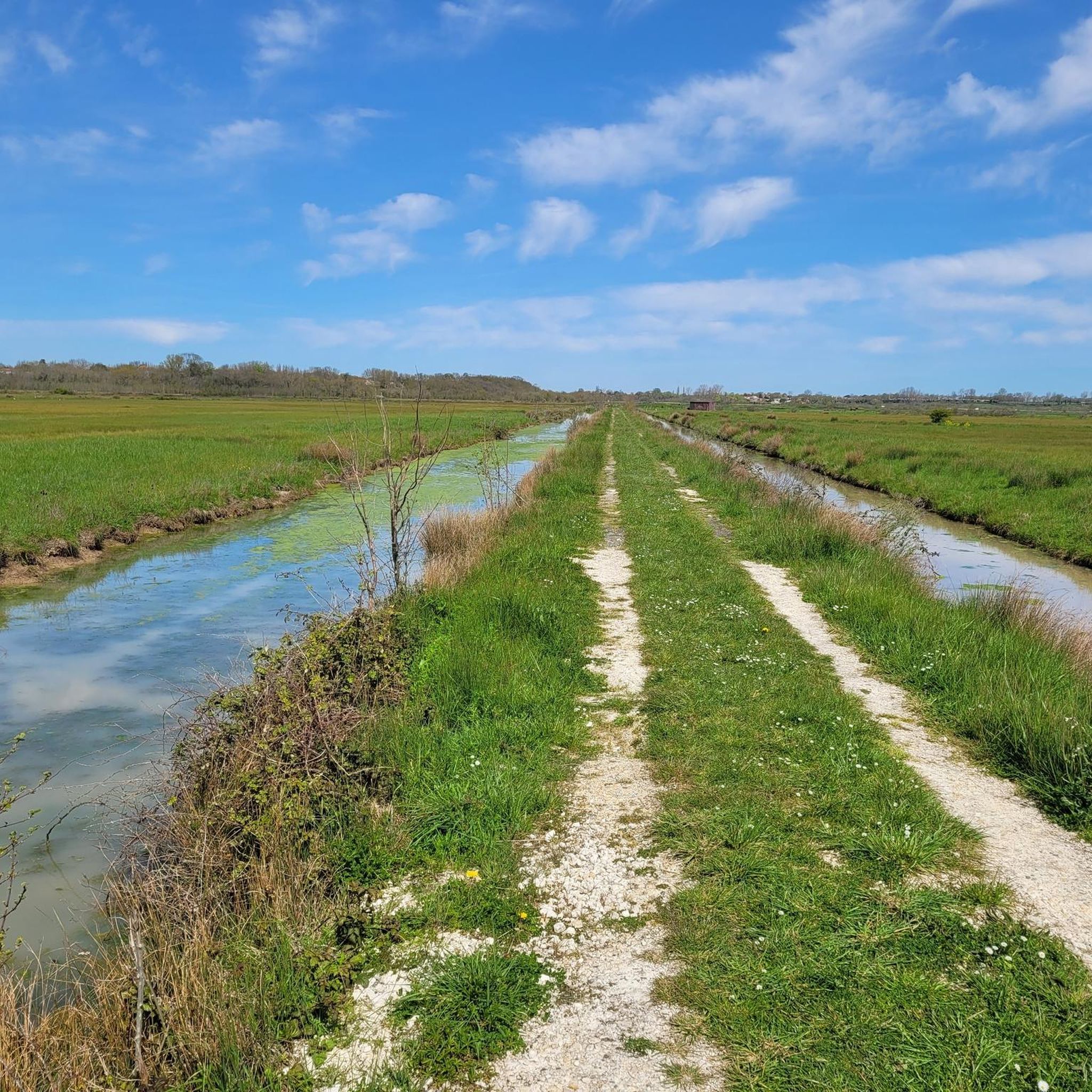
Touring cycling routes around Breuil-Magné traverse a landscape characterized by extensive marshlands and proximity to the Atlantic coast. The terrain is generally flat, offering accessible routes for various fitness levels. Features like the Coteau de Liron provide elevated views over the surrounding wetlands and the Charente estuary. The region's network of paths includes sections of long-distance cycling routes and local trails through cultivated lands.
Best touring cycling routes around Breuil-Magné
- The most popular touring cycling route is The Transporter Bridge…
Last updated: October 14, 2026
4.8
(5)
93
riders
Moderate bike ride. Good fitness required. Mostly paved surfaces. Suitable for all skill levels.
3.0
(1)
8
riders
51.5km
02:57
180m
180m
Moderate bike ride. Good fitness required. Mostly paved surfaces. Suitable for all skill levels.

4.7
(3)
7
riders
10.5km
00:39
40m
40m
Hard bike ride. Great for any fitness level. You may need to push your bike for some segments of this route.
5.0
(1)
5
riders
19.8km
01:30
30m
30m
Easy bike ride. Great for any fitness level. Mostly paved surfaces. Suitable for all skill levels.
5.0
(1)
7
riders
6.76km
00:24
40m
40m
Easy bike ride. Great for any fitness level. Mostly paved surfaces. Suitable for all skill levels.
Get access to more routes and recommendations from other explorers.
Already have an account?
Our route recommendations are based on thousands of hikes, rides, and runs completed by other people on komoot.
Start today with a free account
Your next adventure awaits.


Tips from the Community

Large, pleasant beach safe for swimming (no risk of currents or "baïnes"). The water is a little warmer here than on the other beaches in the region, especially with low tide around midday. Depending on the season and weather, you might encounter kite enthusiasts (including the Kite Festival) and kitesurfers.
0
0

Only for sporty MTB or gravel cardio outings, not at all for a relaxed ride. Be careful, after the metal barriers it's dredge soil (= mud in wet weather or rough, unrideable terrain when dry) and a monotonous high grass path. Personal opinion for local explorers, this western part of the canal is just a useless leg-breaker, prefer the secondary roads and paths in the marshes to the east to continue to be amazed.
0
0

pretty seaside resort, very charming where life is good 🚶🏻♀️🚶♂️😍☀️🏊♀️🏊♂️
0
0

A very beautiful archway!
2
0


Enjoy a superb view of this building, inaugurated in 1900, linking Rochefort to Échillais. For the record, there are only 8 transporter bridges like this one left in the world today!
0
0

Good view from the new bridge :) by the way with a very good bike path
0
0
Frequently Asked Questions
How many touring cycling routes are available around Breuil-Magné?
There are over 230 touring cycling routes around Breuil-Magné, offering a wide variety of options. These include 144 easy routes, 55 moderate routes, and 36 difficult routes, catering to different skill levels and preferences.
What kind of terrain can I expect on touring cycling routes in Breuil-Magné?
The terrain around Breuil-Magné is generally flat, making it accessible for various fitness levels. Routes often traverse extensive marshlands, cultivated lands, and coastal paths. While mostly flat, features like the Coteau de Liron offer slight elevations and panoramic views.
Are there any long-distance cycling routes that pass through or near Breuil-Magné?
Yes, Breuil-Magné is strategically located near major cycling arteries. The renowned Vélodyssée, a 1,200 km Atlantic cycling route, passes through nearby Rochefort. Additionally, parts of the Flow Vélo, which connects the Dordogne to the Île d'Aix, run along the Charente River close to Breuil-Magné.
What are some notable natural features or viewpoints to see while cycling?
Cyclists can explore the extensive marshlands, which are home to diverse wildlife. The Rochefort Transporter Bridge offers a unique historical landmark. For panoramic views, the Coteau de Liron provides elevated perspectives over the surrounding marshlands and, on clear days, extends to the Charente estuary and even Fort Boyard.
Are there any family-friendly cycling routes in the area?
Yes, with 144 easy routes, Breuil-Magné offers many options suitable for families. The generally flat terrain and greenways, such as sections of the Vélodyssée, provide smooth and safe rides. An example of an easy route is the Rochefort-Soubise shuttle loop from Vergeroux, which is just under 10 km.
What attractions can I visit along the touring cycling routes?
You can encounter several interesting attractions. The historic town of Rochefort, just 4 km away, features the Rochefort Transporter Bridge and the Corderie Royale. Other highlights include Châtelaillon Beach, the Tonnay-Charente Suspension Bridge, and the charming settlement of Soubise.
Are there any circular touring cycling routes available?
Yes, many routes are designed as loops. For instance, the The Transporter Bridge – Rochefort Transporter Bridge loop from Rochefort is a popular circular route that takes you through Rochefort. Another option is the Châtelaillon Beach – Carrelets du marais d'Yves loop from Vergeroux, offering coastal and marshland views.
What do other touring cyclists say about the routes in Breuil-Magné?
The touring cycling routes around Breuil-Magné are highly rated by the komoot community, with an average score of 4.4 stars from over 1100 reviews. Cyclists often praise the well-maintained paths, the tranquil marshland scenery, and the accessibility of routes for various skill levels.
Can I observe wildlife while cycling in Breuil-Magné?
Absolutely. The extensive marshlands, particularly sites like the Cabane de Moins nature reserve, are crucial havens for biodiversity. You can observe various bird species, including shelducks and great egrets, and even discreet otters. Observatories are set up along interpretation trails for discreet viewing.
What is the best time of year to go touring cycling in Breuil-Magné?
The region is generally pleasant for cycling from spring through autumn. The flat terrain makes it accessible for much of the year. Spring and early autumn offer comfortable temperatures and vibrant natural scenery, while summer can be warm but enjoyable, especially along coastal paths.
Are there any routes that explore the unique fishing huts (carrelets) of the marshlands?
Yes, you can find routes that showcase these distinctive structures. The The carrelets on the horizon loop from Breuil-Magné is a route that specifically highlights these traditional fishing huts within the marshland landscape.
Is public transport available to access the cycling routes?
Breuil-Magné's proximity to towns like Rochefort, which is a key stop on the Vélodyssée, suggests good connectivity. While specific public transport details for route access aren't provided, Rochefort is well-served and can be a starting point for many tours in the area.
Most popular routes around Breuil-Magné
Most popular attractions around Breuil-Magné

Get inspired with the komoot mobile app


Explore more
Browse the best Cycling routes in other regions.
