The best running trails around Saint-Georges-De-Didonne
4.5
(35)
3,519
runners
43
runs
Jogging routes around Saint-Georges-De-Didonne traverse a diverse landscape, bordered by the Atlantic Ocean and the Gironde estuary. The region features extensive sandy beaches, such as the Grande Conche, and picturesque coastal paths that wind past limestone cliffs and the Vallières lighthouse. Inland, the Suzac Forest provides shaded trails, while the Enlias lake offers a green setting for running.
Best jogging routes around Saint-Georges-De-Didonne
- The most popular jogging route is Saint-Georges-de-Didonne – loop, a 5.1 miles (8.3 km) trail that…
Last updated: June 30, 2026
4.5
(2)
44
runners
8.26km
00:57
70m
70m
Moderate run. Good fitness required. Mostly paved surfaces. Suitable for all skill levels.
4.6
(8)
1,204
runners
Hard run. Very good fitness required. Mostly paved surfaces. Suitable for all skill levels.

Sign up for free
4.5
(2)
375
runners
9.56km
01:00
50m
50m
Moderate run. Good fitness required. Mostly paved surfaces. Suitable for all skill levels.
5.0
(1)
223
runners
Moderate run. Good fitness required. Mostly paved surfaces. Suitable for all skill levels.
5.0
(1)
57
runners
18.6km
02:04
200m
200m
Hard run. Very good fitness required. Mostly paved surfaces. Suitable for all skill levels.
Get access to more routes and recommendations from other explorers.
Sign up for free
Already have an account?
Our route recommendations are based on thousands of hikes, rides, and runs completed by other people on komoot.
Start today with a free account
Your next adventure awaits.
Login or Signup

Tips from the Community

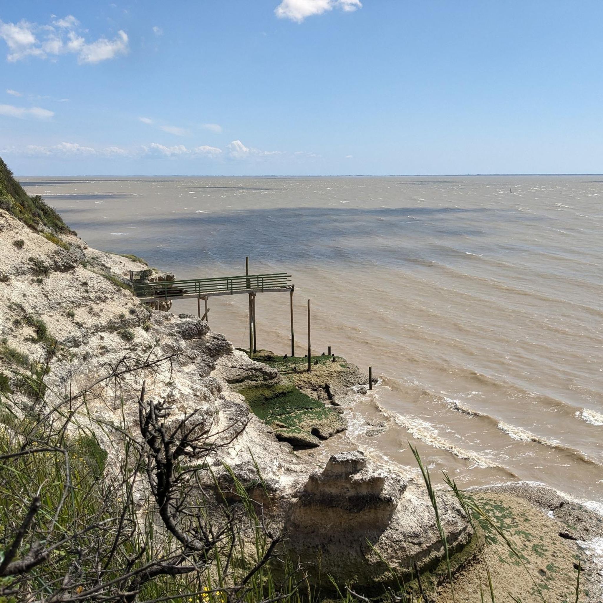
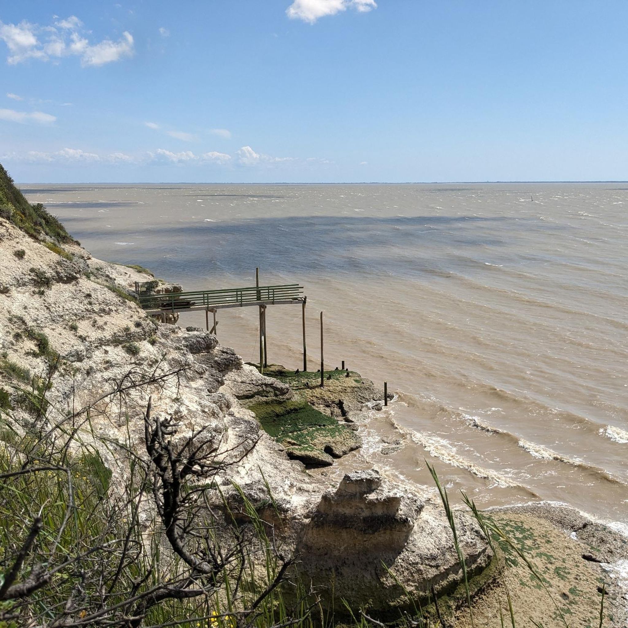
📍 Introducing the Gilet Cove The Gilet Cove is a small, natural beach on the oceanfront, located on Boulevard de la Conche de Gilet / Boulevard de la Falaise, in the town of Vaux-sur-Mer, just before Royan. 🌿 It's a sheltered, rocky cove, appreciated for its tranquility and more intimate setting compared to the larger urban beaches nearby. 🏖️ At high tide, the sea can completely cover this small beach, making the space very limited; at low tide, you can enjoy a patch of sand and rocks for relaxing or swimming. 🧭 Features & Tips 📍 Type of place: small, unsupervised beach, nestled among the rocks with sand and cliffs. 🏖️ Tides: access is best at low tide — at high tide the beach can disappear underwater. 🐶 Animals: prohibited from April 1st to September 30th (subject to municipal regulations). 👣 Access: via stairs from the boulevard above, surrounded by villas with sea views. 🚫 Lifeguard services: no lifeguard station or marked services. 📍 Location La Conche de Gilet is often considered the last small beach in Vaux-sur-Mer before reaching Royan/Pontaillac when following the coastline from Saint-Palais-sur-Mer.
0
0
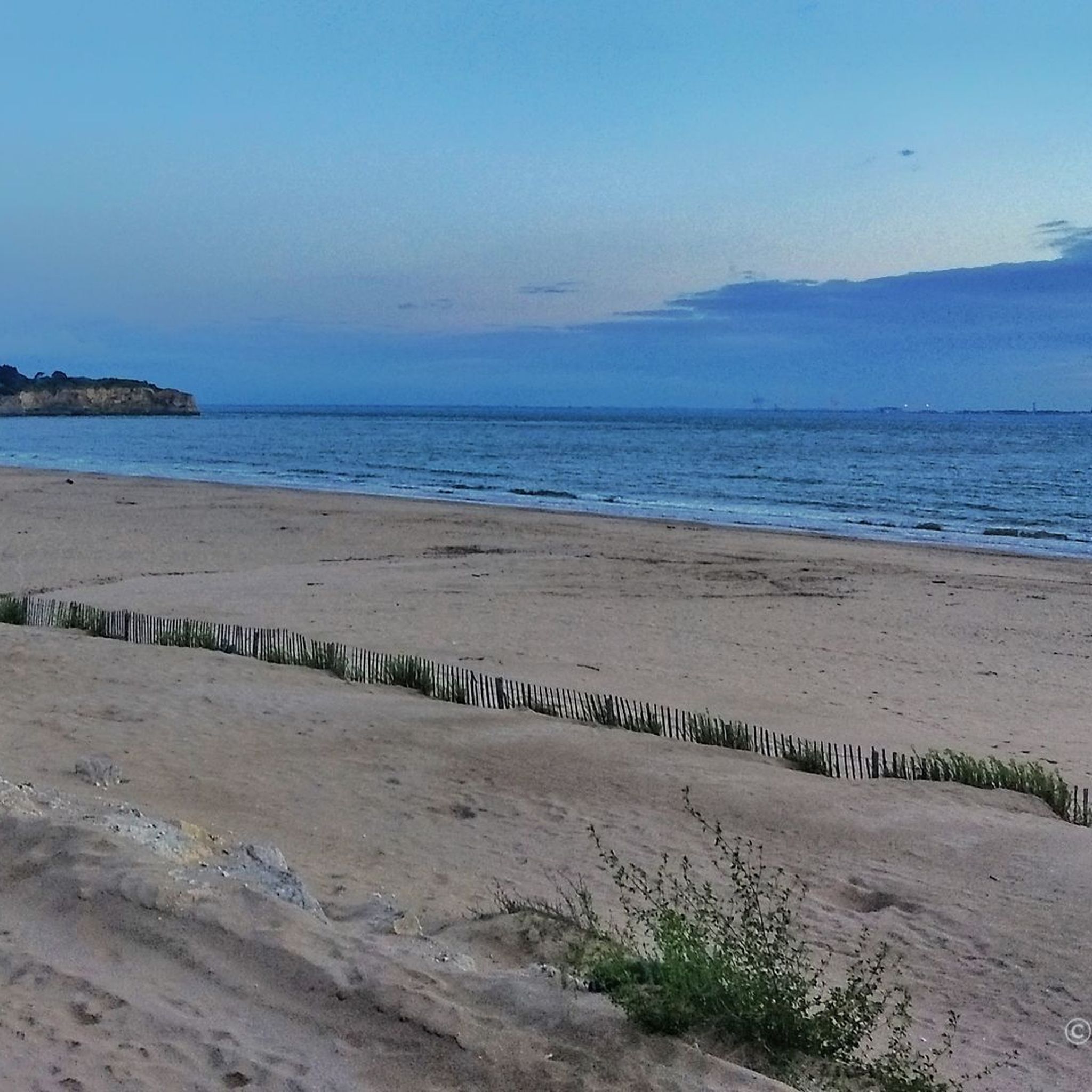
🏖️ General Overview Chay Beach is a family-friendly, fine sandy beach located in Royan (Charente-Maritime), on the Côte d’Argent promenade between Pigeonnier Beach and Pointe du Chay. It stretches for approximately 200 meters and boasts a pleasant natural setting, with a cove bordered by rocks typical of the Charente coastline. 🏝️ Features • 🌊 Beach type: fine sand, sheltered cove. • 🏄♂️ Atmosphere: relatively calm and family-friendly, ideal for children and vacationers seeking relaxation away from the large urban beaches. • 🐾 Pets: prohibited from April 1st to September 30th. • 🫧 Water quality: excellent (Blue Flag label awarded for 2025). 🧭 Lifeguard and Safety • Swimming is supervised during the season (June to early September), with areas marked by red and yellow flags. • The area is classified as a Category 3 "Supervised Beach" and lifeguards are present during the indicated hours. 🪑 Amenities On-site, you can find: • 🏖️ Sun loungers, parasols, and mattresses for rent. • 🚿 Foot rinse and public restrooms. • 📶 Wi-Fi access, first aid station, and an area accessible to people with reduced mobility (assistance may be required depending on the slope). • 🍴 Beachfront restaurant ("Le Chay" bar-restaurant with sea views). 🚶♂️ Atmosphere and Activities • 🎈 Ideal for families and leisurely strolls. • 🌞 People come here for swimming, playing on the sand, flying kites, or simply relaxing by the ocean. • 🅿️ Parking is available nearby, and the beach is easily accessible on foot or by bike from Royan town center in just a few minutes. 🧭 Practical Tips • 📆 Best time to visit: summer for supervised swimming and full services, but also during the off-season for a more peaceful atmosphere. • ☀️ Arriving early in the morning makes parking easier during peak season. • 🐶 Dogs are not allowed during the summer season; check the signs on site during the off-season.
0
0
Located in the town center and close to the port, La Grande Conche stretches over 2,600 meters of fine sand. The supervised area, marked by colored flags, and totems to facilitate navigation, its amenities, and its calm waters make it an ideal beach for families. Nearby, the always lively seafront with its restaurants, ice cream parlors, cafes, and shops. Municipal decree 22-1388, prohibiting access to the town's beaches to animals, even on leashes, applies from April 1st to September 30th. Special signage is posted at each site indicating the mandatory health measures. Nudist activities are prohibited. From the structures in place to cleanliness (daily cleaning) and the quality of bathing water (regular sampling), Royan beaches receive great attention from municipal technical services and the Urban Community. Due to its urban setting and reasonable size, it's relatively easy to find your way around using the lifeguard station or a building as a landmark. Similarly, during the season, they set up information huts on both sides of the beach, tents (canvas beach huts) to provide tourists with some shade, totems to make it easier to find their way around, deckchairs/sun loungers, and a specially designed path (rigid plastic slabs that clip together). Rankings & Labels: Blue Flag Location Details: Footpath nearby. - Sandy beach - Cycle path/route within 500 m - Coastline - Public transport stop within 500 m On-site activities: Water sports - Beach / Swimming area -
0
0
The port of Royan is located between the Foncillon district and the Grande Conche beach, in the heart of the city. Ideally located at the mouth of the Gironde, in the immediate vicinity of the Atlantic Ocean and opposite Port-Médoc, it consists of a marina with a thousand rings and a fishing port, specializing in “noble” species (sole, meagre, sea bass, etc.). You will find the harbor master's office, the Fishing Port and the auction, as well as a covered shopping arcade, “Les voûtes du Port”, which extends the shopping arcades of the “Front de Mer”. Port, 1100 sheltered places – Reception pontoon – Secure pontoons. Access pass is 0.30 m above the zero of the nautical charts. Basins after dredging 2.30 m from the zero of the nautical charts. Services: water, electricity (220 V) on pontoon, toilets, WC, showers, handling in closed technical area, recovery of careening water, grey water and black water pumps, maintenance and ship repair workshops, ship chandlers on the port, wifi, 24/24 CB fuel, slipway. V.H.F. 9. The port is sheltered from all winds because it is protected by the landing stage of the ferries which ensure the crossing of the Gironde for the crossings to the Pointe de Grave/Le Verdon-sur-Mer.
1
0
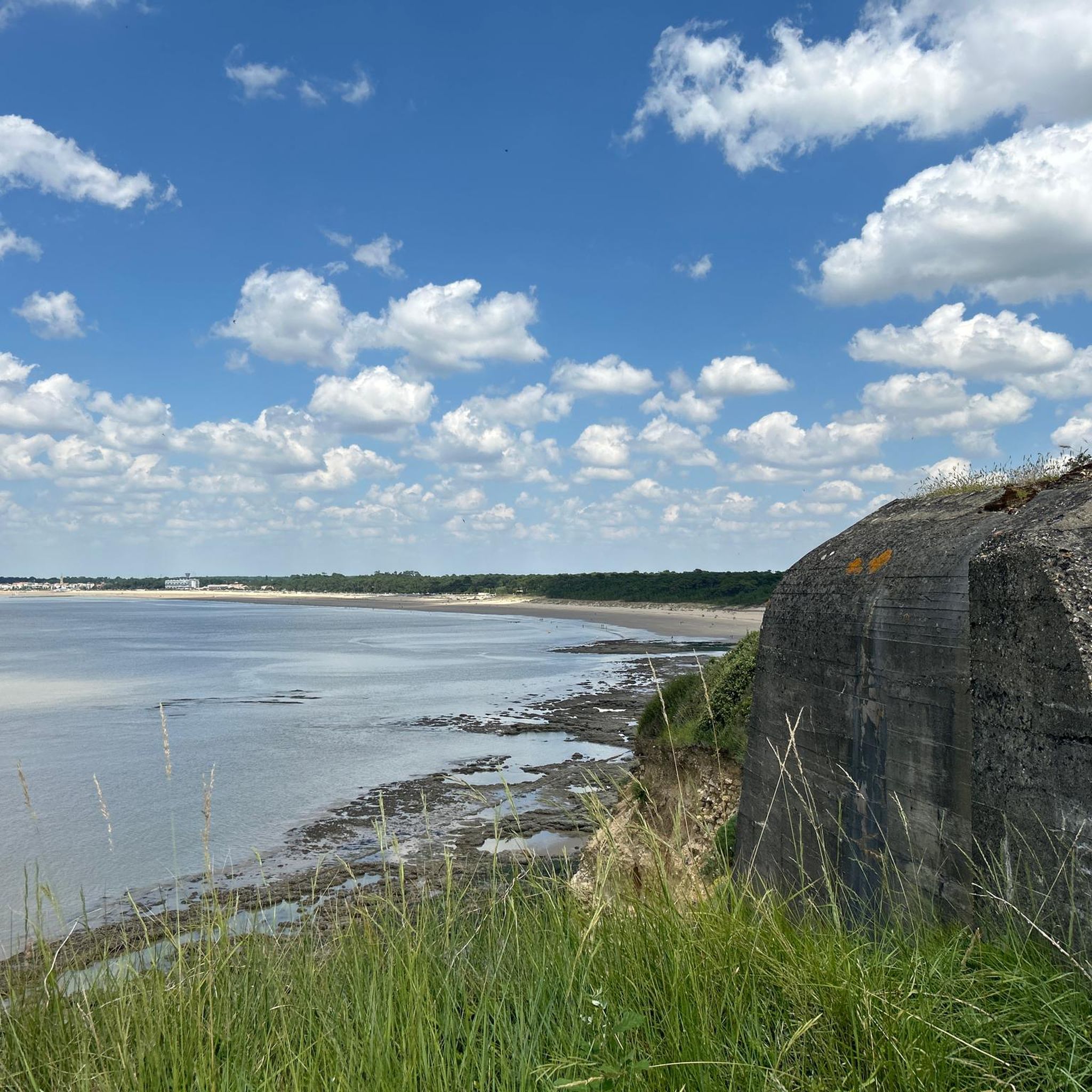
Of the first star-shaped fort (1811), only a few things remain today. In 1859 its plan was redesigned with a solid ground facing the sea separated by a large ditch cutting the fort in two. The redoubt is cut off and allows the access bridge located to the north to be monitored. This redoubt has the particularity of having a specific plan. It only has a machicolation on three of its sides to the north (inland side) and on its two short sides (east and west). The tour of the solid ground is reinforced by a large masonry wall now. At the rear, the star-shaped device protects against attacks coming from the land. The site was affected by erosion and especially lost its relief after the Second World War. The battery line is still visible from the air and on the ground, only a few German and French bunkers are still outcropping. They are inaccessible. Transformed into a promenade, the site borders the coastal path that starts from the port of Royan and continues to the Grande Côte. Today, nearly 75% of the militarized surface of the late 19th century is occupied by residences and the Cordouan Thalazur hotel. The site still has some visible remains, mainly of French origin
0
0
The first fortification projects for Pointe du Chay date back to 1772, counterbalanced on the other bank by Fort du Verdon. But it was not until the battle of 1811 that the military authorities were convinced to fortify the point. However, in 1757, Marshal Senectere, Lord of Didonne, had a defensive element built a little further south of Fort du Chay. He had opened a strategic route to protect the mouth of the estuary. A fort comprising star-shaped bastions was built between 1811 and 1812. It was recaptured by the English in April 1814 and partly destroyed. It was not until the Second Empire that the fort was considerably improved. In addition to the rebuilt embankments, a redoubt derived from the crenellated towers of the 1846 type was built between 1859 and 1860. It served the battery. The battery was remodeled between 1875 and 1877 at the same time as that of the Fort de Suzac. This new battery included eight cannons that would not evolve again until the Second World War. They were divided into four 24cm cannons and four 27cm cannons. One of the vats is disproportionate and seems to indicate that it was planned to install a larger piece there. A fire control post was probably built after 1920, perhaps at the same time as the Arros battery around 1937. It does not appear on the aerial photos of 1920 and is located in front of the firing positions. According to some sources, the Fort du Chay was equipped around 1930 with 75 model 1897 cannons (to be confirmed). The Fort du Chay redoubt would have a hardly more favorable fate than the one near the Fort de Suzac. Integrated into the improvements made to the fort at the end of the 19th century and then at the beginning of the 20th century, this structure would remain until the fort was integrated into the Atlantic Wall around 1942. In 1920, the fort was partially disarmed since only seven of the eight cannons and a reduced garrison remained. At the end of the Second World War, the Fort du Chay redoubt, the oldest vestige of the fort, was literally cut in two by the bombings of 1944 to 1945. Although in 1946, the site remained as it was, it was the object of much covetousness from 1950. The site was largely razed between 1956 and 1957 to make way for a program of 120 housing units. In 1959, it was used temporarily by an equestrian center using a large part of the star-shaped glacis of 1811.
0
0
The Chay de Royan beach is a continuation of the Pigeonnier cove on the Côte d'Argent promenade and offers a larger area than the latter. This sandy beach is family-friendly with a restaurant on the beach. It is supervised during the summer season (mid-June to early September) and you can rent mattresses and cabins. The environment of this beach is very pleasant, there are fewer houses than on the other beaches in Royan. A large car park is available near this beach (left side). Access is possible for people with reduced mobility via an inclined plane with assistance (the slope is steep). Dogs are prohibited from April 1st to October 31st.
1
0
The Pointe de Vallières is one of the many rocky capes that punctuate the coastline of the Côte de Beauté, from the Terre-nègre promontory in Saint-Palais-sur-Mer to that of Caillaud in Talmont-sur-Gironde. From a geological point of view, it is made up of rocks dating from the Upper Cretaceous period dominated by yellowish limestone strata rich in bryozoans, echinoderms and spherulites, which testify to the presence of a warm and shallow sea at the end of the secondary era. A few relict lenses dating from the Eocene period can also be observed near the lighthouse. The coasts of Vallières are made up of cliffs, less steep than those of Suzac due to more pronounced erosion, more jagged too (small sheltered coves, cavities, including the cave of the Pointe de Vallières — but also the modest "île aux mouettes", a fragment of cliff separated from the rest of the point, colonized by seabirds). In its southern part, the Pointe de Vallières is extended by a dike that marks the entrance to the port. To the north as well as to the south, the point is extended by vast reefs, among the most developed on the Côte de Beauté: these are, respectively, the Banc de Vallières and that of Béchade, at the entrance to the port.
1
0
Frequently Asked Questions
How many running routes are available in Saint-Georges-De-Didonne?
Saint-Georges-De-Didonne offers a wide selection of running routes, with over 40 trails to explore. These routes cater to various fitness levels, including easy, moderate, and difficult options.
Are there easy running routes suitable for beginners or families?
Yes, Saint-Georges-De-Didonne has 13 easy running routes perfect for beginners or families. Many of these paths are flat and traverse scenic areas like the beaches or the Enlias lake, providing a pleasant experience for all ages. For a moderate option, consider the Royan Main Beach – Royan Promenade and Beach loop from Saint-Georges-de-Didonne, which is 6.1 km long.
Where can I find longer or more challenging running trails?
For those seeking a more challenging run, Saint-Georges-De-Didonne offers 7 difficult routes. A notable option is the Chay Beach – Chay Beach loop from Saint-Georges-de-Didonne, which spans 17.5 km and explores the coastal scenery around Chay Beach.
What kind of scenery can I expect on the jogging routes in Saint-Georges-De-Didonne?
The running routes in Saint-Georges-De-Didonne offer a diverse range of scenery. You can expect extensive sandy beaches like the Grande Conche, picturesque coastal paths winding past limestone cliffs, and the tranquil Suzac Forest with its shady trails. The region is bordered by the Atlantic Ocean and the Gironde estuary, providing stunning water views.
Are there any specific landmarks or points of interest along the running paths?
Absolutely! Many routes pass by significant landmarks. You can run along the coastal path past the Vallières lighthouse, or explore the Suzac Forest which leads to the Pointe de Suzac, offering panoramic views. The Saint-Georges-de-Didonne Beach and Chay Beach are also prominent features along many trails.
Can I find circular running routes in the area?
Yes, many of the running routes in Saint-Georges-De-Didonne are circular, allowing you to start and end at the same point. An example is the Saint-Georges-de-Didonne – loop, a moderate 8.3 km trail that offers a varied experience through the town and along the coast.
Are the running trails in Saint-Georges-De-Didonne dog-friendly?
While specific regulations for dogs on all trails can vary, many natural areas and forest paths, such as those in the Suzac Forest, are generally welcoming to dogs, often requiring them to be on a leash. It's always best to check local signage, especially on beaches, as rules can change seasonally.
What is the best time of year to go jogging in Saint-Georges-De-Didonne?
Saint-Georges-De-Didonne is enjoyable for jogging year-round. Spring and autumn offer pleasant temperatures and fewer crowds, ideal for exploring. Summer is great for seaside runs, especially in the mornings or evenings to avoid the heat. Even winter can be invigorating, with crisp air and dramatic coastal views.
Are there any running routes that explore the Suzac Forest?
Yes, the Suzac Forest is a fantastic location for trail running, offering shady paths and a peaceful environment. Routes within this extensive forest lead to the Pointe de Suzac, providing stunning views over the Gironde estuary and the Atlantic Ocean.
Where can I find parking near the running trails?
Parking is generally available in Saint-Georges-De-Didonne, especially near popular beaches, the town center, and access points to natural areas like the Suzac Forest. Many routes, such as the Running loop from Parc de l'Estuaire, often have convenient parking nearby.
What do other runners say about the trails in Saint-Georges-De-Didonne?
The running routes in Saint-Georges-De-Didonne are highly rated by the komoot community, with an average score of 4.6 stars from over 25 reviews. Runners frequently praise the varied terrain, from sandy beaches to forested trails, and the scenic coastal paths that offer breathtaking views.
Can I combine a run with a visit to a beach?
Absolutely! Saint-Georges-De-Didonne is perfect for combining running with beach visits. The town boasts several fine sandy beaches like the Grande Conche and Vallières beach, which are ideal for seaside runs. You can easily integrate a run along the shore with time to relax by the water.
Are there any urban running routes that pass through the town?
Yes, there are urban routes that allow you to explore the town while running. An easy 3.5 km urban route takes joggers along the seafront, past the Charles Martel promenade, and towards the Vallières lighthouse, looping back through the town center and past the Saint-Georges church.
Are there routes that offer views of the Gironde estuary?
Many coastal paths and routes, particularly those leading to the Pointe de Suzac, offer spectacular views of the Gironde estuary. The unique geographical position of Saint-Georges-De-Didonne ensures that estuary views are a frequent and beautiful feature of its running landscape.
Most popular routes around Saint-Georges-De-Didonne
Most popular attractions around Saint-Georges-De-Didonne

Get inspired with the komoot mobile app


Explore more
Browse the best Running Trails & Routes in other regions.
