The best walks and hikes around Saint-Georges-De-Didonne
4.4
(165)
1,615
hikers
51
hikes
Hiking around Saint-Georges-De-Didonne offers diverse landscapes, situated between the Atlantic Ocean, the Gironde estuary, and the Suzac forest. The region features limestone cliffs, fine sandy beaches, and marshlands, providing varied terrain for exploration. Trails often lead through protected natural areas like the Suzac Forest, which includes historical remnants and panoramic viewpoints such as Pointe de Suzac. The area's geography supports a range of hiking experiences, from coastal walks to forest paths.
Best hiking trails around Saint-Georges-De-Didonne
- The most popular hiking…
Last updated: October 10, 2026
4.5
(41)
199
hikers
8.27km
02:10
70m
70m
Moderate hike. Good fitness required. Easily-accessible paths. Suitable for all skill levels.
4.5
(6)
24
hikers
9.89km
02:37
100m
100m
Moderate hike. Good fitness required. Easily-accessible paths. Suitable for all skill levels.

4.4
(9)
71
hikers
Moderate hike. Good fitness required. Easily-accessible paths. Suitable for all skill levels.
4.5
(4)
100
hikers
6.23km
01:36
20m
20m
Easy hike. Great for any fitness level. Easily-accessible paths. Suitable for all skill levels.
4.0
(1)
81
hikers
Easy hike. Great for any fitness level. Easily-accessible paths. Suitable for all skill levels.
Get access to more routes and recommendations from other explorers.
Already have an account?
Our route recommendations are based on thousands of hikes, rides, and runs completed by other people on komoot.
Start today with a free account
Your next adventure awaits.

Tips from the Community

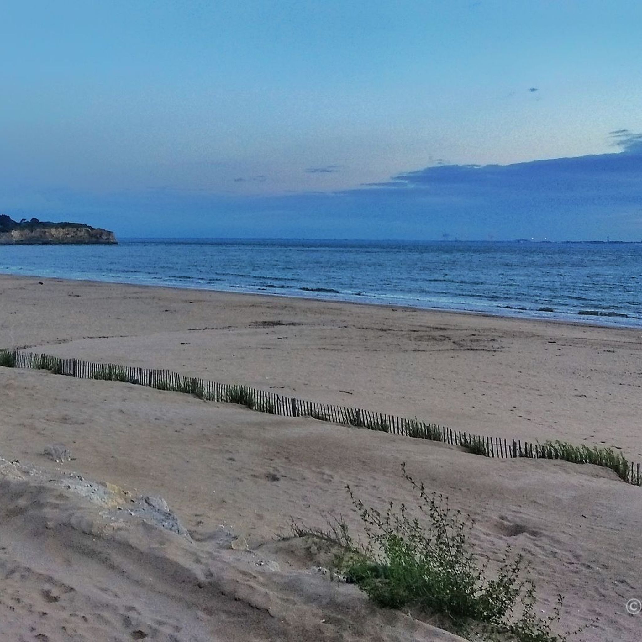
Perfect beachside bike trail along the boulevard, with several rest stops with seating and beach acces.
0
0

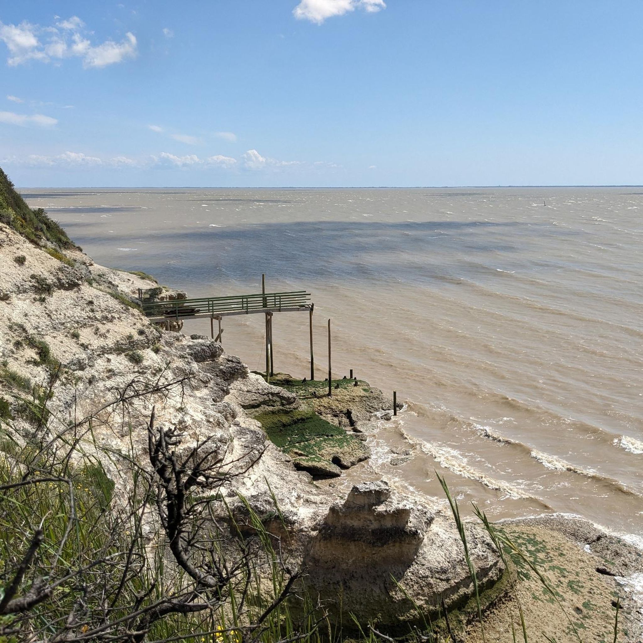
The Pointe de Vallières is one of the many rocky capes that punctuate the coastline of the Côte de Beauté, from the Terre-nègre promontory in Saint-Palais-sur-Mer to that of Caillaud in Talmont-sur-Gironde. From a geological point of view, it is made up of rocks dating from the Upper Cretaceous period dominated by yellowish limestone strata rich in bryozoans, echinoderms and spherulites, which testify to the presence of a warm and shallow sea at the end of the secondary era. A few relict lenses dating from the Eocene period can also be observed near the lighthouse. The coasts of Vallières are made up of cliffs, less steep than those of Suzac due to more pronounced erosion, more jagged too (small sheltered coves, cavities, including the cave of the Pointe de Vallières — but also the modest "île aux mouettes", a fragment of cliff separated from the rest of the point, colonized by seabirds). In its southern part, the Pointe de Vallières is extended by a dike that marks the entrance to the port. To the north as well as to the south, the point is extended by vast reefs, among the most developed on the Côte de Beauté: these are, respectively, the Banc de Vallières and that of Béchade, at the entrance to the port.
1
0

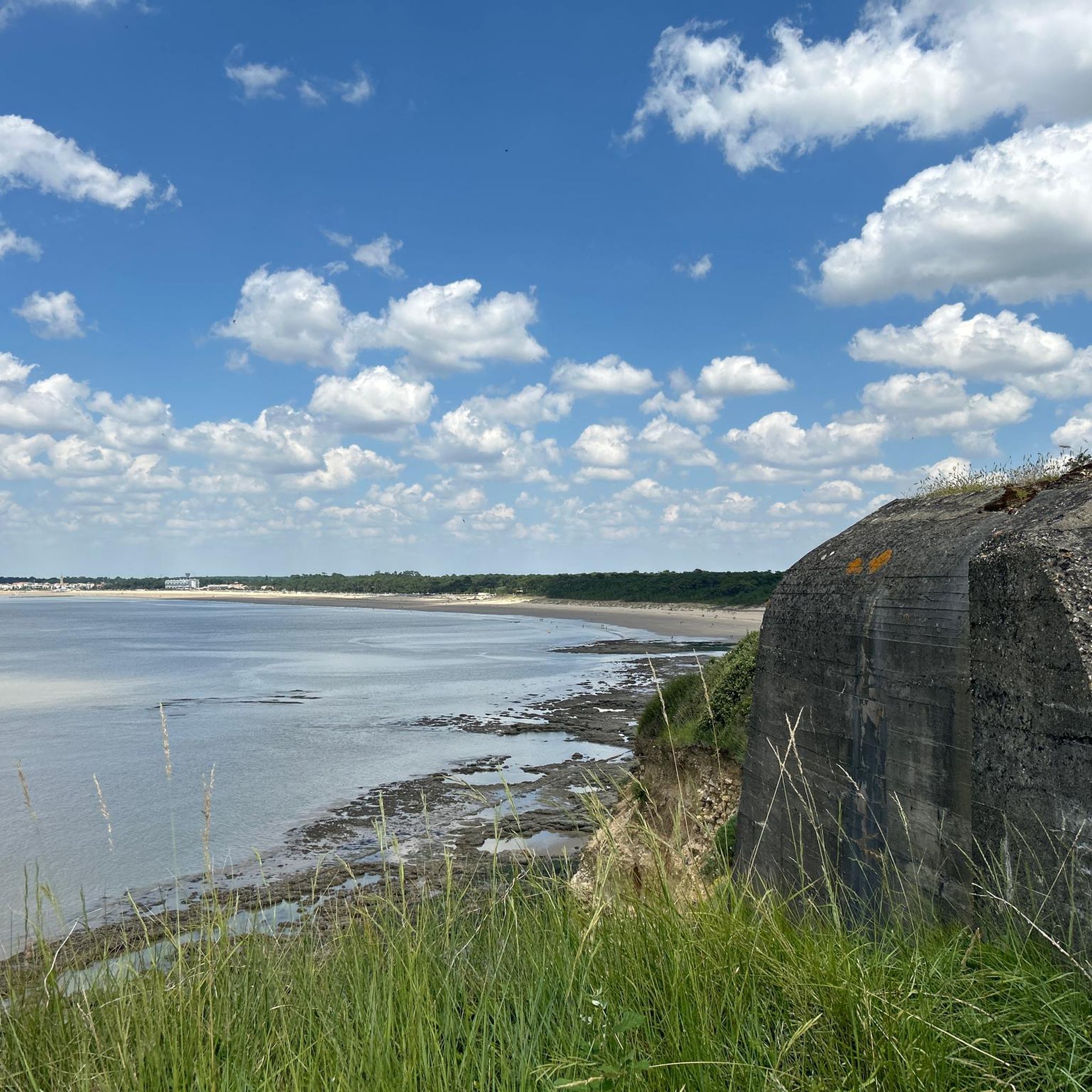
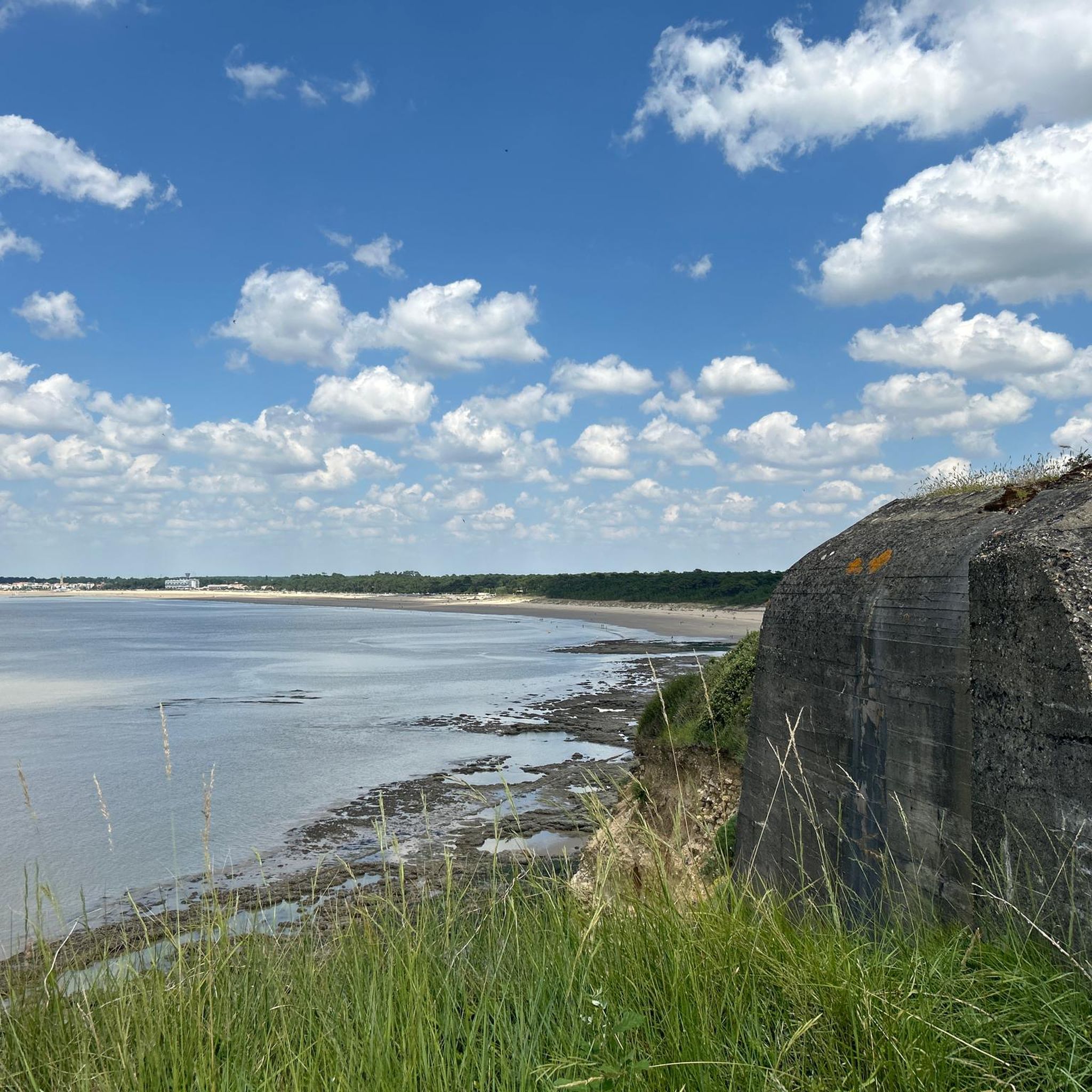
Remains of fortifications from the 19th century and World War II in a beautiful landscape
0
0

Great park with a very nice café and a magnificent view over the sea.
0
0

Originally 75 million years ago, natural holes dug into the sea. Later, they were conditioned by man to serve as homes. They are restored and can be visited.
0
0

The photos correspond to the Ardèche conche. Vergnes beach is further towards Meschers with parking and accessible all the time
0
0

These rock dwellings were created by the sea 65 million years ago and then carved out and repeatedly inhabited by humans.
0
0
Frequently Asked Questions
How many hiking trails are available around Saint-Georges-De-Didonne?
There are over 40 hiking routes recorded around Saint-Georges-De-Didonne, offering a wide variety of experiences. These include easy coastal strolls, moderate forest loops, and longer routes exploring the estuary and cliffs.
What kind of terrain can I expect on hikes in Saint-Georges-De-Didonne?
Hiking in Saint-Georges-De-Didonne offers a diverse range of terrain. You'll find paths winding through the dense Suzac Forest, along dramatic limestone cliffs, across fine sandy beaches, and with views over the Gironde estuary. Some routes also venture into marshlands, providing varied ecosystems to explore.
What do other hikers say about the trails in Saint-Georges-De-Didonne?
The hiking routes in Saint-Georges-De-Didonne are highly rated by the komoot community, with an average score of 4.5 stars from over 140 reviews. Hikers often praise the diverse landscapes, from coastal paths to forest trails, and the well-maintained nature of the routes.
Are there easy hiking options suitable for beginners or casual walkers?
Yes, Saint-Georges-De-Didonne offers plenty of easy hiking options. Out of the 44 available routes, 30 are classified as easy, making them perfect for beginners, families, or those looking for a relaxed stroll. Many coastal paths and shorter forest loops fall into this category.
Are the hiking trails in Saint-Georges-De-Didonne family-friendly?
Absolutely. Many trails in Saint-Georges-De-Didonne are suitable for families, offering moderate loops and easy walks through varied landscapes. The Abgang zum Strand – View from the Cliffs loop from Saint-Georges-de-Didonne, for example, is an easy 4.7-mile trail that provides coastal views without being overly strenuous.
Can I bring my dog on the hiking trails in Saint-Georges-De-Didonne?
Many of the natural areas and trails in Saint-Georges-De-Didonne are dog-friendly, especially within the Suzac Forest and along some coastal paths. However, it's always recommended to keep dogs on a leash, particularly in protected areas or during peak seasons, and to check local regulations for specific beaches or nature reserves.
What natural features or landmarks can I see while hiking?
While hiking in Saint-Georges-De-Didonne, you can explore a wealth of natural features and historical landmarks. Highlights include the protected Suzac Forest, the panoramic views from Pointe de Suzac, and the fascinating Grottes de Matata. You might also spot the historic Vallières Lighthouse and remnants of the Atlantic Wall within the forest.
Are there any hikes that offer great views?
Yes, Saint-Georges-De-Didonne is known for its scenic views. The coastal paths and trails through the Suzac Forest, particularly around Pointe de Suzac, offer stunning panoramic vistas of the Gironde estuary and the Atlantic Ocean. The View from the Cliffs – Suzac Forest loop from Parc de l'Estuaire is an easy route that combines forest exploration with cliffside views.
Are there circular hiking routes available?
Many of the hiking routes around Saint-Georges-De-Didonne are designed as loops, allowing you to start and end at the same point. Examples include the popular Suzac Forest – Grottes de Matata loop from Saint-Georges-de-Didonne, which combines forest and coastal scenery, and the Abgang zum Strand – View from the Cliffs loop from Saint-Georges-de-Didonne.
Is there parking available at the trailheads?
Yes, many of the popular hiking areas in Saint-Georges-De-Didonne, especially those leading into the Suzac Forest or near the main beaches, offer designated parking facilities. It's advisable to check specific route details for parking information, but generally, you'll find convenient access points.
What is the best season for hiking in Saint-Georges-De-Didonne?
Saint-Georges-De-Didonne is enjoyable for hiking throughout much of the year. Spring and autumn offer pleasant temperatures and beautiful natural colors, making them ideal. Summer is also popular, especially for coastal walks, though it can be busier. Even in winter, the mild climate allows for invigorating walks, particularly through the sheltered forest trails.
Are there any historical sites to explore while hiking?
Yes, the region has a rich history that can be discovered on foot. Within the Suzac Forest, you can find remnants of the Atlantic Wall and old blockhouses, offering a glimpse into its military past. The Fort and Forest of Suzac Trail specifically explores these historical features.
Can I combine a hike with a visit to a beach?
Absolutely. Saint-Georges-De-Didonne's location means many hiking routes incorporate or lead to its beautiful sandy beaches. You can enjoy a stroll along the expansive Grande Plage, Vallières beach, or Suzac beach as part of your hike, or discover smaller coves like the Conche de Gilet.
Most popular routes around Saint-Georges-De-Didonne
Most popular attractions around Saint-Georges-De-Didonne

Get inspired with the komoot mobile app


Explore more
Browse the best Hikes in other regions.
