The best road cycling routes around Saint-Barthélemy-Le-Plain
4.5
(278)
8,833
riders
262
rides
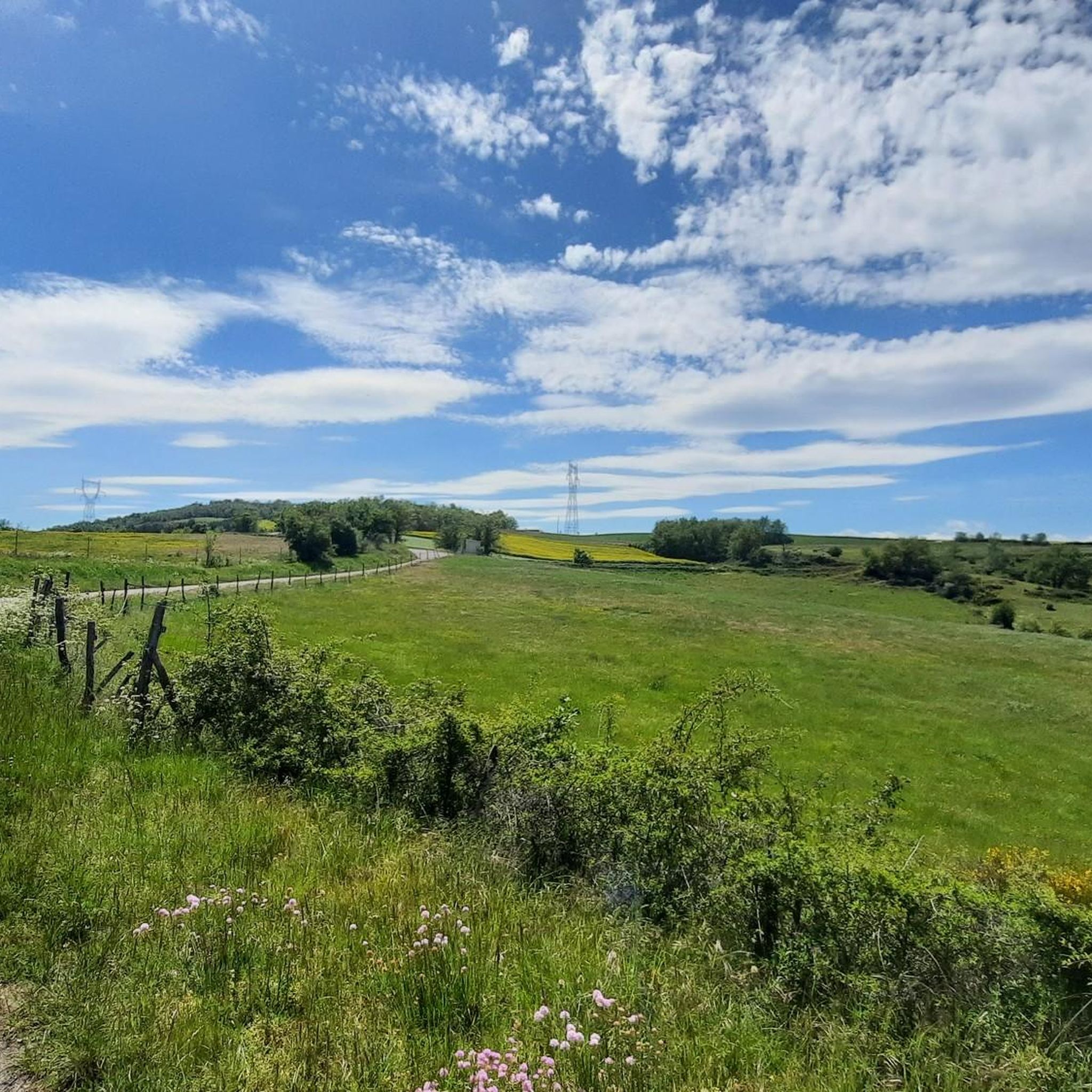
Road cycling around Saint-Barthélemy-Le-Plain offers diverse terrain across a verdant plateau at an average altitude of 400 meters. The region is bordered by the deep gorges of the Doux River to the north and the Duzon River to the south, providing varied elevation changes. Cyclists can experience panoramic views of the Vercors mountain range and, in the distance, the Alps. The well-paved surfaces of the routes cater to various fitness levels.
Best road cycling routes around Saint-Barthélemy-Le-Plain
- The most popular…
Last updated: July 10, 2026
110
riders
133km
06:52
2,130m
2,130m
Hard road ride. Very good fitness required. Mostly well-paved surfaces and easy to ride.
4.5
(2)
39
riders
47.1km
02:34
850m
850m
Moderate road ride. Good fitness required. Mostly well-paved surfaces and easy to ride.

Sign up for free
21
riders
82.4km
04:15
1,360m
1,360m
Hard road ride. Very good fitness required. Mostly well-paved surfaces and easy to ride.
17
riders
81.0km
04:33
1,670m
1,670m
Hard road ride. Very good fitness required. Mostly well-paved surfaces and easy to ride.
23
riders
94.7km
05:01
1,800m
1,800m
Hard road ride. Very good fitness required. Mostly well-paved surfaces and easy to ride.
Get access to more routes and recommendations from other explorers.
Sign up for free
Already have an account?
Our route recommendations are based on thousands of hikes, rides, and runs completed by other people on komoot.
Start today with a free account
Your next adventure awaits.
Login or Signup

Tips from the Community

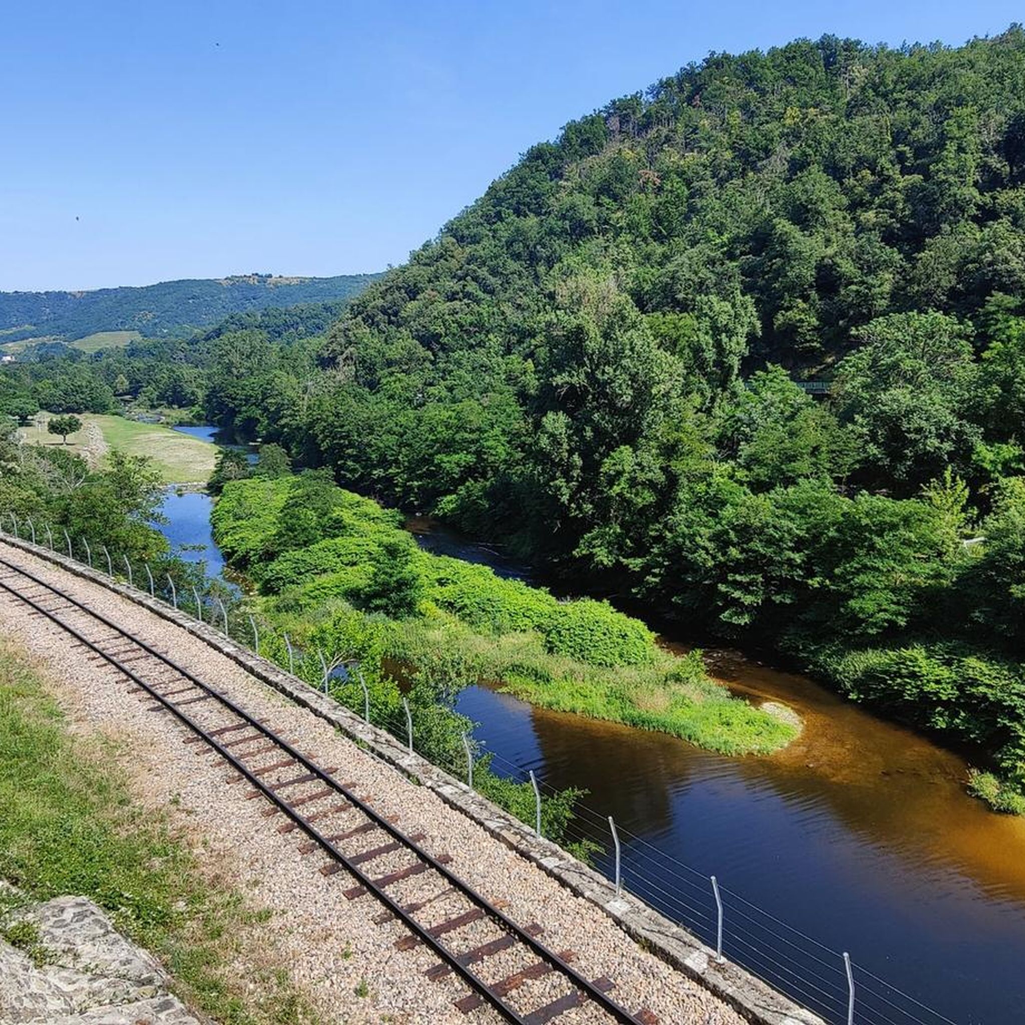
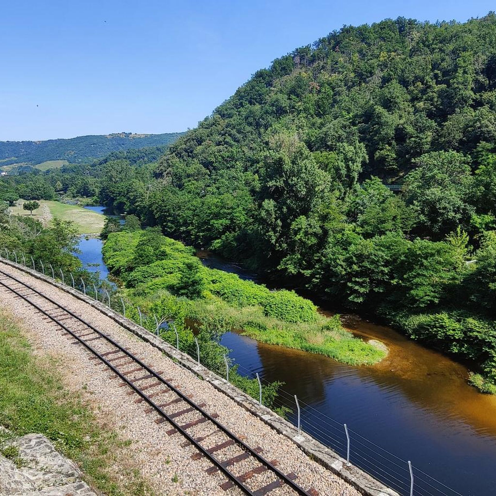
Called the Mastrou or Train de l'Ardèche, the Vivarais railway is a 33-kilometer-long metre-gauge tourist railway line, connecting Lamastre to Saint-Jean-de-Muzols, near Tournon-sur-Rhône. A steam train, with a locomotive classified as a Historic Monument, invites young and old to discover the green Doux valley, a preserved area with panoramas inaccessible by road. Part of the Mastrou line can also be travelled by railbike starting from Boucieu-le-Roi. Twelve kilometers of descent by railbike in the Doux gorges, with a return by historic railcar, to do as a couple, with family or with friends! trainardeche.fr velorailardeche.com
0
0
The Duzon bridge was begun on June 20, 1870, and completed on December 25, 1871 (designed by Marius Bouvier). Built with local stones, it has 8 arches and is 50 meters high. Connecting Tournon to Lamastre, 175 meters long, the bridge sees over 4,000 vehicles and about 200 heavy trucks pass each day in both directions.
0
0
The bridge called the King's Bridge was erected at the beginning of the 13th century. Indeed, in 1291, Philip the Fair officially declared the foundation of Boucieu and thus created a co-lordship with the lord Geronton de Valmordane. Boucieu le Roi was endowed with a charter of franchise (tax exemption for its inhabitants) and a bailiwick (court of justice). The charter of franchise would attract numerous merchants and notables. Access routes were therefore paramount, hence the construction of this 3-arch bridge. It would later be widened in 1773. https://www.ardeche-hermitage.com/fr/catalogue/detail/pont-du-roi-129249/
0
0
Board the Mastrou and discover our entire line, from the T. St Jean de Muzols station to Lamastre. The railway is the only way to admire the wild landscapes of the Doux Valley, a river it follows for 28 kilometers, crossing bridges, viaducts, and tunnels. From the Gorges du Doux to the Ardèche plateau, passing through orchards and chestnut groves, you won't miss a thing in the Ardèche verte! https://www.trainardeche.fr/
0
0
Dating from 1483, the Grand pont was built over the Doux river between Tournon sur Rhône and Saint Jean de Muzols. The arch, measuring 51m, was at the time the largest arch in the world. More than 100 years of work were necessary for the construction of this bridge.
0
0
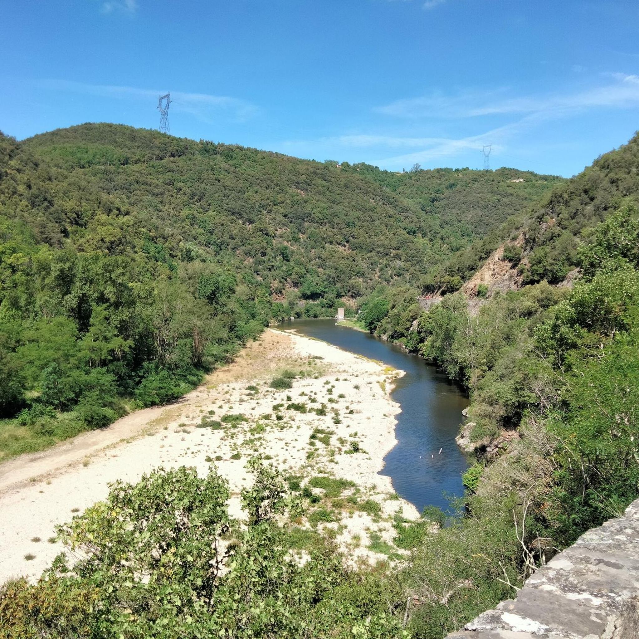
The Gorges du Doux owe their name to the river that flows through them. The name is misleading: the river and the gorges have a wild, even tumultuous aspect! This valley will amaze you with its diversity: river, forest, relief, pastures… This exceptional space has also been classified as a sensitive natural area (Espace Naturel Sensible) since 2015. Discover different atmospheres depending on where you are! In the middle of the valley, stop in the characterful village of Boucieu le Roi and walk to the banks of the Doux river. It is hard to imagine that this modest watercourse can overflow its banks, but one must always be wary of still waters: the floods of the Doux are terrible! Besides, it is said that the name "doux" (soft) was given to moderate the relentless character of the river…
0
0


Lively place, lots of shops.
0
0
Frequently Asked Questions
What kind of terrain can I expect when road cycling around Saint-Barthélemy-Le-Plain?
The region offers diverse terrain, situated on a verdant plateau at an average altitude of 400 meters. You'll find varied elevation changes, bordered by the deep gorges of the Doux River to the north and the Duzon River to the south. Routes feature mostly well-paved surfaces, suitable for road bikes.
Are there road cycling routes suitable for beginners in Saint-Barthélemy-Le-Plain?
Yes, Saint-Barthélemy-Le-Plain has several easy road cycling routes. For instance, the ViaRhôna at Arras-sur-Rhône – Church of Sarras loop is an easy 37.4 km ride with a modest 120 meters of elevation gain. Another gentle option is the Passerelle Marc-Seguin – Le Rioudard in Glun loop, spanning 29.5 km with minimal elevation.
What are the more challenging road cycling routes in the area?
For experienced cyclists seeking a challenge, the region offers routes with significant elevation. The Doux Gorges – Col de Boze (460 m) loop covers 48.3 km with approximately 700 meters of elevation gain. Another demanding option is the Passerelle Marc-Seguin – Col de Mayres loop, which is 55.9 km long and includes an impressive 930 meters of elevation gain.
What scenic views or landmarks can I see while cycling in Saint-Barthélemy-Le-Plain?
Cyclists can enjoy splendid panoramic views of the Vercors mountain range, and in the distance, the majestic Alps, including Mont-Blanc. The Mont Gerbier des Joncs is also visible on the Auvergne side. Notable landmarks include the historic Passerelle Marc-Seguin, a footbridge that has accommodated cyclists since 1958, and the Saint Romain de Lerps Peak for expansive vistas.
Are there any circular road cycling routes available?
Yes, many of the routes around Saint-Barthélemy-Le-Plain are designed as loops, allowing you to start and finish in the same location. Examples include the Passerelle Marc-Seguin loop and the Doux Gorges – Col de Boze (460 m) loop, providing varied distances and elevations.
How many road cycling routes are there in Saint-Barthélemy-Le-Plain?
There are over 260 road cycling routes available around Saint-Barthélemy-Le-Plain, catering to various skill levels. This includes approximately 30 easy routes, 147 moderate routes, and 85 difficult routes.
What do other road cyclists say about the routes in Saint-Barthélemy-Le-Plain?
The road cycling routes in Saint-Barthélemy-Le-Plain are highly rated by the komoot community, with an average score of 4.5 stars from over 200 reviews. Cyclists often praise the diverse landscapes, panoramic views, and the well-paved surfaces that make for an enjoyable ride.
Is Saint-Barthélemy-Le-Plain suitable for family-friendly road cycling?
While the region offers varied terrain, some of the easier, flatter loops, particularly those along river paths like sections of the ViaRhôna, can be suitable for families. Always check the route's elevation profile and distance to ensure it matches your family's cycling ability.
What is the best time of year for road cycling in Saint-Barthélemy-Le-Plain?
The region is generally pleasant for cycling from spring through autumn. The verdant plateau and river gorges offer beautiful scenery during these seasons. Summer can be warm, so early morning or late afternoon rides are often preferred. Winters can be cooler, but specific route conditions would depend on local weather.
Are there any amenities like cafes or accommodation for cyclists in Saint-Barthélemy-Le-Plain?
Saint-Barthélemy-Le-Plain is a charming village, and the surrounding area offers various services. While specific cyclist-focused amenities are not detailed, you can typically find cafes, restaurants, and accommodation options in the village and nearby towns to support your cycling trips.
What are the typical distances and durations for road cycling routes here?
Route distances vary significantly, from shorter, easier loops around 29 km, like the Passerelle Marc-Seguin – Le Rioudard in Glun loop (approx. 1 hour 15 minutes), to more challenging rides over 55 km, such as the Passerelle Marc-Seguin – Col de Mayres loop, which can take around 3 hours. There are options for rides lasting from just over an hour to several hours.
Are there options for public transport or parking near the cycling routes?
While specific public transport links directly to trailheads are not detailed, the region is accessible by road. Parking is generally available in Saint-Barthélemy-Le-Plain and other starting points for routes, such as Tournon-sur-Rhône, which serves as a common starting point for many loops in the area.
Most popular routes around Saint-Barthélemy-Le-Plain
Most popular attractions around Saint-Barthélemy-Le-Plain

Get inspired with the komoot mobile app


Explore more
Browse the best Road cycling routes in other regions.
