The best walks and hikes around Salagnon
4.5
(470)
2,713
hikers
256
hikes
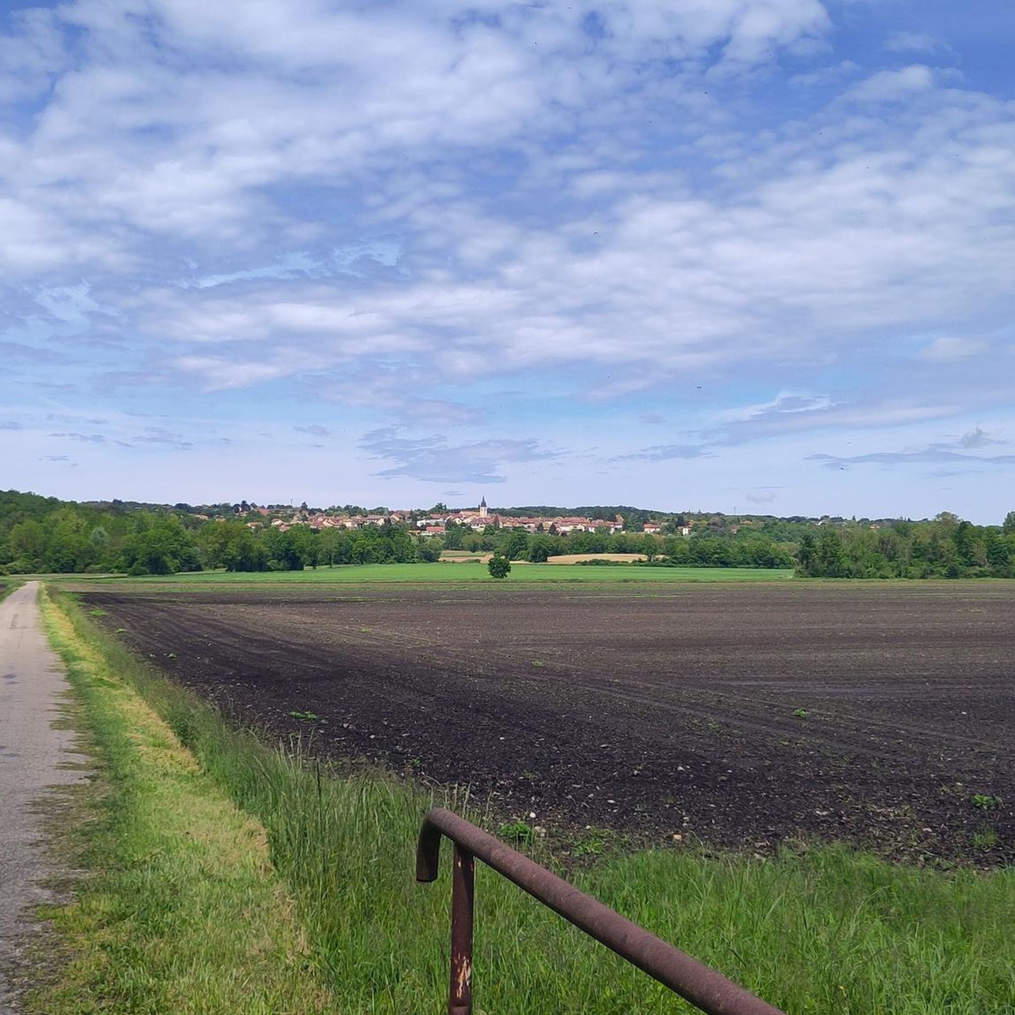
Hiking around Salagnon offers diverse opportunities within the Isère department of France, characterized by its varied topography. The region features undulating plains, verdant hills, and proximity to significant mountain massifs. Trails often trace natural waterways and provide panoramic vistas of the surrounding Bugey region, with distant views of the Alps on clear days. The landscape also includes "buttes and bosquets" within the eastern Liers plain.
Best hiking trails around Salagnon
- The most popular hiking route is Chateau de Chapeau Cornu…
Last updated: June 27, 2026
4.3
(8)
54
hikers
Moderate hike. Good fitness required. Easily-accessible paths. Suitable for all skill levels.
4.8
(10)
18
hikers
6.00km
01:40
110m
110m
Easy hike. Great for any fitness level. Easily-accessible paths. Suitable for all skill levels.

Sign up for free
5.0
(4)
16
hikers
18.1km
05:05
350m
350m
Hard hike. Very good fitness required. Mostly accessible paths. Sure-footedness required.
4
hikers
4.98km
01:26
120m
120m
Easy hike. Great for any fitness level. Easily-accessible paths. Suitable for all skill levels.
4.5
(2)
4
hikers
17.5km
04:43
230m
230m
Moderate hike. Good fitness required. Easily-accessible paths. Suitable for all skill levels.
Get access to more routes and recommendations from other explorers.
Sign up for free
Already have an account?
Our route recommendations are based on thousands of hikes, rides, and runs completed by other people on komoot.
Start today with a free account
Your next adventure awaits.
Login or Signup



Tips from the Community

War memorial in the village center
1
0

Found somewhat by chance and at a very affordable price, this hotel restaurant is a superb stopover for a bike ride!
0
0

Chapeau Cornu Castle was originally a fortified house built on the site of an ancient Roman camp. Between 800 and 1100, feudalism took hold. The sovereigns of Vienna and the Bishop created “rear fiefdoms” to ensure security and repel attackers. In the 12th and 13th centuries, there were two allied families: the Capellas and the Cornutis. It is by derivative of these 2 Latin names that “Chapeau Cornu” was born. In 1300, Amédée de Rossilon was governor of Chapeau Cornu. He left this property to his nephews Pierre and Louis Chapel. After Pierre's death in 1358, Louis succeeded him. Pierre will leave 2 daughters, one of whom Antonia marries the Knight Etienne Laure, Lord of Veyssillieu. The latter was killed by the English while fighting under Duguesclin. His son Jacquemont Laure avenged him and his daughter Béatrice married Imbert de Groslée, Seneschal of the King, in 1413. His sons and descendants remained in Chapeau Cornu until 1650. It was in 1601 that Chapeau Cornu took the name Château. But in 1638, the Castle fell into disuse. The last occupants, the Matthieu de Rame couple, left no children and in 1693, the property passed to Aymard Micha de Burcin. He expanded the estate through multiple purchases and died in 1755, donating all his property to his cousin Philippe Guillaume de Grammont. After the storming of the Bastille on the night of July 25 to 26, 1789, “the great fear” began. A band of rioters, determined to destroy the property of the squires, arrived in Chapeau Cornu at 1 a.m. The steward at the time had the idea of treating them as guests and opened the doors of the wine cellars to them. The damage underground is impressive: the undrinked wine is emptied but the castle remains intact. After the Revolution, the castle was purchased by Jean André Barge from the de Certeau family. He diverted the bed of the stream coming from the hill which then passed into the castle. He had the large buildings to the south-east and east built on the vault. Ruined, he sold part of the land to people from Vignolles. In 1855, the castle and 80 hectares surrounding it were bought by his son Ferdinand de Certeau. The estate remained in the family until 1891. The Bourgoin Court then ordered a judicial liquidation and had the property sold in several lots. Source: Vignieu website
1
0
Nice view of the Chapeau Cornu castle from the road.
0
0
The existence of a castle in Saint-Chef was assured in 1197: on this date, Abbot Hugues Borrel, with the consent of his chapter, granted the inhabitants of the castle relief from certain taxes on burials. At an altitude of 353 meters, the site of the old castle appears like a narrow promontory, clearly dominating the abbey town. The topography of the place, like the name later given to this residential area (castle farmhouse), allows us to imagine that the houses of a castle town were crowded into this space. The tower itself is located on the edge of a vast oval terrace, overlooking a second terrace or lower courtyard, placed to the north. Square in plan, it appears as a homogeneous, extremely massive construction. The thickness of the walls on the ground floor (240 cm) imposed by the thrust of the vaults, reduces the living space to less than half of the built surface. The facing preserved in the upper parts and inside is neat: it is made up of small rubble stones of molasses and limestone, well squared and arranged in regular courses. At the corners of the building, beautiful blocks of the same gray-green molasses, carefully harped. Source: Châteaux de France
1
0
This group of houses, located on either side of the road, was at the time of the canons owned by the Sacristans
1
0
Small intimate and romantic park, closable, above the abbey church of Saint-Chef, with a pretty view point.
1
0
Frequently Asked Questions
How many hiking trails are available around Salagnon?
Salagnon and its vicinity offer a vast network of trails. You can find over 240 hiking routes, catering to various skill levels, from easy strolls to more challenging ascents.
What kind of landscapes can I expect to see while hiking near Salagnon?
The region around Salagnon is characterized by diverse topography, including undulating plains, verdant hills, and natural waterways like the Ruisseau de l'Enfer. Trails often provide panoramic vistas of the surrounding Bugey region, and on clear days, you can even see distant Alps peaks such as Mont-Blanc, Vanoise, Belledonne, and Chartreuse.
Are there easy hiking options suitable for beginners or families?
Yes, Salagnon is part of the Balcons du Dauphiné area, which promotes walks and hikes as family-friendly activities. There are over 100 easy routes available. An example is the Étang Bouvet – Château de Montagnieu loop from Camping Les 3 Lacs du Soleil, which is about 6 km long and takes around 1 hour 40 minutes.
What do other hikers say about the trails in Salagnon?
The hiking routes around Salagnon are highly regarded by the komoot community, with an average rating of 4.6 stars from over 450 reviews. Hikers often praise the varied terrain, scenic views, and the extensive network of well-documented trails.
Are there any circular hiking routes around Salagnon?
Many routes in the area are circular, offering convenient starting and ending points. For instance, the View of the pond – View of the Étang de Moras loop from Vénérieu is a popular moderate circular trail, approximately 8.6 km long.
Can I find trails that pass by historical sites or interesting landmarks?
Absolutely. The region is rich in history and natural beauty. You can explore routes that lead past landmarks like the Chateau de Chapeau Cornu or the medieval town of Crémieu. The Chateau de Chapeau Cornu – Poulet Tower loop from La Tour-du-Pin is a moderate route that explores historical sites.
Are there any specific trails that feature water bodies or lakes?
Yes, several trails incorporate natural waterways and lakes. The Seuillière Washhouse – View of the Étang de Moras loop from Vénérieu takes you through the local countryside and past the Étang de Moras. Other notable lakes in the area include Étang de la Rosière and Étang de Chalignieu.
What are the more challenging hiking options around Salagnon?
For experienced hikers seeking a challenge, there are a few difficult routes available. An example is the Way – Seuillière Washhouse loop from Saint-Hilaire-de-Brens, which spans over 18 km and involves significant elevation changes, typically taking over 5 hours to complete.
Where can I find more information about the Salagnon region?
Salagnon is situated within the Balcons du Dauphiné area. For additional information about the local area and its offerings, you can visit the official tourism website: balconsdudauphine-tourisme.com.
Are there opportunities for wildlife spotting while hiking?
The diverse ecosystems of the Isère department, with its plains, hills, and proximity to mountain massifs, provide habitats for various local flora and fauna. While specific wildlife sightings are not guaranteed, the natural settings along trails, especially near waterways and in wooded areas, offer opportunities to observe local wildlife.
What are the typical durations for hikes in this area?
Hiking durations vary widely depending on the trail's length and difficulty. Easy routes can be as short as 1.5 to 2 hours, while moderate trails often range from 2.5 to 4 hours. More difficult and longer routes can take 5 hours or more to complete.
Most popular attractions around Salagnon

Get inspired with the komoot mobile app


Explore more
Browse the best Hikes in other regions.
