The 5 Most Amazing Peaks around Saint-Michel-Sur-Rhône
Best mountain peaks around Saint-Michel-sur-Rhône are found within the Pilat Regional Natural Park, a mid-mountain massif in the Auvergne-Rhône-Alpes region. This area features diverse landscapes, including forests, plateaus, and mountains, with elevations ranging from 140 to over 1,400 meters. The park offers varied hiking experiences and panoramic views of the Rhône Valley and distant Alps. It is a destination for exploring natural beauty and outdoor activities.
Best mountain peaks around Saint-Michel-sur-Rhône
- The most popular mountain peaks is The Three Teeth, a summit that offers incredible views of the Pilat crests and the Rhône valley. This geological formation is notable for its technical single track with stones and vegetation.
- Another must-see spot is Chapel of the Virgin at Mont Monnet, a religious building and summit. Mont Monnet peaks at 782 meters, offering an exceptional panorama of the Rhône valley from its rocky crest.
- Visitors also love Crêt de l'Œillon, a summit and viewpoint. From its height of 1,364 meters, it provides views of the Pic des Trois dents, the Rhône valley, and on clear days, the Vercors mountains and Mont-Blanc range.
- Saint-Michel-sur-Rhône is known for its summits, viewpoints, and rocky crests. The area provides a variety of mountain peaks to see and explore, from challenging trails to scenic overlooks.
- The mountain peaks around Saint-Michel-sur-Rhône are appreciated by the komoot community, with 116 upvotes and 44 photos shared.
Last updated: October 16, 2026
Crêt de l'Œillon
Highlight • Summit
Translated by Google •
Tip by

The Three Teeth
Highlight • Summit
Translated by Google •
Tip by

Sign up now to discover places like this
Get recommendations on the best single tracks, peaks, & plenty of other exciting outdoor places.
Chapel of the Virgin at Mont Monnet
Highlight • Religious Site
Translated by Google •
Tip by

Pic du midi
Highlight • Summit
Translated by Google •
Tip by

Chirat Rochat
Highlight • Summit
Translated by Google •
Tip by

Sign up for free to discover even more peaks around Saint-Michel-Sur-Rhône.
Already have an account?
Start today with a free account
Your next adventure awaits.


Tips from the Community

For the strenuous climb to Mont Monnet (782 m), you will be rewarded with a breathtaking view of the Phonetal valley. In addition, on the summit, you will find an information board, a small chapel, and a beautiful sculpture of the Madonna and Child.
0
0

A superb November morning, with a changing mist.
0
0

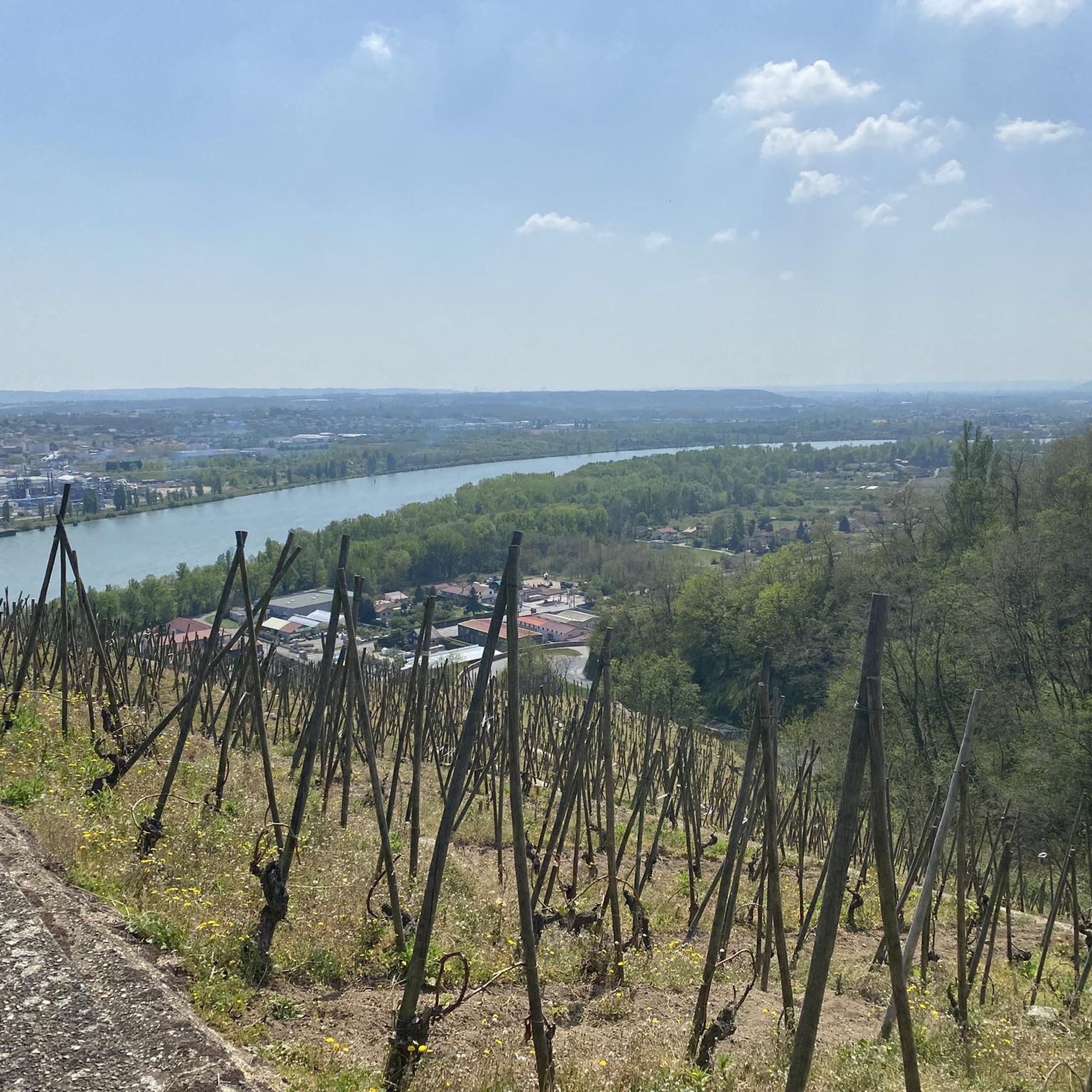
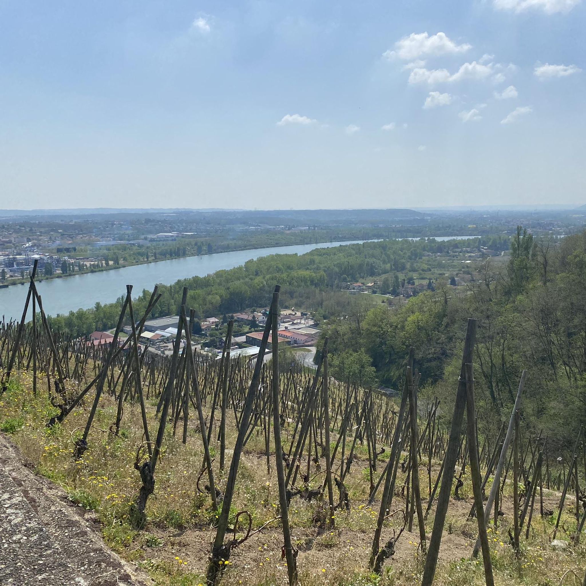
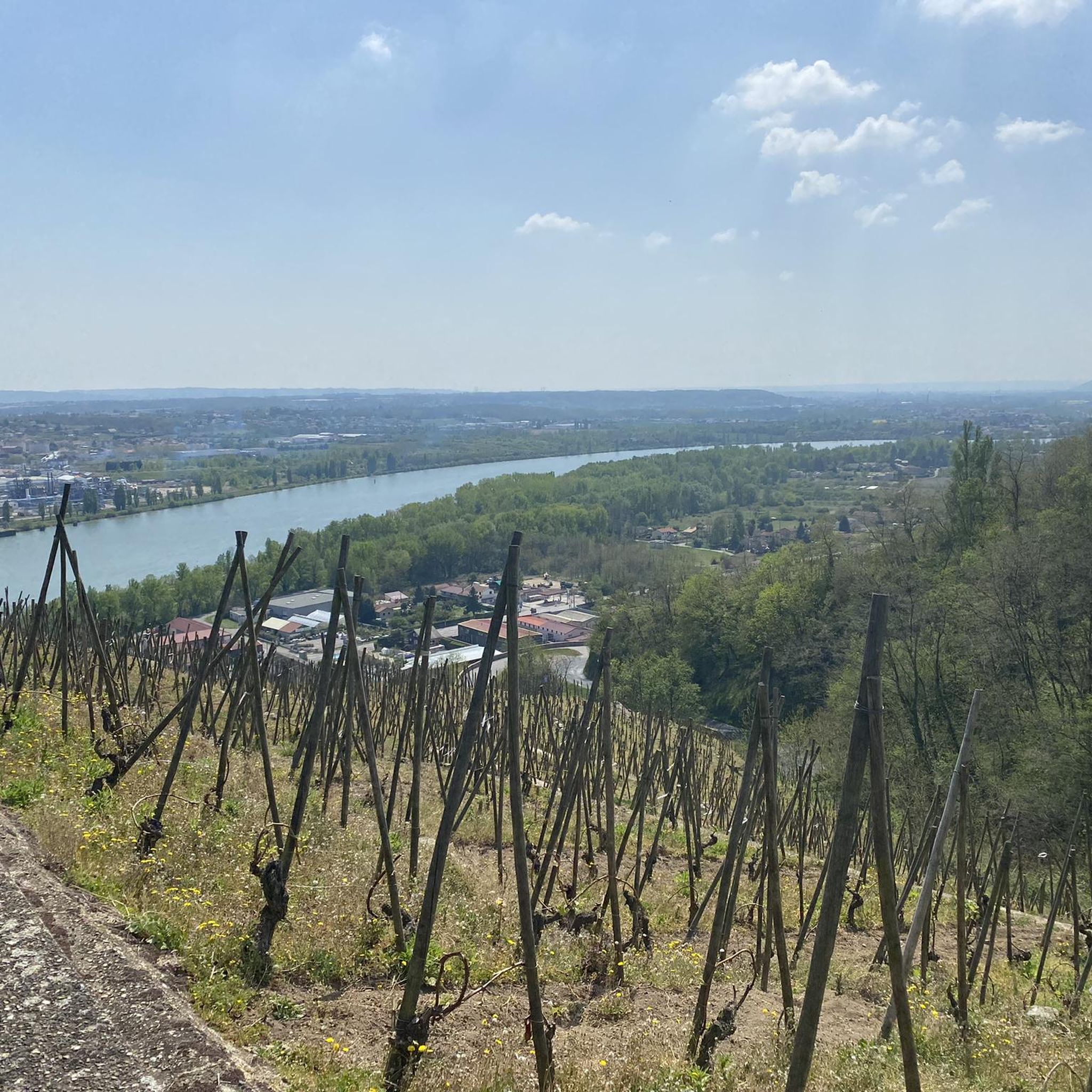
Very beautiful view of the Rhône valley
0
0

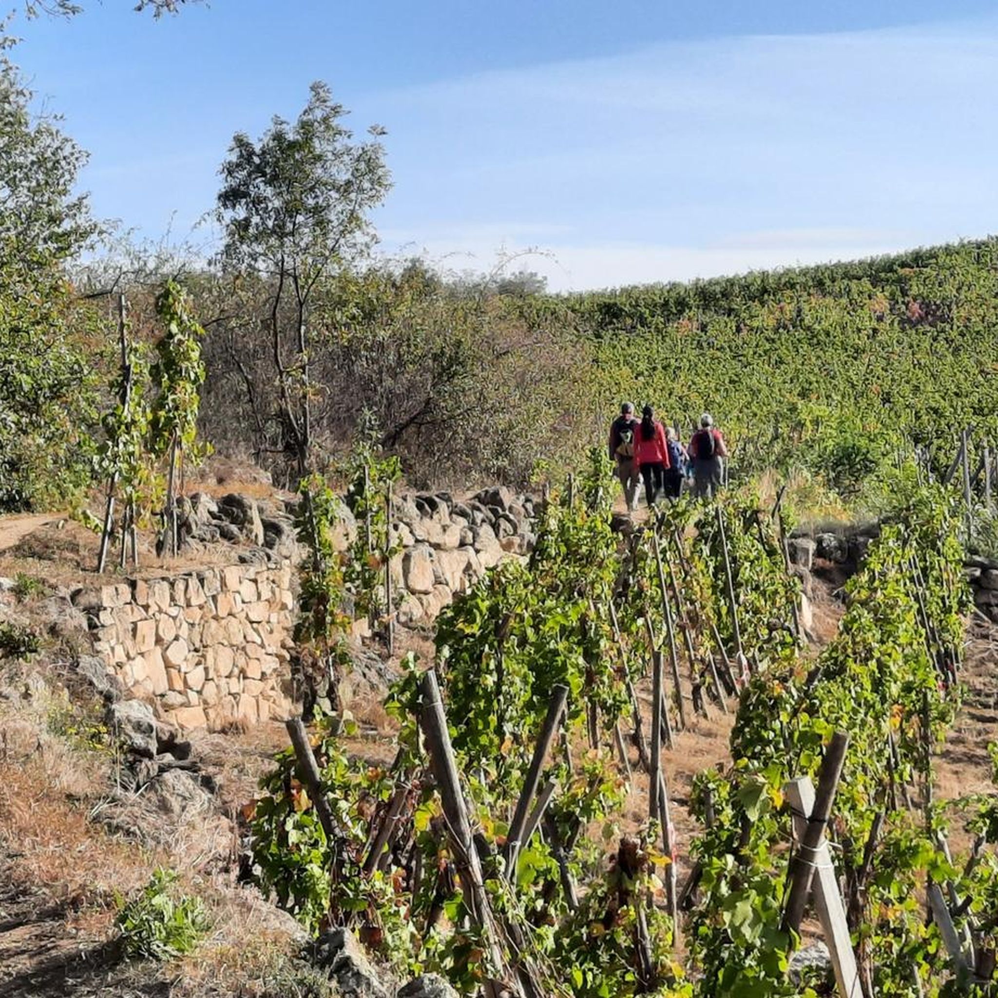
A few small areas where you can put your hands (far from the climbing) which are pleasant and varied, and as a bonus there are blackberries all along the way 👌
0
0

Any self-respecting cyclist must, after reaching the Col de l'Oeillon, continue to the Crêt de l'Oeillon, the true summit and final objective of this climb!
0
0


The second most remarkable summit of the Pilat behind the Crêt de la Perdrix, this giant of gneiss and granite reveals, from its height of 1,364 meters, its trump card: a bird's-eye view of the Pic des Trois dents and the valley of the Rhône which extends at its feet. On a clear day, the gaze wanders to strange apparitions which imprint their reliefs on the horizon line: the Vercors mountains, the Ecrins and the Mont-Blanc range, for a natural spectacle that is both unreal and majestic.
2
0
Frequently Asked Questions
What kind of views can I expect from the mountain peaks near Saint-Michel-sur-Rhône?
The peaks in the Pilat Regional Natural Park offer extensive views. From Crêt de l'Œillon, you can see the Pic des Trois dents, the Rhône valley, and on clear days, the Vercors mountains and Mont-Blanc range. Mont Monnet provides an exceptional panorama of the Rhône valley, while The Three Teeth offers incredible vistas of the Pilat crests and the Rhône valley.
Are there any challenging mountain peaks for experienced hikers in the area?
Yes, for experienced hikers, The Three Teeth offers a technical single track with stones and vegetation, providing a challenging experience. The path to the Chapel of the Virgin at Mont Monnet is also described as very steep and difficult, even for walking.
What is the highest point in the Pilat Regional Natural Park?
The highest point within the Pilat Regional Natural Park is Crêt de la Perdrix, reaching an altitude of 1,431 meters. It offers extensive views over the surrounding landscape.
What outdoor activities can I do near these mountain peaks?
The Pilat Regional Natural Park is ideal for nature lovers and athletes. You can find numerous footpaths, mountain bike trails, and bridle paths. For specific routes, explore the hiking routes around Saint-Michel-Sur-Rhône, road cycling routes, or gravel biking trails.
Are there any unique geological features to see among the peaks?
Yes, The Three Teeth is a notable geological formation with its distinctive crests. Additionally, Chirat Rochat is typical of Pilat, characterized by its numerous rocky masses known as 'chirats'.
What is the best time to visit the mountain peaks in the Pilat Regional Natural Park?
The Pilat Regional Natural Park offers diverse experiences throughout the year. Spring and autumn are generally ideal for hiking due to milder temperatures and vibrant foliage. Summer provides warm weather for outdoor activities, while winter can offer opportunities for snowshoeing or cross-country skiing at higher elevations, though some trails may be more challenging.
Is there a mountain peak with a religious or historical site nearby?
Yes, the Chapel of the Virgin at Mont Monnet is a religious building located on a summit. Mont Monnet peaks at 782 meters and offers an exceptional panorama from its rocky crest, combining natural beauty with cultural heritage.
What kind of terrain can I expect on the trails around the peaks?
The Pilat Regional Natural Park features diverse terrain, from deep forests to livestock farming plateaus. Trails can range from technical single tracks with stones and vegetation, as found near The Three Teeth, to steep, rocky paths like those leading to Mont Monnet.
Are there any other significant mountain peaks further afield that are worth visiting?
While not directly adjacent to Saint-Michel-sur-Rhône, the Pic Saint-Michel in the Vercors massif is a prominent mountain at 1,966 meters. It is renowned for its magnificent panorama over the Grenoble valley and a substantial portion of the Alps, offering a breathtaking 360° view.
What do visitors enjoy most about the mountain peaks around Saint-Michel-sur-Rhône?
Visitors frequently highlight the incredible and superb views of the Rhône valley, the Pilat crests, and distant mountain ranges like the Alps and Mont-Blanc. The diverse landscapes and the challenging yet rewarding trails are also highly appreciated, as evidenced by the 116 upvotes and 44 photos shared by the komoot community for these peaks.
Can I find information about specific hiking routes to these peaks?
Yes, you can find various hiking routes that lead to or pass by these peaks. For example, the Hiking around Saint-Michel-Sur-Rhône guide provides details on routes like the 'Terraced vineyards loop' or 'The Bailly Ponds loop', which offer different levels of difficulty and scenic experiences in the area.
Are there any peaks that are particularly good for photography?
Many peaks offer excellent photographic opportunities due to their panoramic views. Crêt de l'Œillon is a prime spot for capturing the Rhône valley, the Pic des Trois dents, and distant Alps. Pic du midi also offers a very beautiful view of the Rhône valley, ideal for photography.
Most popular routes around Saint-Michel-Sur-Rhône
Most popular attractions around Saint-Michel-Sur-Rhône

Get inspired with the komoot mobile app


Explore more
See even more amazing summits around Saint-Michel-Sur-Rhône with these guides:
