The best walks and hikes around Saint-Michel-Sur-Rhône
4.6
(923)
5,060
hikers
17
hikes
Hiking around Saint-Michel-Sur-Rhône offers diverse landscapes, characterized by the scenic Rhône Valley and its terraced vineyards. The region is influenced by its proximity to the Pilat Natural Regional Park, providing varied terrain from riverbanks to hills. Trails often feature views of wooded hills and the broader Rhône River topography.
Best hiking trails around Saint-Michel-Sur-Rhône
- The most popular hiking route is Terraced vineyards loop from Saint-Michel-sur-Rhône, a 5.3 miles (8.5 km) trail that takes 2 hours 25 minutes to complete.…
Last updated: October 18, 2026
4.3
(3)
9
hikers
8.48km
02:26
200m
200m
Moderate hike. Good fitness required. Easily-accessible paths. Suitable for all skill levels.
5.0
(1)
19
hikers
14.8km
04:08
270m
270m
Moderate hike. Good fitness required. Easily-accessible paths. Suitable for all skill levels.

4.5
(2)
6
hikers
15.9km
04:28
300m
310m
Moderate hike. Good fitness required. Easily-accessible paths. Suitable for all skill levels.
7
hikers
9.29km
02:35
170m
170m
Moderate hike. Good fitness required. Easily-accessible paths. Suitable for all skill levels.
5
hikers
8.36km
02:20
160m
160m
Moderate hike. Good fitness required. Easily-accessible paths. Suitable for all skill levels.
Get access to more routes and recommendations from other explorers.
Already have an account?
Our route recommendations are based on thousands of hikes, rides, and runs completed by other people on komoot.
Start today with a free account
Your next adventure awaits.

Tips from the Community

Everything is broken and there is no power
0
0

Superb landscapes of the Pilat in the Rhône region. With its 782 meters, Mont Monnet dominates the Rhône valley. A hike allows you to climb it and access a orientation table at the summit.
0
0

A wonderful stretch of the route! The stunning scenery and excellent cycle paths make the Via Rhôna cycle tour a truly memorable experience!
0
0
A wonderful stretch of route! The stunning scenery and excellent cycle paths make this bike tour a truly memorable experience!
0
0

Everything was wrecked, taken, the inflator hose was cut and all the keys no longer exist 🤷♂️. It's sad to see this on our cycle paths 😤
1
0

Currently not in operation, had to spend the night on February 21-22, 2025. Unfortunately I couldn't sleep well because my tarpaulin was so loud. Otherwise great place to sleep, toilet available and clean, if necessary you could sleep in the toilet.
2
1

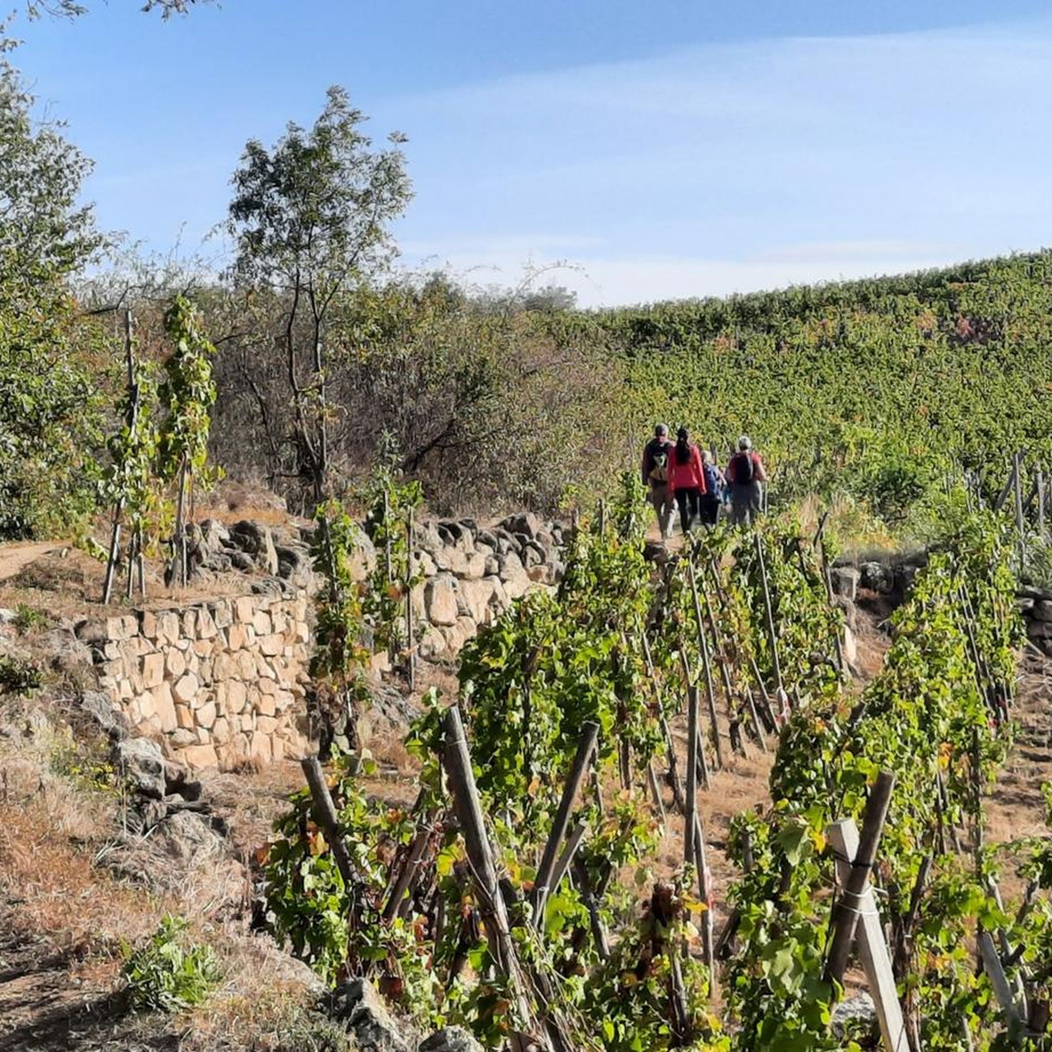
As you walk the winding paths of the Arbuel Valley, you will be rewarded with views of this picturesque valley, nestled among the vineyards of the Condrieu region, offering a tranquil escape from the hustle and bustle of city life. You can explore the charming village of Condrieu, known for its world-renowned white wine, or hike along the banks of the river, admiring the breathtaking scenery and vineyards that stretch as far as the eye can see.
0
0
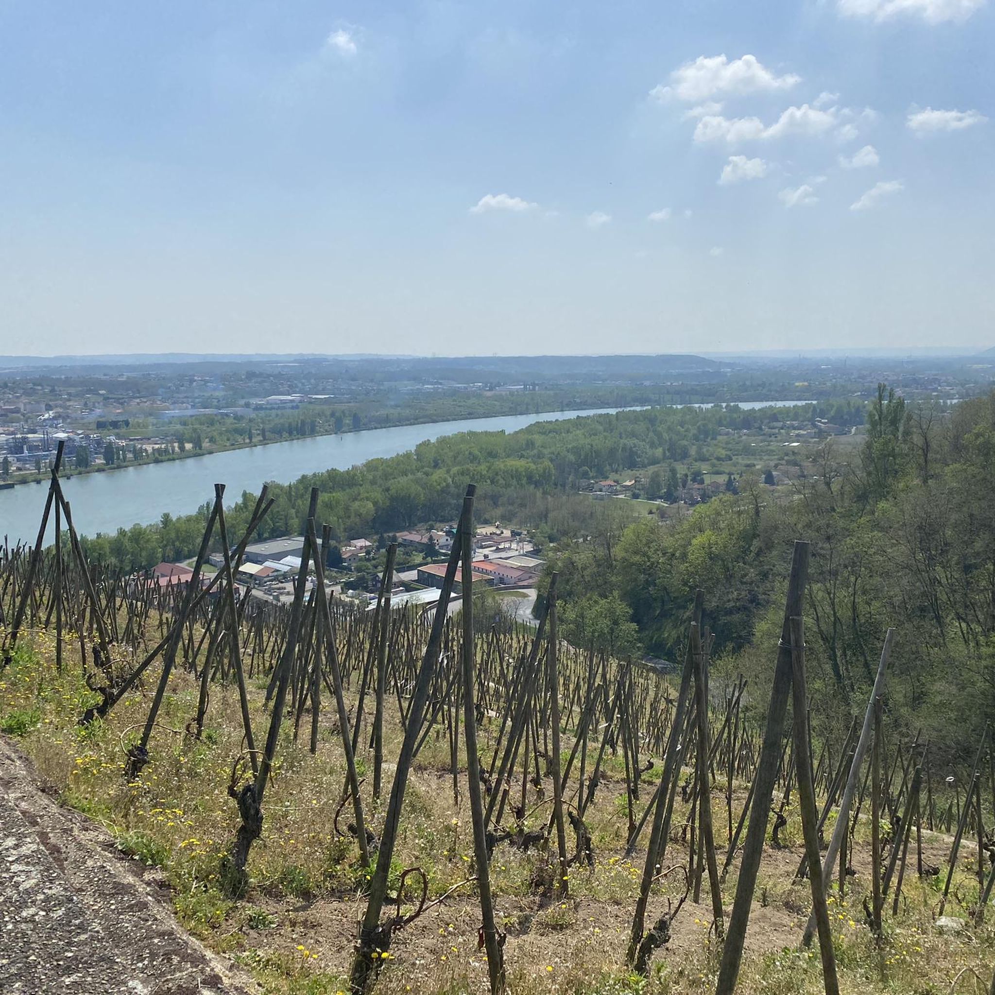
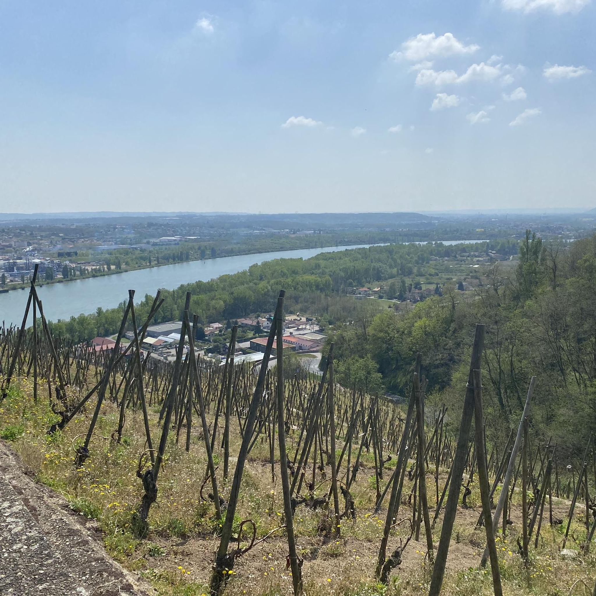
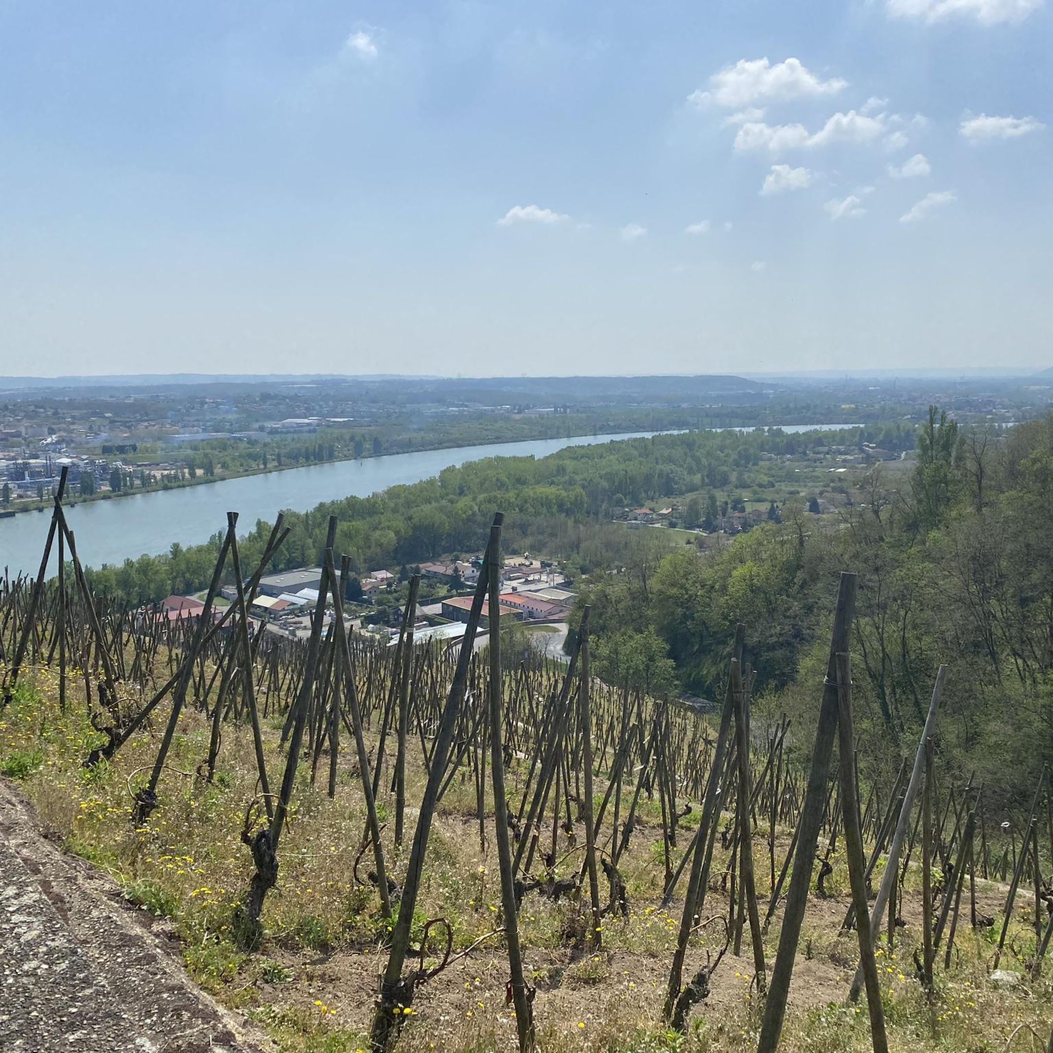
From Rochebret, you’ll have breathtaking panoramic views of the Rhone River winding below, framed by lush vineyards cascading down the hills. This hiking route offers a perfect blend of scenic beauty, with the vibrant green of the vines contrasting with the deep blue of the river. As you hike, take time to soak up the peaceful atmosphere and admire the way the vineyards stretch into the horizon.
0
0
Frequently Asked Questions
How many hiking trails are available around Saint-Michel-Sur-Rhône?
There are over 15 hiking routes available around Saint-Michel-Sur-Rhône, offering a variety of experiences for different skill levels. The region features trails ranging from easy paths to more challenging routes with significant elevation gain.
What kind of terrain can I expect on hikes in Saint-Michel-Sur-Rhône?
Hiking around Saint-Michel-Sur-Rhône is characterized by diverse terrain, including scenic Rhône Valley views, terraced vineyards, and wooded hills. The area is influenced by its proximity to the Pilat Natural Regional Park, contributing to varied landscapes.
Are there any easy hiking trails suitable for beginners in Saint-Michel-Sur-Rhône?
Yes, there are several easy hiking options. For instance, The Bailly Ponds loop from Les Roches-de-Condrieu is an easy 4.7 km (2.9 miles) path that takes just over an hour to complete, offering a gentle introduction to the region's beauty.
What are some notable natural features or landmarks to see while hiking?
The region offers several interesting natural features. You can explore the Vallée de l'Arbuel, a picturesque gorge. Additionally, hikers can find viewpoints offering expansive vistas of the Rhône Valley and its surrounding hills, with the Vercors mountains visible in the distance. Other notable summits include Crêt de l'Œillon and The Three Teeth.
Are there any circular walks available in Saint-Michel-Sur-Rhône?
Yes, many trails in the area are circular. A popular option is the The Bailly Ponds loop from Saint-Michel-sur-Rhône, a moderate 9.3 km (5.8 miles) route that takes about 2 hours 35 minutes to complete.
What do other hikers enjoy most about hiking in Saint-Michel-Sur-Rhône?
The area is highly rated by the komoot community, with an average score of 4.6 stars from over 700 reviews. Hikers often praise the scenic Rhône Valley views, the charm of the terraced vineyards, and the varied terrain that provides engaging experiences for all levels.
Are the hiking trails in Saint-Michel-Sur-Rhône suitable for families?
Yes, the region offers trails suitable for families, especially those looking for easier paths. While some routes involve significant elevation, there are also accessible paths that cater to various skill levels, making it possible to find a suitable option for a family outing.
Can I bring my dog on the hiking trails in Saint-Michel-Sur-Rhône?
Many trails in the Saint-Michel-Sur-Rhône area are dog-friendly, allowing you to enjoy the natural beauty with your canine companion. It's always recommended to keep dogs on a leash and respect local regulations, especially when passing through vineyards or near livestock.
What is the typical duration for hikes in this region?
Hikes in Saint-Michel-Sur-Rhône vary in duration. Shorter, easy routes like The Bailly Ponds loop from Les Roches-de-Condrieu can be completed in just over an hour. Longer, moderate trails such as Vallée de l'Arbuel – Terraced vineyards loop from Saint-Michel-sur-Rhône can take nearly 5 hours, offering options for various time commitments.
Are there any trails that offer views of the terraced vineyards?
Absolutely. The terraced vineyards are a defining feature of the region. The Terraced vineyards loop from Saint-Michel-sur-Rhône is a prime example, offering excellent views of these iconic landscapes.
What is the elevation gain like on hikes around Saint-Michel-Sur-Rhône?
Elevation gain varies significantly across the region. While some easy paths have minimal ascent, more challenging routes can involve considerable elevation changes. For example, the Vallée de l'Arbuel – Terraced vineyards loop from Saint-Michel-sur-Rhône features an elevation gain of over 350 meters (1,150 feet).
Are there any facilities or attractions near the hiking trails?
Yes, you can find various points of interest. For instance, the ViaRhôna Bike Rest Area and Facilities in Condrieu offers amenities. You might also encounter natural monuments like Les Roches de Marlin, providing additional sights during your hike.
Most popular routes around Saint-Michel-Sur-Rhône
Most popular attractions around Saint-Michel-Sur-Rhône

Get inspired with the komoot mobile app


Explore more
Browse the best Hikes in other regions.
