The best running trails around Saint-Martin-Du-Frêne
4.5
(67)
3,484
runners
16
runs
Jogging routes around Saint-Martin-Du-Frêne are set within the Ain department of the Auvergne-Rhône-Alpes region in eastern France. The area features diverse landscapes, including glacial lakes such as Lac de Nantua, surrounded by limestone cliffs. Runners can expect varied terrain, with routes traversing forests, valleys, and hilly sections, offering elevations ranging from 476 to 1,125 meters. This natural environment provides a mix of flat and inclined paths for different workout intensities.
Best jogging routes around Saint-Martin-Du-Frêne
- The most popular jogging route is Panoramic view of the lake – View over Lake Nantua loop from Saint-Martin-du-Frêne, a 13.6 miles (21.9 km) trail that takes 3 hours 31 minutes to complete. This route offers panoramic views of Lac de Nantua and features significant elevation gain.
- Another top favourite among local runners is Descente single loop from Maillat, a difficult 13.7 miles (22.0 km) path. This trail traverses varied terrain with notable elevation changes, providing a challenging running experience.
- Local runners also love the Monts d'Ain loop from Saint-Martin-du-Frêne, a 6.0 miles (9.6 km) trail leading through the Monts d'Ain, often completed in about 1 hour 24 minutes.
- Jogging around Saint-Martin-Du-Frêne is defined by glacial lakes, dense woodlands, and hilly terrain. The network offers options for different ability levels, from moderate paths to more challenging routes with significant elevation gain.
- The routes in Saint-Martin-Du-Frêne are highly rated by the komoot community with an average score of 4.4 stars from over 60 reviews. More than 3600 runners have used komoot to explore Saint-Martin-Du-Frêne's varied terrain.
Last updated: June 27, 2026
5.0
(1)
56
runners
22.3km
03:35
1,050m
1,050m
Hard run. Very good fitness required. Sure-footedness, sturdy shoes and alpine experience required.
17
runners
10.5km
01:06
60m
50m
Moderate run. Good fitness required. Mostly paved surfaces. Suitable for all skill levels.

Sign up for free
13
runners
9.62km
01:25
410m
410m
Hard run. Very good fitness required. Sure-footedness, sturdy shoes and alpine experience required.
4.0
(1)
9
runners
6.80km
00:46
100m
100m
Moderate run. Good fitness required. Mostly paved surfaces. Suitable for all skill levels.
7
runners
11.2km
01:18
120m
130m
Moderate run. Good fitness required. Mostly paved surfaces. Suitable for all skill levels.
Get access to more routes and recommendations from other explorers.
Sign up for free
Already have an account?
Our route recommendations are based on thousands of hikes, rides, and runs completed by other people on komoot.
Start today with a free account
Your next adventure awaits.
Login or Signup

Tips from the Community

Unfortunately I was unlucky with the weather, but even as I drove past the place looked very nice, lots of grass and a place to swim.
0
0

Still tracks but very nice route with a nice climb
1
0

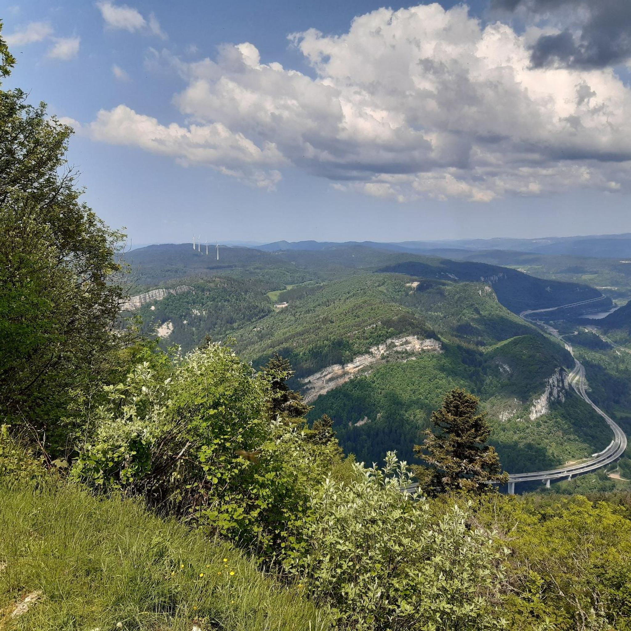
The Chemin des Fècles offers a superb route. As you follow this path which passes from deep woods to steep cliffs, be extremely careful not to go too far to the edge of the void. Above all, respect the safety instructions.
1
0

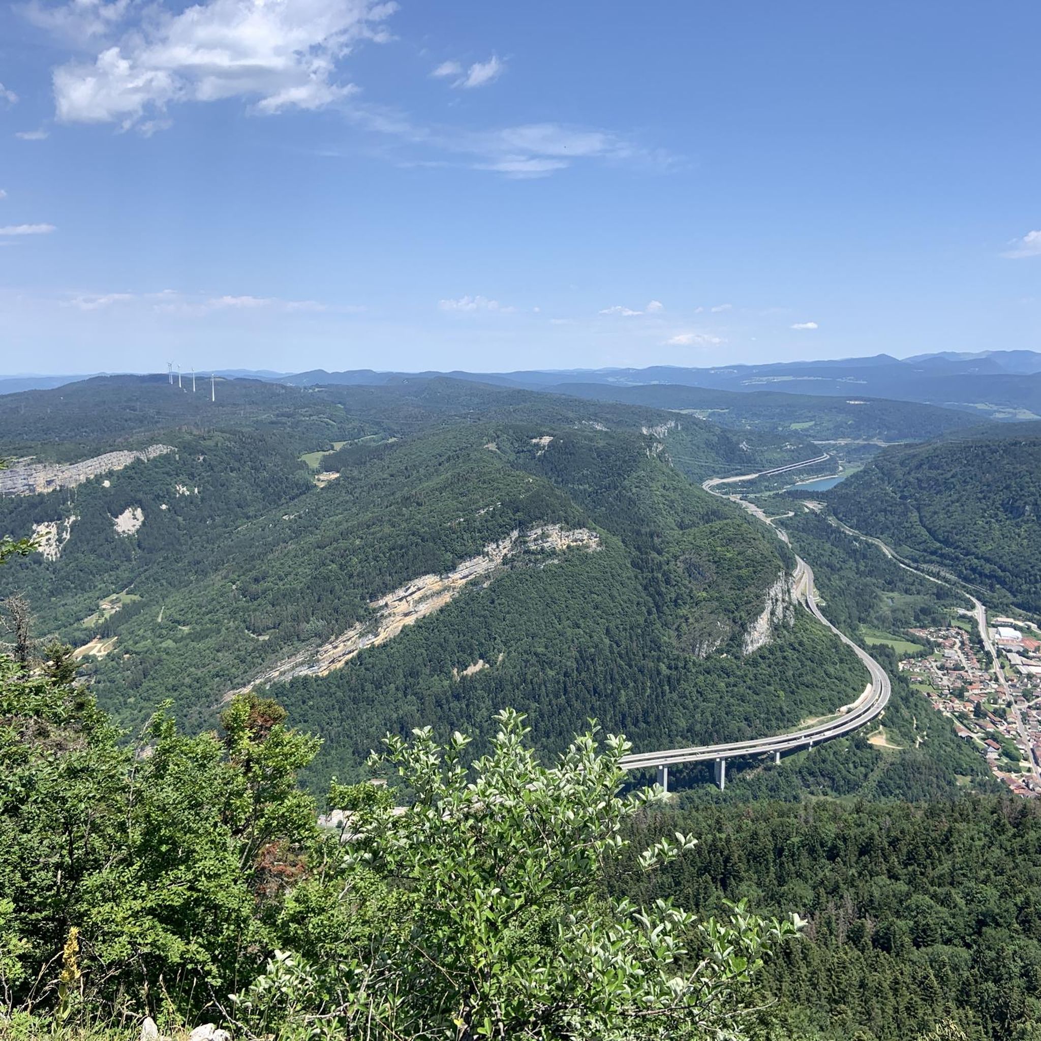
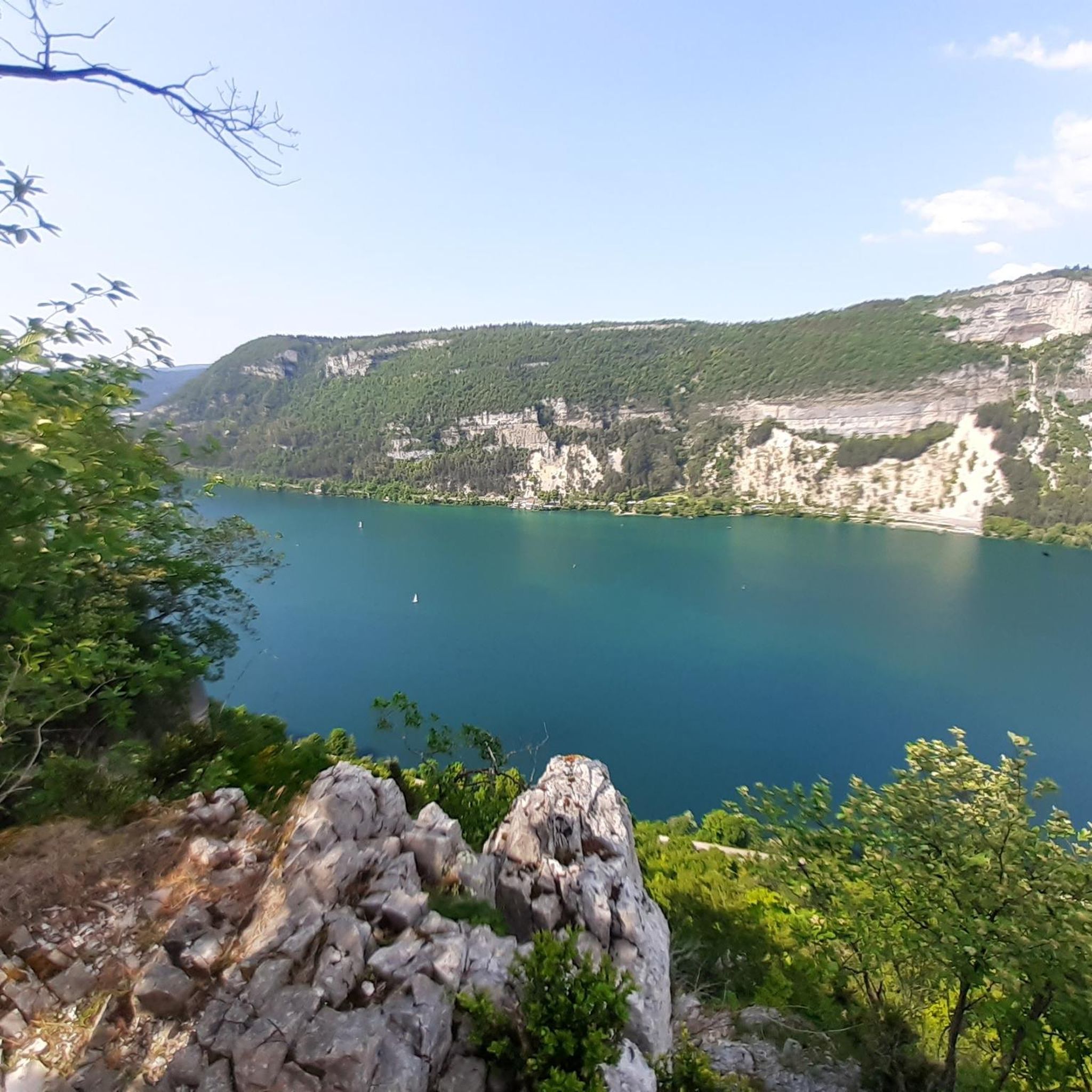
Great view of the Lac from Belvedere.
2
0

Perfect for an overnight stop for bike packing trips. The location is excellent, right by the lake. There are beautiful landscapes and it is close to the shops and restaurants of the village.
4
0

At 300 meters, overlooking Lake Nantua, you can appreciate the colors of the water and the extent of its 41 hectares.
3
0

reserve where you come across jays, deer and butterflies.
2
0

If you are looking for the best camping in the area don't look further. It is old private camping running since 1960, a night for two-person with a tent cost us 13€. We were free to set our tent where we wanted. So we put it at only 5 meters of the lake, waking up with the great view was priceless. It is also very close to a supermarket and the road that do the tour of the lake. You also have a very great restaurant called La Matinière at only a few hundred meters from the camping (south direction). Definitely, a place where we will be back!
4
0
Frequently Asked Questions
How many running routes are available in Saint-Martin-Du-Frêne?
There are over 160 running routes around Saint-Martin-Du-Frêne, offering a wide variety of options for different fitness levels and preferences. You'll find everything from moderate paths to more challenging trails with significant elevation gain.
What kind of terrain can I expect on the jogging trails around Saint-Martin-Du-Frêne?
The jogging trails in Saint-Martin-Du-Frêne feature diverse landscapes. You can expect routes traversing dense forests, picturesque valleys, and hilly sections with varying elevations. The region is also known for its proximity to stunning glacial lakes like Lac de Nantua, which often provide a beautiful backdrop for a run.
Are there running routes suitable for beginners or those looking for an easier jog?
Yes, Saint-Martin-Du-Frêne offers several easier running options. There are 11 routes categorized as easy, perfect for beginners or those seeking a more relaxed pace. These trails typically have less elevation gain and shorter distances.
What are some of the more challenging running options in the area?
For experienced runners seeking a challenge, there are 71 difficult routes available. One notable challenging route is the Panoramic view of the lake – View over Lake Nantua loop from Saint-Martin-du-Frêne, which covers 13.6 miles (21.9 km) and features over 1000 meters of elevation gain. Another demanding option is the Descente single loop from Maillat, a 13.7-mile (22.0 km) path with significant elevation changes.
Are there scenic running routes with viewpoints in Saint-Martin-Du-Frêne?
Absolutely. Many routes offer stunning views, particularly those around Lac de Nantua, known for its 'sapphire blue' waters nestled against limestone cliffs. The Panoramic view of the lake – View over Lake Nantua loop from Saint-Martin-du-Frêne is specifically designed to showcase these breathtaking vistas.
What natural landmarks can I see along the jogging routes?
The region is rich in natural beauty. You might encounter features like the stunning Lake Nantua, various cascades such as Cascade de la Pisse Vache, and dense forests. Some routes also offer elevated perspectives of the village and surrounding valleys.
Are there any circular running routes available?
Yes, many of the running routes in Saint-Martin-Du-Frêne are circular, allowing you to start and finish at the same point. For example, the Monts d'Ain loop from Saint-Martin-du-Frêne is a 6.0-mile (9.6 km) circular trail through the Monts d'Ain.
What do other runners say about the trails in Saint-Martin-Du-Frêne?
The routes in Saint-Martin-Du-Frêne are highly rated by the komoot community, with an average score of 4.4 stars from over 60 reviews. Runners often praise the diverse terrain, the beautiful natural scenery, and the variety of options available for different skill levels.
Are there any family-friendly running paths in the area?
While specific 'family-friendly' designations aren't always explicit, the 11 easy routes available are generally suitable for families or those jogging with children, as they tend to be shorter and have less demanding terrain. Look for routes with minimal elevation gain.
Can I bring my dog on the running trails?
Many natural trails in France are dog-friendly, especially if your dog is kept on a leash. It's always best to check local signage or specific route descriptions for any restrictions, particularly in protected natural areas or near livestock. Generally, the forest and valley paths are suitable for running with a dog.
Are there any specific routes that are less crowded?
While popular routes like those around Lac de Nantua can see more activity, exploring some of the 84 moderate or 71 difficult routes, such as the Running loop from Brion, might lead you to quieter paths, especially during off-peak hours or weekdays. The vast network of trails means you can often find solitude.
What is the best time of year to go jogging in Saint-Martin-Du-Frêne?
The Auvergne-Rhône-Alpes region generally offers pleasant conditions for jogging from spring through autumn. Spring brings blooming flora, while autumn showcases vibrant fall colors. Summer can be warm, so early mornings or late afternoons are ideal. Winter jogging is possible, but some higher elevation trails might be affected by snow or ice.
Are there any places to eat or drink near the running trails?
After a run, you can explore local producers like the Fromagerie de la Combe du Val for regional specialties. While specific cafes directly on trails are rare, the villages in the area, including Saint-Martin-Du-Frêne itself, offer options for refreshments and meals. You might also find picnic areas, such as the one mentioned on hautbugey-tourisme.com, for a post-run snack.
Most popular routes around Saint-Martin-Du-Frêne
Most popular attractions around Saint-Martin-Du-Frêne

Get inspired with the komoot mobile app


Explore more
Browse the best Running Trails & Routes in other regions.
