The best cycling routes around Charvieu-Chavagneux
4.6
(110)
785
riders
27
rides
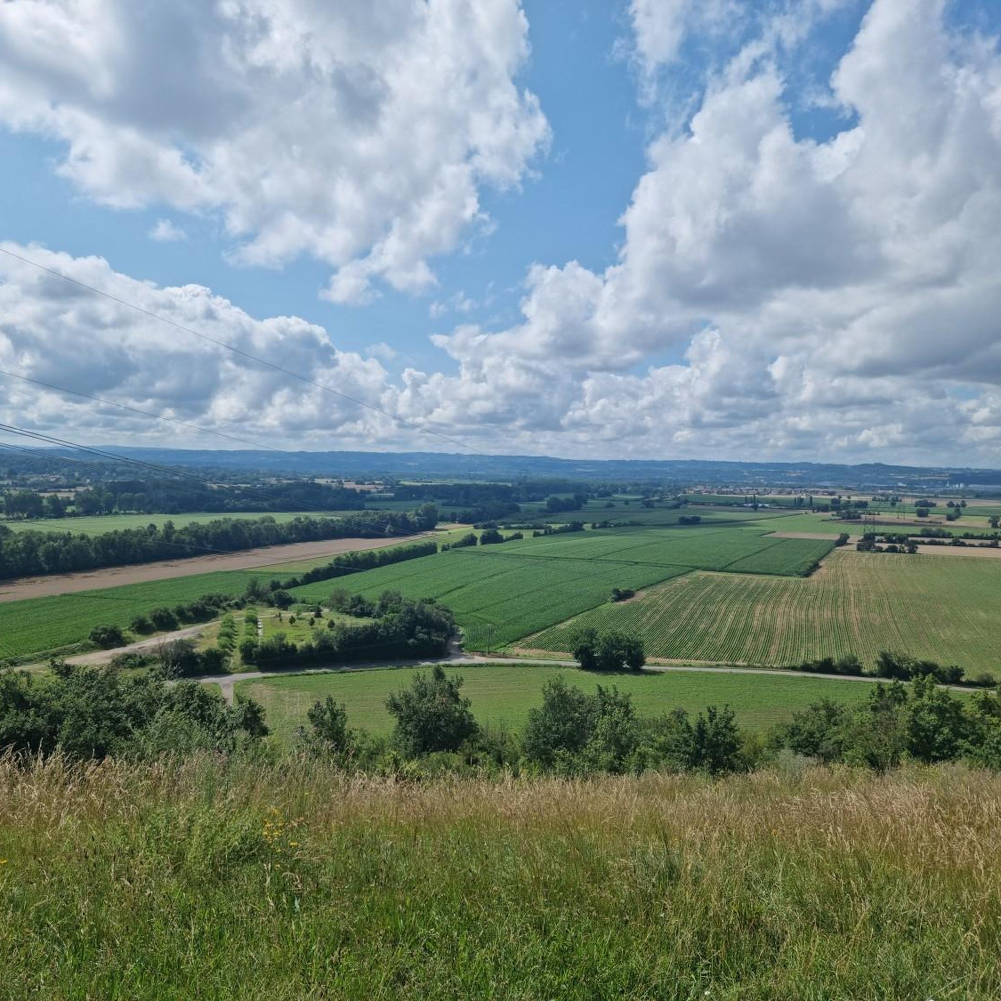
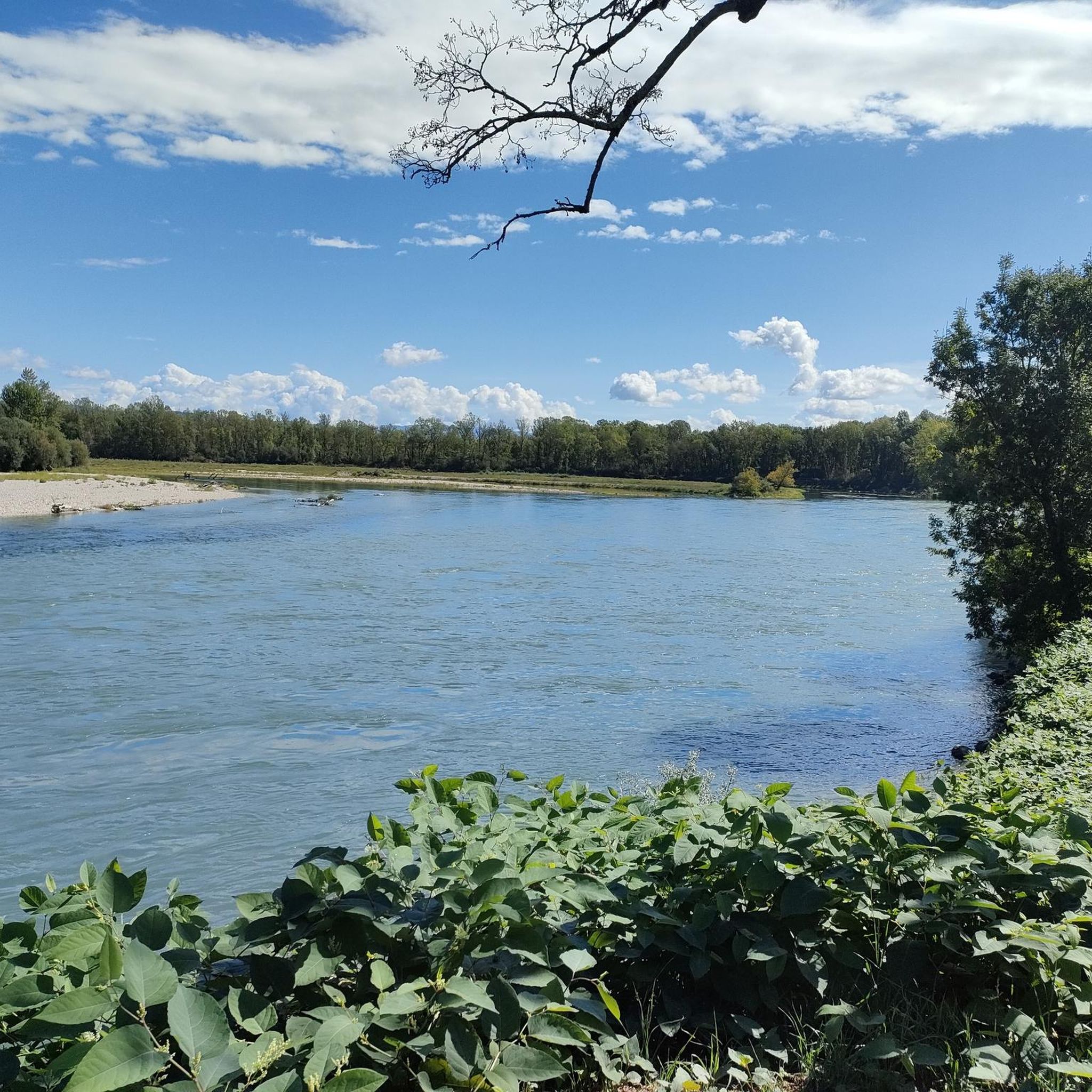
Touring cycling routes around Charvieu-Chavagneux offer a diverse landscape in the Isère department of southeastern France. The region features a mix of terrain, transitioning between the Lyonnaise plain and distant views of the Alps. Cyclists can find routes that incorporate water features such as the Étang du Peillard and the Bourbre river, which forms part of the commune's eastern border. The area provides both paved and unpaved segments, catering to various cycling preferences.
Best touring cycling routes around Charvieu-Chavagneux
- The most popular touring cycling route is Cross of the Spur – View of the Col de l'Éperon loop from Charvieu-Chavagneux, a 13.4 miles (21.6 km) trail that takes 1 hour 39 minutes to complete. This easy route offers views of the surrounding countryside.
- Another top favourite among local touring cyclists is The Shire of Hobbits – Path loop from Charvieu-Chavagneux, a moderate 17.4 miles (28.0 km) path. This route navigates through varied terrain with a moderate elevation gain.
- Local touring cyclists also love the Ruins of Malatrait – Cross of the Spur loop from Charvieu-Chavagneux, a 23.9 miles (38.5 km) trail leading through the local landscape, often completed in about 3 hours 2 minutes.
- Touring cycling around Charvieu-Chavagneux is defined by the Lyonnaise plain, views of the Alps, and the Bourbre river. The network offers options for different ability levels, from easy rides to more challenging routes.
- The routes in Charvieu-Chavagneux are highly rated by the komoot community with an average score of 4.5 stars from over 100 reviews. More than 800 touring cyclists have used komoot to explore Charvieu-Chavagneux's varied terrain.
Last updated: August 25, 2026
4.5
(4)
8
riders
Easy bike ride. Great for any fitness level. Mostly paved surfaces. Suitable for all skill levels.
7
riders
28.0km
02:16
200m
190m
Moderate bike ride. Good fitness required. Mostly paved surfaces. Suitable for all skill levels.

Sign up for free
4
riders
Moderate bike ride. Good fitness required. Mostly paved surfaces. Suitable for all skill levels.
5.0
(1)
6
riders
12.7km
00:49
80m
80m
Easy bike ride. Great for any fitness level. Mostly paved surfaces. Suitable for all skill levels.
6
riders
Moderate bike ride. Good fitness required. Mostly paved surfaces. Suitable for all skill levels.
Get access to more routes and recommendations from other explorers.
Sign up for free
Already have an account?
Our route recommendations are based on thousands of hikes, rides, and runs completed by other people on komoot.
Start today with a free account
Your next adventure awaits.
Login or Signup

Tips from the Community

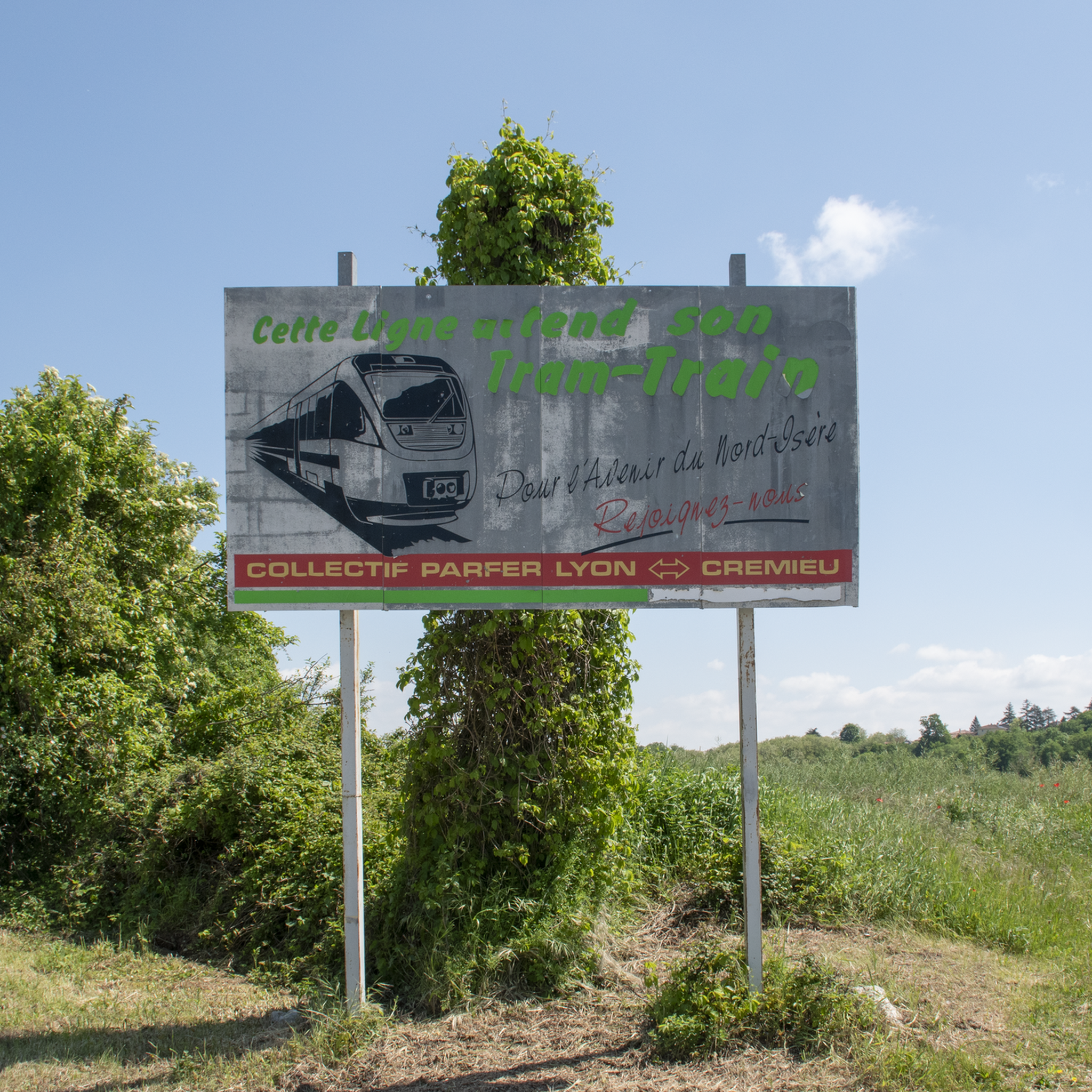
In January 1847, an inquiry was opened into projects towards Geneva, Besançon, Dôle-Châlons. In 1850, the Lyon Chamber of Commerce and Industry adopted the project for a rail link from Lyon to Chambéry via Saint Genis sur Guiers. Applications to operate this line were rejected until 1877. The works lasted 4 years, financed in part by Belgian capital. The inauguration took place on October 9, 1881, and the first train ran on October 30. The line started from the Gare de l'Est (Avenue Félix Faure) and ended at Sablonnières. It had 16 stations and 3 stops over a distance of 72 Kms. Passenger traffic increased from 4 daily round trips in 1897 to 8 in 1935. A passenger took 40 minutes on the 6:35 AM train to get from Lyon to Pont de Chéruy and 34 minutes to return to Lyon on the 7:23 PM train. Despite everything, the line was closed to passengers in December 1938, then reopened from September 1939 to December 31, 1947. VFD (Voie Ferrée du Dauphiné) coaches took over the service between Crémieu and Lyon; Freight traffic supplied the main industries (Grammont in Pont de Chéruy and Vicat in Bouvesse) as well as the various industrial zones. The network served 70 private sidings. At its peak in 1935, 1,000,000 tons transited this line. The decision by the cement works to no longer use the rail in 1978 was to deal it a "fatal" blow. In 1980, in its last year, 540,244 tons (including 150,130 of scrap metal) were still transported. In 2001, CoUrLy (Community of Urban Areas of Lyon) and the General Council of the Rhône adopted a decision to reactivate passenger traffic on part of the route of the Eastern line. The objective is to connect Lyon to Saint Exupéry airport.
0
0
In January 1847, an investigation was opened into projects towards Geneva, Besançon, Dôle-Châlons. In 1850, the Lyon Chamber of Commerce and Industry adopted the project for a rail link from Lyon to Chambéry via Saint Genis sur Guiers. Applications to operate this line were rejected until 1877. The work lasted 4 years, financed in part by Belgian capital. The inauguration took place on October 9, 1881, and the first train ran on October 30. The line started from the Gare de l'Est (Avenue Félix Faure) and ended at Sablonnières. It had 16 stations and 3 stops over a distance of 72 Kms. Passenger traffic increased from 4 daily round trips in 1897 to 8 in 1935. A passenger took 40 minutes on the 6:35 AM train to travel from Lyon to Pont de Chéruy and 34 minutes to return to Lyon on the 7:23 PM train. Despite everything, the line was closed to passengers in December 1938, then reopened from September 1939 to December 31, 1947. VFD (Voie Ferrée du Dauphiné) coaches took over between Crémieu and Lyon; Freight traffic supplied the main industries (Grammont in Pont de Chéruy and Vicat in Bouvesse) as well as the various industrial zones. The network served 70 private sidings. At its peak in 1935, 1,000,000 tons transited through this line. The decision by the cement factories to no longer use the rail in 1978 was to deal it a "fatal" blow. In 1980, during its last year, 540,244 tons (including 150,130 of scrap metal) were still transported. In 2001, CoUrLy (Urban Community of Lyon) and the General Council of the Rhône adopted a decision to reactivate passenger traffic on part of the route of the Est line. The objective is to connect Lyon to Saint Exupéry airport.
0
0

Very beautiful village with character, entirely made of stone; from the village, you can see the Madonna of the Larina Archaeological site.
0
0


Shaky section in the rails of the Eastern Lyon Railway
0
0
Beautiful little town, quite touristy, but worth the detour
0
0
Frequently Asked Questions
How many touring cycling routes are available around Charvieu-Chavagneux?
There are over 25 touring cycling routes around Charvieu-Chavagneux, offering a variety of experiences for different skill levels. You'll find 12 easy routes and 16 moderate routes, ensuring options for everyone from beginners to more experienced cyclists.
Are there any easy touring cycling routes suitable for beginners or families?
Yes, Charvieu-Chavagneux offers several easy routes perfect for beginners or family outings. An excellent option is the Étang des Portions loop from Charvieu-Chavagneux, which is 12.7 km long and takes less than an hour to complete. Another easy choice is the Cross of the Spur – View of the Col de l'Éperon loop from Charvieu-Chavagneux, covering 21.6 km with gentle elevation.
What kind of terrain can I expect on the touring cycling routes?
The region around Charvieu-Chavagneux offers diverse terrain. You'll encounter a mix of paved and unpaved segments, with landscapes transitioning between the Lyonnaise plain and distant views of the Alps. Some routes feature water bodies like the Étang du Peillard and the Bourbre river, providing varied scenery throughout your ride.
Are there any circular touring cycling routes in the area?
Many of the touring cycling routes around Charvieu-Chavagneux are designed as loops, allowing you to start and finish in the same location. Examples include the popular The Shire of Hobbits – Path loop from Charvieu-Chavagneux and the longer Ruins of Malatrait – Cross of the Spur loop from Charvieu-Chavagneux.
What are some notable landmarks or attractions I can see while cycling?
While cycling, you can explore several historical and natural points of interest. The medieval town of Crémieu, with its architectural heritage, is a highlight, featuring the Château Delphinal of Crémieu. You might also pass by the historic Château de Bienassis or the Jonage Dam. The region's water features, like the Étang du Peillard, also offer scenic views.
Is Charvieu-Chavagneux connected to any long-distance cycling routes?
Yes, Charvieu-Chavagneux is conveniently located within reach of the ViaRhôna, a major cycling route that stretches over 800 km from Lake Geneva to the Mediterranean. This provides excellent opportunities for longer touring adventures that can originate from or pass through the area.
What do other touring cyclists say about the routes in Charvieu-Chavagneux?
The touring cycling routes in Charvieu-Chavagneux are highly rated by the komoot community, with an average score of 4.5 stars from over 100 reviews. Cyclists often praise the diverse landscapes, the mix of paved and unpaved segments, and the options available for various ability levels.
Are there any routes that pass through historical towns or villages?
Yes, some routes offer a chance to explore historical areas. For instance, the Muddy Forest Path – Crémieu loop from Charvieu-Chavagneux will take you towards the medieval town of Crémieu, known for its rich heritage and charming architecture.
What is the best time of year to go touring cycling in Charvieu-Chavagneux?
The region is enjoyable for touring cycling across multiple seasons. Spring and autumn generally offer pleasant temperatures and beautiful scenery. Summer is also suitable, though it can be warmer, making early morning or late afternoon rides ideal. The diverse landscapes ensure scenic views throughout the year.
Are there challenging routes for experienced touring cyclists?
While Charvieu-Chavagneux features many easy and moderate routes, some longer moderate options provide a good challenge with varied terrain and elevation gain. Routes like the Ruins of Malatrait – Cross of the Spur loop from Charvieu-Chavagneux, at 38.5 km with over 300 meters of elevation, offer a more demanding experience for those seeking it.
Can I find routes with scenic viewpoints of the Alps?
Yes, the region's unique geography means that many routes offer glimpses of the distant Alps, especially as you transition between the Lyonnaise plain and higher ground. These views provide a stunning backdrop to your cycling adventure.
Most popular routes around Charvieu-Chavagneux
Most popular attractions around Charvieu-Chavagneux

Get inspired with the komoot mobile app


Explore more
Browse the best Cycling routes in other regions.
