The best running trails around Saint-Michel
4.3
(4)
725
runners
106
runs
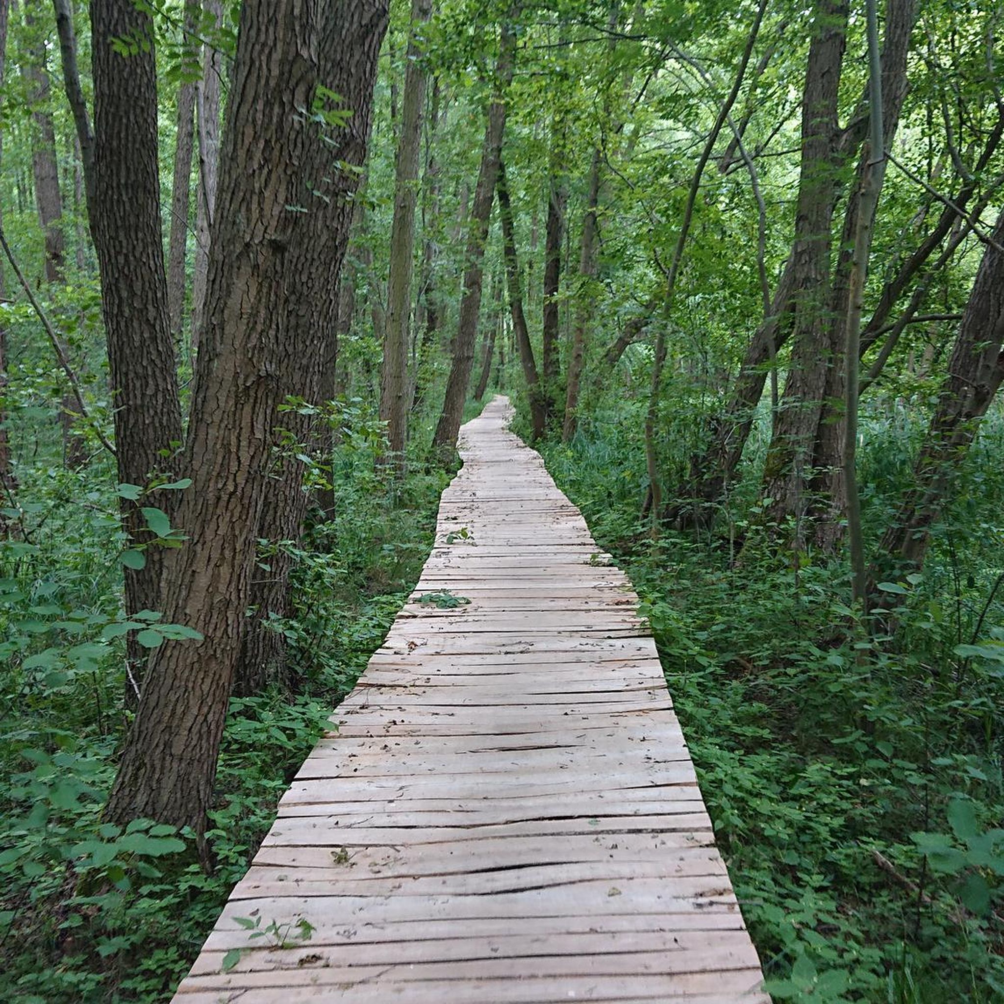
Jogging routes around Saint-Michel are characterized by a diverse landscape, ranging from the iconic Bay of Mont Saint-Michel with its dramatic tides to serene coastal plains and the tranquil Couesnon River. The region also features rolling hills and rural countryside, offering varied terrain for runners. Forested areas provide additional natural settings for jogging, with routes that include old forest roads and small valleys.
Best jogging routes around Saint-Michel
- The most popular jogging route is Port of Valence-d'Agen loop from Pommevic…
Last updated: June 29, 2026
5.0
(1)
12
runners
6.50km
00:42
100m
100m
Moderate run. Good fitness required. Mostly paved surfaces. Suitable for all skill levels.
11
runners
8.34km
00:52
20m
20m
Moderate run. Good fitness required. Mostly paved surfaces. Suitable for all skill levels.

Sign up for free
6
runners
11.8km
01:15
30m
30m
Moderate run. Good fitness required. Mostly paved surfaces. Suitable for all skill levels.
3
runners
7.67km
00:49
80m
80m
Moderate run. Good fitness required. Mostly paved surfaces. Suitable for all skill levels.
4
runners
8.32km
00:54
140m
140m
Moderate run. Good fitness required. Mostly paved surfaces. Suitable for all skill levels.
Get access to more routes and recommendations from other explorers.
Sign up for free
Already have an account?
Our route recommendations are based on thousands of hikes, rides, and runs completed by other people on komoot.
Start today with a free account
Your next adventure awaits.
Login or Signup
Tips from the Community


For lovers of regional products, a farmers' market takes place every Sunday morning under the market hall!
3
0
The village of Auvillar, which overlooks the Garonne valley from its hill, is a stopping point on the road to Santiago de Compostella and has the special feature of being included on the list of most beautiful villages in France.
3
0
The area of Auvillar is 15.6 km², the population density is 63.7 inhabitants per km².
3
0
Auvillar is a municipality in the French department of Tarn-et-Garonne (region Occitanie) and has 994 inhabitants (2004). The town is part of the arrondissement of Castelsarrasin. Auvillar has been recognized by Les Plus Beaux Villages de France as one of the most beautiful villages in France
3
0

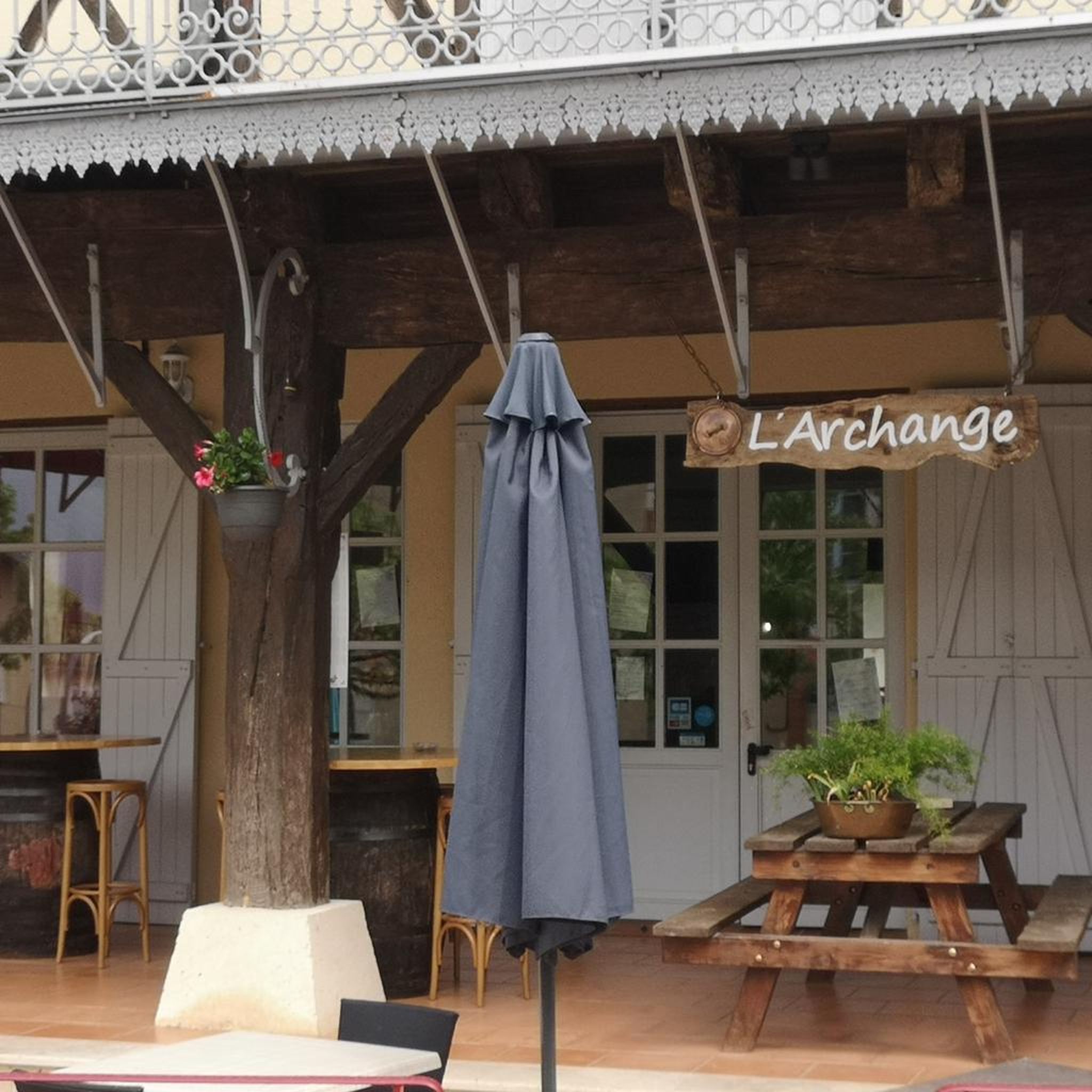
Auvillar is classified among the Most Beautiful Villages of France. The village offers many accommodations and several restaurants.
0
0
Auvillar is classified among the Most Beautiful Villages of France. The village offers many accommodations and several restaurants.
0
1

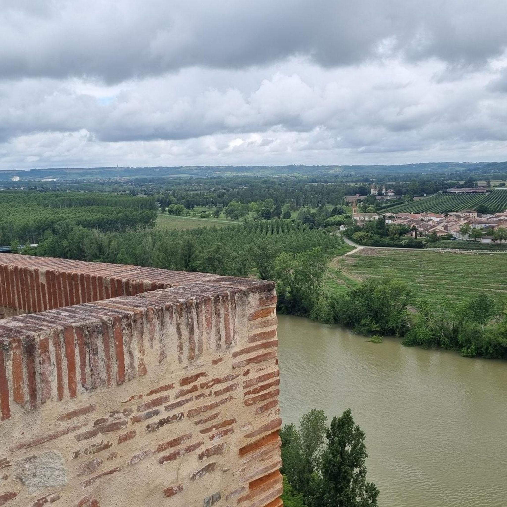
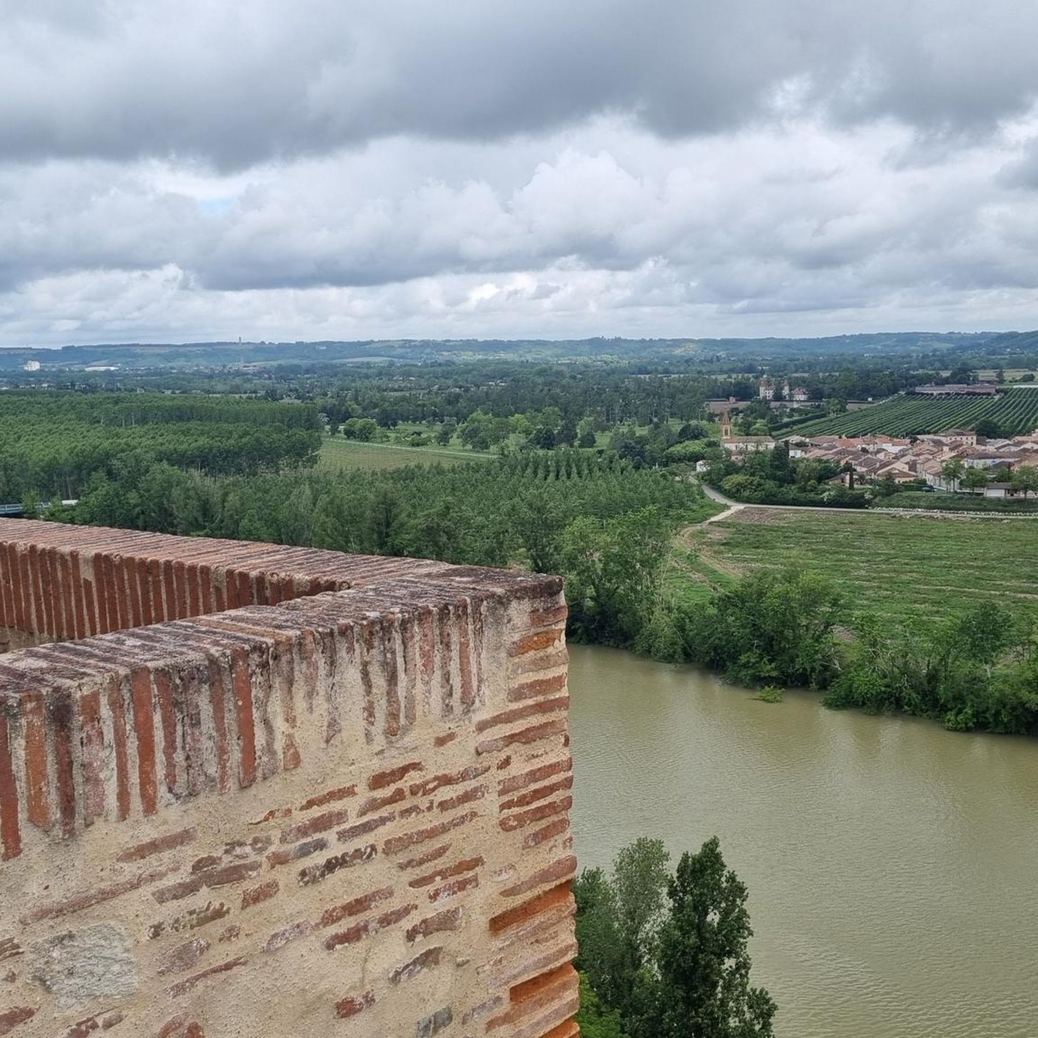
This small village between Agen and Moissac is ranked among the most beautiful in France. A pilgrim city with pink stone walls, it overlooks the Garonne. Don't miss its superb circular grain market. Its church has an imposing rose window and an astonishing bell tower. Finally, you will appreciate the old castle square with its breathtaking view of the river and the valley.
1
0
Frequently Asked Questions
How many running routes are available in Saint-Michel?
Saint-Michel offers a wide selection of running routes, with over 90 trails available for you to explore. These routes cater to various preferences, from easy jogs to more challenging runs.
What kind of terrain can I expect on running trails in Saint-Michel?
The running trails in Saint-Michel feature a diverse landscape. You can expect coastal paths with dramatic tides, serene plains along the Couesnon River, and routes through rolling hills and rural countryside. Some areas also offer forest routes with old forest roads and small valleys.
Are there running routes suitable for beginners in Saint-Michel?
Yes, Saint-Michel has several easy running routes perfect for beginners. These trails typically have minimal elevation changes and offer a pleasant introduction to the region's scenery. There are 3 easy routes available.
What interesting sights or landmarks can I see while running in Saint-Michel?
Many running routes offer stunning views of the iconic Mont Saint-Michel Abbey and its surrounding bay. You can also discover historical and architectural highlights such as the Auvillar Circular Market Hall, the Saint-Saturnin Church, or the Suspension bridge over the Garonne. The charming settlement of Auvillar is also a notable point of interest.
What do other runners say about the trails in Saint-Michel?
The running routes in Saint-Michel are highly regarded by the komoot community, with an average rating of 4.5 out of 5 stars from 4 reviews. Over 700 runners have used komoot to explore the varied terrain, often praising the scenic views and diverse landscapes.
Are there family-friendly running options in Saint-Michel?
While specific 'family-friendly' designations aren't always explicit, many of the easier and moderate routes with less elevation gain, particularly those along the coastal plains or the Couesnon River, would be suitable for families looking for a pleasant jog together.
Can I bring my dog on the running trails in Saint-Michel?
Generally, dogs are welcome on many outdoor trails in France, but it's always best to check local signage for specific restrictions, especially in protected natural areas or near historical sites. Keep your dog on a leash and be mindful of other users and wildlife.
Are there circular running routes available in Saint-Michel?
Yes, many of the running routes in Saint-Michel are circular, offering convenient starting and ending points. Examples include the popular Port of Valence-d'Agen loop from Pommevic and the Auvillar – Auvillar Circular Market Hall loop from Auvillar.
Where can I find parking for running trails in Saint-Michel?
Parking availability varies by route. For routes starting in towns or villages like Auvillar or Pommevic, you can often find public parking areas. For trails in more rural settings, look for designated parking lots near trailheads or consider starting points with known facilities.
Are there running routes accessible by public transport?
Access to running routes by public transport depends on the specific starting point. Larger towns and villages in the Saint-Michel region may have bus services that can get you close to certain trailheads. It's advisable to check local public transport schedules for the specific area you plan to run in.
What are some scenic running trails in Saint-Michel?
For breathtaking scenery, consider routes that offer views of the Bay of Mont Saint-Michel, especially at low tide. Trails along the Couesnon River provide pleasant water views, while routes like the Suspension bridge over the Garonne loop from Auvillar offer picturesque countryside and river vistas.
Are there any challenging running routes for experienced runners?
Yes, for those seeking a more challenging run, Saint-Michel offers routes with significant elevation changes. For example, the Point de Vue de Boudou loop from Malause is classified as difficult, featuring over 360 meters of ascent over its 13.8 km distance.
What is the best time of year to go running in Saint-Michel?
The Saint-Michel region is enjoyable for running throughout much of the year. Spring and autumn offer pleasant temperatures and beautiful scenery. Summer can be warm, so early morning or late evening runs are often preferred. Winter runs are also possible, though conditions may vary.
Most popular attractions around Saint-Michel

Get inspired with the komoot mobile app


Explore more
Browse the best Running Trails & Routes in other regions.
