The best road cycling routes around Innimond
4.4
(161)
3,939
riders
121
rides
Road cycling routes around Innimond traverse diverse landscapes within the Ain region of France. The area features varied topography, including forests, ridges, and significant elevation changes, with altitudes reaching over 1200 meters. Cyclists encounter challenging climbs and descents, offering panoramic views of the Alps, the Rhône Valley, and Mont Blanc from various vantage points. The Bugey Mountains define much of the terrain, providing a network of roads suitable for road cycling.
Best road cycling routes around Innimond
- The most popular road cycling route is Col de Fay – Cerin Peat Bog loop from Innimond, a 49.4 miles (79.4 km) trail that takes 4 hours 23 minutes to complete. This difficult route features over 1700 meters of elevation gain, passing through varied terrain.
- Another top favourite among local road cyclists is Col du Ballon – Col de Ballon (929 m) loop from Saint-Germain-les-Paroisses, a moderate 30.2 miles (48.5 km) path. This route includes the Col du Ballon, offering views within the Bugey Mountains.
- Local road cyclists also love the Marchamp – Cerin Peat Bog loop from Lompnas, a 20.5 miles (33.1 km) trail leading through the Cerin Peat Bog, often completed in about 1 hour 43 minutes.
- Road cycling around Innimond is defined by challenging mountain passes, extensive road networks, and panoramic views of the Alps and Rhône Valley. The network offers options for easy, moderate, and difficult routes, catering to various ability levels.
- The routes in Innimond are highly rated by the komoot community with an average score of 4.5 stars from over 100 reviews. More than 2000 road cyclists have used komoot to explore Innimond's varied terrain.
Last updated: July 4, 2026
4.5
(2)
77
riders
174km
07:46
1,420m
1,420m
Hard road ride. Very good fitness required. Some segments of this route may be unpaved and difficult to ride.
5.0
(1)
24
riders
79.4km
04:24
1,710m
1,710m
Hard road ride. Very good fitness required. Mostly well-paved surfaces and easy to ride.

Sign up for free
19
riders
38.1km
02:05
800m
800m
Moderate road ride. Good fitness required. Mostly well-paved surfaces and easy to ride.
22
riders
33.1km
01:44
580m
580m
Moderate road ride. Good fitness required. Mostly well-paved surfaces and easy to ride.
23
riders
Moderate road ride. Good fitness required. Mostly well-paved surfaces and easy to ride.
Get access to more routes and recommendations from other explorers.
Sign up for free
Already have an account?
Our route recommendations are based on thousands of hikes, rides, and runs completed by other people on komoot.
Start today with a free account
Your next adventure awaits.
Login or Signup

Tips from the Community

Be careful when going through the tunnel, you don't necessarily see the other bikes, otherwise the scenery is very pleasant.
0
0

Beautiful and very wild without cars
0
0

Superb plateau road, without traffic, with a beautiful open view between fir trees, fields and mountains!
1
0

Very cozy, quiet and romantic lodge, on the water and under the stars...
0
0
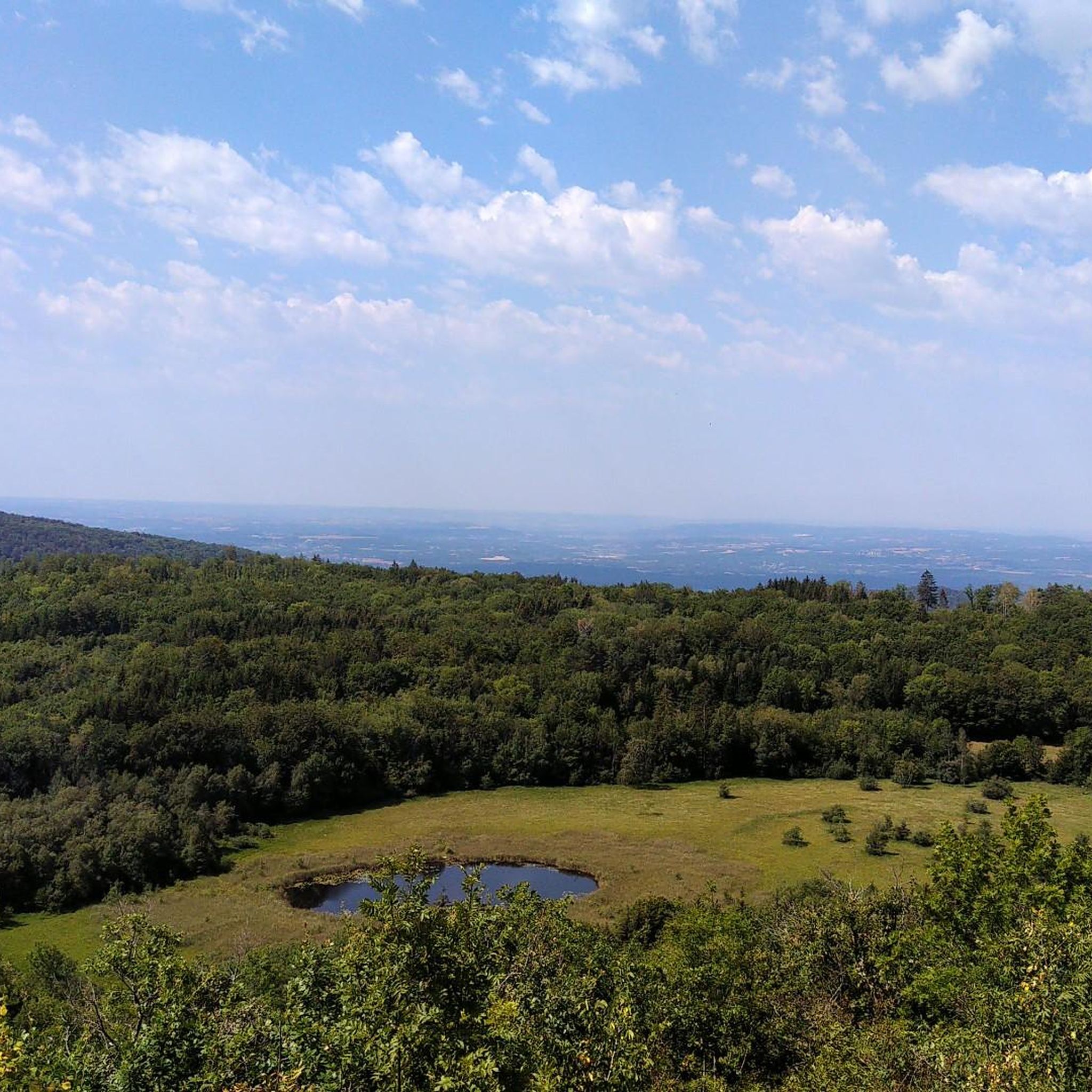
A pretty peat bog that you can't miss when going up to Innimond and the Col du Petit Perthuis
1
0
All the information you need about the upcoming climb: length, average gradient, etc. A great initiative from the Ain Department.
1
0
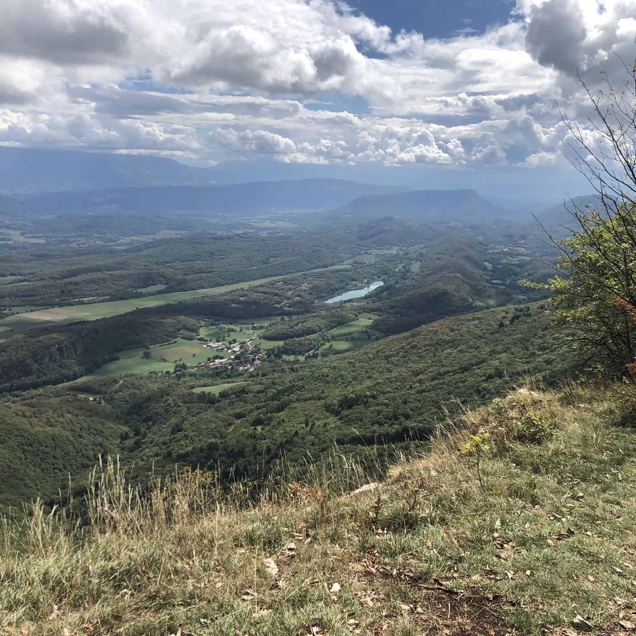
Belvedere with an impressive panorama that is worth the stop during the climb.
1
0

Great atmosphere in this charming little village.
1
0
Frequently Asked Questions
How many road cycling routes are available around Innimond?
Innimond offers a wide selection of road cycling routes, with over 100 tours available. These routes cater to various skill levels, including easy, moderate, and difficult options.
What kind of terrain can I expect when road cycling in Innimond?
Road cycling in Innimond features diverse terrain within the Ain region. You'll encounter a mix of forests, ridges, and significant elevation changes, with altitudes reaching over 1200 meters. The routes often include challenging climbs and descents through the Bugey Mountains, providing a varied and engaging experience.
What panoramic views can I expect on road cycling routes in Innimond?
Innimond is renowned for its breathtaking panoramic views. From various vantage points, especially around passes like the Col du Petit Perthuis and La Croix de la Roche, you can admire the vast expanse of the Alps, the Rhône Valley, and on clear days, even catch a glimpse of Mont Blanc.
Are there routes suitable for beginners or less experienced road cyclists?
Yes, Innimond offers routes suitable for all levels. There are 10 easy road cycling routes available, providing gentler gradients and less demanding distances for beginners or those seeking a more relaxed ride.
Are there challenging routes for experienced road cyclists?
Absolutely. Innimond is well-suited for experienced riders looking for a challenge. There are 53 difficult routes, featuring significant elevation gains and demanding climbs. For example, the Col de Fay – Cerin Peat Bog loop from Innimond is a difficult 79.4 km route with over 1700 meters of elevation gain.
Are there any natural features or landmarks to see along the road cycling routes?
Yes, many routes pass by notable natural features and landmarks. You might encounter beautiful lakes like Lac d'Ambléon, or impressive waterfalls such as Claire Fontaine Waterfall and Cascade des Dards. Other interesting sights include La Roche Percée and the Plateau de Ferlioz.
Can I find circular road cycling routes in Innimond?
Yes, many of the road cycling routes around Innimond are designed as loops, allowing you to start and finish at the same point. For instance, the Col du Ballon – Col de Ballon (929 m) loop from Saint-Germain-les-Paroisses is a popular circular route.
What do other road cyclists say about their experience in Innimond?
The road cycling routes in Innimond are highly rated by the komoot community, with an average score of 4.5 stars from over 100 reviews. Cyclists often praise the magnificent views of the Alps and the Rhône Valley, as well as the challenging yet rewarding climbs and diverse landscapes.
Are there any long-distance road cycling routes in Innimond?
For those seeking longer rides, Innimond offers several options. The Fosses Pass – Lac d'Ambléon loop from Innimond is a challenging route spanning over 63 km with significant elevation, perfect for a longer day out.
Is there parking available near the road cycling routes in Innimond?
While specific parking areas for each route are not detailed, Innimond and its surrounding villages typically offer public parking options. It's advisable to check local village maps or signs upon arrival for designated parking spots near route starting points.
How can I reach the road cycling routes in Innimond using public transport?
Public transport options directly to Innimond may be limited. It's generally recommended to travel by car to reach the starting points of many road cycling routes in this rural region of Ain. However, regional bus services might connect larger towns to smaller villages, so checking local transport schedules for the Ain department could be beneficial.
Are there places to stop for refreshments or food along the routes?
While the routes themselves traverse natural landscapes, many pass through or near small villages where you can find local cafes or small shops for refreshments. Planning your route to include stops in villages like Lompnas or Saint-Germain-les-Paroisses can ensure you have opportunities for food and drink.
Most popular attractions around Innimond

Get inspired with the komoot mobile app


Explore more
Browse the best Road cycling routes in other regions.
