The best cycling routes around Saint-Didier
4.6
(107)
2,623
riders
44
rides
Touring cycling around Saint-Didier offers routes primarily along the Canal du Nivernais, characterized by flat towpaths and gentle gradients. The region features a landscape of river valleys and rural roads, providing a relaxed cycling experience. Elevation changes are generally minimal, making it suitable for various skill levels. The area's terrain is conducive to longer, steady rides through the French countryside.
Best touring cycling routes around Saint-Didier
- The most popular touring cycling route is Canal du Nivernais – Canal de Nivernais…
Last updated: June 22, 2026
4.9
(13)
1,761
riders
Moderate bike ride. Good fitness required. Mostly paved surfaces. Suitable for all skill levels.
4.5
(2)
6
riders
Easy bike ride. Great for any fitness level. Mostly paved surfaces. Suitable for all skill levels.

Sign up for free
4.4
(9)
59
riders
28.8km
01:40
80m
80m
Easy bike ride. Great for any fitness level. Mostly paved surfaces. Suitable for all skill levels.
5.0
(2)
30
riders
71.9km
04:25
420m
420m
Moderate bike ride. Good fitness required. Mostly paved surfaces. Suitable for all skill levels.
5.0
(1)
31
riders
30.2km
01:43
90m
100m
Easy bike ride. Great for any fitness level. Mostly paved surfaces. Suitable for all skill levels.
Get access to more routes and recommendations from other explorers.
Sign up for free
Already have an account?
Our route recommendations are based on thousands of hikes, rides, and runs completed by other people on komoot.
Start today with a free account
Your next adventure awaits.
Login or Signup

Tips from the Community

The Canal du Nivernais During the harsh winter of 1782-1783, the Morvan forest was no longer sufficient to supply the capital with wood. Wood had to be transported from other forests, particularly from the Bazois. To solve this problem, the construction of a small channel between the Loire and the Yonne was considered. Work began in 1784 with the boring of "La Montagne" at La Collancelle, and in 1786, the construction of a navigable canal was planned. After 56 years of construction, the three tunnels were completed in 1840, and on March 15, 1841, the Nivernais Canal was officially opened. In the first four decades, the canal saw an increase in traffic, as it served as a means of transport for heavy loads such as stone, wood, and coal. With the decline in demand for wood in the capital and the advent of the railway, the decline of navigation on the canal began. In the 1970s, political will and financial support were needed to promote river tourism, ecotourism, and cycling tourism. To this day, the Canal du Nivernais is one of the busiest canals in France, thanks to its gentle cruising.
0
0
The Nivernais Canal During the cold winter of 1782-1783, the Morvan forest was no longer sufficient to supply the capital with wood. It became necessary to transport wood from other forests, those of Bazois. Work was then considered to build a small channel between the Loire and the Yonne. In 1784, construction began with the drilling of "La Montagne" from La Collancelle, and in 1786, the construction of a navigation canal was planned. In 1840, the construction of the three tunnels was completed, then on March 15, 1841, the official commissioning of the Nivernais Canal took place. In the first 40 years, traffic on the canal increased, and it was also used as a means of transport for heavy loads (especially stone, but also wood and coal). With the decline in demand for wood in the capital and the development of the railway, navigation on the canal began to decline. In the 1970s, political will and funding were needed to develop river tourism, ecotourism, and cycle tourism. To this day, the Canal du Nivernais is one of the busiest canals in France due to its philosophy of gentle roaming.
0
0
The Nivernais Canal During the cold winter of 1782-1783, the Morvan forest was no longer sufficient to supply the capital with wood. It became necessary to transport wood from other forests, those of Bazois. Work was then considered to create a small channel between the Loire and the Yonne. In 1784, construction began with the boring of "La Montagne" in La Collancelle, and in 1786, the construction of a navigation canal was planned. In 1840, the construction of the three tunnels was completed, then on March 15, 1841, the official opening of the Nivernais Canal took place. In the first 40 years, traffic on the canal increased, and it was also used as a means of transport for heavy loads (particularly stone, but also wood and coal). With the decline in demand for wood in the capital and the development of the railway, navigation on the canal began to decline. In the 1970s, political will and funding were needed to develop river tourism, ecotourism, and cycle tourism. To this day, the Canal du Nivernais is one of the most frequented canals in France, thanks to its philosophy of gentle roaming.
0
0

There are no two alike! Plus, it's excellent with quality local products Yep & Pèt' https://maps.app.goo.gl/d31KRAa95boizLW16
0
0

Very friendly owners. Nice place for a bite and a drink. Name is " Yep and Pet "
1
0


Very nice cycle route along the canal with many sights.
2
0
Frequently Asked Questions
Are there easy touring cycling routes suitable for beginners or families in Saint-Didier?
Yes, Saint-Didier offers a good selection of easy touring cycling routes. There are 9 routes specifically graded as easy, characterized by flat towpaths and gentle gradients along the Canal du Nivernais. A great option for families is the Loop from Asnois and along the Canal du Nivernais via the V51 and the D985, which combines canal-side riding with quiet local roads.
Can I find circular touring cycling routes around Saint-Didier?
Many of the touring cycling routes in Saint-Didier are designed as loops, allowing you to start and finish at the same point. For example, the popular Canal du Nivernais – Canal de Nivernais Towpath loop from Flez Cuzy Tannay is a 44-mile circular route that follows the scenic canal towpath.
Are there challenging touring cycling routes for experienced cyclists in the Saint-Didier area?
While the region is known for its gentle gradients, there are 14 routes graded as difficult for those seeking more of a challenge. These routes often venture further into the rural roads and river valleys, potentially incorporating longer distances or more varied terrain compared to the flat towpaths.
What is the typical length and duration of touring cycling routes in Saint-Didier?
The routes vary significantly in length and duration. You can find shorter rides like the Loop from Asnois, which is about 17 miles (27 km) and takes around 1 hour 35 minutes. Longer routes, such as the Canal du Nivernais – Canal de Nivernais Towpath loop, can be up to 44 miles (70 km) and take over 4 hours to complete.
When is the best time of year for touring cycling in Saint-Didier?
The best time for touring cycling in Saint-Didier is typically from spring through early autumn (April to October). During these months, the weather is generally pleasant, making for comfortable riding conditions along the canal towpaths and rural roads. Summer offers longer daylight hours, ideal for extended rides.
What kind of terrain can I expect on the touring cycling routes around Saint-Didier?
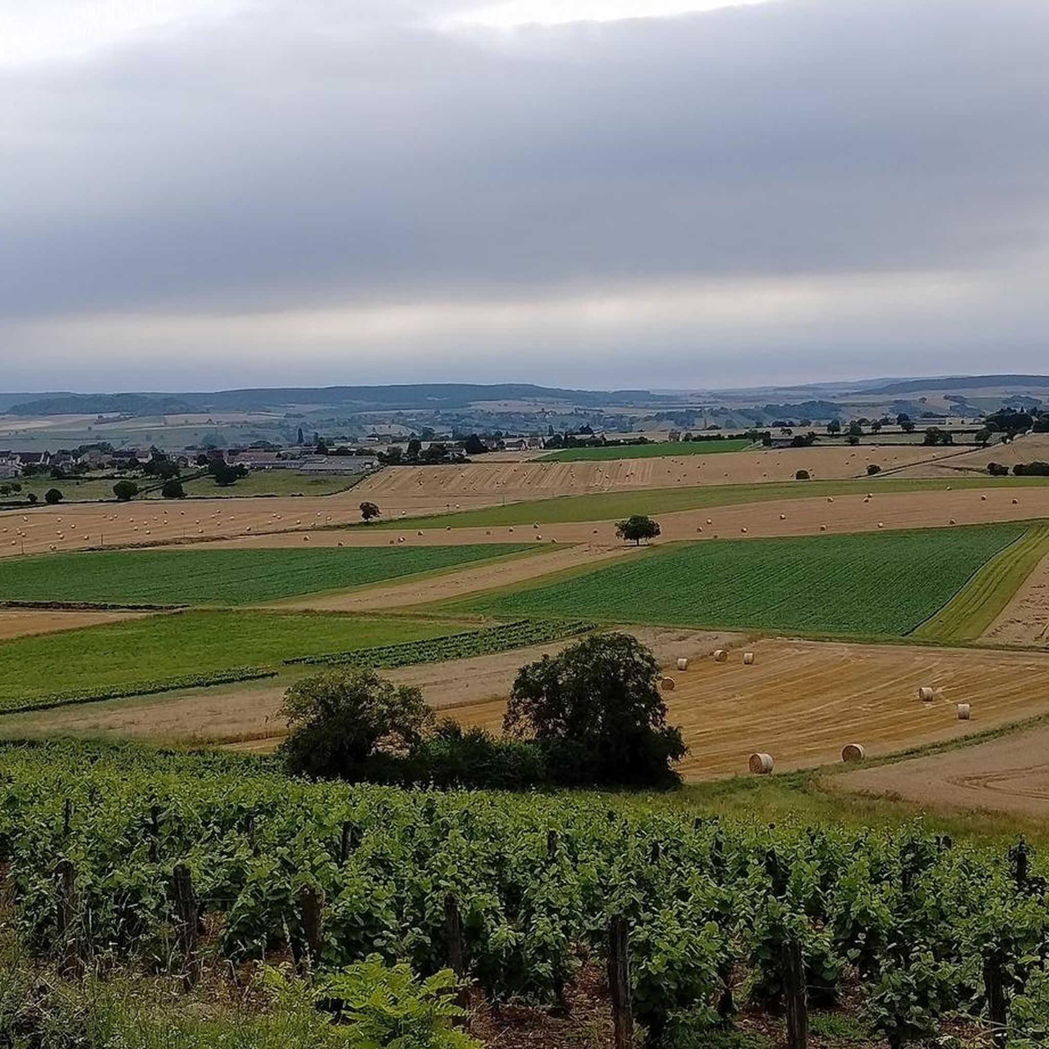
The terrain around Saint-Didier is primarily characterized by flat towpaths along the Canal du Nivernais, gentle gradients, river valleys, and quiet rural roads. Elevation changes are generally minimal, making for a relaxed cycling experience suitable for various skill levels.
What can I see along the touring cycling routes in Saint-Didier?
Many routes follow the scenic Canal de Nivernais Towpath, offering picturesque views of the waterway and surrounding countryside. You might also pass by historic sites such as Cuncy Castle, the charming Town of Corbigny, or the unique Cuncy Lock. The Canal du Nivernais – Historic centre of Clamecy loop, for instance, takes you through canal-side scenery and past the historic centre of Clamecy.
Are there any hidden gem touring cycling routes in the Provence region near Saint-Didier?
While Saint-Didier itself is a gem for canal-side cycling, exploring the broader Provence region can uncover more diverse landscapes. Within the immediate Saint-Didier area, routes like the Canal du Nivernais – Manual Drawbridge loop from Flez Cuzy Tannay offer a charming experience, showcasing the unique engineering of the canal system away from busier paths.
What do other touring cyclists enjoy most about cycling in Saint-Didier?
The area is highly rated by the komoot community, with an average score of 4.6 stars from over 80 reviews. Reviewers often praise the quiet, well-maintained canal towpaths, the gentle gradients suitable for all abilities, and the picturesque French countryside that provides a relaxed and enjoyable cycling experience.
How many touring cycling routes are available around Saint-Didier?
There are over 35 touring cycling routes available around Saint-Didier. This network includes 9 easy routes, 16 moderate routes, and 14 difficult routes, offering options for various skill levels and preferences.
Is public transport accessible near the touring cycling routes in Saint-Didier?
Access to public transport in the immediate vicinity of Saint-Didier's cycling routes can be limited, as many routes follow rural canal paths and quiet country roads. It's advisable to check local bus or train schedules for specific starting points if you plan to use public transport to reach the area.
What should I bring for a touring cycling trip in Saint-Didier?
For touring cycling in Saint-Didier, it's recommended to bring essentials such as water, snacks, a basic repair kit (patch kit, pump), sun protection, and appropriate clothing for the weather. Given the canal-side nature of many routes, insect repellent might also be useful, especially during warmer months. A fully charged phone with offline maps is always a good idea.
Most popular attractions around Saint-Didier

Get inspired with the komoot mobile app


Explore more
Browse the best Cycling routes in other regions.
