The best walks and hikes in Asturias
4.4
(12540)
83,145
hikers
2,487
hikes
Hiking in Asturias offers diverse terrain, from the towering limestone mountains of Picos de Europa National Park to the rugged Cantabrian coastline. The region features deep gorges, lush Atlantic forests, and numerous glacial lakes. These varied landscapes provide a wide array of trails, including high-mountain treks, riverside paths, and coastal walks. A significant portion of the territory is protected, ensuring well-preserved natural environments for outdoor activities.
Best hiking trails in Asturias
- The most popular hiking route is Route of Cares…
Last updated: October 13, 2026
4.8
(983)
5,883
hikers
23.1km
07:28
990m
990m
The Ruta del Cares plunges you into a landscape that seems otherworldly, a trail carved into the walls of a gorge that will leave you breathless. You'll hike between imposing…
4.8
(226)
1,632
hikers
Hard hike. Good fitness required. Sure-footedness, sturdy shoes and alpine experience required.

4.2
(13)
104
hikers
11.0km
03:40
420m
410m
Hike the moderate 6.9-mile Lagos de Covadonga circular trail, gaining 1368 feet with stunning glacial lakes and mountain views.
4.7
(94)
457
hikers
Moderate hike. Good fitness required. Mostly accessible paths. Sure-footedness required.
4.8
(59)
642
hikers
Hard hike. Very good fitness required. Sure-footedness, sturdy shoes and alpine experience required.
4.8
(106)
557
hikers
7.72km
02:32
320m
320m
Moderate hike. Good fitness required. Mostly accessible paths. Sure-footedness required.
4.7
(127)
672
hikers
12.3km
03:36
340m
340m
The Circular Route of the Lake Valley — Somiedo Natural Park plunges you into a spectacular glacial landscape, where Lake del Valle, the largest in Asturias, is the crown jewel.…
4.6
(71)
600
hikers
The La Olla de San Vicente and Puente Medieval on the Dobra River route immerses you in a dreamlike river landscape, where the emerald waters of the Dobra River wind…
4.8
(78)
445
hikers
Hard hike. Very good fitness required. Mostly accessible paths. Sure-footedness required.
4.7
(75)
645
hikers
11.6km
04:05
650m
650m
If you're looking for a hiking experience that offers the best of Asturias, the Pico Pienzu Trail from Mirador del Fitu is an unbeatable choice. This moderate 7.2-mile (11.6 km)…
Get access to more routes and recommendations from other explorers.
Already have an account?
Our route recommendations are based on thousands of hikes, rides, and runs completed by other people on komoot.
Start today with a free account
Your next adventure awaits.
Other adventures in Asturias


Tips from the Community

A very beautiful old shepherd's path, which connects Sotres with Tielve through the deep gorge of the Rio Duje, offering an impressive view along the gorge in both directions - before the road was built, this was the only connection between the two villages. The path is not really suitable for fast walking, but otherwise, in my opinion, it is unproblematic. Unfortunately, the path does not go all the way to Tielve, the last section has to be walked along the road. The somewhat unsightly thing is that a high-voltage power line also connects the two villages through this gorge and follows this path approximately, with a few pylons built right next to the path. Of course, electricity is needed - but it spoils the view a bit.
0
0
A beautiful picnic spot, at the end of which you have a great view from a steel platform into the gorge of the Rio Duje to the south into the highlands of the Picos de Europa - if you follow this gorge along the river and go a little further, you will reach the mountain station of the Fuente Dé cable car.
0
0
The huts of the Majada de Tobaos stretch for about 500m along the path. Many are dilapidated, some are still in quite good condition - and one looks as if it is still permanently inhabited, including power supply and satellite dish. During my visit, the clouds unfortunately hung low in the mountains, missing the magnificent backdrop shown in other photos here. This gave the place a completely different atmosphere, but also very beautiful.
0
0

My opinion about Lake Enol is that it is the most beautiful and spectacular of the Lagos de Covadonga, and one of the most special mountain landscapes in Asturias. 🌊 Iconic image: its deep lake, the reflected mountains, and the grazing cows create a perfect postcard. 🏔️ Sense of grandeur: it conveys more "high mountain" than Lake Ercina. 📸 Very photogenic: especially with light fog, at dawn, or after rain. 🚶♀️ Accessible: it can be enjoyed without long hikes.
1
0

Very nice, but also very crowded.
1
0

The ascent of Pico Pienzu can be one of the most rewarding routes you'll find in the Asturian mountains. The contrast between sea and mountains at its summit will leave you speechless, and any route you choose for the climb will offer a fantastic day in the mountains.
0
0
The Bolín Bridge, in Posada de Valdeón (León), is a small but significant mountain bridge that is part of several hiking trails in the Picos de Europa, especially as an access route to the challenging Canal de Trea. It is located on the outskirts of Posada de Valdeón, towards the Mirador del Tombo and the beginning of the Canal de Trea. It is close to Fuente Prieta and areas such as El Agua Las Huertas, in a natural setting of great beauty.
3
0

Wonderful location in the Picos de Europa
2
0
Frequently Asked Questions
How many hiking trails are available in Asturias?
Asturias offers a vast network of hiking trails, with over 2,100 routes available on komoot. These range from easy strolls to challenging high-mountain ascents, ensuring options for every skill level.
What do other hikers enjoy most about trails in Asturias?
The trails in Asturias are highly rated by the komoot community, with an average score of 4.5 stars from over 9,300 reviews. Hikers frequently praise the region's diverse landscapes, from the dramatic Picos de Europa mountains to the stunning coastline, and the well-preserved natural environments.
Are there hiking trails suitable for beginners or those looking for easy walks in Asturias?
Yes, Asturias has plenty of options for easier hikes. Over 750 routes are classified as easy, including gentle riverside paths and coastal strolls. For example, the La Olla de San Vicente and the Puente Medieval on the Río Dobra offers a moderate, relatively flat experience along the river.
What kind of terrain can I expect when hiking in Asturias?
Asturias is known for its incredibly diverse terrain. You can expect towering limestone mountains in areas like the Picos de Europa, deep river gorges such as the Cares, lush Atlantic forests, and dramatic, well-preserved coastlines. The region also features numerous glacial lakes and rolling green pastures.
Are there any hikes in Asturias that feature impressive waterfalls?
Yes, Asturias is home to several beautiful waterfalls. The Redes Natural Park, a UNESCO Biosphere Reserve, features the impressive Tabayón de Mongallu waterfall, often found along routes through ancient beech forests. The Oneta Waterfalls also offer a short and easy route to a series of cascades.
Can I find trails that lead to beautiful lakes in Asturias?
Absolutely. The region is famous for its glacial lakes. The iconic Lakes of Covadonga, including Lake Enol and Lake Ercina, offer a stunning circular route with high-mountain panoramas, such as the Lakes of Covadonga Circular Trail. Another excellent option is the Saliencia Lakes Loop in Somiedo Natural Park, which provides wide high-mountain views around four distinct glacial lakes.
Are there coastal hiking options in Asturias?
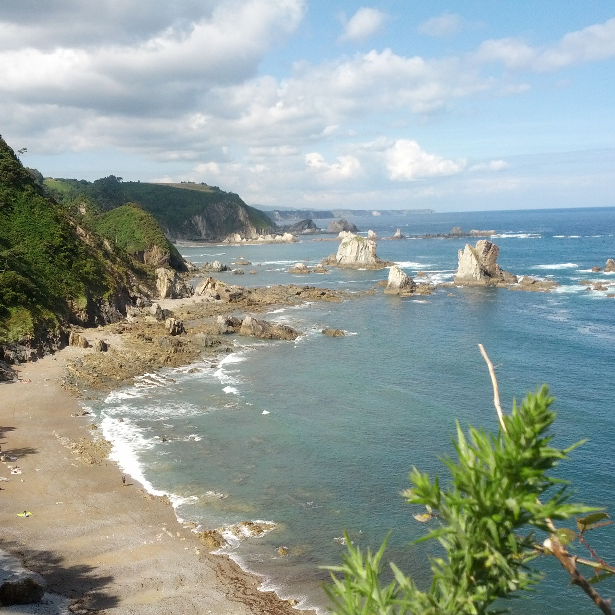
Yes, Asturias's 'Costa Verde' (Green Coast) offers exceptionally well-preserved coastal trails. You can explore dramatic cliffs, pristine beaches, and routes like the Cabo Peñas Trail at the northernmost point of Asturias, or the Acantilados del Infierno Trail known for its striking rock formations and blowholes.
Are there any family-friendly hiking trails in Asturias?
Many trails in Asturias are suitable for families. The Senda del Oso (Bear Path), an old railway line, is a popular greenway perfect for both hiking and cycling, offering a chance to spot brown bears. The La Olla de San Vicente route is another moderate option that can be enjoyed by families.
Are dogs allowed on hiking trails in Asturias?
Many trails in Asturias are dog-friendly, especially in natural parks and less restricted areas. However, it's always advisable to check specific park regulations, particularly in national parks like Picos de Europa, where certain areas might have restrictions to protect wildlife. Always keep your dog under control and clean up after them.
Are there circular hiking routes available in Asturias?
Yes, Asturias features numerous circular routes that allow you to start and end at the same point. Popular examples include the Lakes of Covadonga Circular Trail in Picos de Europa and the Saliencia Lakes Loop in Somiedo Natural Park.
What nearby attractions can I explore after a hike in Asturias?
Asturias offers a variety of attractions near its hiking trails. You can visit historical sites like the Castillo de San Martín or the Medieval Tower of Proaza. For scenic views, consider highlights like the Pico del Sol Viewpoint or the Campa Torres Viewpoint.
Is public transport available to access hiking trails in Asturias?
Public transport options vary by location. While some popular trailheads, especially within Picos de Europa National Park (like Covadonga), have seasonal bus services, many more remote trails require private vehicle access. It's recommended to check local bus schedules for specific routes if you plan to rely on public transport.
Do I need permits for hiking in Picos de Europa National Park?
Generally, permits are not required for day hiking on most trails within Picos de Europa National Park. However, certain areas, especially during peak season, might have restricted vehicle access or require reservations for specific activities or overnight stays. Always check the official park website for the latest regulations before your visit.
Most popular routes in Asturias
Most popular attractions in Asturias

Get inspired with the komoot mobile app


Didn’t find what you were looking for?
Check out more Hikes throughout Asturias below and find the perfect route in your destination.
Explore more
Browse the best Hikes in other regions.
