The best road cycling routes around Saires-La-Verrerie
4.3
(34)
1,928
riders
429
rides
Road cycling routes around Saires-La-Verrerie traverse a landscape characterized by rolling hills and rural roads, typical of the Normandy region. The area features a mix of open countryside, agricultural land, and occasional forested sections. Elevations vary, with routes including moderate climbs and descents, providing varied terrain for road cyclists.
Best road cycling routes around Saires-La-Verrerie
- The most popular road cycling route is Flers train station – Tranquil camping loop from La Ferrière-aux-Étangs, a 39.9 miles (64.3 km) trail that…
Last updated: July 5, 2026
8
riders
51.6km
02:16
490m
490m
Moderate road ride. Good fitness required. Mostly well-paved surfaces and easy to ride.
9
riders
64.3km
02:47
520m
520m
Moderate road ride. Good fitness required. Mostly well-paved surfaces and easy to ride.

Sign up for free
9
riders
70.1km
03:07
650m
650m
Moderate road ride. Good fitness required. Mostly well-paved surfaces and easy to ride.
7
riders
Moderate road ride. Good fitness required. Some segments of this route may be unpaved and difficult to ride.
7
riders
7.87km
00:24
100m
100m
Easy road ride. Great for any fitness level. Mostly well-paved surfaces and easy to ride.
Get access to more routes and recommendations from other explorers.
Sign up for free
Already have an account?
Our route recommendations are based on thousands of hikes, rides, and runs completed by other people on komoot.
Start today with a free account
Your next adventure awaits.
Login or Signup


Tips from the Community

Magnificent, a must-see.
0
0

These are the last stone and brick calcination kilns in Normandy. They were part of the La Ferrière-aux-Etangs iron mine, which was in operation until 1938.
0
0


There was already a church in Bellou-en-Houlme in 1053, when the building was donated by Guillaume de la Ferté-Macé to the Abbey of Saint-Julien in Tours. The bell tower-porch appears to be of Romanesque origin, having been built in the 11th century and then remodeled in the 12th century. Several architectural elements bear witness to this: "the semicircular arches, the small round interior door above the gallery, the narrow openings of the bell tower, the modillions bordering the dripstone" recall the 11th century, while "the pointed arches which are inscribed in the semicircular arches and especially the underside of the tower where the tore-shaped arcades intersect, each ending in a abacus" (Le Pays Bas-Normand, 1962 n°2) show that the tower was modified at the end of the 12th century. The rest of the building was largely transformed during the first half of the 18th century, as indicated by the date 1718 inscribed on the lintel of the door of the south arm of the transept and that of 1749, inscribed on the lintel of one of the south bays of the chevet. The church was originally surrounded by a cemetery, transferred outside the town in 1840.
0
0
Toruly impressive farm-camping spot. Husband and wife team provide warm welcome, when I visited in early May '25 a major new facility was just being finished off. This provides truly excellent shower/wash facilities and fully-covered and very well-equipped cooking and dining and sitting area. It is in a peaceful spot, so you get all all the bucolic advantages AND top-notch facilities. Breakfast is available, but bring your own provisions for cooking as there is not a shop and it is a long way to the nearest one (and a steep climb back). Very highly recommended
1
0

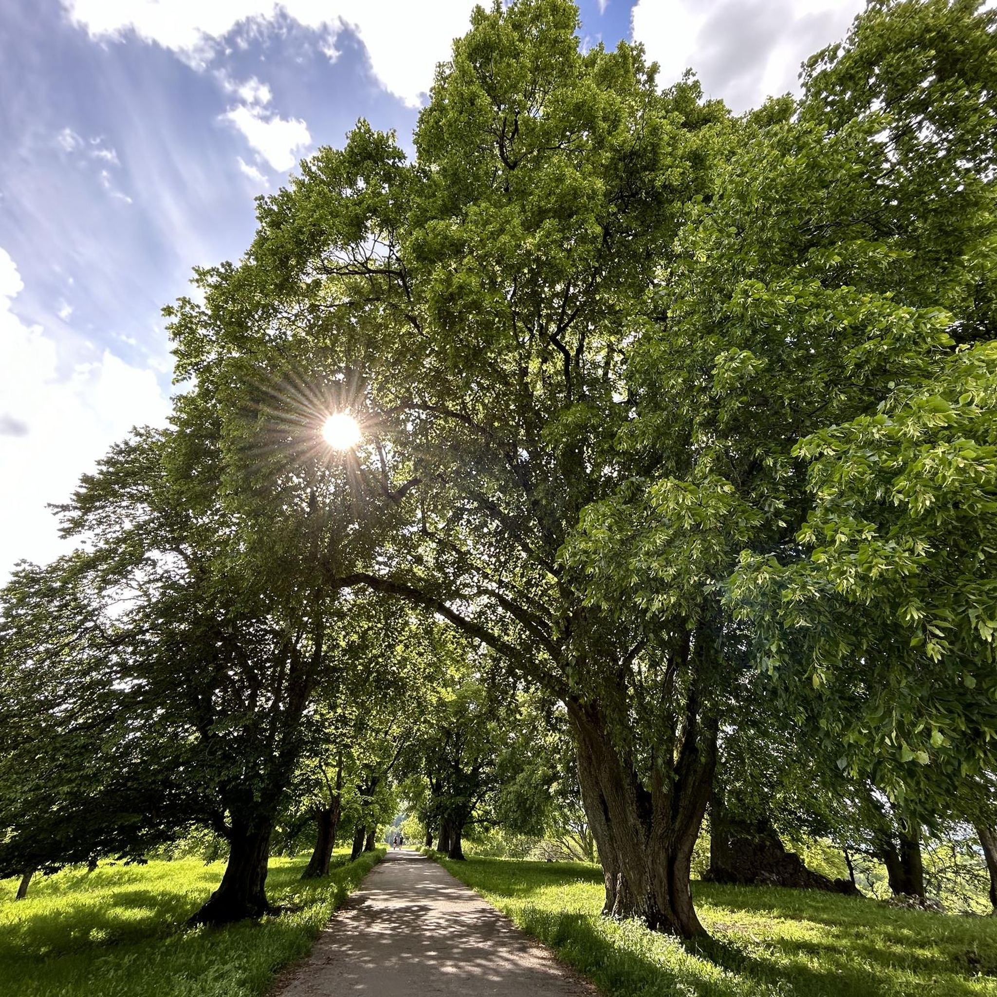
A male tree and a female tree with trunks 11m in circumference.
0
0
Lots of bike circuits to do, the countryside is very beautiful, the roads are worth the detour.
0
0
Frequently Asked Questions
How many road cycling routes are available around Saires-La-Verrerie?
There are over 450 road cycling routes documented around Saires-La-Verrerie on komoot, offering a wide variety of options for different skill levels and preferences.
What kind of terrain can I expect on road cycling routes in Saires-La-Verrerie?
The region is characterized by rolling hills and rural roads, typical of Normandy. You'll encounter a mix of open countryside, agricultural land, and occasional forested sections, with varied elevations providing moderate climbs and descents.
Are there easy road cycling routes suitable for beginners in Saires-La-Verrerie?
Yes, Saires-La-Verrerie offers around 45 easy road cycling routes. These routes typically feature less elevation gain and shorter distances, making them ideal for those new to road cycling or looking for a more relaxed ride.
What are some challenging road cycling routes for experienced riders?
For experienced riders seeking a challenge, there are approximately 77 difficult routes in the area. One such route is the Abbaye Notre-Dame de Lonlay – Old Le Chatellier Station loop from La Ferrière-aux-Étangs, which covers over 72 km with significant elevation changes.
What is the best time of year for road cycling in Saires-La-Verrerie?
The best time for road cycling in Saires-La-Verrerie is generally from spring to early autumn (April to October). During these months, the weather is typically milder and drier, offering more pleasant conditions for exploring the rural landscapes.
What do other road cyclists enjoy most about the routes in Saires-La-Verrerie?
The road cycling routes in Saires-La-Verrerie are highly rated by the komoot community, with an average score of 4.3 stars from over 30 reviews. Cyclists often praise the tranquil rural landscapes, the varied terrain with rolling hills, and the well-maintained roads that make for an enjoyable ride.
Are there any long-distance road cycling options in the region?
Yes, many routes offer longer distances. For example, the La Roche d'Oëtre – Charming panorama loop from La Ferrière-aux-Étangs is a substantial 78.5 km ride, providing a good option for those looking for a longer day out on the bike.
What interesting landmarks or attractions can I see along the road cycling routes?
While cycling, you can explore several historical and natural attractions. Consider visiting the impressive Château de Flers, the charming village of La Carneille, or the historic Saint-Clair-de-Halouze Iron Mine. The Andaines Forest also offers scenic sections.
Are most road cycling routes in Saires-La-Verrerie circular?
Many of the road cycling routes around Saires-La-Verrerie are designed as loops, allowing you to start and finish at the same point. This makes planning your ride and transportation more convenient. An example is the La Carneille – Route No. 30 Athis-de-l'Orne loop from La Ferrière-aux-Étangs.
Where can I find parking for road cycling routes in Saires-La-Verrerie?
Given the rural nature of the area, parking is often available in or near the starting points of routes, particularly in villages or at designated trailheads. It's advisable to check the specific route details on komoot for parking suggestions near your chosen starting point.
Are there any road cycling routes that pass through scenic viewpoints?
Yes, the region's rolling hills naturally offer several scenic viewpoints. Routes like the La Roche d'Oëtre – Charming panorama loop from La Ferrière-aux-Étangs are known for providing picturesque panoramas of the surrounding countryside.
Can I find road cycling routes with cafe stops or amenities along the way?
Many routes pass through or near small villages where you can find local cafes, bakeries, or small shops for refreshments. Planning your route with komoot allows you to identify these points of interest and plan your stops accordingly.
Most popular routes around Saires-La-Verrerie
Most popular attractions around Saires-La-Verrerie

Get inspired with the komoot mobile app


Explore more
Browse the best Road cycling routes in other regions.
