The best mountain hikes in Goms
4.9
(34)
455
hikers
23
hikes
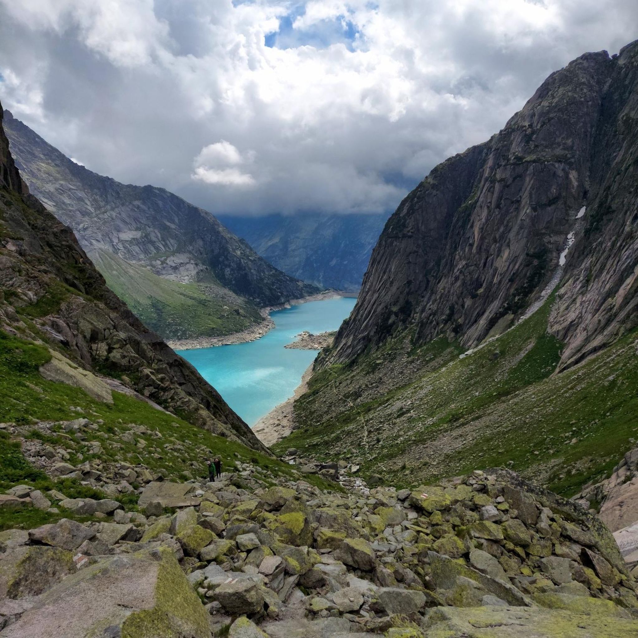
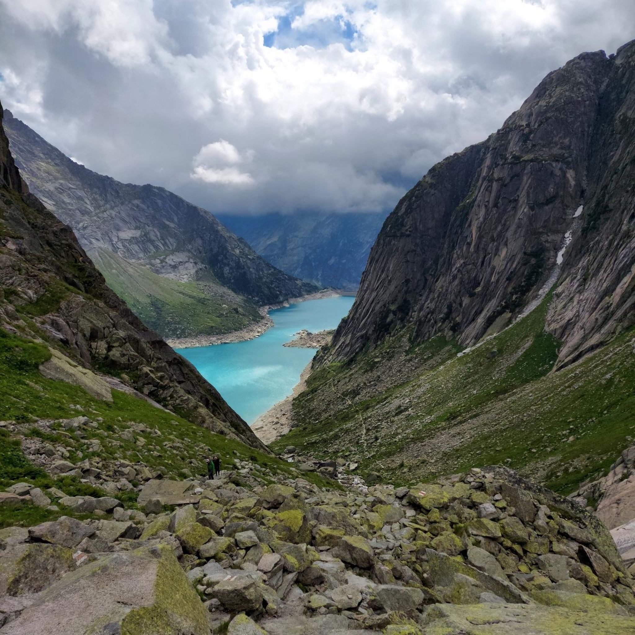
Mountaineering in Goms, nestled in Switzerland's Valais region, offers a diverse alpine environment for outdoor enthusiasts. The landscape is characterized by high alpine peaks, including views of iconic 4,000-meter mountains, and features the vast Aletsch Glacier, a UNESCO World Heritage Site. The region also encompasses the picturesque Rhone Valley, known locally as the Rotten, providing a mix of challenging ascents and high-alpine traverses. Mountaineering routes here demand good fitness, sure-footedness, and alpine experience.
Best mountaineering routes in Goms
- The most popular mountaineering route is Footpath to Mönchsjoch Hut – Mönch Ascent Entry Point loop from Moench, a 3.2 miles (5.2 km) trail that takes 4 hours 15 minutes to complete. This difficult route provides access to high-alpine terrain near the Mönch.
- Another top favourite among local mountaineers is Finsteraarhorn Summit loop from Finsteraarhorn, a difficult 3.7 miles (6.0 km) path. This challenging ascent leads to the summit of the Finsteraarhorn, one of the prominent 4,000-meter peaks in the Alps.
- Local mountaineers also love the Furka Pass Summit – Gross Muttenhorn loop from Furkapass, an 8.4 miles (13.5 km) trail leading through high mountain passes and offering panoramic views, often completed in about 5 hours 51 minutes.
- Mountaineering in Goms is defined by high alpine peaks, the expansive Aletsch Glacier, and the scenic Rhone Valley. The network offers options primarily for experienced mountaineers, with a few moderate routes available.
- The routes in Goms are highly rated by the komoot community with an average score of 4.8 stars from over 40 reviews. More than 500 mountaineers have used komoot to explore Goms's varied terrain.
Last updated: July 4, 2026
5.0
(2)
59
hikers
3.17km
01:33
150m
150m
Hard mountaineering route. Great for any fitness level. Sure-footedness, sturdy shoes and alpine experience required.
5.0
(3)
151
hikers
6.16km
04:33
440m
440m
Hard mountaineering route. Good fitness required. Sure-footedness, sturdy shoes and alpine experience required.

Sign up for free
48
hikers
6.05km
07:05
1,030m
1,030m
Hard mountaineering route. Very good fitness required. Sure-footedness, sturdy shoes and alpine experience required.
4.9
(7)
28
hikers
Hard mountaineering route. Very good fitness required. Sure-footedness, sturdy shoes and alpine experience required.
5.0
(3)
28
hikers
12.0km
03:46
350m
350m
Moderate mountaineering route. Good fitness required. Mostly accessible paths. Sure-footedness required.
5.0
(2)
23
hikers
13.4km
05:46
640m
640m
Hard mountaineering route. Very good fitness required. Sure-footedness, sturdy shoes and alpine experience required.
5.0
(3)
15
hikers
15.6km
06:34
850m
850m
Hard mountaineering route. Very good fitness required. Sure-footedness, sturdy shoes and alpine experience required.
5.0
(3)
12
hikers
8.05km
03:26
630m
630m
Hard mountaineering route. Good fitness required. Sure-footedness, sturdy shoes and alpine experience required.
5
hikers
13.0km
06:14
830m
830m
Hard mountaineering route. Very good fitness required. Sure-footedness, sturdy shoes and alpine experience required.
4.8
(4)
11
hikers
Hard mountaineering route. Good fitness required. Sure-footedness, sturdy shoes and alpine experience required.
Get access to more routes and recommendations from other explorers.
Sign up for free
Already have an account?
Our route recommendations are based on thousands of hikes, rides, and runs completed by other people on komoot.
Start today with a free account
Your next adventure awaits.
Login or Signup
Popular around Goms



Other adventures in Goms


Tips from the Community


At 2866 meters, you reach one of the highest viewpoints in the region. From here, a vast view opens up over the Great Aletsch Glacier and the surrounding peaks of the Valais Alps. Note: Construction measures are planned at the mountain station in the coming years, which may lead to temporary restrictions.
0
0

The Furka Pass is a 2,429 m high Swiss road pass in the Alps. It connects the Urseren Valley (the upper valley of the Reuss River) in the canton of Uri with the Goms district in the canton of Valais. It straddles the European watershed between the Mediterranean Sea and the North Sea. Source: Furka Pass – Wikipedia https://share.google/zJGI3KsPRtARfpYje
6
0
Frequently Asked Questions
What level of experience is required for mountaineering in Goms?
Mountaineering in Goms is primarily suited for experienced individuals. Most routes are classified as difficult, requiring good fitness, sure-footedness, and alpine experience. There are a few moderate routes available, but the region's high alpine terrain and challenging ascents are a defining characteristic.
When is the best time of year for mountaineering in Goms?
The prime season for mountaineering in Goms typically runs from late spring through early autumn, when snowmelt allows access to higher elevations and passes. However, the region's diverse terrain means conditions can vary. Always check local weather and trail conditions before setting out, especially for high-alpine routes.
Are there any circular mountaineering routes in Goms?
Yes, Goms offers several circular mountaineering routes. An example is the Furka Pass Summit – Gross Muttenhorn loop from Furkapass, which is a difficult 13.5 km trail offering panoramic views through high mountain passes.
What notable landmarks or viewpoints can I expect to see along mountaineering routes in Goms?
Mountaineering in Goms offers breathtaking views of iconic peaks and glaciers. You can experience the vast Aletsch Glacier, a UNESCO World Heritage site, from viewpoints like Bettmerhorn and Eggishorn. Other notable features include the Furka Pass and the Jungfraujoch, which provide access to high-alpine terrain and stunning panoramas.
Are there any routes that lead to prominent summits in Goms?
Absolutely. The region is home to mighty three and four-thousand-meter peaks. For instance, the Finsteraarhorn Summit loop from Finsteraarhorn is a challenging ascent to the summit of the Finsteraarhorn, one of the prominent 4,000-meter peaks in the Alps.
What do other mountaineers say about the routes in Goms?
The mountaineering routes in Goms are highly rated by the komoot community, with an average score of 4.8 stars from over 40 reviews. Mountaineers often praise the challenging ascents, the spectacular alpine backdrop, and the diverse terrain that ranges from glaciers to alpine meadows.
Are there options for public transport to reach mountaineering trailheads in Goms?
Goms is well-connected by public transport, particularly the Matterhorn Gotthard Bahn, which runs through the valley. Many villages serve as starting points for routes, and post buses often connect to more remote areas or alpine passes like Furka Pass, Grimsel Pass, and Nufenen Pass, which are excellent starting points for high-altitude excursions.
Are there any family-friendly or dog-friendly mountaineering options in Goms?
While most mountaineering routes in Goms are demanding and require alpine experience, making them less suitable for young children or dogs, the broader Goms region offers extensive hiking trails. These range from leisurely walks to demanding mountain tours, some of which might be more appropriate for families or dogs. Always check specific route details for suitability and any restrictions.
Can I find amenities like cafes or accommodation near the mountaineering routes?
Yes, the traditional villages scattered throughout the Goms valley offer various amenities. You'll find cafes, restaurants, and accommodation options in places like Fiesch, Münster, and Ulrichen. Some mountain huts, such as the Mönchsjoch Hut, also provide shelter and refreshments on higher-altitude routes.
Are there any suspension bridges or gorges to explore along the routes?
Yes, Goms features impressive natural and man-made structures. You can find highlights like the Aspi-Titter suspension bridge, which offers thrilling crossings and scenic views. The region also boasts several gorges, such as the Twingi Gorge, providing dramatic landscapes to explore.
How many mountaineering routes are available in Goms?
There are over 25 mountaineering routes available in Goms on komoot, offering a wide range of challenging ascents and high-alpine traverses for experienced mountaineers.
Most popular routes in Goms
Most popular attractions in Goms

Get inspired with the komoot mobile app


Didn’t find what you were looking for?
Check out more Mountain Hikes & Routes throughout Goms below and find the perfect route in your destination.
Explore more
Browse the best Mountain Hikes & Routes in other regions.
