The best cycling routes around Campagna-De-Sault
4.7
(40)
2,362
riders
44
rides
Touring cycling routes around Campagna-De-Sault traverse the Sault Plateau, a heavily wooded area ranging from 990 to 1,310 meters in altitude within the Aude department of France. The region is characterized by its diverse natural heritage, including extensive forests and high-altitude terrain. Cyclists encounter varied landscapes, from the Pyrenees Audoises to routes featuring significant elevation gains.
Best touring cycling routes around Campagna-De-Sault
- The most popular touring cycling route is Pailhères Pass – Mijanès loop from Pla de Mounégou, a…
Last updated: October 7, 2026
308
riders
32.2km
02:57
1,320m
1,320m
Hard bike ride. Very good fitness required. Mostly paved surfaces. Suitable for all skill levels.
4.3
(6)
307
riders
52.9km
04:35
1,940m
1,940m
Hard bike ride. Very good fitness required. Mostly paved surfaces. Suitable for all skill levels.

5.0
(3)
128
riders
29.4km
02:38
1,150m
1,150m
Hard bike ride. Very good fitness required. Mostly paved surfaces. Suitable for all skill levels.
5.0
(3)
76
riders
50.3km
04:11
1,660m
1,660m
Hard bike ride. Very good fitness required. Mostly paved surfaces. Suitable for all skill levels.
27
riders
17.0km
01:32
670m
670m
Hard bike ride. Very good fitness required. Mostly paved surfaces. Suitable for all skill levels.
Get access to more routes and recommendations from other explorers.
Already have an account?
Our route recommendations are based on thousands of hikes, rides, and runs completed by other people on komoot.
Start today with a free account
Your next adventure awaits.
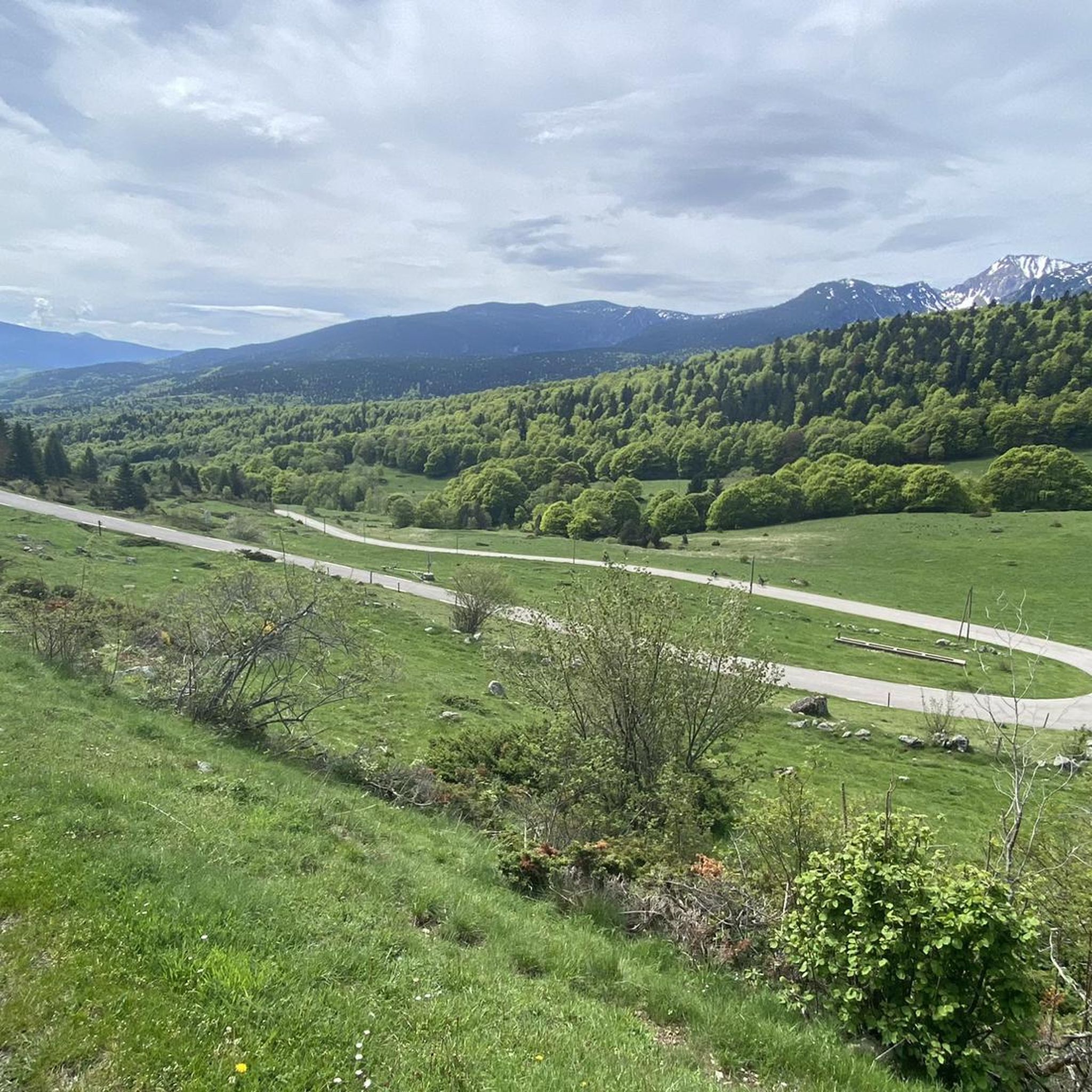
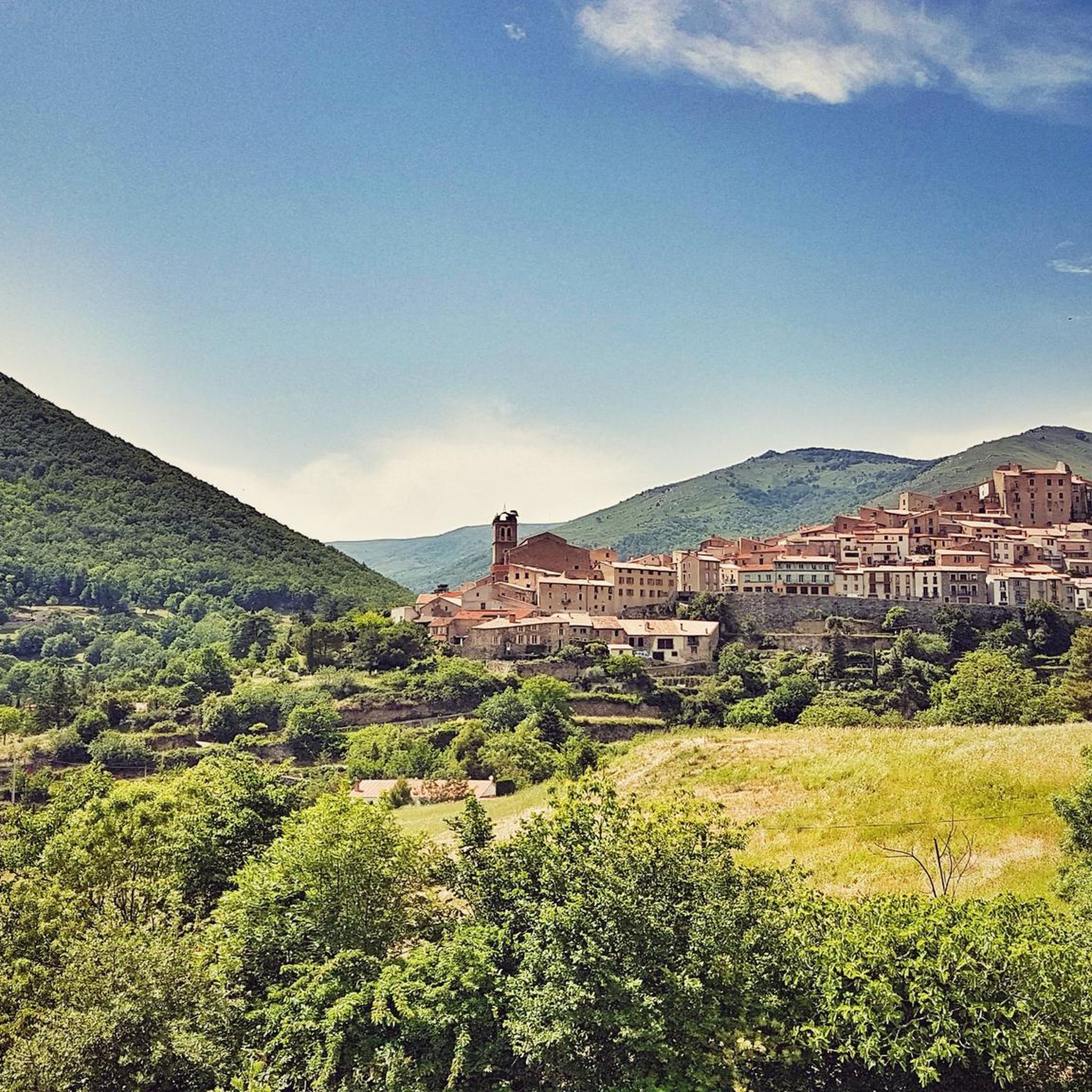
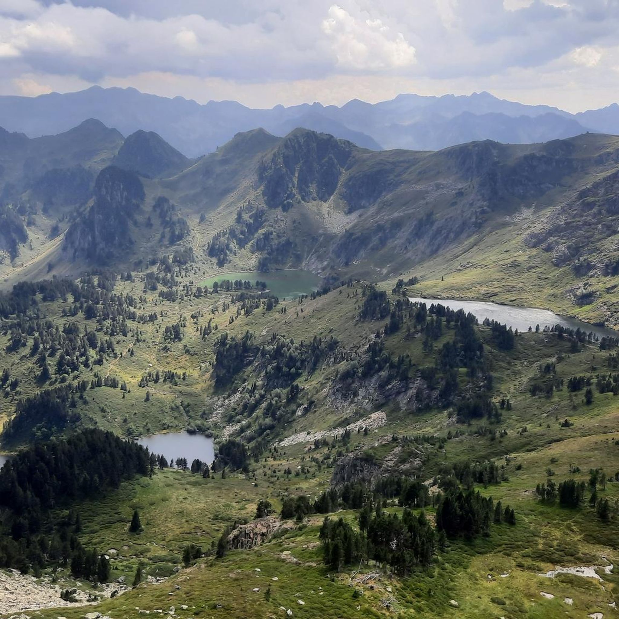
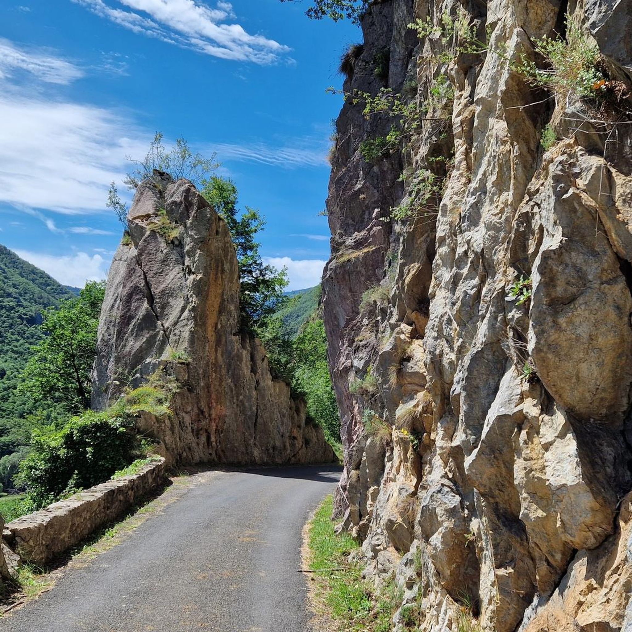

Tips from the Community

Status in April: It is still winter above, spring is slowly coming below
1
0
One of the best experiences on my entire tour. I have this picture with the view of the mountains as my screen background. The roads are still closed, the snow is piled up meters high on the sides and at the same time there is not a single car on the road. Simply fantastic
1
0
Small road, little traffic. Just enjoy the nature and keep going. Remember to bring enough food and water. The climb is long but it's worth it!
0
0
In spring, between the ski and hiking seasons, there is absolutely nothing going on here. The roads are unused and in winter they are even closed until April and you have everything to yourself. As a cyclist you can get through, cars and motorbikes can't get past. Very good :) Just pedal and keep pedaling
2
0
The place is suitable as a last stop before the climb up the Col de Pailheres. There is drinking water and at least a bar. Unfortunately they didn't have a kitchen when I was there and no working toilet, but there is a public toilet.
1
1
The climb to the Col de Pailheres begins in the last (almost deserted) village. It is closed in winter until April. I simply rode over it on my bike because you can lift the bike past the barrier. Cycling must have its advantages too :) The pass itself is fantastically beautiful, very long and very little used.
0
2

If you are not sitting on the racer and driving through beautiful countryside, you could visit the castle
0
0

Shortly after beginning the ascent to Port de Pailhères on its eastern slope, the Usson castle can be perfectly admired in its splendor. The view of the castle continues during the first 3 km, so you can take several panoramic views of it.
0
0
Frequently Asked Questions
How many touring cycling routes are available around Campagna-De-Sault?
There are over 40 touring cycling routes in the Campagna-De-Sault area. These routes are highly rated by the komoot community, with an average score of 4.6 stars from over 20 reviews.
Are there any easy touring cycling routes suitable for beginners or families?
The touring cycling routes around Campagna-De-Sault are predominantly challenging, with 36 out of 40 routes rated as 'difficult' due to significant elevation gains. There are 4 routes rated as 'moderate', but none are specifically classified as 'easy'. The region's mountainous terrain, part of the Pyrenees Audoises, means most paths involve substantial climbing.
What kind of terrain can I expect on touring cycling routes in Campagna-De-Sault?
You can expect diverse and often challenging terrain. Routes traverse the heavily wooded Pays de Sault plateau, with altitudes ranging from 990 to 1,310 meters. This includes mountain passes like Pailhères Pass, dense beech forests, and summer pastures. While many surfaces are paved, some segments may be unpaved.
What are some notable natural attractions or landmarks to see while cycling?
The region offers stunning natural beauty. You can encounter significant peaks such as Pic de Tarbesou and Pic du Midi de Roquefeuil. There are also serene lakes like Étang de Pailhères and Étang de Rabassoles, and dramatic natural features like the Gorges de l'Aude and Gorges de la Pierre-Lys nearby.
Are there any historical sites or charming villages accessible from the cycling routes?
Yes, the area is rich in history. You can explore Cathar castles like Chateau de Puilaurens and Montsegur, or the fortified towns of Mont-Louis and Villefranche-de-Conflent, known for their Vauban fortifications. Nearby towns such as Quillan and Ax-les-Thermes (a spa town) also offer cultural interest.
What is the best time of year for touring cycling in Campagna-De-Sault?
Given the high-altitude plateaus and mountain passes, the best time for touring cycling is typically from late spring through early autumn (May to October). This avoids the colder temperatures and potential snow that can affect higher elevations during winter months.
Are there any circular touring cycling routes available?
Yes, many routes in the area are designed as loops. For example, the Pailhères Pass – Mijanès loop from Pla de Mounégou is a popular 32.2 km (20.0 miles) difficult route. Another option is the Mijanès – Pailhères Pass loop from Rouze, covering 29.4 km (18.3 miles).
What are the typical distances and durations for touring cycling routes in this region?
Routes vary, but many are designed for a substantial day out. For instance, the Pailhères Pass – Mijanès loop from Mijanès is 52.8 km (32.8 miles) and can take over 4.5 hours. Shorter options like the Mijanès – Col de Pailhères start point loop from Escouloubre are around 28.2 km (17.5 miles) and take about 2 hours.
Is public transport available to access touring cycling trails in Campagna-De-Sault?
Public transport options directly to trailheads in Campagna-De-Sault may be limited due to its rural, mountainous location. It's advisable to check local bus schedules or consider driving to a starting point, especially for routes deep within the Pays de Sault plateau.
Where can I find parking near the touring cycling routes?
Parking is generally available in the villages that serve as starting points for many routes, such as Rouze or Mijanès. For specific trailheads, it's recommended to check the route details on komoot for designated parking areas or suitable roadside spots.
Are there any amenities like cafes or accommodation along the routes?
While the routes traverse natural and often remote areas, you will find amenities in the charming villages and towns within or near the Pays de Sault plateau. It's a good idea to plan your stops in advance, especially for longer rides, to ensure access to cafes, pubs, or accommodation.
Can I cycle with my dog on these touring routes?
The suitability of cycling with dogs depends on the specific route and local regulations. While many natural areas are dog-friendly, some trails may have restrictions, especially in protected Natura 2000 sites or areas with livestock. Always keep your dog on a leash and ensure they are fit for the terrain and distance.
Most popular routes around Campagna-De-Sault
Most popular attractions around Campagna-De-Sault

Get inspired with the komoot mobile app


Explore more
Browse the best Cycling routes in other regions.
