The best MTB trails around Carla-De-Roquefort
4.3
(70)
408
riders
56
rides
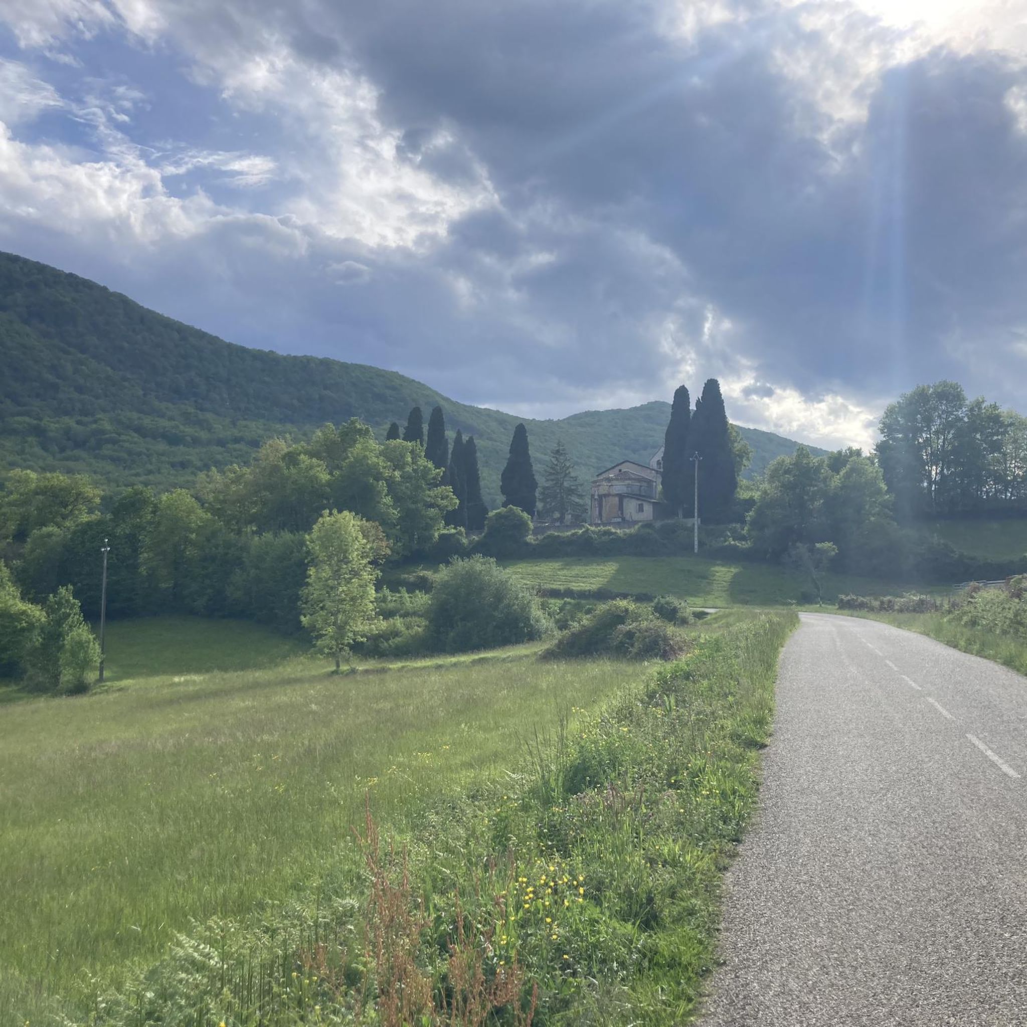
Mountain bike trails around Carla-De-Roquefort are set within the diverse landscapes of the Ariège department in southwestern France. The commune is characterized by its six natural zones of ecological interest and the Douctouyre river, which contributes to verdant scenery. Riders can expect varied terrain, from river valleys to higher elevations, offering both scenic routes and challenging climbs. This area, part of the picturesque Pays d'Olmes, provides a compelling destination for outdoor activities.
Best mountain bike trails around Carla-De-Roquefort
- The most…
Last updated: July 4, 2026
4.9
(7)
15
riders
32.2km
02:25
450m
450m
Moderate mountain bike ride. Good fitness required. Suitable for all skill levels.
4.8
(8)
19
riders
44.0km
04:38
1,480m
1,480m
Hard mountain bike ride. Very good fitness required. Advanced riding skills necessary. Some portions of the route may require you to push your bike.

Sign up for free
4.5
(2)
10
riders
34.6km
02:30
650m
650m
Moderate mountain bike ride. Good fitness required. Suitable for all skill levels.
8
riders
17.9km
02:08
630m
630m
Moderate mountain bike ride. Good fitness required. Suitable for all skill levels.
2.5
(2)
5
riders
20.2km
01:56
470m
470m
Moderate mountain bike ride. Good fitness required. Suitable for all skill levels.
Get access to more routes and recommendations from other explorers.
Sign up for free
Already have an account?
Our route recommendations are based on thousands of hikes, rides, and runs completed by other people on komoot.
Start today with a free account
Your next adventure awaits.
Login or Signup



Tips from the Community

Beautiful view of the "safe mountain" - the somewhat arduous climb is definitely worth it, because from the top you have a fantastic view ☺️
1
0

Short but difficult, plus the heat...I had raindrops 🥵
0
0

very nice pass, first 5 km a little difficult but nothing more, then very smooth and very beautiful view
0
0

Beautiful view of the heights, continuing the road we have beautiful landscapes!
0
0
Nice pass with a very nice view! Nice view of the castle (which despite being visibly in ruins is paying for the visit)
0
0

Montferrier is a town in Ariège, in the Occitanie region, 25 km southeast of Foix. Its territory of nearly 52 km² ranges from 548 to 2,343 m above sea level and is crossed by the course of the Touyre and dominated to the south by the massif of Tabe also known as Saint-Barthélemy and the Col de Girabal.
1
0

Frequently Asked Questions
How many mountain bike trails are available around Carla-De-Roquefort?
There are over 50 mountain bike trails around Carla-De-Roquefort, offering a wide range of options for different skill levels. You'll find 9 easy routes, 34 moderate routes, and 13 difficult routes to explore.
Are there any family-friendly mountain bike routes in the area?
While specific family-designated routes aren't highlighted, the region offers easier paths suitable for less experienced riders. The Douctouyre valley, for instance, has sections that are more gentle. Look for routes marked as 'easy' in komoot to find suitable options.
What kind of terrain can I expect on mountain bike trails near Carla-De-Roquefort?
The terrain around Carla-De-Roquefort is quite varied, ranging from river valleys along the Douctouyre to higher elevations with panoramic views of the Ariège Pyrenees. You can expect a mix of wooded areas, open ridges, and some technical descents, especially on routes like those found in the Douctouyre Itinerary.
Are there any circular mountain bike routes?
Yes, many of the mountain bike routes in the area are circular. For example, the Camon Railway Tunnel – Camon Village loop from Lavelanet and the Bélesta – La Bastide-sur-l'Hers loop from Villeneuve-d'Olmes are popular loop trails.
What are some notable natural attractions or landmarks to see while mountain biking?
The region is rich in natural beauty and historical sites. You can encounter unique natural spectacles like the petrifying waterfalls of Roquefort-les-Cascades. From elevated points, such as the plateau of Mouillet, you can enjoy stunning views of the Pyrenees Ariégeoises. Historical sites like Roquefixade Castle also add to the scenic appeal.
Are there any challenging mountain bike trails for experienced riders?
Absolutely. For experienced riders seeking a challenge, routes like the Camon Railway Tunnel – Camon Village loop from Lavelanet, which is over 64 km long with significant elevation changes, offer a demanding ride. Another difficult option is the La Lauze Pass – Montferrier loop from Lavelanet, which leads through higher elevations.
What do other mountain bikers say about the trails in Carla-De-Roquefort?
The mountain bike trails around Carla-De-Roquefort are highly regarded by the komoot community, with an average rating of 4.4 out of 5 stars from over 70 reviews. Riders often praise the diverse terrain, the scenic beauty of the Pays d'Olmes, and the variety of routes available for different skill levels.
Are there any mountain passes accessible by bike in this area?
Yes, the region features several mountain passes that can be incorporated into your rides. Notable passes include La Lauze Pass, Porte-Pa Pass, and Calzan Pass, offering both challenging climbs and rewarding views.
Can I find moderate-difficulty mountain bike trails?
Yes, the majority of trails around Carla-De-Roquefort are rated as moderate. There are 34 moderate routes available, such as the Bélesta – La Bastide-sur-l'Hers loop from Villeneuve-d'Olmes, which explores the local area with a mix of landscapes, and the La Lauze Pass – Col de Montségur loop from Lavelanet.
What is the best time of year for mountain biking in Carla-De-Roquefort?
The region's diverse landscapes are enjoyable throughout much of the year. Spring and autumn are particularly beautiful, with the petrifying waterfalls of Roquefort-les-Cascades being especially impressive during these seasons due to higher water flow. Summer offers warmer conditions, while winter riding might be possible depending on snow levels at higher elevations.
Are there any routes that pass by interesting historical sites?
The Pays d'Olmes region has a rich Cathar heritage. While specific routes aren't detailed to pass directly through all historical sites, the general area offers a blend of natural landscapes and cultural history. You can find highlights like Roquefixade Castle which are accessible and add a historical dimension to your outdoor excursions.
Most popular routes around Carla-De-Roquefort
Most popular attractions around Carla-De-Roquefort

Get inspired with the komoot mobile app


Explore more
Browse the best MTB trails in other regions.
