The best road cycling routes around Lorcières
4.2
(13)
573
riders
76
rides
Road cycling routes around Lorcières are situated in the Cantal department of France, characterized by diverse and rugged natural landscapes. The region features mountainous terrain, high plateaus, and river valleys, offering varied challenges for cyclists. Notable features include the Margeride massif with its significant elevation changes and the Truyère Gorges, which provide a mix of flat sections and ascents. The area's volcanic landscapes also contribute to a dynamic cycling environment.
Best road cycling routes around Lorcières
- The most popular road…
Last updated: July 1, 2026
35
riders
43.2km
02:07
520m
520m
Moderate road ride. Good fitness required. Mostly well-paved surfaces and easy to ride.
8
riders
33.7km
01:47
640m
640m
Moderate road ride. Good fitness required. Mostly well-paved surfaces and easy to ride.

Sign up for free
9
riders
56.3km
03:05
1,100m
1,100m
Hard road ride. Very good fitness required. Mostly well-paved surfaces and easy to ride.
15
riders
62.8km
03:09
1,040m
1,040m
Hard road ride. Very good fitness required. Mostly well-paved surfaces and easy to ride.
6
riders
Moderate road ride. Good fitness required. Mostly well-paved surfaces and easy to ride.
Get access to more routes and recommendations from other explorers.
Sign up for free
Already have an account?
Our route recommendations are based on thousands of hikes, rides, and runs completed by other people on komoot.
Start today with a free account
Your next adventure awaits.
Login or Signup

Tips from the Community


Le Malzieu-Ville is a medieval gem in the Lozère department. The fortified old town, with its towers, gates, and narrow streets, invites exploration. Situated on the banks of the Truyère River, it is a stop on the Way of St. James. The surrounding forests and plateaus offer wonderful hiking and nature experiences.
0
0


It's nice to see beautiful Aubrac cows on the side of the road.
2
0

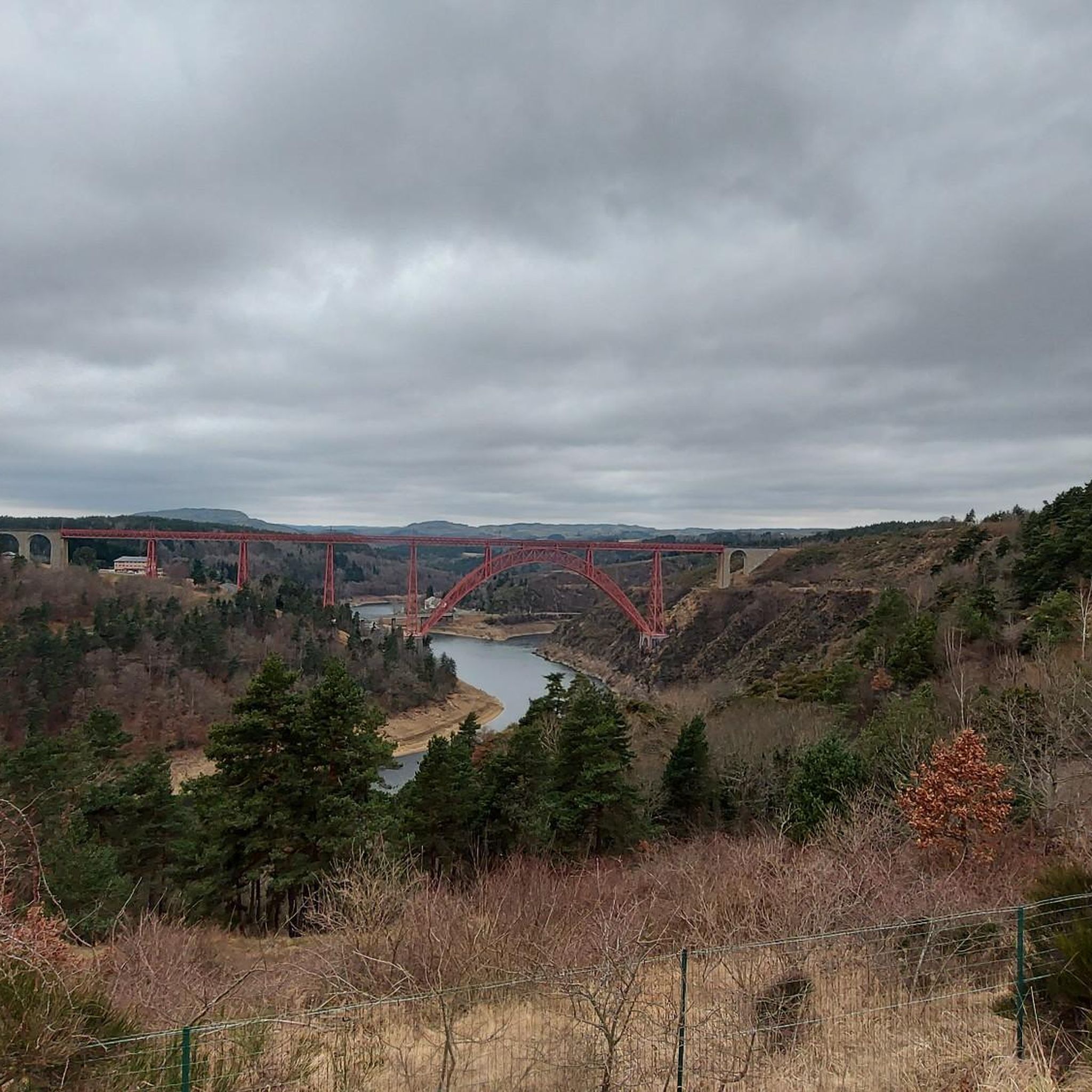
Superb view of the Garabit viaduct, allowing you to cross the Truyère gorges. This metal structure, created by Gustave Eiffel, is 565 meters long and rises to 122 meters above the water. It was at one time the “highest viaduct in the world”!
0
0

very pretty little village
0
0

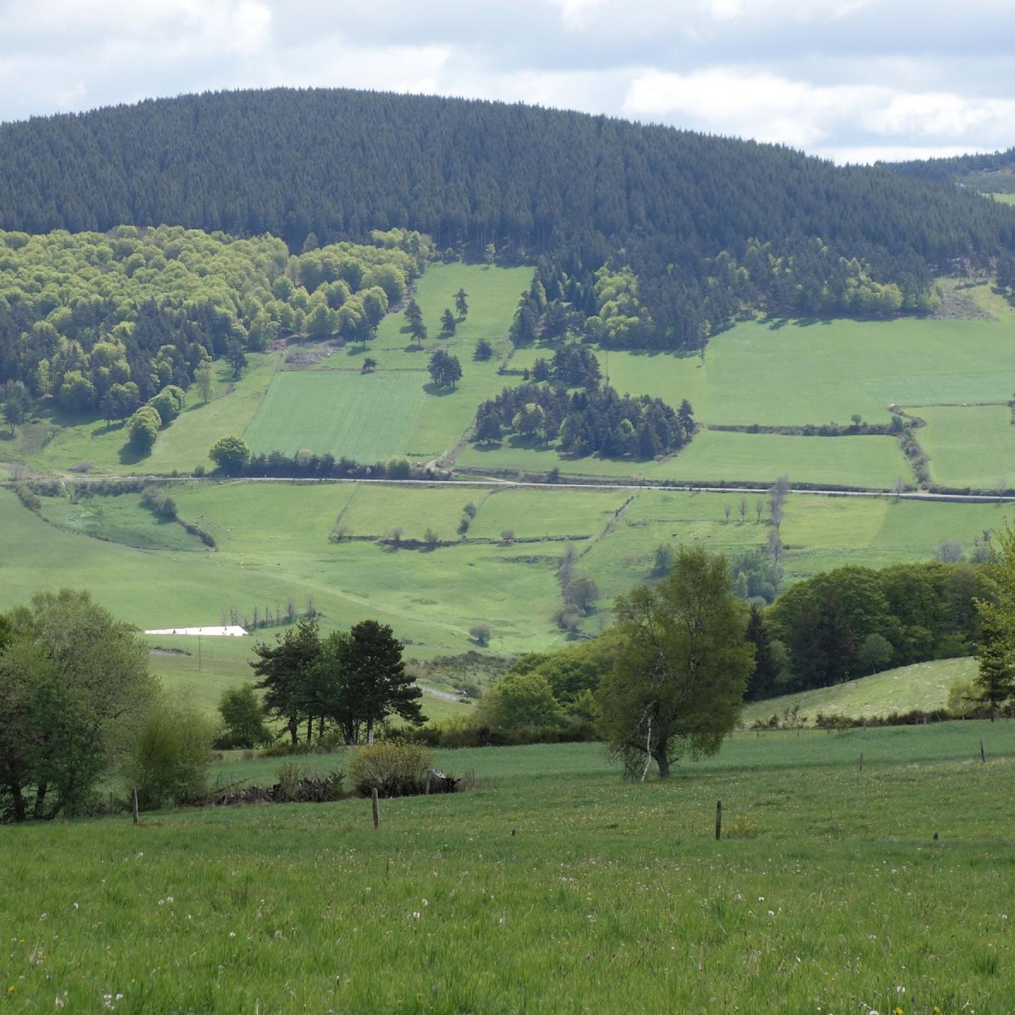
Panoramic view of Cantal and the lower town.
0
0

Impressive viaduct designed by Eiffel. Go as close as possible for snaps.
0
0
Frequently Asked Questions
How many road cycling routes are available around Lorcières?
There are over 60 road cycling routes available around Lorcières, offering a wide range of options for different skill levels. The komoot community has explored these routes over 300 times, highlighting the area's popularity among cyclists.
What are the typical difficulty levels for road cycling routes in Lorcières?
The routes around Lorcières cater to various abilities. You'll find a few easy routes, but the majority are moderate (around 36 routes) and difficult (around 31 routes), reflecting the region's mountainous terrain and significant elevation changes. This makes it a great destination for cyclists looking for a challenge.
What kind of landscapes can I expect on road cycling routes near Lorcières?
Road cycling around Lorcières offers incredibly diverse landscapes. You can expect mountainous terrain, high plateaus, and river valleys. Highlights include the rugged beauty of the Margeride massif, the dramatic Truyère Gorges, and the expansive, serene high plateaus like the Cézallier, which features volcanic formations and lush pasturelands.
Are there challenging road cycling routes in the Lorcières area?
Yes, the Lorcières area, particularly near the Margeride massif and the broader Cantal volcanic landscapes, offers numerous challenging routes. These often feature significant elevation changes and climbs, providing a rewarding experience for experienced road cyclists. An example of a difficult route is the View of the Garabit Viaduct – Saint-Flour Medieval Town loop from Loubaresse, which covers 62.7 km with over 1000 meters of ascent.
Are there easier road cycling routes suitable for beginners or families?
While many routes are moderate to difficult, there are a few easier options available for those seeking a less strenuous ride or for families. These routes typically navigate through less demanding terrain, offering a gentler introduction to the region's beauty. For example, the Saint-Chély-d'Apcher loop from Albaret-Sainte-Marie is a moderate route that is shorter and has less elevation gain than some of the more challenging options.
Can I find circular road cycling routes around Lorcières?
Yes, many of the road cycling routes around Lorcières are designed as loops, allowing you to start and finish at the same point. This is convenient for planning your ride. Examples include the popular Malzieu-Ville – Saint-Alban-sur-Limagnole loop from Saint-Léger-du-Malzieu and the Ruynes-en-Margeride – View of the Garabit Viaduct loop from Clavières.
What scenic viewpoints or landmarks can I see while road cycling near Lorcières?
The region is rich in scenic viewpoints and landmarks. You might encounter stunning views from the Summit of Mont Mouchet in the Margeride massif, or the unique rock formations of The Fairy Gate above the Truyère Gorges. Many routes also offer views of the impressive Garabit Viaduct.
Are there any historical sites or picturesque villages to explore along the routes?
Absolutely. Cycling routes in this area often pass through charming hamlets and offer glimpses of historical sites. You could cycle through picturesque villages like Malzieu-Ville, known for its medieval character, or discover the Roc-Saint-Pierre chapel. These provide excellent opportunities for breaks and cultural exploration.
What do other road cyclists enjoy the most about road cycling in Lorcières?
The area is highly rated by the komoot community, with an average score of 4.0 stars from over 9 reviews. Cyclists often praise the unspoiled natural landscapes, the variety of terrain from challenging climbs to serene plateaus, and the peacefulness of the routes away from heavy traffic. The scenic views, especially around the Truyère Gorges and the Margeride massif, are frequently highlighted.
What is the best time of year for road cycling in Lorcières?
The best time for road cycling in Lorcières is generally from late spring to early autumn (May to October). During these months, the weather is typically mild and pleasant, making for ideal cycling conditions. The natural landscapes are vibrant, and the higher passes are usually clear of snow, allowing access to a wider range of routes.
Are there options for parking at road bike trailheads in Lorcières?
While specific parking information for every trailhead isn't detailed, the region's focus on outdoor activities and its numerous villages suggest that parking is generally available in or near the starting points of many routes. It's advisable to check local village parking options or designated areas when planning your ride.
Can I access road cycling routes near Lorcières using public transport?
The Lorcières area, being in a rural part of the Cantal department, has limited public transport options directly to specific trailheads. While some regional bus services might connect larger towns, reaching the more remote starting points often requires personal vehicle transport. Planning ahead and checking local transport schedules is recommended if you intend to use public transport.
Most popular attractions around Lorcières

Get inspired with the komoot mobile app


Explore more
Browse the best Road cycling routes in other regions.
