The best running trails around Sainte-Marguerite-Lafigère
4.6
(38)
372
runners
48
runs
Jogging routes around Sainte-Marguerite-Lafigère are set within a mid-mountain environment, with altitudes ranging from 255m to 1000m, providing varied terrain. The region is characterized by the winding Chassezac River and its dramatic gorges, featuring limestone cliffs and lush green forests. Runners can also explore the mountainous Montagne du Tanargue and the tranquil Lac de Villefort, which offer diverse landscapes for running. This area provides a mix of challenging ascents and scenic paths suitable for different running preferences.
Best jogging routes…
Last updated: July 8, 2026
5.0
(1)
6
runners
Hard run. Very good fitness required. Sure-footedness, sturdy shoes and alpine experience required.
8
runners
4.39km
00:31
40m
40m
Easy run. Great for any fitness level. Mostly paved surfaces. Suitable for all skill levels.

Sign up for free
3.0
(1)
6
runners
8.12km
00:57
280m
280m
Moderate run. Good fitness required. Mostly paved surfaces. Suitable for all skill levels.
4
runners
10.7km
01:19
230m
230m
Moderate run. Good fitness required. Mostly accessible paths. Some sure footedness required.
4.5
(2)
4
runners
19.0km
02:22
540m
540m
Hard run. Very good fitness required. Mostly paved surfaces. Suitable for all skill levels.
Get access to more routes and recommendations from other explorers.
Sign up for free
Already have an account?
Our route recommendations are based on thousands of hikes, rides, and runs completed by other people on komoot.
Start today with a free account
Your next adventure awaits.
Login or Signup

Tips from the Community

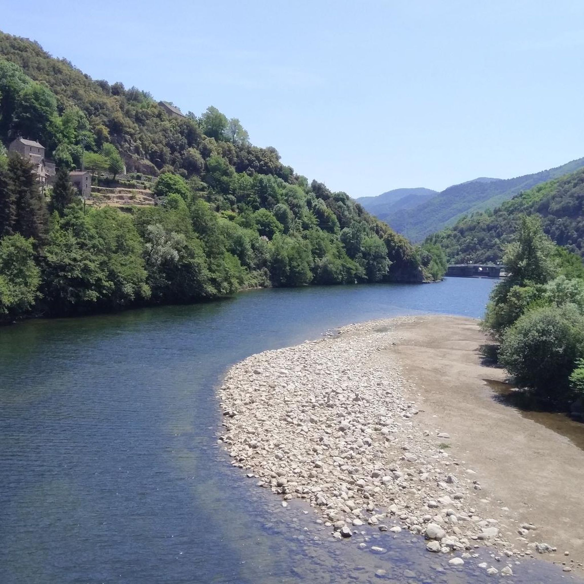
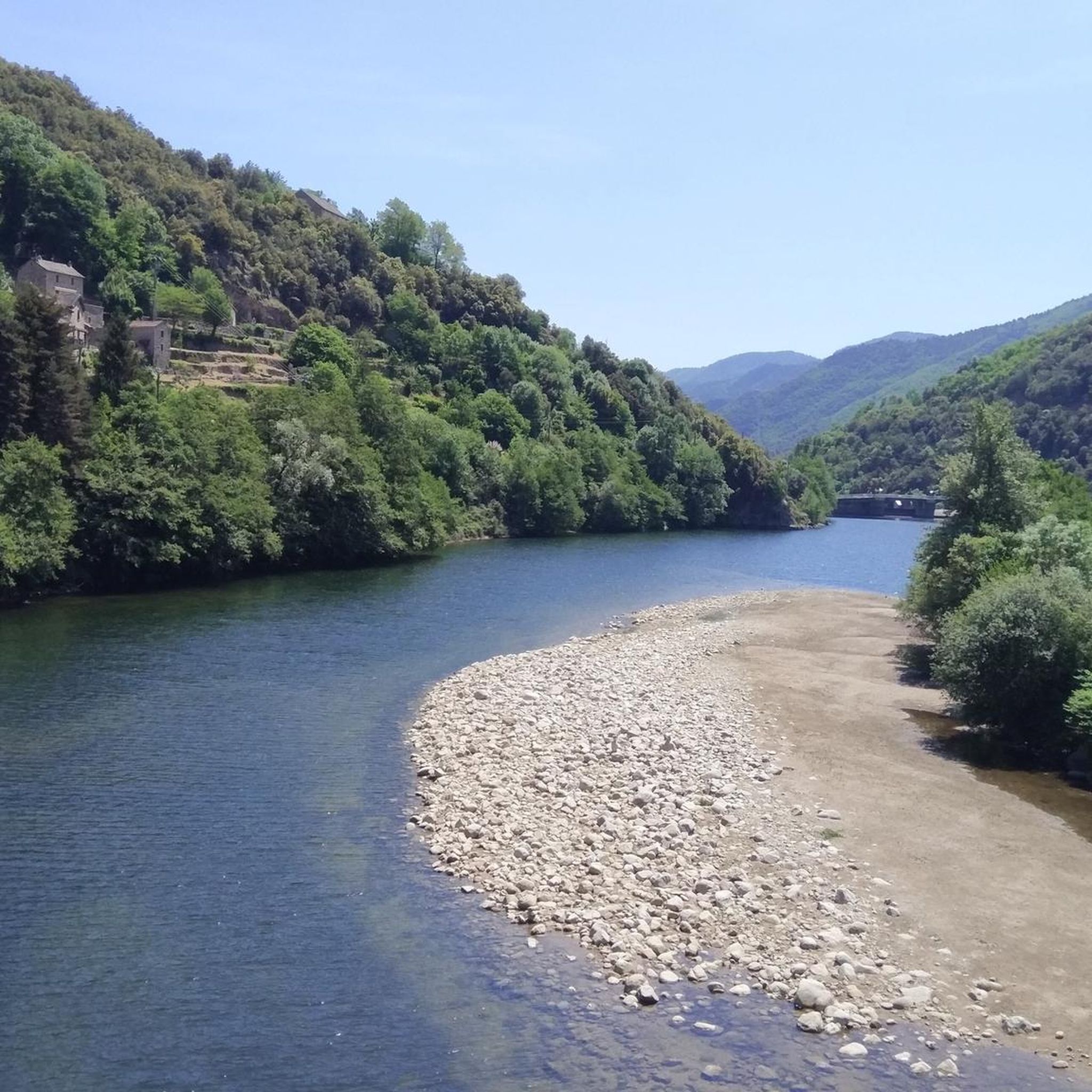
We didn't manage to cross. The water was quite fast. Too dangerous with bare feet, and perhaps even with hiking boots, besides the fact that they would have gotten wet.
0
0

Toilets, drinking water, tables, and benches are available. Great for eating your picnic!
0
0
It's not always easy to find the trail when you cross. You have to try to find the yellow markings. This is an ideal place to refresh yourself (before having to go back up).
0
0

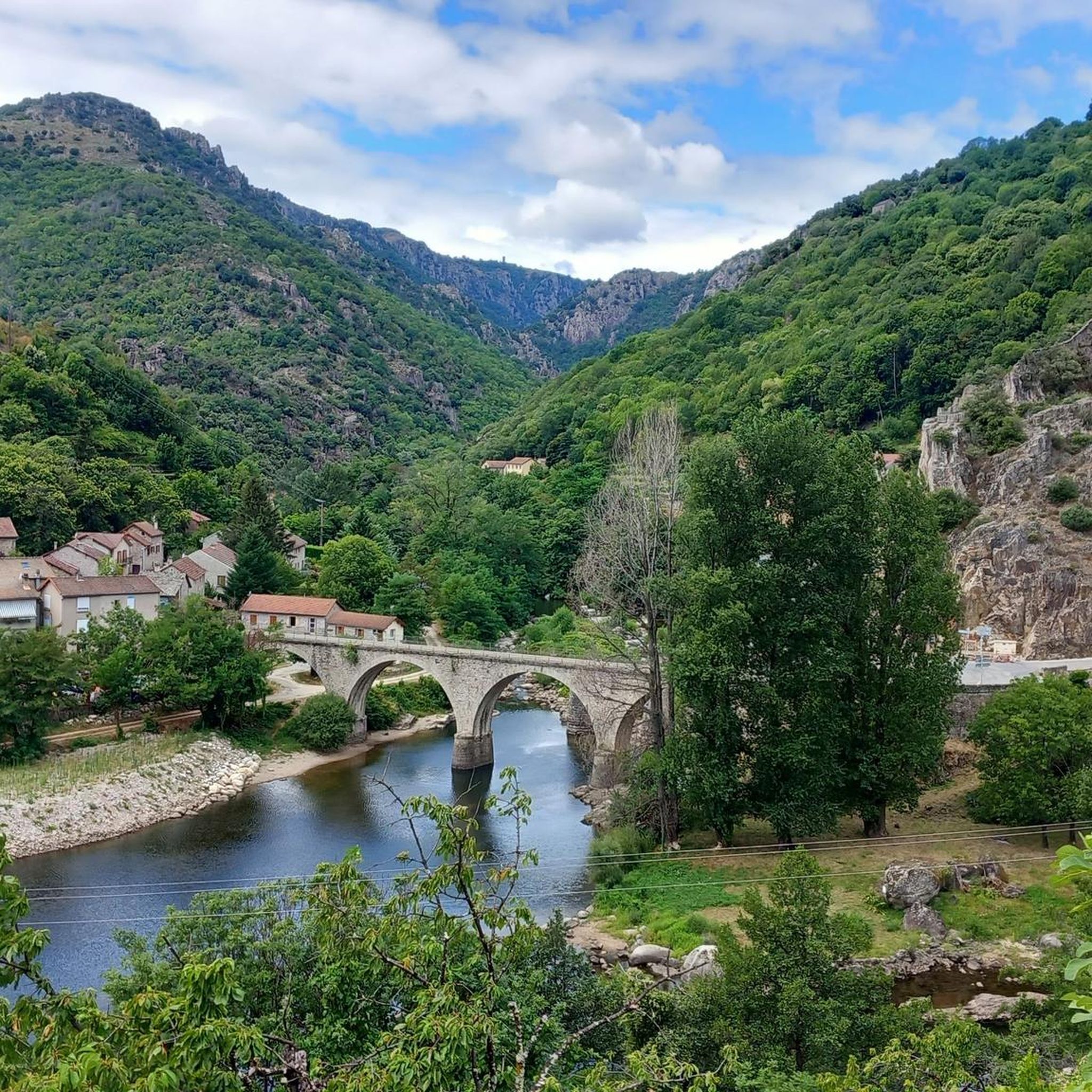
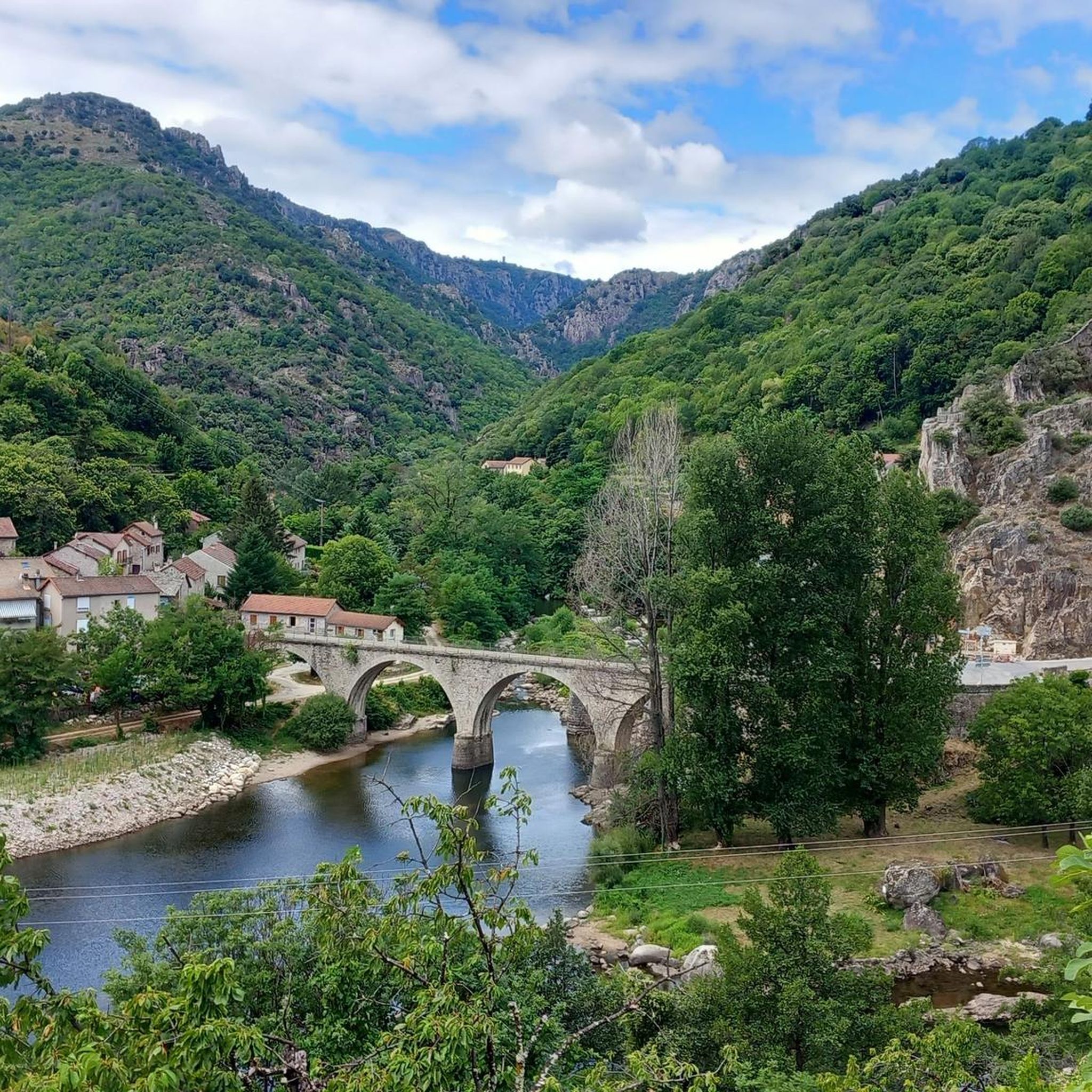
Interesting old bridge piers, small town, unfortunately nothing going on.
0
0
Pleasant hike with beautiful viewpoints and magical places.
0
0

The stone bridge at Pied-de-Borne, nestled in the heart of the Cévennes, is a charming old bridge that spans the Chassezac River. Surrounded by green hills and forests, it is an ideal place for a quiet break. The clear waters that flow under the bridge invite you to take a refreshing swim or simply enjoy the serenity of the place.
0
0

favor the period at the end of May, beginning of June to avoid the high heat and take advantage of the carpets of flowering broom which scent the air
1
0
Frequently Asked Questions
How many running routes are available in Sainte-Marguerite-Lafigère?
Sainte-Marguerite-Lafigère offers a wide selection of over 45 running routes. These routes cater to various preferences, with a mix of moderate and difficult trails, ensuring options for different fitness levels.
Are there any easy or beginner-friendly jogging routes in the area?
While many routes in Sainte-Marguerite-Lafigère are rated moderate to difficult due to the mid-mountain terrain and elevation changes, there are options like the Villefort Beach – Lake Villefort loop from Villefort. This 7.1 km route is rated moderate and offers a less strenuous experience around Lac de Villefort, suitable for those looking for a more relaxed run.
What kind of landscapes can I expect to see while running in Sainte-Marguerite-Lafigère?
The region boasts a diverse mid-mountain environment. You'll encounter the dramatic gorges and limestone cliffs of the Chassezac River, lush green forests, and the tranquil shores of Lac de Villefort. More challenging routes might take you into the mountainous terrain of Montagne du Tanargue or over scenic mountain passes, offering breathtaking vistas.
Are there any circular running routes available?
Yes, many of the running paths in Sainte-Marguerite-Lafigère are circular. For example, the popular La Garde-Guérin Tower – Villefort Beach loop from Villefort and the Lac de Villefort – Villefort Beach loop from Villefort are both excellent circular options that allow you to start and finish at the same point.
What are some scenic points or natural attractions I can discover along the running trails?
The area is rich in natural beauty. You can run alongside the Chassezac River and explore the Rock Pools of the Gorges de Chassezac. The tranquil Lac de Villefort offers beautiful lakeside views, and you might even discover the scenic Waterfall in L’Hivernet on some routes. The La Drobie Valley also provides stunning natural scenery.
Is Sainte-Marguerite-Lafigère suitable for family-friendly jogging?
While many routes involve significant elevation, families can find suitable options, especially around Lac de Villefort or in dedicated green spaces like Parc de la Garenne. When choosing a route, look for those marked as moderate with shorter distances, such as the Villefort Beach – Lake Villefort loop from Villefort, which is 7.1 km long and offers a pleasant experience for active families.
What do other runners say about the jogging experience in Sainte-Marguerite-Lafigère?
The running routes in Sainte-Marguerite-Lafigère are highly regarded by the komoot community, with an average rating of 4.6 stars from over 37 reviews. Runners often praise the diverse terrain, from river gorges to mountainous paths, and the stunning natural beauty that makes each run an adventure.
Are there any specific areas or parks ideal for jogging?
Beyond the extensive trail network, Parc de la Garenne is specifically identified as an expansive green space ideal for jogging and other physical activities. The shores around Lac de Villefort also provide tranquil settings for runs.
What is the best time of year to go running in Sainte-Marguerite-Lafigère?
The Ardèche region, including Sainte-Marguerite-Lafigère, is generally excellent for outdoor activities. Spring and autumn offer pleasant temperatures for running, avoiding the peak heat of summer while still enjoying the vibrant natural scenery. Winter can be challenging due to higher altitudes and potential snow on mountain passes, but lower elevation routes might still be accessible.
Are dogs allowed on the running trails in Sainte-Marguerite-Lafigère?
The Ardèche region is generally welcoming to outdoor enthusiasts and their pets. Many hiking and running trails are dog-friendly, but it's always advisable to keep dogs on a leash, especially in nature reserves or areas with livestock, and to follow local regulations regarding waste disposal to ensure a pleasant experience for everyone.
Where can I find parking for the running trails?
While specific parking locations for every trailhead are not detailed, popular starting points for routes, especially those around Lac de Villefort or near villages like Villefort, typically offer designated parking areas. It's recommended to check the route details on komoot for specific parking information before heading out.
Can I access the running routes using public transport?
Access to trailheads in a mid-mountain environment like Sainte-Marguerite-Lafigère can be limited by public transport. While some larger towns might have bus services, reaching specific trail starting points often requires a car. It's best to research local bus schedules or consider carpooling if you plan to rely on public transport.
Are there any longer, more challenging trail running options for experienced runners?
Absolutely. The region's mountainous terrain and passes provide excellent challenges. Routes like the La Garde-Guérin Tower – Villefort Beach loop from Villefort, at 17.4 km with significant elevation gain, are rated difficult and perfect for experienced trail runners seeking a rigorous workout. The mountain passes, such as Col de la Croix Blanche, also offer demanding ascents.
Most popular routes around Sainte-Marguerite-Lafigère
Most popular attractions around Sainte-Marguerite-Lafigère

Get inspired with the komoot mobile app


Explore more
Browse the best Running Trails & Routes in other regions.
