The best MTB trails around Marcilly-La-Gueurce
4.6
(28)
63
riders
17
rides
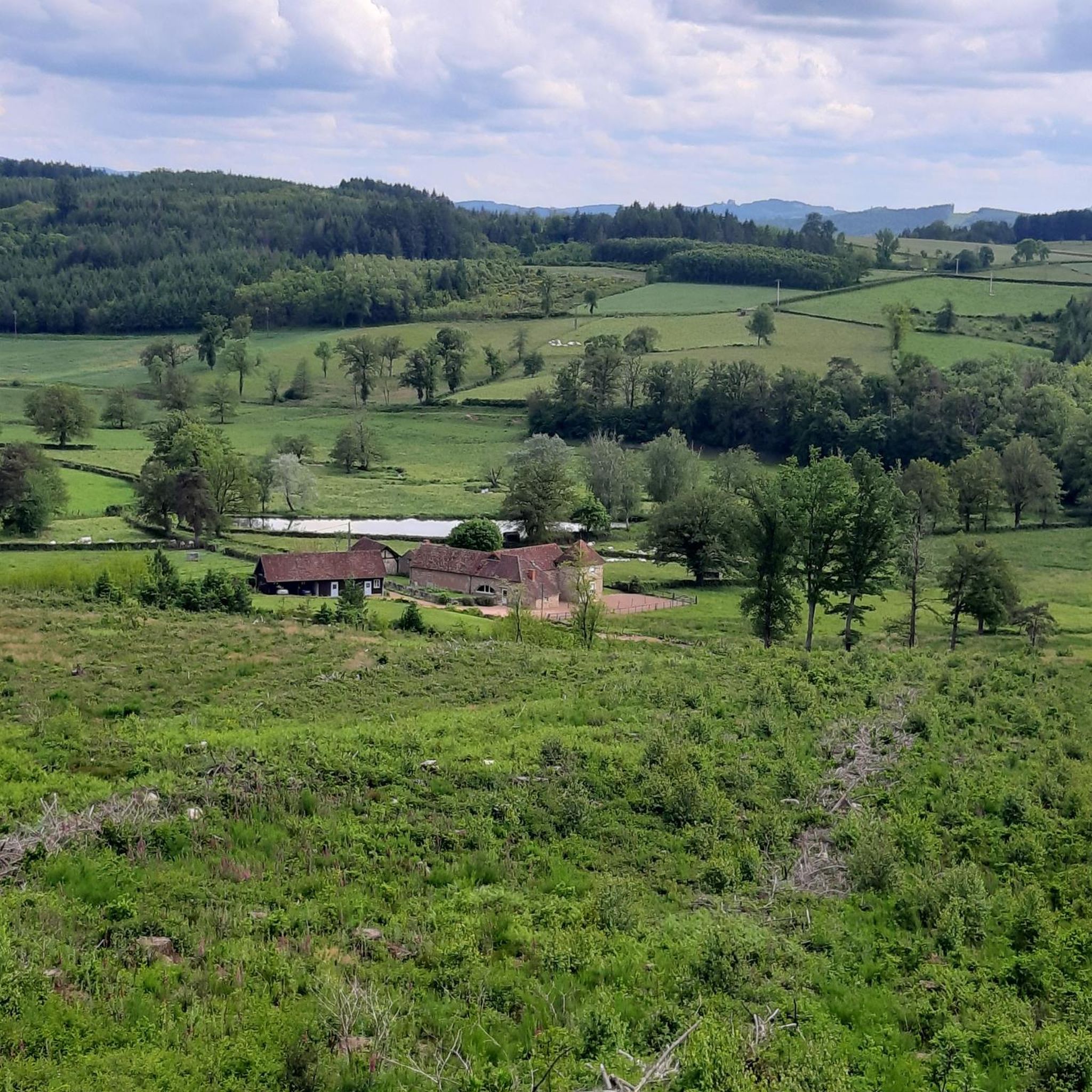
Mountain bike trails around Marcilly-La-Gueurce traverse the verdant Charolais bocage in Saône-et-Loire, offering diverse landscapes for cycling. The region features lush green fields, hedgerows, and woodlands, alongside rolling hills and forests. Riders can expect varied terrain, from peaceful countryside paths to more challenging ascents in the Monts du Charolais. The heights of Saint-Firmin provide panoramic views over the surrounding area.
Best mountain bike trails around Marcilly-La-Gueurce
- The most popular mountain bike trail is Mount Saint-Cyr – Mount St. Cyr loop…
Last updated: July 2, 2026
4.3
(3)
6
riders
19.8km
01:51
500m
500m
Moderate mountain bike ride. Good fitness required. Suitable for all skill levels.
5.0
(1)
5
riders
32.0km
02:23
500m
500m
Moderate mountain bike ride. Good fitness required. Suitable for all skill levels.

Sign up for free
5.0
(1)
6
riders
43.4km
04:12
1,080m
1,080m
Hard mountain bike ride. Very good fitness required. Advanced riding skills necessary.
5.0
(2)
3
riders
28.2km
02:30
610m
610m
Moderate mountain bike ride. Good fitness required. Suitable for all skill levels.
3.0
(1)
3
riders
25.9km
01:53
380m
380m
Moderate mountain bike ride. Good fitness required. Advanced riding skills necessary.
Get access to more routes and recommendations from other explorers.
Sign up for free
Already have an account?
Our route recommendations are based on thousands of hikes, rides, and runs completed by other people on komoot.
Start today with a free account
Your next adventure awaits.
Login or Signup


Tips from the Community

Mont Saint-Cyr is located in southern Burgundy (Département Saône-et-Loire) in the municipality of Montmelard and, at 771 meters, is the highest point in the Mâconnais mountains. From the summit, there is a wide panoramic view of the surrounding landscapes of Charolais, Brionnais, and Clunisois. In very clear weather, the view to the east even extends to Mont Blanc in the Alps. On the mountain are the historical remains of a 10th-century monastery that was destroyed during the Huguenot Wars. There is a picnic area in the forest, as well as orientation panels that are helpful in identifying the surrounding peaks and valleys.
0
0
Mont Saint-Cyr is located in southern Burgundy (Saône-et-Loire department) in the municipality of Montmelard and, at 771 meters, is the highest point of the Mâconnais mountains. From the summit, there is a wide panoramic view of the surrounding landscapes of Charolais, Brionnais, and Clunisois. In very clear weather, the view extends eastwards to Mont Blanc in the Alps. On the mountain are the historical remains of a 10th-century monastery, which was destroyed during the Huguenot Wars. There is a picnic area in the forest as well as orientation panels that are helpful in identifying the surrounding peaks and valleys.
0
0

Impressive views over southern Burgundy and Haut-Beaujolais
1
0

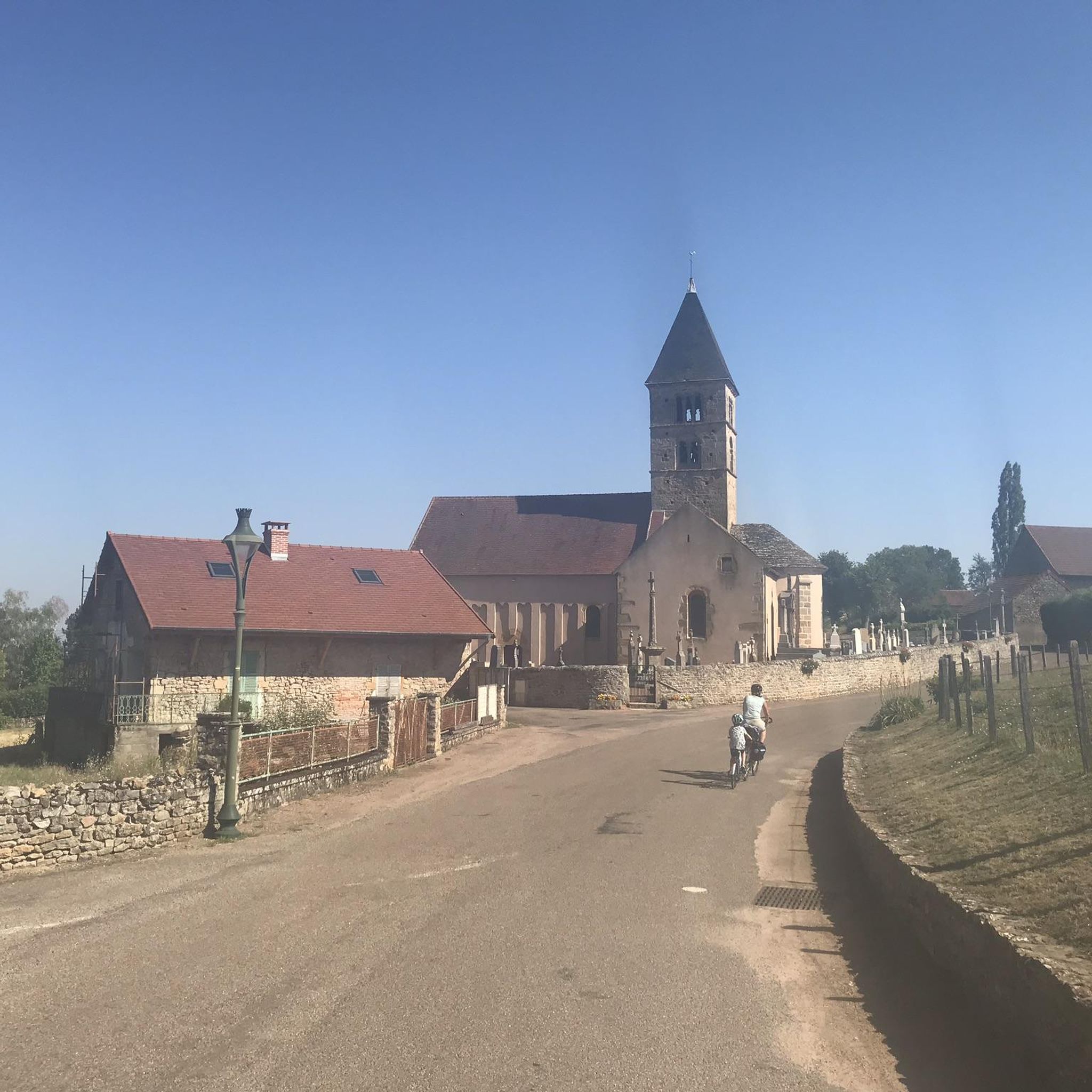
Bois-Sainte-Marie experienced a commercial boom from the 11th century. It once had a wall and became a royal castellany at the end of the 12th century. Its Romanesque church dates from the 11th century. The building occupied today by a retirement home was an asylum and orphanage which in the 19th century accommodated 60 old people and 100 orphans.
0
0

A very steep climb from Montmelard, not much fun by bike. View is good, best very early or in the evening.
1
0

Mont Saint-Cyr, with its 771 m, is the highest point of the Mâconnais mountains. From its summit, you can enjoy a 360° view of the surroundings and even of the Alps when the weather allows it.
3
0
Mont Saint-Cyr, at 771 m, is the highest point of the Mâconnais mountains. From its summit, you can enjoy a 360° view of the surroundings and even of the Alps when the weather allows it.
4
0

You have the choice depending on the conditions... fording or small narrow bridge a few meters away to get dry ;-) Picnic area also here.
0
0
Frequently Asked Questions
How many mountain bike trails are available around Marcilly-La-Gueurce, and what are their difficulty levels?
There are 17 mountain bike trails around Marcilly-La-Gueurce. These include 3 easy routes, 12 moderate routes, and 2 difficult routes, offering options for various skill levels.
What kind of terrain can I expect on mountain bike trails in Marcilly-La-Gueurce?
The trails in Marcilly-La-Gueurce primarily traverse the picturesque Charolais bocage, characterized by lush green fields, hedgerows, and woodlands. You'll encounter varied terrain, including rolling hills and forests, providing a mix of peaceful countryside paths and more challenging ascents.
Are there any challenging mountain bike trails for experienced riders in the area?
Yes, for experienced riders seeking a challenge, there are 2 difficult mountain bike trails. One notable option is the Montrouant Castle – Mount St. Cyr loop from Gibles, which covers nearly 49 km with significant elevation gain.
Can I find mountain bike trails suitable for beginners or families in Marcilly-La-Gueurce?
Yes, there are 3 easy mountain bike routes available, which are generally suitable for beginners or families looking for a less strenuous ride. These trails offer a gentle introduction to the region's beautiful countryside.
What is the best time of year to go mountain biking in Marcilly-La-Gueurce?
The verdant landscapes of Marcilly-La-Gueurce are particularly enjoyable during spring, summer, and early autumn when the weather is mild and the bocage is at its lushest. These seasons offer the most pleasant conditions for exploring the trails.
Are there options for circular mountain bike routes in Marcilly-La-Gueurce?
Yes, many of the mountain bike trails in the area are designed as loops. For example, the Rest area by the stream – Gibles Boules Court loop from Gibles is a moderate 31.6 km circular path, and the Gibles Boules Court – Montrouant Castle loop from Gibles is another popular loop covering 28.2 km.
Is parking available for mountain bikers in Marcilly-La-Gueurce?
While specific designated mountain bike parking areas are not detailed, Marcilly-La-Gueurce and nearby villages like Gibles typically offer public parking options. It's advisable to check local signage upon arrival for the most convenient spots.
Are mountain bike trails in Marcilly-La-Gueurce dog-friendly?
Many outdoor trails in rural France are dog-friendly, especially if dogs are kept on a leash. However, specific regulations can vary. It's always best to ensure your dog is well-behaved and to clean up after them to respect other users and local wildlife.
What can I see along the mountain bike trails or nearby in Marcilly-La-Gueurce?
The region offers several points of interest. You can spot historic châteaux like Montrouant Castle, the Vieux Château, Château de Terzé, and Château de Moulin-la-Cour. The 11th-century Romanesque church in Marcilly-La-Gueurce is also a significant historical site. Additionally, the heights of Saint-Firmin provide panoramic views over the Charolais bocage.
What do other mountain bikers enjoy the most about mountain biking in Marcilly-La-Gueurce?
The area is highly rated by the komoot community, with an average score of 4.5 stars from over 20 reviews. Reviewers often praise the diverse landscapes, from peaceful countryside paths to engaging ascents, and the scenic views over the Charolais bocage.
Are there any places to eat or stay in Marcilly-La-Gueurce after a ride?
Marcilly-La-Gueurce and its surrounding villages offer options for dining and accommodation. While specific cafes, pubs, or restaurants are not listed, you can find local establishments and gîtes or campsites for an overnight stay. For a relaxed experience, the picnic area at Saint-Firmin includes an activity area.
Are there any trails that offer particularly good views?
Yes, the Mount Saint-Cyr – Mount St. Cyr loop from Gibles is known for offering views of the surrounding bocage. The heights of Saint-Firmin also provide panoramic vistas over the Monts du Charolais, making them excellent spots for scenic breaks.
What is the average duration for mountain bike trails in this region?
The duration of mountain bike trails varies depending on their length and difficulty. For example, a moderate route like the Mount Saint-Cyr – Mount St. Cyr loop from Gibles (19.7 km) typically takes around 1 hour 49 minutes, while longer routes can take 2 hours 30 minutes or more.
Most popular routes around Marcilly-La-Gueurce
Most popular attractions around Marcilly-La-Gueurce

Get inspired with the komoot mobile app


Explore more
Browse the best MTB trails in other regions.
